- National Register of Historic Places listings in Marion County, Kansas
-
 Location of Marion County in Kansas
This is a list of the National Register of Historic Places listings in Marion County, Kansas.
This is intended to be a complete list of the properties and districts on the National Register of Historic Places in Marion County, Kansas, United States. The locations of National Register properties and districts for which the latitude and longitude coordinates are included below, may be seen in a Google map.[1]
There are 25 properties and districts listed on the National Register in the county.
-
- This National Park Service list is complete through NPS recent listings posted November 10, 2011.[2]
Current listings
[3] Landmark name[4] Image Date listed Location City or Town Summary 1 1927 Hillsboro Water Tower October 6, 2011 Lots 10 & 11, Block 2, Hill's 2nd Addition
38°21′15″N 97°12′25″W / 38.35417°N 97.20694°WHillsboro 2 Amelia Park Bridge [5][6] January 21, 2004 0.5 miles west of U.S. Route 77 on 260th Street (approximate 1 mile north-east of Antelope)
38°26′47″N 96°57′58″W / 38.44639°N 96.96611°WAntelope 3 Bethel School [7][8] December 17, 1987 5.25 miles east of Lincolnville on 290th Street
38°29′37″N 96°51′38″W / 38.49361°N 96.86056°WLincolnville 4 Bichet School, District 34 [9][10] 
January 28, 2004 4.5 miles east of Florence on U.S. Route 50, then 0.1 mile north on Bluestem Road
38°15′8″N 96°50′53″W / 38.25222°N 96.84806°WFlorence 5 Burns Union School [11][12] 
March 26, 1975 Southwest corner of Ohio and Main Streets
38°5′20″N 96°53′14″W / 38.08889°N 96.88722°WBurns Current name is Burns Community Museum.[13] 6 Doyle Place [14][15] October 11, 2000 0.3 mile south of Florence railroad track on Main Street
38°14′4″N 96°55′33″W / 38.23444°N 96.92583°WFlorence 7 Elgin Hotel [16][17] September 13, 1978 115 North 3rd Street
38°20′56″N 97°1′11″W / 38.34889°N 97.01972°WMarion [18] 8 Florence Opera House January 18, 2011 Southwest corner of 5th and Main Streets
38°14′32″N 96°55′36″W / 38.24222°N 96.92667°WFlorence Theaters and Opera Houses of Kansas MPS 9 Florence Water Tower [19][20] May 6, 1973 525 West 5th Street
38°14′31.35″N 96°56′1.75″W / 38.2420417°N 96.9338194°WFlorence 10 Harvey House [21][22] August 14, 1973 221 North Marion Street
38°14′24″N 96°55′41″W / 38.24°N 96.92806°WFlorence See Fred Harvey Company. [23] 11 Hill Grade School [24][25] May 28, 1976 601 East Main Street
38°20′54″N 97°0′54″W / 38.34833°N 97.015°WMarion 12 Island Field Ranch House [26][27] May 11, 1995 3.5 miles south of Lincolnville on U.S. Route 77 (1 mile east of Antelope)
38°26′13″N 96°57′28″W / 38.43694°N 96.95778°WLincolnville 13 Lost Springs[28][29] September 30, 1976 2.5 miles west of Lost Springs on 340th Street
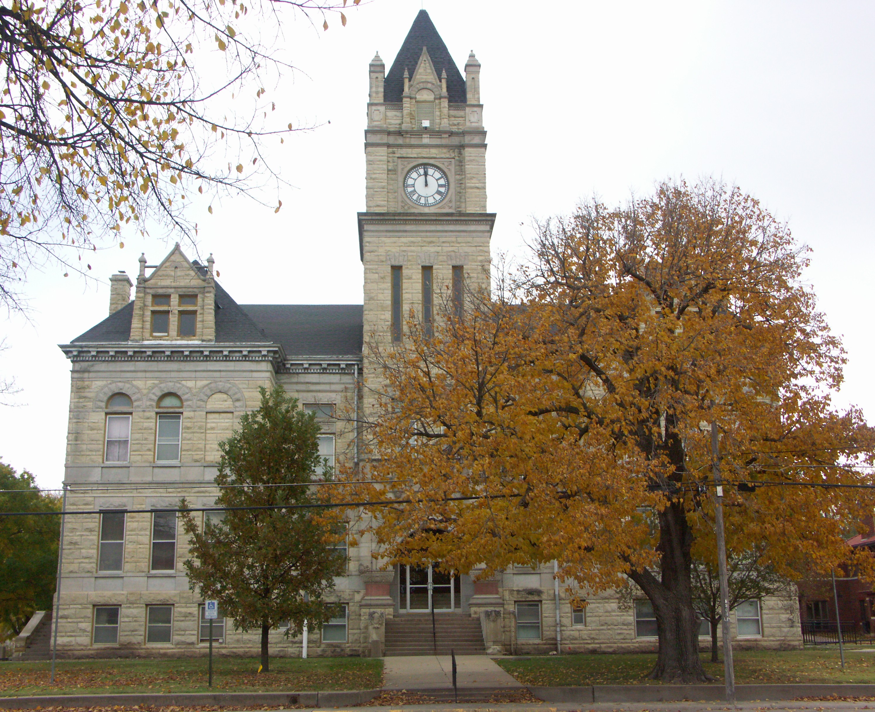
38°34′0″N 97°0′46″W / 38.566667°N 97.01278°WLost Springs 14 Marion Archeological District April 21, 1976 Restricted address (not released to public) Marion 15 Marion County Courthouse [30][31] 
May 28, 1976 200 South 3rd Street
38°20′50″N 97°1′9″W / 38.34722°N 97.01917°WMarion See Marion County, Kansas. [32] 16 Marion County Park and Lake [33][34] June 6, 2002 1 mile east of Marion on 190th Street (Main), then 1.75 miles south on Upland Road
38°19′14″N 96°58′59″W / 38.32056°N 96.98306°WMarion [35] 17 P.H. Meehan House November 28, 2007 401 North Columbus Street
38°32′54″N 97°9′22″W / 38.54833°N 97.15611°WTampa 18 W.H. Morgan House [36][37] January 22, 1996 212 North Walnut Street
38°10′1″N 97°6′23″W / 38.16694°N 97.10639°WPeabody 19 Old Peabody Library [38][39] July 2, 1973 106 East Division Avenue
38°10′2″N 97°6′22″W / 38.16722°N 97.10611°WPeabody Current name is Peabody Historical Museum.[40] 20 Peabody Downtown Historic District [41][42] 
May 29, 1998 Walnut Street area, between Division and First Streets
38°9′57″N 97°6′25″W / 38.16583°N 97.10694°WPeabody 21 Peabody Township Carnegie Library [43][44] 
June 25, 1987 214 North Walnut Street
38°10′2″N 97°6′24″W / 38.16722°N 97.10667°WPeabody Current name is Peabody Township Library.[45] See Carnegie library. 22 Pioneer Adobe House [46][47] March 30, 1973 501 South Ash Street
38°20′51″N 97°12′23″W / 38.3475°N 97.20639°WHillsboro Current name is Peter Paul Loewen House.[48] 23 Santa Fe Trail - Marion County Trail Segments [49][50] May 11, 1995 From corner of 270th St and Falcon Rd, parallels on west side of railroad tracks towards southwest
38°27′26″N 97°16′39″W / 38.45722°N 97.2775°WDurham See Santa Fe Trail. 24 William F. and Ida G. Schaeffler House [51][52] May 16, 2002 312 East Grand Avenue
38°21′15″N 97°12′2″W / 38.35417°N 97.20056°WHillsboro Current name is William F. Schaeffler House Museum.[53] 25 J.S. Schroeder Building [54][55] December 6, 1991 111 North Walnut Street
38°9′54″N 97°6′13″W / 38.165°N 97.10361°WPeabody See also
- List of National Historic Landmarks in Kansas
- National Register of Historic Places listings in Kansas
References
- ^ The latitude and longitude information provided in this table was derived originally from the National Register Information System, which has been found to be fairly accurate for about 99% of listings. For about 1% of NRIS original coordinates, experience has shown that one or both coordinates are typos or otherwise extremely far off; some corrections may have been made. A more subtle problem causes many locations to be off by up to 150 yards, depending on location in the country: most NRIS coordinates were derived from tracing out latitude and longitudes off of USGS topographical quadrant maps created under North American Datum of 1927, which differs from the current, highly accurate GPS system used by Google maps. Chicago is about right, but NRIS longitudes in Washington are higher by about 4.5 seconds, and are lower by about 2.0 seconds in Maine. Latitudes differ by about 1.0 second in Florida. Some locations in this table may have been corrected to current GPS standards.
- ^ "National Register of Historic Places: Weekly List Actions". National Park Service, United States Department of the Interior. Retrieved on November 10, 2011.
- ^ Numbers represent an ordering by significant words. Various colorings, defined here, differentiate National Historic Landmark sites and National Register of Historic Places Districts from other NRHP buildings, structures, sites or objects.
- ^ "National Register Information System". National Register of Historic Places. National Park Service. 2008-04-24. http://nrhp.focus.nps.gov/natreg/docs/All_Data.html.
- ^ Amelia Park Bridge - NRHP Application (0.9MB)
- ^ Amelia Park Bridge - NRHP Photos (0.5MB)
- ^ Bethel School - NRHP Application (0.2MB)
- ^ Bethel School - NRHP Photos (3.3MB)
- ^ Bichet School - NRHP Application (0.3MB)
- ^ Bichet School - NRHP Photos (0.2MB)
- ^ Burns Union School - NRHP Application (0.4MB)
- ^ Burns Union School - NRHP Photos (1.1MB)
- ^ Burns Union School - Official Website
- ^ Doyle Place - NRHP Application (0.4MB)
- ^ Doyle Place - NRHP Photos (2.4MB)
- ^ Elgin Hotel - NRHP Application (0.4MB)
- ^ Elgin Hotel - NRHP Photos (1.2MB)
- ^ Elgin Hotel - Official Website
- ^ Florence Water Tower - NRHP Application (0.5MB)
- ^ Florence Water Tower - NRHP Photos (TBD)
- ^ Harvey House - NRHP Application (0.4MB)
- ^ Harvey House - NRHP Photos (1.0MB)
- ^ Harvey House - Official Website
- ^ Hill Grade School - NRHP Application (0.4MB)
- ^ Hill Grade School - NRHP Photos (1.3MB)
- ^ Island Field Ranch House - NRHP Application (0.3MB)
- ^ Island Field Ranch House - NRHP Photos (1.9MB)
- ^ Lost Springs - NRHP Application (0.3MB)
- ^ Lost Springs - NRHP Photos (1.9MB)
- ^ Marion County Courthouse - NRHP Application (0.3MB)
- ^ Marion County Courthouse - NRHP Photos (2.1MB)
- ^ Marion County Courthouse - Official Website
- ^ Marion County Park and Lake - NRHP Application (0.5MB)
- ^ Marion County Park and Lake - NRHP Photos (4.5MB)
- ^ Marion County Park and Lake - Official Website
- ^ W.H. Morgan House - NRHP Application (0.3MB)
- ^ W.H. Morgan House - NRHP Photos (0.8MB)
- ^ Old Peabody Library - NRHP Application (0.3MB)
- ^ Old Peabody Library - NRHP Photos (0.3MB)
- ^ Old Peabody Library - Website
- ^ Peabody Downtown Historic District - NRHP Application (2.1MB)
- ^ Peabody Downtown Historic District - NRHP Photos (6.3MB)
- ^ Peabody Township Carnegie Library - NRHP Application (0.4MB)
- ^ Peabody Township Carnegie Library - NRHP Photos (1.1MB)
- ^ Peabody Township Carnegie Library - Official Website
- ^ Pioneer Adobe House - NRHP Application (0.4MB)
- ^ Pioneer Adobe House - NRHP Photos (0.7MB)
- ^ Pioneer Adobe House - Official Website
- ^ Santa Fe Trail - NRHP Application (0.3MB)
- ^ Santa Fe Trail - NRHP Photos (0.6MB)
- ^ W.F. Schaeffler House - NRHP Application (0.5MB)
- ^ W.F. Schaeffler House - NRHP Photos (1.4MB)
- ^ W.F. Schaeffler House - Official Website
- ^ J.S. Schroeder Building - NRHP Application (0.2MB)
- ^ J.S. Schroeder Building - NRHP Photos (3.3MB)
Municipalities and communities of Marion County, Kansas County seat: Marion Cities 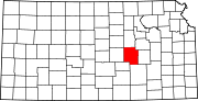
Townships Blaine | Catlin | Centre | Clark | Clear Creek | Colfax | Doyle | Durham Park | East Branch | Fairplay | Gale | Grant | Lehigh | Liberty | Logan | Lost Springs | Menno | Milton | Moore | Peabody | Risley | Summit | West Branch | Wilson
Unincorporated
communitiesAntelope | Aulne | Canada | Eastshore | Pilsen
Ghost towns Gnadenau | Horners | Oursler | Waldeck | Watchorn
Footnotes ‡This populated place also has portions in an adjacent county or counties
Categories:- National Register of Historic Places in Kansas by county
- Marion County, Kansas
- Buildings and structures in Marion County, Kansas
-


Wikimedia Foundation. 2010.