- Durham, Kansas
-
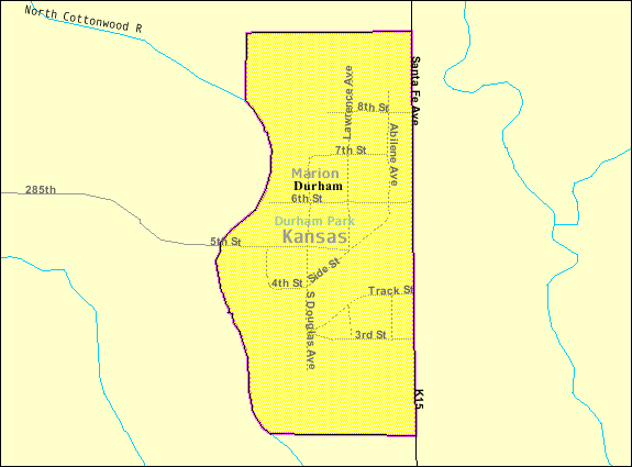
Durham, Kansas — City — Location of Durham, Kansas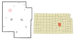 Detailed map of Durham, Kansas
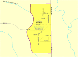
Coordinates: 38°29′4″N 97°13′38″W / 38.48444°N 97.22722°WCoordinates: 38°29′4″N 97°13′38″W / 38.48444°N 97.22722°W Country  United States
State  Kansas
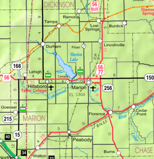
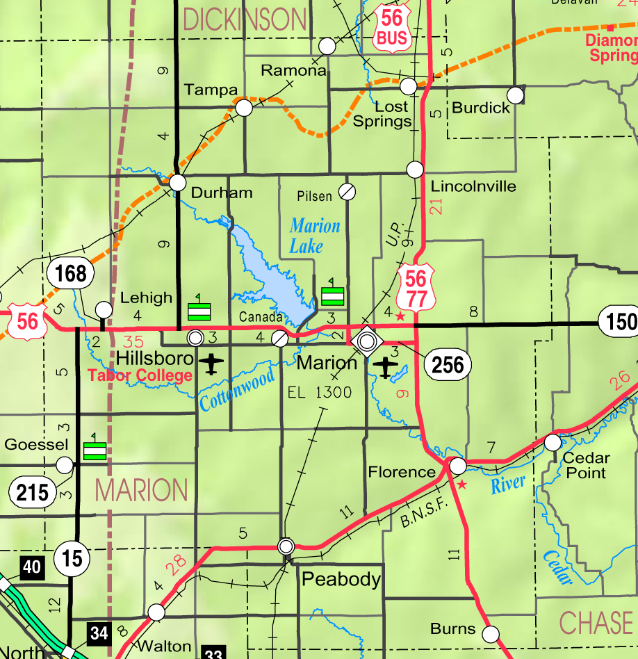
County Marion Platted 1887 (Durham)
1887 (Funk)Incorporated 1906 Government – Type Mayor–Council – Mayor Michael Sorensen[1] – City Clerk Joyce Medley[1] Area – Total 0.2 sq mi (0.5 km2) – Land 0.2 sq mi (0.5 km2) – Water 0.0 sq mi (0.0 km2) Elevation 1,371 ft (418 m) Population (2010)[2] – Total 112 – Density 560/sq mi (216.2/km2) Time zone Central (CST) (UTC-6) – Summer (DST) CDT (UTC-5) ZIP code 67438 Area code(s) 620 FIPS code 20-19050[3] GNIS feature ID 0477238[4] Website City website W i k i p e d i a Durham is a city in Marion County, Kansas, United States.[5] As of the 2010 census, the city population was 112.[2] Home of Donahue Corporation.[6]
Contents
History
19th century
For millennia, the land that is currently Kansas was inhabited by Native Americans. In 1803, most of modern Kansas was secured by the United States as part of the Louisiana Purchase. In 1806, Zebulon Pike led the Pike expedition westward from St Louis, Missouri, of which part of their journey followed the Cottonwood River through Marion County near the current towns of Florence, Marion, Durham.[7] In 1855, Marion County, Kansas, where Durham is located, was founded.
In 1887, the Chicago, Kansas and Nebraska Railway built a main line from Herington through Durham to Pratt.[8] In 1888, this line was extended to Liberal. Later, it was extended to Tucumcari, New Mexico and El Paso, Texas. It foreclosed in 1891 and taken over by Chicago, Rock Island and Pacific Railway, which shut down in 1980 and reorganized as Oklahoma, Kansas and Texas Railroad, merged in 1988 with Missouri Pacific Railroad, and finally merged in 1997 with Union Pacific Railroad. Most locals still refer to this railroad as the "Rock Island".
Durham Park post office was moved to Durham in 1887.
20th century
In 1962, James C Donahue established The Donahue Corporation, maker of farm implement carriers, and has grown to a 40,000 sq ft (3,700 m2) facility. They have built and distributed over 50,000 implement carriers.[6]
Geography
Durham is located at 38°29′04″N 97°13′38″W / 38.484392°N 97.227337°W (38.484392, -97.227337).[9] According to the United States Census Bureau, the city has a total area of 0.2 square miles (0.52 km2), all land, except the North Cottonwood River.
Area attractions
Durham has one listing on the National Register of Historic Places (NRHP).
- Santa Fe Trail:
- Santa Fe Trail - Marion County Segments[10] (NRHP), 2.5 miles (4.0 km) south-west of Durham. From corner of 270th St and Falcon Rd, parallels on west side of railroad tracks towards southwest. The ruts are approximate 3 miles (4.8 km) long, and described by the National Park Service as "outstanding". Not open to public.
- Santa Fe Trail Cottonwood Crossing Kiosk, 1 west at 290th St.[11]
- Santa Fe Trail Cottonwood Crossing Marker, north-west of Durham.
- Santa Fe Trail Markers, numerous markers in the area.
- Santa Fe Trail Self-Guided Auto Tour.
- Marion Reservoir, south-east of Durham.
Demographics
Historical populations Census Pop. %± 1960 183 — 1970 143 −21.9% 1980 130 −9.1% 1990 119 −8.5% 2000 114 −4.2% 2010 112 −1.8% U.S. Decennial Census As of the census of 2000,[3] there were 114 people, 51 households, and 29 families residing in the city. The population density was 541.7 people per square mile (209.6/km2). There were 64 housing units at an average density of 304.1 per square mile (117.7/km2). The racial makeup of the city was 98.25% White and 1.75% from two or more races. Hispanic or Latino of any race were 0.88% of the population.
There were 51 households out of which 27.5% had children under the age of 18 living with them, 45.1% were married couples living together, 9.8% had a female householder with no husband present, and 41.2% were non-families. 37.3% of all households were made up of individuals and 25.5% had someone living alone who is 65 years of age or older. The average household size was 2.24 and the average family size was 2.87.
In the city the population was spread out with 23.7% under the age of 18, 6.1% from 18 to 24, 19.3% from 25 to 44, 29.8% from 45 to 64, and 21.1% who were 65 years of age or older. The median age was 46 years. For every 100 females there were 100.0 males. For every 100 females age 18 and over, there were 77.6 males.
The median income for a household in the city was $26,875, and the median income for a family was $47,917. Males had a median income of $28,000 versus $25,625 for females. The per capita income for the city was $16,402. No families and 3.1% of the population were below the poverty line, including none under the age of 18 and over age 65.
Government
The Durham government consists of a mayor and five council members. The council meets the 1st Tuesday after the 1st Monday of each month at 7PM.[1]
- Fire Department, Douglas Ave.
- Durham Community Center, Douglas Ave.
- U.S. Post Office, 508 S Douglas Ave.
Education
Primary and secondary education
Durham is part of Unified School District 410.[12][13] The high school is a member of T.E.E.N., a shared video teaching network between five area high schools.[14] All students attend schools in Hillsboro.
- Hillsboro High School, located in Hillsboro.
- Hillsboro Middle School, located in Hillsboro.
- Hillsboro Elementary School, located in Hillsboro.
Library
- Becker Library, 109 S Douglas St.
Infrastructure
Transportation
K-15 highway runs along the east side of the city. Durham is served by the Union Pacific Railroad, formerly the Southern Pacific, and prior, the Chicago, Rock Island and Pacific Railroad. Durham is located on UP's Golden State main line to El Paso, Texas. A Union Pacific Local still serves the Durham Elevator during the Kansas summer harvests. The line was originally built by the Chicago, Kansas and Nebraska Railroad.
Utilities
- Internet
- Wireless is provided by Pixius Communications.
- Satellite is provided by HughesNet, StarBand, WildBlue.
- TV
- Satellite is provided by DirecTV, Dish Network.
- Terrestrial is provided by regional digital TV stations.
- Electricity
- Rural is provided by Flint Hills RECA.
- Water
- City is provided by City of Durham.
- Rural is provided by Marion County RWD #1 and #4.
See also
- National Register of Historic Places listings in Marion County, Kansas
- Historical Maps of Marion County, Kansas
- Santa Fe Trail
Further reading
- Durham
- Durham Kansas Centennial 1887-1987 Pride in the Past Faith in the Future; B002FD0F7E; 222 pages; 1987.
- Marion County
- Marion County Kansas - Past and Present; Sondra Van Meter; MB Publishing House in Hillsboro, KS; LCCN 72-92041; 344 pages; 1972.
- Standard Atlas of Marion County, Kansas; Geo A. Ogle & Co; 1902.[15]
- World War Roll of Honor, Marion County Kansas, 1917-1920; Mrs Alexander and Mrs Dean of Marion, Kansas; 221 pages; 1920.[16]
- The Early Schools Of Marion County, Kansas; Wilma Stewart Stallwitz; Located at Peabody Township Library; 33 pages; November 11, 1960.
- Kansas
- Kansas: A Cyclopedia Of State History, Embracing Events, Institutions, Industries, Counties, Cities, Towns, Prominent Persons, Etc; Frank W. Blackmar; Standard Publishing Co; 1912.[17][18][19]
- History Of The State of Kansas; William G. Cutler; A.T. Andreas Publisher; 1883.[20]
- The Story of the Marking of the Santa Fe Trail by the Daughters of the American Revolution in Kansas and the State of Kansas; Almira Cordry; Crane Co; 164 pages; 1915.[21]
References
- ^ a b c Durham - Directory of Public Officials
- ^ a b "2010 City Population and Housing Occupancy Status". U.S. Census Bureau. http://factfinder2.census.gov/faces/tableservices/jsf/pages/productview.xhtml?pid=DEC_10_PL_GCTPL2.ST13&prodType=table. Retrieved March 6, 2011.
- ^ a b "American FactFinder". United States Census Bureau. http://factfinder.census.gov. Retrieved 2008-01-31.
- ^ "US Board on Geographic Names". United States Geological Survey. 2007-10-25. http://geonames.usgs.gov. Retrieved 2008-01-31.
- ^ http://www.skyways.org/towns/Durham/index.html
- ^ a b Donahue Corporation
- ^ 1806 Pike Expedition map through Marion County.
- ^ Rock Island Rail History
- ^ "US Gazetteer files: 2010, 2000, and 1990". United States Census Bureau. 2011-02-12. http://www.census.gov/geo/www/gazetteer/gazette.html. Retrieved 2011-04-23.
- ^ National Register of Historic Places - Santa Fe Trail - Marion County Segments
- ^ Cottonwood Crossing
- ^ USD 410
- ^ Kansas School District Boundary Map
- ^ T.E.E.N. video teaching network
- ^ Standard Atlas of Marion County, Kansas; 1902. (Download eBook)
- ^ World War Roll of Honor, Marion County Kansas, 1917-1920; 1920. (Downlaod eBook)
- ^ Kansas: A Cyclopedia Of State History, Embracing Events, Institutions, Industries, Counties, Cities, Towns, Prominent Persons, Etc - Vol 1; 1912. (Download eBook)
- ^ Kansas: A Cyclopedia Of State History, Embracing Events, Institutions, Industries, Counties, Cities, Towns, Prominent Persons, Etc - Vol 2; 1912.
- ^ Kansas: A Cyclopedia Of State History, Embracing Events, Institutions, Industries, Counties, Cities, Towns, Prominent Persons, Etc - Vol 3; 1912.
- ^ History Of The State of Kansas; 1883. (Download eBook)
- ^ The Story of the Marking of the Santa Fe Trail; 1915. (Download eBook)
External links
- City
- Schools
- Historical
- KsGenWeb Marion County cemetery list
- Historic Images of Durham, Special Photo Collections at Wichita State University Library.
- Maps
- Durham City Map, KDOT
- Marion County Map, KDOT
- Topo Map of Durham / Hillsboro area, USGS
- Santa Fe Trail map, NPS
Municipalities and communities of Marion County, Kansas Cities 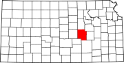
Townships Blaine | Catlin | Centre | Clark | Clear Creek | Colfax | Doyle | Durham Park | East Branch | Fairplay | Gale | Grant | Lehigh | Liberty | Logan | Lost Springs | Menno | Milton | Moore | Peabody | Risley | Summit | West Branch | Wilson
Unincorporated
communitiesAntelope | Aulne | Canada | Eastshore | Pilsen
Ghost towns Gnadenau | Horners | Oursler | Waldeck | Watchorn
Footnotes ‡This populated place also has portions in an adjacent county or counties
Categories:- Cities in Kansas
- Populated places in Marion County, Kansas
- Santa Fe Trail:


Wikimedia Foundation. 2010.