- Herington, Kansas
Infobox Settlement
official_name = Herington, Kansas
settlement_type =City
nickname =
motto =
imagesize =
image_caption =
image_
imagesize =
image_caption =
image_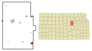
mapsize = 250px
map_caption = Location of Herington, Kansas
mapsize1 =
map_caption1 =subdivision_type = Country
subdivision_name =United States
subdivision_type1 = State
subdivision_name1 =Kansas
subdivision_type2 = Counties
subdivision_name2 = Dickinson, Morris
government_footnotes =
government_type =
leader_title =
leader_name =
leader_title1 =
leader_name1 =
established_title =
established_date =unit_pref = Imperial
area_footnotes =area_magnitude =
area_total_km2 = 5.5
area_land_km2 = 5.5
area_water_km2 = 0.0
area_total_sq_mi = 2.1
area_land_sq_mi = 2.1
area_water_sq_mi = 0.0population_as_of = 2000
population_footnotes =
population_total = 2563
population_density_km2 = 466.0
population_density_sq_mi = 1206.9timezone = Central (CST)
utc_offset = -6
timezone_DST = CDT
utc_offset_DST = -5
elevation_footnotes =
elevation_m = 413
elevation_ft = 1355
latd = 38 |latm = 40 |lats = 19 |latNS = N
longd = 96 |longm = 56 |longs = 44 |longEW = Wpostal_code_type =
ZIP code
postal_code = 67449
area_code = 785
blank_name = FIPS code
blank_info = 20-31400GR|2
blank1_name = GNIS feature ID
blank1_info = 0476991GR|3
website =
footnotes =Herington is a city in Dickinson and Morris counties in the
U.S. state ofKansas . The population was 2,563 at the 2000 census.Geography
Herington is located at coor dms|38|40|19|N|96|56|44|W|city (38.671990, -96.945423)GR|1.
According to the
United States Census Bureau , the city has a total area of 2.1square mile s (5.5km² ), all land.Demographics
As of the
census GR|2 of 2000, there were 2,563 people, 1,126 households, and 669 families residing in the city. Thepopulation density was 1,206.9 people per square mile (466.8/km²). There were 1,305 housing units at an average density of 614.5/sq mi (237.7/km²). The racial makeup of the city was 95.79% White, 0.62% African American, 0.39% Native American, 0.51% Asian, 0.04% Pacific Islander, 1.64% from other races, and 1.01% from two or more races. Hispanic or Latino of any race were 4.53% of the population.There were 1,126 households out of which 26.6% had children under the age of 18 living with them, 47.2% were married couples living together, 8.9% had a female householder with no husband present, and 40.5% were non-families. 36.9% of all households were made up of individuals and 19.9% had someone living alone who was 65 years of age or older. The average household size was 2.21 and the average family size was 2.88.
In the city the population was spread out with 24.0% under the age of 18, 7.0% from 18 to 24, 25.0% from 25 to 44, 20.1% from 45 to 64, and 24.0% who were 65 years of age or older. The median age was 41 years. For every 100 females there were 88.7 males. For every 100 females age 18 and over, there were 83.7 males.
The median income for a household in the city was $28,333, and the median income for a family was $36,696. Males had a median income of $28,359 versus $15,515 for females. The
per capita income for the city was $16,526. About 6.2% of families and 8.2% of the population were below thepoverty line , including 10.0% of those under age 18 and 7.6% of those age 65 or over.Railroads
Herington has had a rich history with railroads. From its beginnings, Herington has been a hub for the Rock Island, the Cotton Belt Route, Southern Pacific, and currently
Union Pacific Railroad . UP still uses this as its hub on its system to this day. Herington has also been served by the Rio Grande,Missouri Pacific , and theOklahoma, Kansas and Texas Railroad .Notable residents (past and present)
*
Bruce P. Blake ,Bishop of theUnited Methodist Church
*Terry Nichols , accomplice in the bombing of theAlfred P. Murrah Federal Building inOklahoma City, Oklahoma References
External links
* [http://skyways.lib.ks.us/towns/Herington/ Blue Skyways - Herington, KS]
Wikimedia Foundation. 2010.