- Marion Reservoir
-
Marion Reservoir 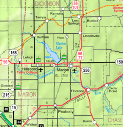
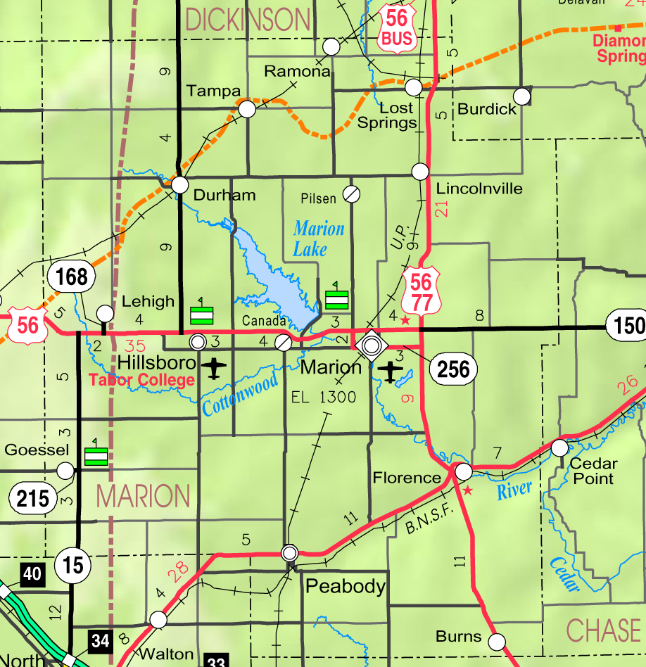
2005 KDOT Map of Marion County, Kansas Location Marion County, Kansas Coordinates 38°22′08″N 97°05′06″W / 38.36889°N 97.085°WCoordinates: 38°22′08″N 97°05′06″W / 38.36889°N 97.085°W [1] Lake type Reservoir Primary inflows North Cottonwood River,
French CreekPrimary outflows North Cottonwood River Catchment area 200 square miles (520 km2) [2] Basin countries United States Built February 1968 Surface area 6,160 acres (24.9 km2) [3] Water volume 67,734 acre·ft (83,549,000 m3) Shore length1 60 miles (97 km) Surface elevation 1,348.79 feet (411.11 m) [2] Settlements Eastshore, Canada,
Marion, Hillsboro, DurhamReferences [2] [3] 1 Shore length is not a well-defined measure. Marion Reservoir is a reservoir on the Cottonwood River and 3 miles (4.8 km) north-west of Marion, on the western edge of the Flint Hills region of Kansas. It was completed in 1968 and is operated by the Army Corps of Engineers for the purpose of flood control. This larger reservoir is also known as the Marion Lake, and is often confused with the similar named yet smaller and older Marion County Lake which is south-east of Marion. Most locals refer to the larger one using the term 'Reservoir' and smaller one using the term 'Lake'.
Contents
History
A flood of record occurred in June and July 1951 with a peak discharge of 54,000 cu ft/s (1,500 m3/s) and a volume of 78,950 acre feet (97,380,000 m3) which is equivalent to 7.40 inches (188 mm) of runoff from the drainage area above the dam site.[4] The 1951 record flood in the region was one of the leading reasons for building the Marion Reservoir, and downstream leevee's in Marion and Florence.
Construction was started in March 1964, embankment closure was completed in October 1967, and the project was placed in full flood control operation in February 1968.
In 2011, the Cottonwood Point recreation area will be expanded by adding 61 new campsites, 23 new day-use sites, picnic shelters, and a new beach.[5]
Recreation areas
Camping and picnicking opportunities are numerous in four parks: Cottonwood Point, Hillsboro Cove, Marion Cove, French Creek Cove. Campsites contain picnic tables, grills and/or fire-rings, sun-shelters, and gravel parking pads. Facilities at class "A" parks (Cottonwood Point and Hillsboro Cove) include electrical hookups, showers, RV dump stations, group camping areas, group picnic areas, playgrounds, and beaches. Potable water is available in all parks.[6]
- Recreation areas around Marion Reservoir
- Cottonwood Point [7] [8], Class A. North of US-56 on Pawnee Road (note: Old Mill Road over Dam merges with Pawnee).
- In 2011, may be closed during construction, see History section.
- French Creek Cove [9], Class C. North of US-56 on Limestone Road.
- Hillsboro Cove [10], Class A. North of US-56 on Nighthawk Road.
- Marion Cove [11], Class C. North of US-56 on Pawnee Road (note: Old Mill Road over Dam merges with Pawnee).
- Durham Cove. 250th Street and Kansa Road. The undeveloped ramp is free.
- Broken Bridge. The undeveloped ramp is free.
- Overlook and Dam. North of US-56 on Old Mill Road.
See also
References
- ^ GNIS entry for Marion Dam
- ^ a b c "Marion Reservoir - Current Readings". U.S. Army Corps of Engineers. http://www.swt-wc.usace.army.mil/MARI.lakepage.html. Retrieved 2010-12-13.
- ^ a b "Marion Reservoir - Fishing Information". Kansas Department of Wildlife & Parks. http://www.kdwp.state.ks.us/news/Fishing/Where-to-Fish-in-Kansas/Fishing-Locations-Public-Waters/Region-4/Marion-Reservoir. Retrieved 2010-12-13.
- ^ Marion Reservoir - Information
- ^ Cottonwood Point expansion underway; Peabody Gazette-Bulletin; April 20, 2010.
- ^ Marion Reservoir - Recreation Areas
- ^ Marion Reservoir - Cottonwood Point - Recreation Information
- ^ Marion Reservoir - Cottonwood Point - Public Use Expansion Study; U.S. Army Corp Of Engineers; September 2009
- ^ Marion Reservoir - French Creek Cove - Recreation Information
- ^ Marion Reservoir - Hillsboro Cove - Recreation Information
- ^ Marion Reservoir - Marion Cove - Recreation Information
External links
- Official
- Maps
- Marion Reservoir - Detailed Map, USACE
- Marion County Map, KDOT
- Topo Map of Aulne / Canada / Marion area, USGS
- Topo Map of Eastshore / Pilsen area, USGS
- Supplies
- Canada Bait ‘n’ Tackle; 1942 Nighthawk Rd; Canada, Kansas
Municipalities and communities of Marion County, Kansas Cities 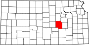
Townships Blaine | Catlin | Centre | Clark | Clear Creek | Colfax | Doyle | Durham Park | East Branch | Fairplay | Gale | Grant | Lehigh | Liberty | Logan | Lost Springs | Menno | Milton | Moore | Peabody | Risley | Summit | West Branch | Wilson
Unincorporated
communitiesAntelope | Aulne | Canada | Eastshore | Pilsen
Ghost towns Gnadenau | Horners | Oursler | Waldeck | Watchorn
Footnotes ‡This populated place also has portions in an adjacent county or counties
Categories:- Reservoirs in Kansas
- Kansas state parks
- Protected areas of Marion County, Kansas

Wikimedia Foundation. 2010.