- National Register of Historic Places listings in Butler County, Kansas
-
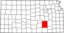 Location of Butler County in Kansas
This is a list of the National Register of Historic Places listings in Butler County, Kansas.
This is intended to be a complete list of the properties on the National Register of Historic Places in Butler County, Kansas, United States. The locations of National Register properties for which the latitude and longitude coordinates are included below, may be seen in a Google map.[1]
There are 17 properties listed on the National Register in the county.
-
- This National Park Service list is complete through NPS recent listings posted November 10, 2011.[2]
Current listings
[3] Landmark name [4] Image Date listed Location City or town Summary 1 Augusta Theater October 31, 1990 525 State St.
37°40′37″N 96°59′22″W / 37.676944°N 96.989444°WAugusta 2 Beaumont St. Louis and San Francisco Railroad Retention Pond October 6, 2011 SE 116th St. & SE Beaumont Rd.
37°39′19″N 96°32′06″W / 37.655278°N 96.535°WBeaumont 3 Beaumont St. Louis and San Francisco Railroad Water Tank August 19, 1993 Junction of 3rd and D Sts.
37°39′18″N 96°31′51″W / 37.655°N 96.530833°WBeaumont 4 Butler County Courthouse April 26, 2002 205 W. Central Ave.
37°49′01″N 96°51′06″W / 37.816944°N 96.851667°WEl Dorado 5 Douglass Township Community Building April 27, 1995 206 S. Forest
37°31′05″N 97°00′56″W / 37.518056°N 97.015556°WDouglass 6 El Dorado Carnegie Library June 25, 1987 101 S. Star
37°49′00″N 96°51′17″W / 37.816667°N 96.854722°WEl Dorado 7 El Dorado Missouri Pacific Depot May 6, 1994 430 N. Main St.
37°49′18″N 96°50′57″W / 37.821667°N 96.849167°WEl Dorado 8 C. N. James Cabin April 13, 1973 305 State St.
37°39′53″N 96°58′46″W / 37.664722°N 96.979444°WAugusta 9 Little Walnut River Pratt Truss Bridge May 9, 2003 SW. 160th Rd., ½ mile west of its intersection with Purity Springs Rd.
37°35′46″N 96°55′24″W / 37.596111°N 96.923333°WBois D'Arc 10 Loomis-Parry Residence July 8, 2009 1003 State St.
37°40′56″N 96°58′44″W / 37.682333°N 96.978986°WAugusta 11 Muddy Creek Bridge July 2, 1985 Off U.S. Route 77
37°32′03″N 96°57′04″W / 37.534167°N 96.951111°WDouglass 12 Oak Lawn Farm Dairy Barn November 5, 2005 12464 NW. Meadowlark
38°00′24″N 97°05′46″W / 38.006667°N 97.096111°WWhitewater 13 James T. Oldham House November 21, 2006 321 S. Denver St.
37°48′53″N 96°51′23″W / 37.814722°N 96.856389°WEl Dorado 14 Polecat Creek Bridge July 2, 1985 5 miles west and 2 miles south of Douglass
37°29′23″N 97°06′33″W / 37.489722°N 97.109167°WDouglass 15 Towanda Masonic Lodge No. 30 A.F. and A.M. January 14, 2004 401 Main St.
37°47′44″N 97°00′09″W / 37.795556°N 97.0025°WTowanda 16 US Post Office-Augusta October 17, 1989 119 E. 5th St.
37°40′33″N 96°58′38″W / 37.675833°N 96.977222°WAugusta 17 Yingling Brothers Auto Company July 5, 2011 411 S. Main St.
37°48′51″N 96°51′01″W / 37.814167°N 96.850278°WEl Dorado Roadside Kansas MPS See also
- List of National Historic Landmarks in Kansas
- National Register of Historic Places listings in Kansas
References
- ^ The latitude and longitude information provided in this table was derived originally from the National Register Information System, which has been found to be fairly accurate for about 99% of listings. For about 1% of NRIS original coordinates, experience has shown that one or both coordinates are typos or otherwise extremely far off; some corrections may have been made. A more subtle problem causes many locations to be off by up to 150 yards, depending on location in the country: most NRIS coordinates were derived from tracing out latitude and longitudes off of USGS topographical quadrant maps created under North American Datum of 1927, which differs from the current, highly accurate GPS system used by Google maps. Chicago is about right, but NRIS longitudes in Washington are higher by about 4.5 seconds, and are lower by about 2.0 seconds in Maine. Latitudes differ by about 1.0 second in Florida. Some locations in this table may have been corrected to current GPS standards.
- ^ "National Register of Historic Places: Weekly List Actions". National Park Service, United States Department of the Interior. Retrieved on November 10, 2011.
- ^ Numbers represent an ordering by significant words. Various colorings, defined here, differentiate National Historic Landmark sites and National Register of Historic Places Districts from other NRHP buildings, structures, sites or objects.
- ^ "National Register Information System". National Register of Historic Places. National Park Service. . http://nrhp.focus.nps.gov/natreg/docs/All_Data.html.
Municipalities and communities of Butler County, Kansas County seat: El Dorado Cities 
Townships Augusta | Benton | Bloomington | Bruno | Chelsea | Clay | Clifford | Douglass | El Dorado | Fairmount | Fairview | Glencoe | Hickory | Lincoln | Little Walnut | Logan | Milton | Murdock | Pleasant | Plum Grove | Prospect | Richland | Rock Creek | Rosalia | Spring | Sycamore | Towanda | Union | Walnut
Unincorporated
communitiesBeaumont | Bois d'Arc | Brainerd | De Graff | Gordon | Haverhill | Prospect | Rosalia
Ghost towns Oil Hill | Smileyberg
Footnotes ‡This populated place also has portions in an adjacent county or counties
Categories:- Butler County, Kansas
- National Register of Historic Places in Kansas by county
- Buildings and structures in Butler County, Kansas
-


Wikimedia Foundation. 2010.