- Benton, Kansas
-
Benton, Kansas — City — Circle Middle School Location of Benton, Kansas
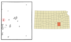 Detailed map of Benton, Kansas
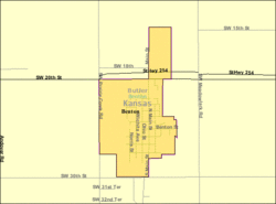
Coordinates: 37°47′21″N 97°6′30″W / 37.78917°N 97.10833°WCoordinates: 37°47′21″N 97°6′30″W / 37.78917°N 97.10833°W Country United States State Kansas County Butler Incorporated January 6, 1909 Government - Mayor Ken Gile Area - Total 0.7 sq mi (1.9 km2) - Land 0.7 sq mi (1.9 km2) - Water 0.0 sq mi (0.0 km2) Elevation 1,375 ft (419 m) Population (2010)[1] - Total 880 - Density 1,257.1/sq mi (485.4/km2) Time zone Central (CST) (UTC-6) - Summer (DST) CDT (UTC-5) ZIP code 67017 Area code(s) 316 FIPS code 20-06175[2] GNIS feature ID 0473887[3] Website BentonKS.org Benton is a city in Butler County, Kansas, United States. As of the 2010 census, the city population was 880.[1]
Contents
Geography
Benton is located at 37°47′21″N 97°6′30″W / 37.78917°N 97.10833°W (37.789302, -97.108402)[4]. According to the United States Census Bureau, the city has a total area of 0.8 square miles (2.1 km2), all of it land.
Films
- The Gypsy Moths, 1969, part of the film was shot in the Benton area.
Demographics
Historical populations Census Pop. %± 1910 240 — 1920 224 −6.7% 1930 253 12.9% 1940 235 −7.1% 1950 269 14.5% 1960 452 68.0% 1970 517 14.4% 1980 609 17.8% 1990 669 9.9% 2000 827 23.6% 2010 880 6.4% U.S. Decennial Census As of the census[2] of 2000, there were 827 people, 308 households, and 238 families residing in the city. The population density was 1,109.0 people per square mile (425.7/km²). There were 327 housing units at an average density of 438.5 per square mile (168.3/km²). The racial makeup of the city was 97.46% White, 0.12% African American, 0.24% Native American, 0.24% Asian, 0.48% from other races, and 1.45% from two or more races. Hispanic or Latino of any race were 1.33% of the population.
There were 308 households out of which 36.0% had children under the age of 18 living with them, 64.9% were married couples living together, 8.8% had a female householder with no husband present, and 22.7% were non-families. 20.1% of all households were made up of individuals and 8.1% had someone living alone who was 65 years of age or older. The average household size was 2.69 and the average family size was 3.07.
In the city the population was spread out with 28.1% under the age of 18, 7.9% from 18 to 24, 28.5% from 25 to 44, 23.3% from 45 to 64, and 12.2% who were 65 years of age or older. The median age was 34 years. For every 100 females there were 99.8 males. For every 100 females age 18 and over, there were 99.7 males.
The median income for a household in the city was $49,750, and the median income for a family was $58,214. Males had a median income of $40,380 versus $30,179 for females. The per capita income for the city was $21,975. About 3.8% of families and 5.5% of the population were below the poverty line, including 10.5% of those under age 18 and none of those age 65 or over.
Education
Primary and secondary education
Benton is home to Benton Grade School and Circle Middle School. The middle school is visible as one drives on the highway past K-254.
Circle Middle School
Circle Middle School is the home of the Thunderbolts. The school is a part of the Walnut Valley League (WVL). Students from Benton Grade School, Towanda Grade School, and Oil Hill Grade School attend this school in their seventh and eighth grades. After graduating, the students move onto Circle High School in Towanda.
Circle Middle School used to be a combination of Benton Grade School and Towanda Grade School, which, at the time, were both K-8 schools. Oil Hill Grade School bused their kids over to Towanda Grade School for classes. When the schools became too crowded due to the influx of jobs in nearby Wichita, El Dorado, and Andover, the school board voted to build a middle school in Benton.[citation needed] The project was completed by Summer 2002.[citation needed] Classes began in the fall. The first 8th grade class to go through the middle school graduated in 2007 from Circle High School.[citation needed]
References
- ^ a b "2010 City Population and Housing Occupancy Status". U.S. Census Bureau. http://factfinder2.census.gov/faces/tableservices/jsf/pages/productview.xhtml?pid=DEC_10_PL_GCTPL2.ST13&prodType=table. Retrieved March 6, 2011.
- ^ a b "American FactFinder". United States Census Bureau. http://factfinder.census.gov. Retrieved 2008-01-31.
- ^ "US Board on Geographic Names". United States Geological Survey. 2007-10-25. http://geonames.usgs.gov. Retrieved 2008-01-31.
- ^ "US Gazetteer files: 2010, 2000, and 1990". United States Census Bureau. 2011-02-12. http://www.census.gov/geo/www/gazetteer/gazette.html. Retrieved 2011-04-23.
Further reading
- County
- History of Butler County Kansas; Vol P Mooney; Standard Publishing; 869 pages; 1916. (Download 68MB PDF eBook)
- Kansas
- History of the State of Kansas; William G. Cutler; A.T. Andreas Publisher; 1883. (Online HTML eBook)
- Kansas : A Cyclopedia of State History, Embracing Events, Institutions, Industries, Counties, Cities, Towns, Prominent Persons, Etc; 3 Volumes; Frank W. Blackmar; Standard Publishing Co; 944 / 955 / 824 pages; 1912. (Volume1 - Download 54MB PDF eBook), (Volume2 - Download 53MB PDF eBook), (Volume3 - Download 33MB PDF eBook)
External links
- City
- Schools
- USD 375, local school district
- Historical
- Maps
- Benton City Map, KDOT
- Butler County Map, KDOT
Municipalities and communities of Butler County, Kansas Cities 
Townships Augusta | Benton | Bloomington | Bruno | Chelsea | Clay | Clifford | Douglass | El Dorado | Fairmount | Fairview | Glencoe | Hickory | Lincoln | Little Walnut | Logan | Milton | Murdock | Pleasant | Plum Grove | Prospect | Richland | Rock Creek | Rosalia | Spring | Sycamore | Towanda | Union | Walnut
Unincorporated
communitiesBeaumont | Bois d'Arc | Brainerd | De Graff | Gordon | Haverhill | Prospect | Rosalia
Ghost towns Oil Hill | Smileyberg
Footnotes ‡This populated place also has portions in an adjacent county or counties
Categories:- Cities in Kansas
- Populated places in Butler County, Kansas
- Wichita metropolitan area


Wikimedia Foundation. 2010.