- Clay Township, Butler County, Kansas
-
Clay Township — Township — Location in Butler County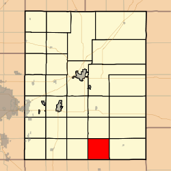
Coordinates: 37°31′30″N 096°46′51″W / 37.525°N 96.78083°WCoordinates: 37°31′30″N 096°46′51″W / 37.525°N 96.78083°W Country United States State Kansas County Butler Area – Total 36.43 sq mi (94.36 km2) – Land 36.35 sq mi (94.15 km2) – Water 0.08 sq mi (0.21 km2) 0.22% Elevation 1,381 ft (421 m) Population (2000) – Total 83 – Density 2.3/sq mi (0.9/km2) GNIS feature ID 0470031 Clay Township is a township in Butler County, Kansas, USA. As of the 2000 census, its population was 83.
Geography
Clay Township covers an area of 36.43 square miles (94.4 km2) and contains no incorporated settlements. According to the USGS, it contains two cemeteries: Bryant and Lone Star.
The stream of North Branch Rock Creek runs through this township.
References
External links
Municipalities and communities of Butler County, Kansas Cities 
Townships Augusta | Benton | Bloomington | Bruno | Chelsea | Clay | Clifford | Douglass | El Dorado | Fairmount | Fairview | Glencoe | Hickory | Lincoln | Little Walnut | Logan | Milton | Murdock | Pleasant | Plum Grove | Prospect | Richland | Rock Creek | Rosalia | Spring | Sycamore | Towanda | Union | Walnut
Unincorporated
communitiesBeaumont | Bois d'Arc | Brainerd | De Graff | Gordon | Haverhill | Prospect | Rosalia
Ghost towns Oil Hill | Smileyberg
Footnotes ‡This populated place also has portions in an adjacent county or counties
Categories:- Townships in Butler County, Kansas
- Kansas geography stubs

Wikimedia Foundation. 2010.