- Elbing, Kansas
Infobox Settlement
official_name = Elbing, Kansas
settlement_type =City
nickname =
motto =
imagesize =
image_caption =
image_
imagesize =
image_caption =
image_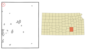
mapsize = 250px
map_caption = Location of Elbing, Kansas
mapsize1 =
map_caption1 =subdivision_type = Country
subdivision_name =United States
subdivision_type1 = State
subdivision_name1 =Kansas
subdivision_type2 = County
subdivision_name2 = Butler
government_footnotes =
government_type =
leader_title =
leader_name =
leader_title1 =
leader_name1 =
established_title =
established_date =unit_pref = Imperial
area_footnotes =area_magnitude =
area_total_km2 = 0.4
area_land_km2 = 0.4
area_water_km2 = 0.0
area_total_sq_mi = 0.2
area_land_sq_mi = 0.2
area_water_sq_mi = 0.0population_as_of = 2000
population_footnotes =
population_total = 218
population_density_km2 = 492.3
population_density_sq_mi = 1275.0timezone = Central (CST)
utc_offset = -6
timezone_DST = CDT
utc_offset_DST = -5
elevation_footnotes =
elevation_m = 439
elevation_ft = 1440
latd = 38 |latm = 3 |lats = 15 |latNS = N
longd = 97 |longm = 7 |longs = 38 |longEW = Wpostal_code_type =
ZIP code
postal_code = 67041
area_code = 316
blank_name = FIPS code
blank_info = 20-20050GR|2
blank1_name = GNIS feature ID
blank1_info = 0478025GR|3
website =
footnotes =Elbing is a city in Butler County,
Kansas ,United States . The population was 218 at the 2000 census.History
In 1887 the Chicago, Kansas, and Nebraska (Rock Island) Railroad began to lay track between Wichita, Kansas and Peabody, Kansas. The track passed through the land of Jacob W. Regier in section 17 of the Fairmount Township in Butler county in south central Kansas. The Regiers sold eighty acres of section 17 to the Elbing Town Company for $5,000. The 1/4 mile by 1/2 mile plot ran along the west side of the CK&NR tracks. The railroad wanted to call the town “Regier” but Mr. Regier suggested three other possibilities: Elbing,
Danzig and Marienburg – cities inPrussia where he had lived. Elbing was chosen. The town was founded May 18, 1887. Within a few months people began to build houses and businesses in Elbing. By November four passenger trains (two in each direction) served Elbing. The trains also provided mail delivery and pick-up twice daily.School district 160 for the Elbing community was established in 1887 and provided public education for several local primary school students. The original frame building was replaced by a red brick building in 1919. The brick building stands vacant today and has not been used for classes for about twenty years. Now, Elbing students who attend a public school travel to nearby Whitewater, Kansas for grades K-8 or to nearby Burns, Kansas for grades 9-12.
The Methodist Episcopal Church, Elbing’s first church, was built in 1905, but the church disbanded in 1937. The Missionary Church, built in Elbing in 1910, was used until the 1960s when the congregation moved to nearby Newton, Kansas. The building was razed in 1975. The Zion Mennonite Church, which built in Elbing in 1924, is the only church which remains in town.
Elbing grew slowly. By 1895 it had a few businesses and 50 residents. By the turn of the century telephone service was available to the residents of Elbing on a party-line basis–four families for each telephone line. By 1910 the population had reached 100 and the town had several businesses: general store (with a post office), hardware store, implement store, bank, blacksmith shop, lumber yard, barber shop, cafe, and hotel. The town also had a doctor. Electricity did not come to Elbing until 1929 and residents had to provide their own water from wells or cisterns until the city installed a city-wide water system in 1967. The city sewer system was installed in 1972. Until then each residence had its own septic tank.
In 1919 the first of several oil wells were drilled near Elbing. As a result of the oil boom, Elbing grew dramatically for a brief time. Although the town’s population increased for a few years, the new residents had little lasting effect upon the town. The oil field rapidly declined and a fire destroyed much of Elbing in 1933. Although new residences were eventually rebuilt, Elbing never regained its businesses. For several decades downtown Elbing included only a grocery/hardware store, a gas station/garage, a Post Office, and a grain elevator. Elbing’s grocery/hardware store closed a little over a year ago. Today the garage and grain elevator are the only downtown businesses.
In 1946 Berean Academy was founded at the south end of Elbing. Although it began with fifteen students in grades nine and ten, it quickly expanded to include grades nine through twelve. By the 1970 Berean Academy had an enrollment of 300 students. Today, Berean Academy includes gradesK-12 and has an enrollment of about 260 students. The academy was established as a Mennonite school, but in 1966 it dropped its Mennonite distinctives to become an interdenominational Christian school. Berean Academy, probably more than any business or group of people, has sustained the life of Elbing. Although the town has several residents who are retired or are employed in nearby towns, a significant number of families reside in Elbing because of their connection to Berean Academy. Some live here because they teach at the school and others make it their home here so that their children can attend Berean Academy.
Today Elbing has about 350 residents. It still has only three north and south streets (Main, Regier, and Johnson); and with the exception of about twenty acres that was added at the south end by annexing Berean Academy, it is still 1/4 mile wide and 1/2 mile long. The area surrounding Elbing is mostly devoted to grain farming–primarily red winter wheat and sorghum grain. Nearby farms also raise a few cattle and hogs. During the last three decades almost forty houses have been built in Elbing, so only a few of its original lots remain unoccupied. The town still has a small Post Office and is in the process of building its first fire station. Until the fire station is in operation, Elbing continues to depend upon the help of volunteer firemen and the fire protection services of nearby Newton, Kansas.
The Elbing railroad depot was removed in the 1970s and for a few years in the railroad track past Elbing was rarely used. Today, one or more freight trains pass each day but no passenger trains use the tracks.
Current residents provide for most of their medical needs in Newton or Wichita. Since only two businesses remain in town, most residents also travel to Newton or Wichita to do their shopping.
*Much of this information was found in Elbing-Next Stop which was written by Arnold and Helen Regier and published in 1994.
Geography
Elbing is located at coor dms|38|3|15|N|97|7|38|W|city (38.054115, -97.127119)GR|1.
According to the
United States Census Bureau , the city has a total area of 0.2square mile s (0.4km² ), all of it land.Demographics
As of the
census GR|2 of 2000, there were 218 people, 73 households, and 62 families residing in the city. Thepopulation density was 1,275.0 people per square mile (495.1/km²). There were 77 housing units at an average density of 450.3/sq mi (174.9/km²). The racial makeup of the city was 94.95% White, 2.75% African American, and 2.29% from two or more races. Hispanic or Latino of any race were 2.75% of the population.There were 73 households out of which 43.8% had children under the age of 18 living with them, 79.5% were married couples living together, 5.5% had a female householder with no husband present, and 13.7% were non-families. 11.0% of all households were made up of individuals and 6.8% had someone living alone who was 65 years of age or older. The average household size was 2.99 and the average family size was 3.27.
In the city the population was spread out with 35.8% under the age of 18, 3.2% from 18 to 24, 22.9% from 25 to 44, 18.3% from 45 to 64, and 19.7% who were 65 years of age or older. The median age was 38 years. For every 100 females there were 98.2 males. For every 100 females age 18 and over, there were 89.2 males.
The median income for a household in the city was $45,417, and the median income for a family was $49,375. Males had a median income of $40,750 versus $16,250 for females. The
per capita income for the city was $16,513. None of the families and 0.8% of the population were living below thepoverty line .References
External links
Wikimedia Foundation. 2010.