- Cheyenne Township, Barton County, Kansas
-
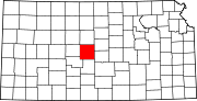
Cheyenne Township — Township — Location in Barton County
Coordinates: 38°31′21″N 098°38′46″W / 38.5225°N 98.64611°WCoordinates: 38°31′21″N 098°38′46″W / 38.5225°N 98.64611°W Country United States State Kansas County Barton Area - Total 72.25 sq mi (187.11 km2) - Land 67.34 sq mi (174.4 km2) - Water 4.91 sq mi (12.72 km2) 6.8% Elevation 1,801 ft (549 m) Population (2000) - Total 238 - Density 3.5/sq mi (1.4/km2) GNIS feature ID 0475521 Cheyenne Township is a township in Barton County, Kansas, United States. As of the 2000 census, its population was 238.[1]
Geography
Cheyenne Township covers an area of 72.25 square miles (187.1 km2) and contains no incorporated settlements. The unincorporated community of Redwing lies in the center of the township.[2] According to the USGS, it contains one cemetery, Holy Family.[3]
The Cheyenne Bottoms Wildlife Area is located almost exclusively in Cheyenne Township; it occupies most of the southern half of the township. Blood Creek runs through some of the township's southern part, emptying into the lake at the center of Cheyenne Bottoms.[2]
Two oil fields are located in Cheyenne Township: one in the northeast, and one in the west.[2]
References
- ^ "Subcounty population estimates: Kansas 2000-2006" (CSV). United States Census Bureau, Population Division. 2007-06-28. http://www.census.gov/popest/cities/files/SUB-EST2006_20.csv. Retrieved 2008-05-28.
- ^ a b c DeLorme. Kansas Atlas & Gazetteer. 4th ed. Yarmouth: DeLorme, 2009, p. 46. ISBN 0-89933-342-7.
- ^ U.S. Geological Survey Geographic Names Information System: Cheyenne Township, Barton County, Kansas
External links
Municipalities and communities of Barton County, Kansas County seat: Great Bend Cities Albert | Claflin | Ellinwood | Galatia | Great Bend | Hoisington | Olmitz | Pawnee Rock | Susank
Townships Albion | Beaver | Buffalo | Cheyenne | Clarence | Cleveland | Comanche | Eureka | Fairview | Grant | Great Bend | Independent | Lakin | Liberty | Logan | North Homestead | Pawnee Rock | South Bend | South Homestead | Union | Walnut | Wheatland
Unincorporated
communitiesCategories:- Townships in Barton County, Kansas
- Kansas geography stubs


Wikimedia Foundation. 2010.