- Cheyenne Bottoms
-
Cheyenne Bottoms is one of 29 places in the United States on the List of Ramsar wetlands of international importance. It is located 2 miles (3.2 km) east of US Highway 281, midway between Hoisington and Great Bend in Kansas.[1]
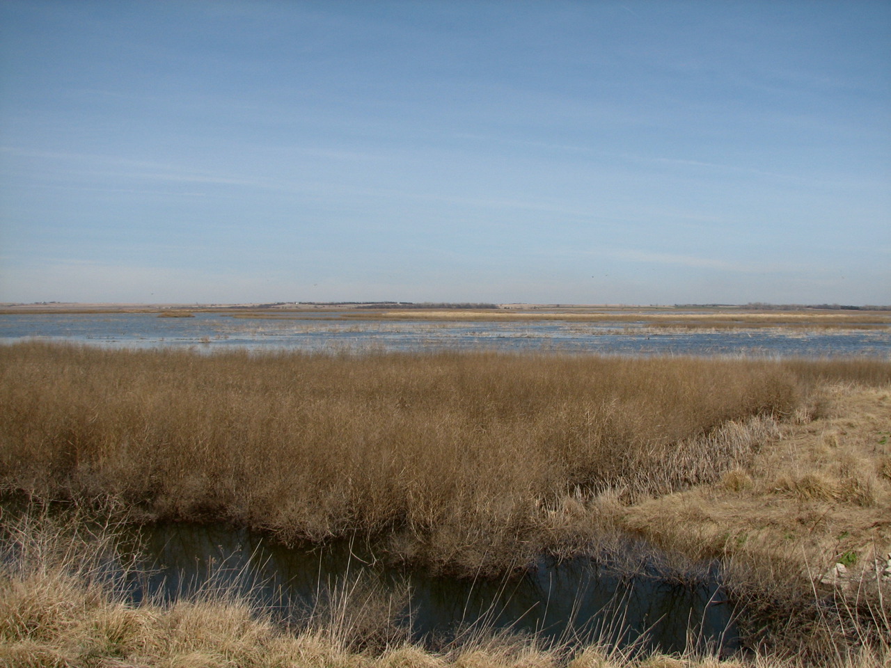
The 41,000 acres (165.92 km2; 64.06 sq mi) wetland is said to be the largest wetland in the interior United States. Kansas claims that 45 percent of shorebirds in the United States stop at the marsh. At least 320 species of birds have been recorded there, including numerous Whooping Cranes and thousands of Sandhill Cranes.[2]
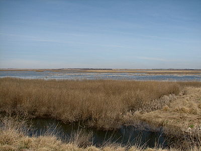 The Cheyenne Bottoms marshes are the largest wetland in the Great Plains, covering an area of 64 square miles.
A core 19,857 acres (80.36 km2; 31.03 sq mi) parcel belongs to the Kansas Department of Wildlife and Parks (KDWP). The Nature Conservancy owns an adjacent 7,300 acres (29.54 km2; 11.41 sq mi).
On January 29, 2008, Quivira National Wildlife Refuge and Cheyenne Bottoms were jointly named as one of the 8 Wonders of Kansas.
Contents
History
According to legend, a battle in 1825 between the Cheyenne and the Kiowa (or Pawnee) turned one of the streams blood red. Blood Creek now flows into the lowlands. Greyhound racing in the United States traces its start to a coursing event in the bottoms in 1886.[3]
In 1900, a project known as the Koen Ditch attempted to divert Arkansas River water 12 miles (19 km) to the bottoms so that it could be used for irrigation. The ditch washed out in a flood. During the 1920s various plans were put forth to drain the bottoms and convert it to farmland.[4] The debate over whether to convert it to farmland or use it as a hunting preserve continued through the early 1920s. Residents downstream at Hutchinson, Kansas protested that draining the bottoms would create flood problems for them. The Little Cheyenne Creek drains into Cow Creek which joins the Arkansas at Hutchinson.[5]
In 1925, the Kansas Forestry, Fish and Game Commission (now part of KDWP) was created to develop and care for the bottoms. In August 1927, 14 inches (36 cm) of rain upstream turned it overnight into "Lake Cheyenne," and caused flooding downstream of Little Cheyenne Creek. Clifford Hope, Charles Curtis, Henry Allen and Arthur Capper made an unsuccessful plea to get federal money to convert it into a National Wildlife Refuge.[6]
Following the Pittman-Robertson Federal Aid in Wildlife Restoration Act (named for Key Pittman and A. Willis Robertson)[7] of 1937, which taxed sporting arms and ammunition, funds became available to develop the bottoms.[8]
In 1952, after the construction of dikes, roads and hunting blinds, part of the area was opened to public hunting. In 1957, a new canal from the Arkansas River was built. However, relatively little water from the Arkansas was pumped into the bottom because of drought and claims by other entities on the water supply. In the 1990s, an extensive renovation subdivided the marshes. The renovations allowed the marshes to be more self-sustaining, although an adequate water supply and management of water levels continue to be critical problems.[9]
Also in the 1990s, The Nature Conservancy began acquiring land adjacent to the state wildlife area.[10]
Geology
The formation of the wetland in a natural basin in a semi-arid area is not entirely understood. It is surrounded on the north, east, and west by bluffs as high as 100 feet (30 m). The basin traps the water of Blood and Deception Creeks. One of the most popular theories is that Cheyenne Bottoms was created as a sinkhole when incoming freshwater dissolved underground salt.[11] However, this theory is challenged by critics who say that not enough salt is present in the base to cause this.
Other theories to explain the formation of Cheyenne Bottoms are that there was structural movement in its base, that it was part of a Pleistocene drainage system involving the Smoky Hill River, and that it was created by sand dunes that scoured the flatlands and blocked drainage.[12]
Description
Historically, Cheyenne Bottoms has been a lake of varying size, a mudflat, or dry. With management to control water and provide a secure way-station for migrating waterfowl and shore birds, it now has 5 pools, crisscrossed by dikes, canals, and pathways, that cover most of the acreage of the wildlife management area. The pools average less than one foot deep. Pools one and five are closed to all human activities. Surrounding the pools are mudflats, ponds, and islands. Elevated areas are primarily grasslands with a few trees. The Kansas State and Nature Conservancy lands are managed with the objective of providing a diverse marsh habitat for the use of migrating and breeding waterfowl and shorebirds. Waterfowl hunting, primarily for geese, is permitted along the southern border of the state wildlife management area.[13] The Kansas Wetlands Education Center within the wildlife management area interprets the wetlands and wildlife for visitors. Approximately 60,000 people visit Cheyenne Bottoms yearly.[14]
Birds
Cheyenne Bottoms is especially noted for the concentration of migratory shorebirds that come here to feed on the mudflats. As many as 600,000 shorebirds from 39 species pass through Cheyenne Bottoms during spring migration and up to 200,000 in fall. About 45 percent of all shorebirds in North America utilize the area. Cheyenne Bottoms is critical habitat for many endangered species, including the Whooping Crane.[15]
A total of 340 species of birds have been observed at Cheyenne Bottoms.[16]
References
- ^ http://www.kdwp.state.ks.us/news/Other-Services/Publications/Maps-State-Wildlife-Areas
- ^ Cheyenne Bottoms: Jewel of the Prairie - cheyennebottoms.net - Retrieved February 10, 2009
- ^ [History of the Greyhound and Greyhound Racing - The Greyhound Review, February 2006]
- ^ Creating a Sea of Galilee: The Rescue of Cheyenne Bottoms by Douglas S. Harvey - Kansas History - Spring 2001
- ^ Creating a Sea of Galilee: The Rescue of Cheyenne Bottoms by Douglas S. Harvey - Kansas History - Spring 2001
- ^ Creating a Sea of Galilee: The Rescue of Cheyenne Bottoms by Douglas S. Harvey - Kansas History - Spring 2001
- ^ http://www.nodc.us/nvdemshistory.htm
- ^ Cheyenne Bottoms: Jewel of the Prairie - cheyennebottoms.net - Retrieved February 10, 2009
- ^ http://www.wetlands.org/RSIS/_COP9Directory/Directory/4US007.html, accessed Mar 4, 2011; Cheyenne Bottoms: Jewel of the Prairie - cheyennebottoms.net - Retrieved February 10, 2009
- ^ Cheyenne Bottoms, Kansas by James S. Aber - emporia.edu - Retrieved February 10, 2009
- ^ Cheyenne Bottoms, Kansas by James S. Aber - emporia.edu - Retrieved February 10, 2009
- ^ Cheyenne Bottoms, Kansas by James S. Aber - emporia.edu - Retrieved February 10, 2009
- ^ http://www.visitgreatbend.com/Cheyenne_Bottoms.asp; http://kansaswetlands.us/images/Copyofcheyennebottomsmapsmaller.jpg; http://www.whsrn.org/site-profile/cheyenne-bottoms, accessed 27 Sep 2011
- ^ http://www.kansaswetlandsandwildlifescenicbyway.com/cheyenne-bottoms; http://wetlandscenter.fhsu.edu/birding.shtml, accessed 5 Mar 2011
- ^ http://www.wetlands.org/RSIS/_COP9Directory/Directory/4US007.html, accessed 5 Mar 2011
- ^ http://wetlandscenter.fhsu.edc/birding.shtml, accessed 5 Mar 2011
External links
Coordinates: 38°27′46″N 98°39′10″W / 38.46283°N 98.65277°W
Categories:- Great Plains
- Wetlands of Kansas
- Ramsar sites in the United States
- Protected areas of Barton County, Kansas
- Important Bird Areas of the United States
- Recreational areas in Kansas
- Landforms of Kansas
- Nature Conservancy preserves
- Nature reserves in Kansas
Wikimedia Foundation. 2010.