- Wetland
-
For other uses, see Wetland (disambiguation).
 The Florida Everglades' massive wetland system in the United States saw 1.7 billion gallons of fresh water flushed from it daily and pumped into the ocean following one of the most successive water management and development projects in the country. Sixty years later, it now home to the largest ecological restoration project in the world. [1]
A wetland is an area of land whose soil is saturated with water either permanently or seasonally.[2] Wetlands are categorised by their characteristic vegetation, which is adapted to these unique soil conditions.[3][4] The water found in wetlands can be saltwater, freshwater, or brackish.[4] Wetlands include swamps, marshes, and bogs, among others.[5]
Wetlands are found on every continent except Antarctica.[5] One of the world's largest natural wetlands is the Pantanal, which straddles Brazil, Bolivia, and Paraguay in South America.[6] The main functions of wetlands are as water purification systems, flood control, shoreline stability, and as reservoirs of biodiversity. [7] Wetlands may be converted for agriculture or development or constructed as a water management tool as in the recent developing field of Water Sensitive Urban Design.
The study of wetlands has recently been termed paludology in some publications.[8] Wetlands also are known internationally as inland water or coastal/marine ecosystems.[9]
The UN Millennium Ecosystem Assessment determined that environmental degradation is more prominent within wetland systems than any other ecosystem on Earth. International conservation efforts and the development of rapid assessment tools are being used in conjunction with each other to inform people about wetland issues.
Contents
Technical definitions
Wetlands have been categorized both as biomes and ecosystems. A patch of land that develops pools of water after a rain storm would not be considered a "wetland" though the land is wet. Wetlands have unique characteristics: they are generally distinguished from other water bodies or landforms based on their water level and on the types of plants that thrive within them. Specifically, wetlands are characterized as having a water table that stands at or near the land surface either permanently or seasonally for a long enough period each year to support aquatic plants.[10][11] A concise definition is a community composed of hydric soil and hydrophytes.[5]
Wetlands have also been described as ecotones, providing a transition between dry land and water bodies.[12] Mitsch and Gosselink write that wetlands exist "...at the interface between truly terrestrial ecosystems and aquatic systems, making them inherently different from each other, yet highly dependent on both."[13]
In environmental-decision making, there are subsets of definitions that are agreed upon to make regulatory and policy decisions.
Ramsar Convention definition
Under the Ramsar international wetland conservation treaty, an international agreement signed by 160 countries, wetlands are defined as follows:[14]
- Article 1.1: "...wetlands are areas of marsh, fen, peatland or water, whether natural or artificial, permanent or temporary, with water that is static or flowing, fresh, brackish or salt, including areas of marine water the depth of which at low tide does not exceed six metres."
- Article 2.1: "[Wetlands] may incorporate riparian and coastal zones adjacent to the wetlands, and islands or bodies of marine water deeper than six metres at low tide lying within the wetlands".
Regional definitions
In the United States, wetlands are defined as "those areas that are inundated or saturated by surface or groundwater at a frequency and duration sufficient to support, and that under normal circumstances do support, a prevalence of vegetation typically adapted for life in saturated soil conditions. Wetlands generally include swamps, marshes, bogs and similar areas".[15] This definition has been used in the enforcement of the Clean Water Act. Some US states, such as Massachusetts and New York, have separate definitions that may differ from the federal government.
Characteristics
Wetlands vary widely due to local and regional differences in topography, hydrology, vegetation, and other factors, including human disturbance. Wetlands can be divided into two main classes: tidal and non-tidal areas.[5]
Hydrology
Wetland hydrology is associated with the spatial and temporal dispersion, flow, and physiochemical attributes of surface and ground water in its reservoirs. Based on hydrology, wetlands can be categorized as riverine, lacustrine, and palustrine. Sources of hydrological flows into wetlands are predominately precipitation, surface water, and ground water. Water flows out of wetlands by evapotranspiration, surface run-off, and sub-surface water outflow. Hydrodynamics (the movement of water through and from a wetland) affects hydroperiods (temporal fluctuations in water levels) by controlling the water balance and water storage within a wetland.[16]
Landscape characteristics control wetland hydrology and hydro-chemistry. The O2 and CO2 concentrations of water depend on temperature and atmospheric pressure. Hydro-chemistry within wetlands is determined by the pH, salinity, nutrients, conductivity, soil composition, hardness, and the sources of water. Water chemistry of wetlands varies across landscapes and climatic regions. Wetlands are generally minerotrophic with the exception of bogs.
Bogs receive their water from the atmosphere and therefore their water has low mineral ionic composition because ground water has a higher concentration of dissolved nutrients and minerals in comparison to precipitation.
The water chemistry of fens ranges from low pH and low minerals to alkaline with high accumulation of calcium and magnesium because they acquire their water from precipitation as well as ground water.[17]
The role of salinity
Salinity has a strong influence on wetland water chemistry. In non-riverine wetlands, natural salinity is regulated by interactions between ground and surface water, which may be influenced by human activity.[18]
Soil
Carbon is the major nutrient cycled within wetlands. Most nutrients, such as sulfur, phosphorus, carbon, and nitrogen are found within the soil of wetlands. Anaerobic and aerobic respiration in the soil influences the nutrient cycling of carbon, hydrogen, oxygen, and nitrogen,[19] and the solubility of phosphorus[20] thus contributing to the chemical variations in its water. Wetlands with low pH and saline conductivity may reflect the presence of acid sulfates[21] and wetlands with average salinity levels can be heavily influenced by calcium or magnesium. Biogeochemical processes in wetlands are determined by soils with low redox potential.[22]
Biota
The biota of a wetland system includes its vegetation zones and structure as well as animal populations and distribution which are highly dependent on water chemistry. The chemistry of water flowing into wetlands depends on the source of water and the geological material in which it flows through[23] as well as the nutrients discharged from organic matter in the soils and plants at higher elevations in slope wetlands.[24] Biota may vary within a wetland due to season or migratory animals.
Flora
There are four main groups of hydrophytes that found in wetland systems throughout the world.[25]
Submerged water plants. This type of vegetation in found completely underwater. It may range from sea grasses in inter-tidal zones to ribbonweed, the most common native plant found within Australian waterways. Submerged wetland vegetation can grow in saline and fresh-water conditions and may still possess a peak growing season. Endemic submerged species provide a food source for native fauna, habitat for invertrebrates, and also possess filtration capabilities.
Floating water plants. Floating vegetation is usually small although it may take up a large surface area in a wetland system. These hydrophytes have small roots and are only found in slow-moving water with rich-nutrient level water Floating aquatic plants are a food resource for avian species. A common example seen in wetland systems is the Lily pad or the Australian native duckweed.
Emergent water plants. Emergent water plants can seen above the surface of the water but whose roots are completely submerged. These hydrophytes will store nutrients and will proliferate to counter-balance harmful algal blooms and invasive species. Common rush is a common native emergent water plan found in the continent of Australia. It can grow up to one metre high and flowers in spring and summer.
Surrounding trees and shrubs. Surrounding wetland vegetation can be riparian or forested. Riparian vegetation grows close to river bank or coastal area stabilizing the shore, providing shade to regulate water temperature, and provides habitat to native communities. Trees surround many wetland areas promoting a carbon sink, stabilization, wind breaks, and erosion control. The Paperbark tree in Australia is commonly found in still or slow-moving water in swamps and creeks.
Fauna
Fish: Fish are more dependent on wetland ecosystems than any other type of habitat. Every single species of both fresh water and saltwater fish spends part of its life-cycle in a coastal wetland. 75% of the United States’ commercial fish and shellfish stocks depend solely on estuaries to survive.[7] Tropical fish species need mangroves for critical hatchery and nursery grounds and the coral reef system for food.
Amphibians: Frogs are the most crucial amphibian species in wetland systems. Frogs need both terrestrial and aquatic habitats in which to reproduce and feed. While tadpoles control algal populations, adult frogs forage on insects. Frogs are used as an indicator of ecosystem health due to their thin skin which absorbs both nutrient and toxins from the surrounding environment resulting in an above average extinction rate in unfavorable and polluted environmental conditions.[26]
Reptiles: Alligators and crocodiles are two common reptilian species. Alligators are found in fresh water along with the fresh water species of the crocodile. The saltwater crocodile is found in estuaries and mangroves and can be seen in the coastline bordering the Great Barrier Reef in Australia. The Florida Everglades is the only place in the world where both crocodiles and alligators co-exist.[1] Snakes, lizards, goannas, and turtles also can be seen throughout wetlands.
Mammals: Multiple small mammals as well as large herbivore and apex species such as the Florida Panther live within and around wetlands. The wetland ecosystem attracts mammals due to its prominent seed sources, invertebrate populations, and numbers of small reptiles and amphibians.
Marsupials: The platypus (Ornithorhynchus anatinus) is found in eastern Australia living in freshwater rivers or lakes, and much like the beaver creates dams, create burrows for shelter and protection. The platypus swims through the use of webbed feet. Platypuses feed on insect larvae, worms, or other freshwater insects hunting mainly by night by the use of their bill. They turn up mud on the bottom of the lake or river, and with the help of the electroreceptors located on the bill, unearth insects and freshwater insects. The platypus stores their findings in special pouches behind their bill and consumes its prey upon returning to the surface.[27]
Insects and invertebrates: These species total more than half of the 100,000 known animal species in wetlands. Insects and invertebrates can be submerged in the water or soil, on the surface, and in the atmosphere.
Algae
Algae are diverse water plants that can vary in size, color, and shape. Algae occur naturally in habitats such as inland lakes, inter-tidal zones, and damp soil and provide a dedicated food source for animals, fish, and invertebrates. There are three main groups of algae:
Plankton are algae which are microscopic, free-floating algae. This algae is so tiny that on average, if fifty of these microscopic algae were lined up end-to-end, it would only measure one millimetre, which is only 3/100's of an inch! Plankton are the basis of the food web and are responsible for primary production in the ocean using photosynthesis to make food. Filamentous algae are long strands of algae cells that form floating mats. Chara and Nitella algae are upright algae that look like a submerged plant with roots.[28]
Biota importance
Many of the flora and fauna that are part of wetlands are disappearing. As most species are endemic to wetlands, biologists and other scientists routinely census wetland biota to look for threatened populations. The IUCN's global red list[29] can be accessed on the internet to determine if there is any species within a particular wetland system that has been identified as needing assistance to prevent extinction.
Climates
Temperature
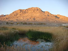 Wetlands contrast the hot, arid landscape around Middle Spring, Fish Springs National Wildlife Refuge, Utah.
Temperatures vary greatly depending on the location of the wetland. Many of the world's wetlands are in temperate zones (midway between the North or South Pole and the equator). In these zones, summers are warm and winters are cold, but temperatures are not extreme. However, wetlands found in the tropic zone, around the equator, are warm year round. Wetlands on the Arabian Peninsula, for example, can reach 50 °C (122 °F) and would therefore be subject to rapid evaporation. In northeastern Siberia, which has a polar climate, wetland temperatures can be as low as −50 °C (−58 °F). In a moderate zone, such as the Gulf of Mexico, a typical temperature might be 11 °C (51 °F).
Rainfall
The amount of rainfall a wetland receives varies widely according to its location. Wetlands in Wales, Scotland, and Western Ireland typically receive about 1500 mm (or 60 in) per year. In some places in Southeast Asia, where heavy rains occur, they can receive up to 10,000 mm (about 200 in). In the northern areas of North America, wetlands exist where as little as 180 mm (7 inches) of rain fall each year.
Temporal variation:[30]
- Perennial systems
- Seasonal systems
- Episodic (periodic or intermittent) systems
- Surface flow may occur in some segments, with subsurface flow in other segments
- Ephemeral (short-lived) systems
- Migratory species
Human-disturbance:[31]
- Encroachment
- Drainage
- Development
- Over-grazing
- Mining
- Unsustainable water use
- Ecosystem Stress
- Water Scarcity
- Endangered species
- Disruption of breeding grounds
- Imbalance in sediment load and nutrient filtration
The peatswamps of South-east Asia
In Southeast Asia, peatswamp forests and soils are being drained, burnt, mined, and overgrazed contributing severely to climate change.[31] As a result of peat drainage, the organic carbon that was built up over thousands of years and is normally under water, is suddenly exposed to the air. It decomposes and turns into carbon dioxide (CO2), which is released into the atmosphere. Peat fires cause the same process and in addition create enormous clouds of smoke that cross international borders, such as happen every year in Southeast Asia. Peatlands form only 3% of all the world’s land area, however, their degradation equals 7% of all fossil fuel CO2 emissions.
Through the building of dams, Wetlands International is halting the drainage of peatlands in Southeast Asia, hoping to mitigate CO2 emissions. Concurrent wetland restoration techniques include reforestation with native tree species as well as setting up community fire brigades. This sustainable approach can be seen in Central Kalimantan and Sumatra, Indonesia.
Aquaculture
Concerns are developing over certain aspects of farm fishing, which uses natural waterways to harvest fish for human consumption and pharmaceuticals. This practice has become especially popular within Asia and the South Pacific. Its impact downstream upon much larger water ways has negatively influenced many small island developing states.[32]
Ecosystem Services.
The function of natural wetlands can be classified by their ecosystem benefits. The United Nations Millennium Ecosystem Assessment and Ramsar Convention found wetlands to be of biosphere significance and societal importance in the following areas:
• Flood control • Groundwater replenishment • Shoreline stabilisation and storm protection • Water purification • Reservoirs of biodiversity • Wetland products • Cultural values • Recreation and tourism • Climate change mitigation and adaptation
The economic worth of the ecosystem services provided to society by intact, naturally functioning wetlands is frequently much greater than the perceived benefits of converting them to ‘more valuable’ intensive land use – particularly as the profits from unsustainable use often go to relatively few individuals or corporations, rather than being shared by society as a whole.-Ramsar convention
Unless otherwise cited,Ecosystem services is based on the following series of references.[7]
Flood control.
Major wetland type: floodplain
Storage Reservoirs and Flood Protection. The wetland system of floodplains is formed from major rivers downstream from their headwaters. Notable river systems that produce large spans of floodplain include the Nile River (Africa), Mississippi River (USA), Amazon River (South America), Yangtze River (China), Danube River (Central Europe) and Murray-Darling River (Australia). "The floodplains of major rivers act as natural storage reservoirs, enabling excess water to spread out over a wide area, which reduces its depth and speed. Wetlands close to the headwaters of streams and rivers can slow down rainwater runoff and spring snowmelt so that it doesn’t run straight off the land into water courses. This can help prevent sudden, damaging floods downstream.”[7]
Human-Impact. Converting wetlands through drainage and development have contributed to the issue of irregular flood control through forced adaption of water channels to narrower corridors due to loss of wetland area. These new channels must manage the same amount of precipitation causing flood peaks to be [higher or deeper] and floodwaters to travel faster.
Water management engineering developments in the past century have degraded these wetlands through the construction on artificial embankments. These constructions may be classified as dykes, bunds, levees, weirs, barrages and dams but serve the single purpose of concentrating water into a select source or area. Wetland water sources that were once spread over slowly over a large, shallow area are pooled into deep, concentrated locations. Loss of wetland floodplains results in more severe and damaging flooding. Catastrophic human impact in the Mississippi River floodplains was seen in death of several hundred individuals during a levee breach in New Orleans caused by Hurricane Katrina. Ecological catastrophic events from human-made embankments have been noticed along the Yangtze River floodplains after the where the middle of the river has become prone to more frequent and damaging flooding including the loss of riparian vegetation, a 30% loss of the vegetation cover throughout the river’s basin, a doubling of the percentage of the land affected by soil erosion, and a reduction in reservoir capacity through siltation build-up in floodplain lakes. [7]
File:Ramsar Pakistan wetland.jpgHighland wetlands.This photo of Pakistan demonstrates the interaction of wetlands within a larger ecosystem. A peat-lined lake lies adjacent to Karumbar Lake at 4,150m (13,615 ft). This makes highland wetlands such as these important to not only the wildlife that lives within the area but to all the lakes and waterways lying at a lower altitude and the communities living near them. [33]Groundwater replenishment
Major wetland type: marsh, swamp, & subterranean karst and cave hydrological systems
The surface water which is the water visibly seen in wetland systems only represents a portion of the overall water cycle which also includes atmospheric water and groundwater. Wetland systems are directly linked to groundwater and a crucial regulator of both the quantity and quality of water found below the ground. Wetland systems that are made of permeable sediments like limestone or occur in areas with highly variable and fluctuating water tables especially have a role in groundwater replenishment or water recharge. Sediments that are porous allow water to filter down through the soil and overlying rock into aquifers which are the source of 95% of the world’s drinking water. Wetlands can also act as recharge areas when the surrounding water table is low and as a discharge zone when it is too high. Karst (cave) systems are a unique example of this system and are a connection of underground rivers influenced by rain and other forms of precipitation. These wetland systems are capable of regulating changes in the water table on upwards of 130 meters (426.5 feet).
Human-Impact. Groundwater is an important source of water for drinking and irrigation of crops. Over 1 billion people in Asia and 65% of the public water sources in Europe source 100% of their water from groundwater. Irrigation is a massive use of groundwater with 80% of the world’s groundwater used for agricultural production. [7]
Unsustainable abstraction of groundwater has become a major concern. In the Commonwealth of Australia, water licensing is being implemented to control use of the water in major agricultural regions. On a global scale, groundwater deficits and water scarcity is one of the most pressing concerns facing the 21st century.[7]
Shoreline stabilisation and storm protection.
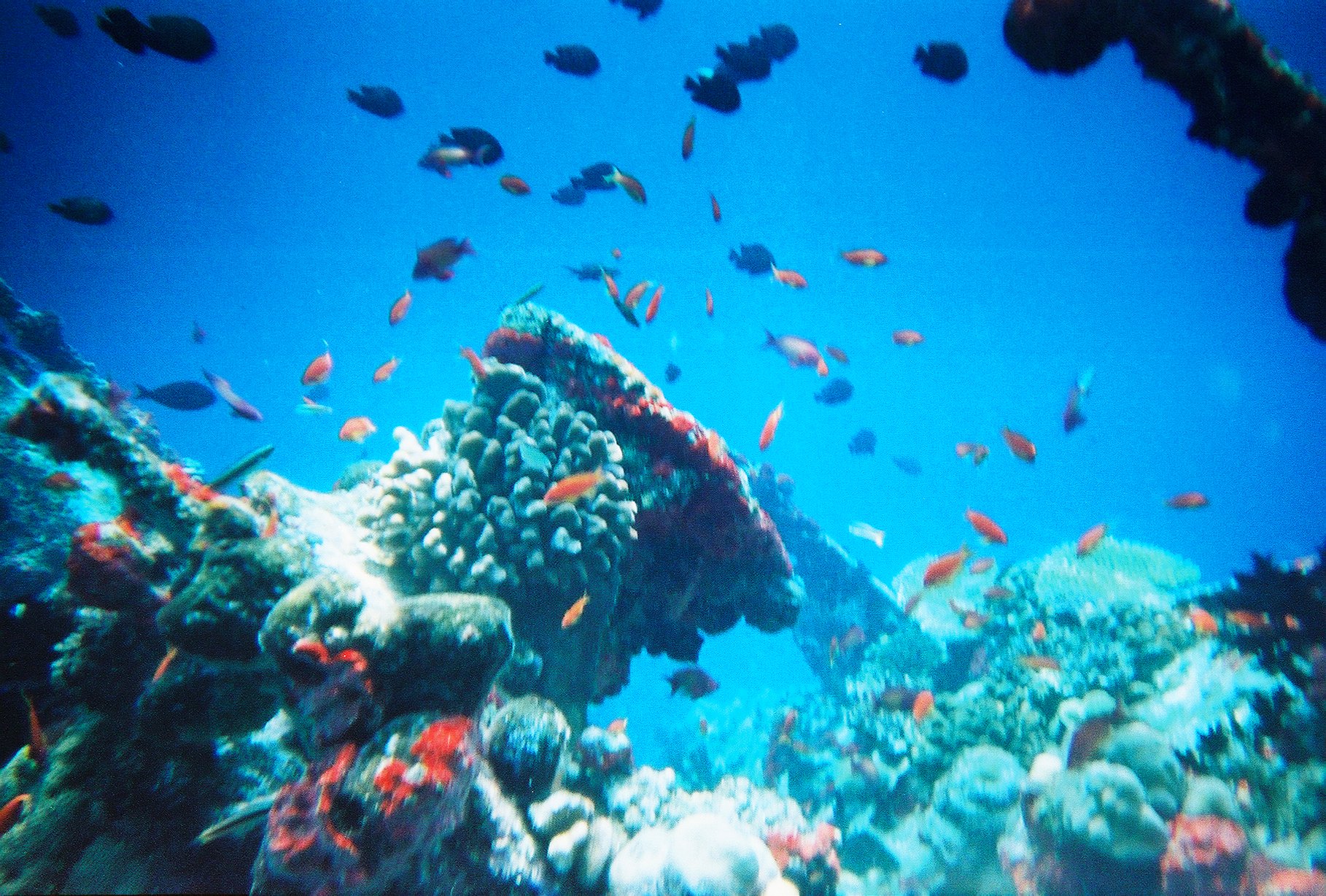
Wetland type: Mangroves, Coral Reefs, Saltmarsh
Tidal and inter-tidal wetland systems protect and stabilize coastal zones. Coral reefs provide a protective barrier to coastal shoreline. Mangroves stabilize the coastal zone from the interior and will migrate with the shoreline to remain adjacent to the boundary of the water. The main conservation benefit these systems have against storms and tidal waves is the ability to reduce the speed and height of waves and floodwaters.
Human-Impact. The sheer number of people who live and work near the coast is expected to grow immensely over the next 50 years. From an estimated 200 million people that currently live in low-lying coastal regions, the development of urban coastal centers is projected to increase the population by 5 fold within 50 years. [34] . The United Kingdom has begun the concept of managed coastal realignment. This management technique provides shoreline protection through restoration of natural wetlands rather than through applied engineering.
Water Purification.
Wetland Type: Floodplain, Mudflat, Saltmarsh, Mangroves
Nutrient Retention. Wetlands cycle both sediments and nutrients balancing terrestrial and aquatic ecosystems. A natural function of wetland vegetation is the up-take and storage of nutrients found in the surrounding soil and water. These nutrients are retained in the system until the plant dies or is harvested by animals or humans. Wetland vegetation productivity is linked to the climate, wetland type, and nutrient availability. The grasses of fertile floodplains such as the Nile produce the highest yield including plants such as Arundo donax(giant reed), Cyperus papyrus (papyrus), Phragmites (reed) and Typha (cattail, bulrush).
Sediment Traps. Rainfall run-off is responsible for moving sediment through waterways. These sediments move towards larger and more sizable waterways through a natural process that moves water towards oceans. All types of sediments which may be composed of clay, sand, silt, and rock can be carried into wetland systems through this process. Reedbeds or forests located in wetlands act as physical barriers to slow waterflow and trap sediment.
Water purification. Many wetland systems possess biofilters, hydrophytes, and organisms that in addition to nutrient up-take abilities have the capacity to remove toxic substances that have come from pesticides, industrial discharges, and mining activities. The up-take occurs through most parts of the plant including the stems, roots, and leaves . Floating plants can absorb and filter heavy metals. Eichhornia crassipes (water hyacinth), Lemna (duckweed) and Azolla (water fern) store iron and copper commonly found in wastewater. Many fast-growing plants rooted in the soils of wetlands such as Typha (cattail) and Phragmites (reed) also aid in the role of heavy metal up-take. Animals such as the oyster can filter more than 200 liters (53 gallons) of water per day while grazing for food, removing nutrients, suspended sediments, and chemical contaminants in the process.
Capacity. The ability of wetland systems to store nutrients and trap sediment is highly efficient and effective but each system has a threshold. An overabundance of nutrient input from fertilizer run-off, sewage effluent, or non-point pollution will cause eutrophication. Upstream erosion from deforestation can overwhelm wetlands making them shrink in size and see dramatic biodiversity loss through excessive sedimentation load. The capacity of wetland vegetation to store heavy metals is affected by waterflow, number of hectares (acres), climate, and type of plant.
Human-Impact. Introduced hydrophytes in different wetland systems can have devastating results. The introduction of water hyacinth, a native plant of South America into Lake Victoria in East Africa as well as duckweed into non-native areas of Queensland, Australia, have overtaken entire wetland systems suffocating the ecosystem due to their phenomenal growth rate and ability to float and grow on the surface of the water.
Constructed Wetlands
The function of most natural wetland systems is not to manage to wastewater, however, their high potential for the filtering and the treatment of pollutants has been recognized by environmental engineers that specialize in the area of wastewater treatment. These constructed artificial wetland systems are highly-controlled environments that intend to mimic the occurrences of soil, flora, and microorganisms in natural wetlands to aid in treating wastewater effluent. Artificial wetlands provide the ability to experiment with flow regimes, micro-biotic composition, and flora in order to produce the most efficient treatment process. Other advantages are the control of retention times and hydraulic channels. [35] The most important factors of constructed wetlands are the water flow processes combined with plant growth. Constructed wetland systems can be surface flow systems with only free-floating macrophytes, floating-leaved macrophytes, or submerged macrophytes; however, typical free water surface systems are usually constructed with emergent macrophytes.[36] Constructed wetlands can be adapted to treat raw sewage, secondary domestic sludge, enhance water quality of oxidation ponds’ discharge, storm waters, mining waste, and industrial and agricultural waste effluents. International wastewater management programs can be seen from Kolkata (Calcutta), India to Arcata, California, USA[37].
Kolkata’s constructed wetland. Kolkata is an example of how constructed wetlands are being utilized in developing countries.
Using the purification capacity of wetlands, the Indian city of Kolkata (Calcutta) has pioneered a system of sewage disposal that is both efficient and environmentally-friendly. Built to house one million people, Kolkata is now home to over 10 million, many living in slums. But the 8,000-hectare East Kolkata Wetlands Ramsar Site, a patchwork of tree-fringed canals, vegetable plots, rice paddies and fish ponds – and the 20,000 people that work in them – daily transform one-third of the city’s sewage and most of its domestic refuse into a rich harvest of fish and fresh vegetables. For example, the Mudialy Fishermen’s Cooperative Society is a collective of 300 families that lease 70 hectares into which wastewater from the city is released. Through a series of natural treatment processes – including the use of Eichhornia crassipes and other plants for absorbing oil, grease and heavy metals – the Cooperative has turned the area into a thriving fish farm and nature park. In 2005/06, the Cooperative sold fish worth over US$135,000 and shared income of more than US$55,000 among its members.[7]
Reservoirs of biodiversity.
Wetland systems' rich biodiversity is becoming a focal point at International Treaty Conventions and within the World Wildlife Fund organization due to the high number of species present in wetlands, the small global geographic area of wetlands, the number of species which are endemic to wetlands, and the high productivity of wetland systems. Hundred of thousands of animal species, 20,000 of them vertebrates, are living in wetland systems. The discovery rate of fresh water fish is at 200 new species per year.
Biodiverse river basins. The Amazon holds 3,000 species of fresh water fish species within the boundaries of its basin whose function it is to disperse the seeds of trees. One of its key species, the Piramutaba catfish, Brachyplatystoma vaillantii, migrates more than 3,300 km (2,051 miles) from its nursery grounds near the mouth of the Amazon River to its spawning grounds in Andean tributaries (400 m or 437 yards above sea level) distributing plants seed along the route.
Productive intertidal zones. Intertidal mudflats have a similar productivity even while possessing a low number of species. The abundance of invertebrates found within the mud are a food source for migratory waterfowl.
Critical life-stage habitat. Mudflats, saltmarshes, mangroves, and seagrass beds contain bother species richness and productivity, and are home to important nursery areas for many commercial fish stocks.
Genetic Diversity. Many species in wetland systems are unique due to the long period of time that the ecosystem has been physically isolated from other aquatic sources. The number of endemic species in Lake Baikal in Russia classifies it as a hotspot for biodiversity and one of the most biodiverse wetlands in the entire world.
Lake Baikal. Evidence from a research study by Mazepova et. al suggest that the number of crustacean species endemic to Baikal Lake (>690 species and subspecies) exceeds the number of the same groups of animals inhabiting all the fresh water bodies of Eurasia together. Its 150 species of free-living Platyhelminthes alone is analogous to the entire number in all of Eastern Siberia. The 34 species and subspecies number of Baikal sculpins is more than twice the number of the analogous fauna that inhabits Eurasia. One of most exciting discoveries was made by A.V. Shoshin who registered about 300 species of free-living nematodes using only 6 near-shore sampling localities in the Southern Baikal. "If we will take into consideration, that about 60 % of the animals can be found nowhere else except Baikal, it may be assumed that the lake may be the biodiversity center of the Eurasian continent."[38]
Human Impact. Biodiversity loss occurs in wetland systems through land use changes, habitat destruction, pollution, exploitation of resources, and invasive species. Vulnerable, threatened, and endangered species number at 17% of waterfowl, 38% of fresh-water dependent mammals, 33% of fresh water fish, 26% of fresh water amphibians, 72% of fresh water turtles, 86% of marine turtles, 43% of crocodilians and 27% of coral reef-building species.
The impact of maintaining biodiversity is seen at the local level through job creation, sustainability, and community productivity. A good example is the Lower Mekong basin which runs through Cambodia, Laos, and Vietnam. Supporting over 55 million people, the sustainability of the region is enhanced through wildlife tours. The US state of Florida has estimated that US$ 1.6 billion was generated in state revenue from recreational activities associated with wildlife. Sustainable harvesting for medicinal remedies found in native wetlands plants in the Caribbean and Australia include the Red Mangrove Rhizophora mangle which possesses antibacterial, wound-healing, anti-ulcer effects, and antioxidant properties.[39]
Wetland Products.
Wetland systems naturally produce an array of vegetation and other ecological products that can harvested for personal and commercial use. The most significant of these is fish which have all or part of their life-cycle occur within a wetland system. Fresh and saltwater fish are the main source of protein for one billion people and comprise 15% of an additional two billion people’s diets. In addition, fish generate a fishing industry that provides 80% of the income and employment to residents in developing countries. Another food staple found in wetland systems is rice, a popular grain that is consumed at the rate of 1/5 of the total global calorie count. In Bangladesh, Cambodia and Vietnam, where rice paddies are predominant on the landscape, rice consumption reach 70%.[39]
Food converted to sweeteners and carbohydrates include the sago palm of Asia and Africa (cooking oil), the nipa palm of Asia (sugar, vinegar, alcohol, and fodder) and honey collection from mangroves. More than supplemental dietary intake, this produce sustains entire villages. Coastal Thailand villages earn the key portion of their income from sugar production while the country of Cuba relocates more than 30,000 hives each year to track the seasonal flowering of the mangrove Avicennia.
Other mangrove- derived products.
• fuelwood • salt (produced by evaporating seawater) • animal fodder • traditional medicines (e.g. from mangrove bark) • fibers for textiles • dyes and tannins
Human Impact. Over-fishing is the major problem for sustainable use of wetlands. The field of aquaculture within the fisheries industries is eliminating mass areas of wetland systems through practices seen such as in the shrimp farming industry's destruction of mangroves. Aquaculture is continuing to develop rapidly throughout the Asia-Pacific region specifically in China with world holdings in Asia equal to 90% of the total number of aquaculture farms and 80% of its global value.[39] Threats to rice fields mainly stem from inappropriate water management, introduction of invasive alien species, agricultural fertilizers, pesticides, and land use changes. Industrial-scale production of palm oil threatens the biodiversity of wetland ecosystems in parts of south-east Asia, Africa, and other developing countries. Exploitation can occur at the community level as is sometimes seen throughout coastal villages of Southern Thailand where each resident may obtain for themselves every consumable of the mangrove forest (fuelwood, timber, honey, resins, crab, and shellfish) which then becomes threatened through increasing population and continual harvest. Other issues that occur on a global level include a uneven contribution to climate change, point and non-point pollution, and air and water quality issues due to destructive wetland practices.
Wetlands and climate change
'All references within this section were obtained from the following source'. [40]]]
Scientific Projections.
“Low water and occasional drying of the wetland bottom during droughts (dry marsh phase) stimulate plant recruitment from a diverse seed bank and increase productivity by mobilizing nutrients. In contrast, high water during deluges (lake marsh phase) causes turnover in plant populations and creates greater interspersion of element cover and open water, but lowers overall productivity. During a cover cycle that ranges from open water to complete vegetation cover, annual net primary productivity may vary 20-fold.” [41]
Mitigation and Adaption.
Wetlands perform two important functions in relation to climate change. They have mitigation effects through their ability to sink carbon, and adaptation effects through their ability to store and regulate water.
Conservation
Main article: Wetland conservationWetlands have historically been the victim of large draining efforts for real estate development, or flooding for use as recreational lakes. Since the 1970s, more focus has been put on preserving wetlands for their natural function yet by 1993 half the world's wetlands had been drained.[42]. Wetlands provide a valuable flood control function. Wetlands are very effective at filtering and cleaning water pollution,[43] (often from agricultural runoff from the farms that replaced the wetlands in the first place). To replace these wetland ecosystem services enormous amounts of money had to be spent on water purification plants, along with the remediation measures for controlling floods: dam and levee construction.
In order to produce sustainable wetlands, short-term, private-sector profits need to come secondary to global equity. Decision-makers must valuate wetland type, provided ecosystem service, long-term benefit, and current subsidies inflating valuation on either the private or public sector side. Analysis using the impact of hurricanes versus storm protection features projected wetland valuation at US$33,000/hectare/year. [44]
Balancing wetland conservation with the needs of people
Wetlands are vital ecosystems that provide livelihoods for the millions of people who live in and around them. The Millennium Development Goals (MDGs) called for different sectors to join forces to secure wetland environments in the context of sustainable development and improving human wellbeing. A three-year project carried out by Wetlands International in partnership with the International Water Management Institute found that it is possible to conserve wetlands while improving the livelihoods of people living among them. Case studies conducted in Malawi and Zambia looked at how dambos – wet, grassy valleys or depressions where water seeps to the surface – can be farmed sustainably to improve livelihoods. Mismanaged or overused dambos often become degraded, however, using a knowledge exchange between local farmers and environmental managers, a protocol was developed using soil and water management practices. Project outcomes included a high yield of crops, development of sustainable farming techniques, and adequate water management generating enough water for use as irrigation. Before the project, there were cases where people had died from starvation due to food shortages. By the end of it, many more people had access to enough water to grow vegetables. A key achievement was that villagers had secure food supplies during long, dry months. They also benefited in other ways: nutrition was improved by growing a wider range of crops, and villagers could also invest in health and education by selling produce and saving money. [45]
Ramsar Convention
The Convention on Wetlands of International Importance, especially as Waterfowl Habitat, or Ramsar Convention, is an international treaty designed to address global concerns regarding wetland loss and degradation. The primary purposes of the treaty are to list wetlands of international importance and to promote their wise use, with the ultimate goal of preserving the world's wetlands. Methods include restricting access to the majority portion of wetland areas, as well as educating the public to combat the misconception that wetlands are wastelands. The Convention works closely with five International Organisation Partners. These are: Birdlife International, IUCN, International Water Management Institute, Wetlands International and World Wide Fund for Nature. The partners provide technical expertise, help conduct or facilitate field studies and provide financial support. The IOPs also participate regularly as observers in all meetings of the Conference of the Parties and the Standing Committee and as full members of the Scientific and Technical Review Panel.
Conservation by country
Conservation efforts vary in intensity and method by country.
New Zealand
Over 90% of the wetlands in New Zealand have been drained since European settlement, predominantly to create farmland. Wetlands now have a degree of protection under the Resource Management Act.
South Africa
The South African Department of Environmental Affairs and Tourism in conjunction with the departments of Water Affairs and Forestry, and of Agriculture, supports the conservation and rehabilitation of wetlands through the Working for Wetlands program.[46] The aim of this program is to encourage the protection, rehabilitation and sustainable use of South African wetlands through co-operative governance and partnerships. The program is also a poverty relief effort, providing employment in wetland maintenance.
Sweden
The Swedish national wetland inventory (VMI) is one of the world's most extensive systematic inventories of nature types that has ever been done. VMI has surveyed the wetlands of Sweden below the alpine region during a 25-year period.[47] In total 35 000 objects (sites) are included in VMI, corresponding to an area of 4.3 million hectares, or 10% of the land area of Sweden. The aim of the survey has been to increase the general knowledge of wetlands in Sweden, as a basis for environmental monitoring and natural resources planning. By investigating the impact of human activities on wetlands and identifying the most valuable wetlands, their values can be preserved for future generations. The results from the inventory were also meant to function as background data for the authorities' decisions concerning e.g. drainage permits.
United States
The USA centred its wetland conservation efforts through legislation enforcement creating requirements that if a wetland had to be drained; developers had to offset the loss through the generation of artificial wetlands. A restoration project by the State of Florida in the Everglades acquired U.S. Sugar Corporation land allowing for water delivery, water treatment, and water storage of sufficient quantity and quality to mimic the Everglades' natural system.[48] [49]
Republic of Macedonia
The fragments of wetland habitats that are still in existence in the Republic of Macedonia are present as marsh or swamp communities. These patches are present at Studenchishte (small fragment near Ohrid Lake), Pelagonia (village Chepigovo), Negortsi Spa, Bansko, Belchishte wetland and Monospitovo marsh. The large areas of swamps that used to be present in most of the valleys in contemporary Republic of Macedonia have undergone a great transformation over the last 50-60 years. The main cause for their reduction is land reclamation, drainage, and conversion into arable land for agricultural needs (Smith and Smith, 2003)[citation needed]. Some of the remaining wetlands (Negortsi Spa, Bansko) are of great importance for understanding the genesis of marsh vegetation in the Republic of Macedonia as many mountainous marshes and peat bogs suffered anthropogenic transformation due to the capturing of water from mountain springs and streams for the purposes of generating drinking water (Smith, 2003)[citation needed]. Accordingly, the fragmentation and transformation of previous swamps had a major impact on faunal distribution and abundance. Amphibians are the most affected species along with invertebrate and vertebrate groups including the European Otter (Lutra Lutra L.). It is listed as Nearly Threatened according to the IUCN’s red list and mainly found now only in the Belchishte wetland (Smith 2003; Smith and Smith, 2003). The otter has importance for the wetland communities not just in Macedonia but also in other European countries such as the Netherlands and Germany (Reuther, 1995; Reuther et al., 2001)[citation needed]. Macedonian wetlands lie within the network of some of the bigger rivers in Macedonia including the Vardar River, a catchment area equal to 80% of Macedonian territory. .
Valuation
The value of a wetland system to the earth and to humankind is one of the most important valuations that can be computed for sustainable development. A guideline involving assessing a wetland, keeping inventories of known wetlands, and monitoring the same wetlands over time is the current process that is used to educate environmental decision-makers such as governments on the importance of wetland protection and conservation.
Important considerations
- Constructed Wetlands take 10-100 years to fully resemble the vegetative composition of a natural wetland.
- Artificial wetlands do not have hydric soil. The soil has very low levels of organic carbon and total nitrogen compared to natural wetland systems.
- Organic matter can be added to degraded natural wetlands to help restore their productivity before the wetland is destroyed.[50]
Assessment
Rapid assessment.
Five steps to assessing a wetland
- Collect general biodiversity data in order to inventory and prioritize wetland species, communities and ecosystems. Obtain baseline biodiversity information for a given area.
- Gather information on the status of a focus or target species such as threatened species. Collect data pertaining to the conservation of a specific species.
- Gain information on the effects of human or natural disturbance (changes) on a given area or species.
- Gather information that is indicative of the general ecosystem health or condition of a specific wetland ecosystem.
- Determine the potential for sustainable use of biological resources in a particular wetland ecosystem.
Inventory
Developing a global inventory of wetlands has proven to be a large and difficult undertaking. Current efforts are based on available data, but both classification and spatial resolution have proven to be inadequate for regional or site-specific environmental management decision-making. It is difficult to identify small, long, and narrow wetlands within the landscape. Many of today’s remote sensing satellites do not have sufficient spatial and spectral resolution to monitor wetland conditions, although multispectral IKONOS and QuickBird data may offer improved spatial resolutions once it is 4 m or higher. Majority of the pixels are just mixtures of several plant species or vegetation types and are difficult to isolate which translates into an inability to classify the vegetation that defines the wetland. Improved remote sensing information, coupled with good knowledge domain on wetlands will facilitate expanded efforts in wetland monitoring and mapping. This will also be extremely important because we expect to see major shifts in species composition due to both anthropogenic land use and natural changes in the environment caused by climate change.
Monitoring
Mapping
A wetland system needs to be monitored over time to in order to assess whether it is functioning at an ecologically sustainable level or whether it is becoming degraded. Degraded wetlands will suffer a loss in water quality, a high number of threatened and endangered species, and poor soil conditions.
Due to the large size of wetlands, mapping is an effective tool to monitor wetlands. There are many remote sensing methods that can be used to map wetlands. Remote-sensing technology permits the acquisition of timely digital data on a repetitive basis. This repeat coverage allows wetlands, as well as the adjacent land-cover and land-use types, to be monitored seasonally and/or annually. Using digital data provides a standardized data-collection procedure and an opportunity for data integration within a geographic information system. Traditionally, Landsat 5 Thematic Mapper (TM), Landsat 7 Enhanced Thematic Mapper Plus (ETM + ), and the SPOT 4 and 5 satellite systems have been used for this purpose. More recently, however, multispectral IKONOS and QuickBird data, with spatial resolutions of 4 m by 4 m and 2.44 m by 2.44 m, respectively, have been shown to be excellent sources of data when mapping and monitoring smaller wetland habitats and vegetation communities.
For example, Detroit Lakes Wetland Management District assessed area wetlands in Michigan, USA using remote sensing. Through using this technology, satellite images were taken over a large geographic area and extended period. In addition, using this technique was less costly and time-consuming compared to the older method using visual interpretation of aerial photographs. In comparison, most aerial photographs also require experienced interpreters to extract information based on structure and texture while the interpretation of remote sensing data only requires analysis of one characteristic (spectral).
However, there are a number of limitations associated with this type of image acquisition. Analysis of wetlands has proved difficult because to obtain the data it is often linked to other purposes such as the analysis of land cover or land use. Practically, many natural wetlands are difficult to monitor as these areas are quite often difficult to access and require exposure to native wildlife and potential endemic disease.
Further improvements
Methods to develop a classification system for specific biota of interest could assist with technological advances that will allow for identification at a very high accuracy rate. The issue of the cost and expertise involved in remote sensing technology is still a factor hindering further advancements in image acquisition and data processing. Future improvements in current wetland vegetation mapping could include the use of more recent and better geospatial data when it is available.
List of wetland types
Wetland types: [51]
- A—Marine and Coastal Zone wetlands
- Marine waters—permanent shallow waters less than six metres deep at low tide; includes sea bays, straits
- Subtidal aquatic beds; includes kelp beds, seagrasses, tropical marine meadows
- Coral reefs
- Rocky marine shores; includes rocky offshore islands, sea cliffs
- Sand, shingle or pebble beaches; includes sand bars, spits, sandy islets
- Intertidal mud, sand or salt flats
- Intertidal marshes; includes saltmarshes, salt meadows, saltings, raised salt marshes, tidal brackish and freshwater marshes
- Intertidal forested wetlands; includes mangrove swamps, nipa swamps, tidal freshwater swamp forests
- Brackish to saline lagoons and marshes with one or more relatively narrow connections with the sea
- Freshwater lagoons and marshes in the coastal zone
- Non-tidal freshwater forested wetlands
- B—Inland wetlands
- Permanent rivers and streams; includes waterfalls
- Seasonal and irregular rivers and streams
- Inland deltas (permanent)
- Riverine floodplains; includes river flats, flooded river basins, seasonally flooded grassland, savanna and palm savanna
- Permanent freshwater lakes (> 8 ha); includes large oxbow lakes
- Seasonal/intermittent freshwater lakes (> 8 ha), floodplain lakes
- Permanent saline/brackish lakes
- Seasonal/intermittent saline lakes
- Permanent freshwater ponds (< 8 ha), marshes and swamps on inorganic soils; with emergent vegetation waterlogged for at least most of the growing season
- Seasonal/intermittent freshwater ponds and marshes on inorganic soils; includes sloughs, potholes; seasonally flooded meadows, sedge marshes
- Permanent saline/brackish marshes
- Seasonal saline marshes
- Shrub swamps; shrub-dominated freshwater marsh, shrub carr, alder thicket on inorganic soils
- Freshwater swamp forest; seasonally flooded forest, wooded swamps; on inorganic soils
- Peatlands; forest, shrub or open bogs
- Alpine and tundra wetlands; includes alpine meadows, tundra pools, temporary waters from snow melt
- Freshwater springs, oases and rock pools
- Geothermal wetlands
- Inland, subterranean karst wetlands
- C—Human-made wetlands
- Water storage areas; reservoirs, barrages, hydro-electric dams, impoundments (generally > 8 ha)
- Ponds, including farm ponds, stock ponds, small tanks (generally < 8 ha)
- Aquaculture ponds; fish ponds, shrimp ponds
- Salt exploitation; salt pans, salines
- Excavations; gravel pits, borrow pits, mining pools
- Wastewater treatment; sewage farms, settling ponds, oxidation basins
- Irrigated land and irrigation channels; rice fields, canals, ditches
- Seasonally flooded arable land, farm land
- Canals
Variations of names for wetland systems:
See also
- Converted wetland
- Saline marshlands
- Wetland conservation
References
- ^ a b http://www.dep.state.fl.us/evergladesforever/about/default.htm
- ^ "Department of Environmental Protection State of Florida Glossary". State of Florida. http://www.dep.state.fl.us/evergladesforever/about/glossary.htm#. Retrieved 2011-25-09.
- ^ Butler S., ed (2010). Macquarie Concise Dictionary (5th ed.). Sydney Australia: Macquarie Dictionary Publishers Ltd. ISBN 9781876429850.
- ^ a b "Official page of the Ramsar Convention". http://www.ramsar.org/cda/en/ramsar-pubs/main/ramsar/1-30_4000_0__. Retrieved 2011-25-09.
- ^ a b c d "US EPA". http://water.epa.gov/type/wetlands/what.cfm. Retrieved 2011-25-09.
- ^ "WWF Pantanal Programme". http://wwf.panda.org/who_we_are/wwf_offices/bolivia/our_work/pantanal_programme/. Retrieved 2011-25-09.
- ^ a b c d e f g h "Ramsar Convention Ecosystem Services Benefit Factsheets". http://www.ramsar.org/cda/en/ramsar-pubs-info-ecosystem-services/main/ramsar/1-30-103%5E24258_4000_0__. Retrieved 2011-25-09.
- ^ http://psjc.icm.edu.pl/psjc/cgi-bin/getdoc.cgi?AAAA015683
- ^ "Ramsar Convention Technical Reports". http://www.ramsar.org/cda/en/ramsar-pubs-reports/main/ramsar/1-30-99_4000_0__. Retrieved 2011-25-09.
- ^ http://www.cvwd.net/water_glossary.htm
- ^ http://mapping2.orr.noaa.gov/portal/calcasieu/calc_html/resources/glossary.html
- ^ http://www.alabamapower.com/hydro/glossary.asp
- ^ Mitsch, William J.; James G. Gosselink (2007-08-24). Wetlands (4th ed.). New York: John Wiley & Sons. ISBN 978-0471699675.
- ^ "The Ramsar 40th Anniversary Message for November". Ramsar. http://www.ramsar.org/cda/en/ramsar-home/main/ramsar/1_4000_0__. Retrieved 2011-10-10.
- ^ EPA Regulations listed at 40 CFR 230.3(t)
- ^ Richardson, JL, Arndt, JL & Montgomery, JA 2001, ‘Hydrology of wetland and related soils’ in JL Richardson & MJ Vepraskas (eds), Wetland Soils, Lewis Publishers, Boca Raton
- ^ Vitt, DH & Chee, W 1990, 'The relationships of vegetation to surface water chemistry and peat chemistry in fens of Alberta, Canada', Plant Ecology, vol. 89, no. 2, pp. 87-106.
- ^ Smith, MJ, Schreiber, ESG, Kohout, M, Ough, K, Lennie, R, Turnbull, D, Jin, C & Clancy, T 2007 'Wetlands as landscape units: spatial patterns in salinity and water chemistry, Wetlands, Ecology & Management, vol. 15, no. 2, pp. 95-103.
- ^ Ponnamperuma, FN 1972, ‘The chemistry of submerged soils’, Advances in Agronomy, vol. 24, pp. 29–96.
- ^ Moore Jr., PA & Reddy, KR 1994, ‘Role of Eh and pH on phosphorus geochemistry in sediments of Lake Okeechobee, Florida’ Journal of Environmental Quality, vol. 23, pp. 955–964.
- ^ Minh LQ, Tuong TP, van Mensvoort MEF, Bouma J 1998 ‘Soil and water table management effects on aluminum dynamics in an acid sulphate soil in Vietnam’, Agriculture, Ecosystems & Environment, vol. 68, no. 3, pp. 255–262.
- ^ Schlesinger, WA 1997, Biogeochemistry: An analysis of global change, 2nd edn, Academic Press, San Diego
- ^ Bedford, BL 1996, 'The need to define hydrologic equivalence at the landscape scale for freshwater wetland mitigation', Ecological Applications, vol. 6, no. 1, pp. 57-68.
- ^ Nelson, ML, Rhoades, CC & Dwire, KA 2011, ‘Influences of Bedrock Geology on Water Chemistry of Slope Wetlands and Headwaters Streams in the Southern Rocky Mountains', Wetlands, vol. 31, pp. 251-261.
- ^ "Blacktown Council wetlands". http://www.blacktown.nsw.gov.au/environment/educational-resources/wetlands/animals-plants-and-algae-in-wetlands.cfm. Retrieved 2011-25-09.
- ^ "Frogs as Ecosystem Indicators". http://www.savethefrogs.com/why-frogs/.
- ^ Taken from Australian fauna.
- ^ Taken from Blacktown Council Wetland Inventory
- ^ IUCN.org
- ^ "Ramsar Convention Technical Reports". http://www.ramsar.org/cda/en/ramsar-pubs-reports/main/ramsar/1-30-99_4000_0__.
- ^ a b "Wetlands.org". http://www.wetlands.org/.
- ^ http://www.fao.org/figis/servlet/static?%20dom=root&xml=index.xml
- ^ http://www.ramsar.org/cda/en/ramsar-media-sites-photo-essay-high/main/ramsar/1-25-34%5E19479_4000_0__
- ^ [htttp:www.unep.org "UNEP"]. htttp:www.unep.org.
- ^ Brix, H 1993, ‘Wastewater treatment in constructed wetlands: system design, removal processes, and treatment performance’ in AG Moshiri (ed), Constructed Wetlands for Water Quality Improvement, CRC Press, Boca Raton, Florida.
- ^ Vymazal, J & Kröpfleova, L 2008, ‘Wastewater treatment in constructed wetlands with horizontal sub-surface flow’, Environmental Pollution, vol. 14.
- ^ Arcata, California Constructed Wetland: A Cost-Effective Alternative for Wastewater Treatment
- ^ Timoshkin O.A, ed (2004). Index of animal species inhabiting Lake Baikal and its catchment area. Guides and Keys to Identification of Fauna and Flora of Lake Baikal. 1 (1st ed.). Novosibirsk, Nauka: John Wiley & Sons. ISBN 5020317365.
- ^ a b c "The Ramsar Information Sheet on Wetlands of International Importance". September 18, 2009. http://www.ramsar.org/cda/en/ramsar-documents-info/main/ramsar/1-31-59_4000_0__. Retrieved November 19, 2011.
- ^ U.S. EPA, 2009, Synthesis of Adaptation Options for Coastal Areas, Washington DC US, Environmental Protection Agency, Climate Ready Estuaries Program, EPA 430-F-08-024
- ^ Johnson W C, Millett B V, Gilmanov T, Voldseth R A, Guntenspergen G R & Naugle D E 2005 Vulnerability of Northen Prairie Wetlands to Climate Change Bio Science 10: 863-872
- ^ "unknown title". New Scientist (1894): 46. 1993-10-09.
- ^ Letting Nature Do the Job
- ^ dom=root&xml=index.xml "FAO". http://www.fao.org/figis/servlet/static? dom=root&xml=index.xml. Retrieved 2011-25-09.
- ^ "Good practices and lessons learned in integrating ecosystem conservation and poverty reduction objectives in wetlands". The Ramsar Convention on Wetlands. December 1, 2008. http://www.ramsar.org/pdf/wn/w.n.iwmi_poverty_report.pdf. Retrieved November 19, 2011.
- ^ http://wetlands.sanbi.org/ Working for Wetlands
- ^ "Swedish national wetland inventory - The result of 25 years of inventories". Swedish Environmental Protection Agency. http://www.naturvardsverket.se/Documents/publikationer/978-91-620-5925-5.pdf. Retrieved 23 August 2010.
- ^ U.S Sugar Corp Land Transaction "US Sugar Land Transaction". http://www.evergladesfoundation.org/pages/us-sugar U.S Sugar Corp Land Transaction.
- ^ US Sugar "Everglades foundation". http://www.evergladesfoundation.org/pages/us-sugar US Sugar.
- ^ Hart T M & Davis S E, 2011, Wetland development in a previously mined landscape of East Texas, USA Wetlands Ecological Management, 19: 317-329
- ^ http://www.environment.gov.au/water/publications/environmental/wetlands/directory.html
Further reading
- Mitsch, W.J., J.G. Gosselink, C.J. Anderson, and L. Zhang. (2009) "Wetland Ecosystems". John Wiley & Sons, Inc., New York, 295 pp.
- Ghabo, A. A. (2007) Wetlands Characterization; Use by Local Communities and Role in Supporting Biodiversity in the Semiarid Ijara District, Kenya. Terra Nuova East Africa. Wetlands in drylands.
- 1987 U.S. Army Corps of Engineers Wetland delineation manual
- Dugan, Patrick (editor) (1993) Wetlands in Danger, World Conservation Atlas Series
- Brinson, M. (1993) A Hydrogeomorphic Classification of Wetlands
- Fredrikson, Leigh H. (1983) "Wetlands: A Vanishing Resource" Yearbook of Agriculture
- W.H. MacKenzie and J.R. Moran (2004) "Wetlands of British Columbia: A Guide to Identification. Ministry of Forests, Land Management Handbook 52. [1]
External links
- WetlandInfo: Queensland Department Environment and Natural Resource
- US Fish & Wildlife Service: National Wetlands Inventory
- Wetlands: The Ecological Effect of Loss (Research article)
- (French)Pôle-relais zones humides littorales de la façade atlantique, Manche et Mer du Nord
- Marshlands of Iberá (in English and Spanish)
- Wetlands Water Quality Information Center, U.S. Department of Agriculture
- Centro Studi Naturalistici
- Wetlands legal updates
- Wetland of Hong Kong
- Forum des Marais Atlantiques - Pôle-relais zones humides littorales de la façade atlantique, Manche et Mer du Nord
- Wetlands International - A non-profit global organisation to sustain and restore wetlands, their resources and biodiversity for future generations
Biomes and Ecozones Terrestrial
biomesPolar/montaneTemperate(Sub)tropicalDryWetAquatic
biomesOther biomes Ecozones Categories:- Wetlands
- Terrestrial biomes
- Habitat (ecology) terminology
- Environmental terminology
- Aquatic ecology
- Freshwater ecology

Wikimedia Foundation. 2010.