- Coldwater, Kansas
-
Coldwater, Kansas — City — Location of Coldwater, Kansas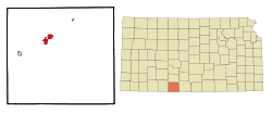
Coordinates: 37°16′10″N 99°19′34″W / 37.26944°N 99.32611°WCoordinates: 37°16′10″N 99°19′34″W / 37.26944°N 99.32611°W Country United States State Kansas County Comanche Government - Type Mayor–Council Area - Total 3.0 sq mi (7.7 km2) - Land 2.6 sq mi (6.8 km2) - Water 0.3 sq mi (0.9 km2) Elevation 2,106 ft (642 m) Population (2010)[1] - Total 828 - Density 276/sq mi (106.6/km2) Time zone Central (CST) (UTC-6) - Summer (DST) CDT (UTC-5) ZIP code 67029 Area code(s) 620 FIPS code 20-14700[2] GNIS feature ID 0470738[3] Website ColdwaterKansas.com Coldwater is a city in and the county seat of Comanche County, Kansas, United States.[4] As of the 2010 census, the city population was 828.[1]
Contents
Geography
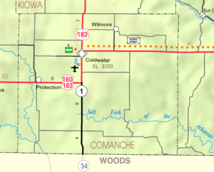
Coldwater is located at 37°16′10″N 99°19′34″W / 37.26944°N 99.32611°W (37.269553, -99.326061)[5]. According to the United States Census Bureau, the city has a total area of 3.0 square miles (7.8 km2), of which, 2.6 square miles (6.7 km2) of it is land and 0.3 square miles (0.78 km2) of it (11.45%) is water.
Area attractions
- Comanche County Historical Museum, 105 West Main Street.
- Chief Theater (NRHP), 122 East Main Street.
- Comanche County Courthouse (NRHP), 201 South New York Avenue.
Demographics
Historical populations Census Pop. %± 1990 939 — 2000 792 −15.7% 2010 828 4.5% U.S. Decennial Census As of the census[2] of 2000, there were 792 people, 380 households, and 209 families residing in the city. The population density was 301.3 people per square mile (116.3/km²). There were 460 housing units at an average density of 175.0 per square mile (67.5/km²). The racial makeup of the city was 98.11% White, 0.13% African American, 0.63% Native American, 0.13% Pacific Islander, 0.13% from other races, and 0.88% from two or more races. Hispanic or Latino of any race were 2.15% of the population.
There were 380 households out of which 20.3% had children under the age of 18 living with them, 46.6% were married couples living together, 8.4% had a female householder with no husband present, and 45.0% were non-families. 42.9% of all households were made up of individuals and 28.2% had someone living alone who was 65 years of age or older. The average household size was 2.01 and the average family size was 2.75.
In the city the population was spread out with 20.3% under the age of 18, 5.4% from 18 to 24, 17.9% from 25 to 44, 24.6% from 45 to 64, and 31.7% who were 65 years of age or older. The median age was 50 years. For every 100 females there were 80.8 males. For every 100 females age 18 and over, there were 76.8 males.
The median income for a household in the city was $27,167, and the median income for a family was $36,786. Males had a median income of $23,438 versus $16,625 for females. The per capita income for the city was $16,851. About 8.7% of families and 9.8% of the population were below the poverty line, including 8.8% of those under age 18 and 8.9% of those age 65 or over.
Education
Primary and secondary education
Coldwater is part of Unified School District 300.[6]
Infrastructure
Transporation
U.S. Route 160 and U.S. Route 183 passes through Coldwater.
Notable people
- Harold S. Herd, former Kansas Supreme Court justice, minority leader in the Kansas State Senate, mayor of Coldwater, officer in the U.S. Navy during World War II.
See also
References
- ^ a b "2010 City Population and Housing Occupancy Status". U.S. Census Bureau. http://factfinder2.census.gov/faces/tableservices/jsf/pages/productview.xhtml?pid=DEC_10_PL_GCTPL2.ST13&prodType=table. Retrieved March 27, 2011.
- ^ a b "American FactFinder". United States Census Bureau. http://factfinder.census.gov. Retrieved 2008-01-31.
- ^ "US Board on Geographic Names". United States Geological Survey. 2007-10-25. http://geonames.usgs.gov. Retrieved 2008-01-31.
- ^ "Find a County". National Association of Counties. http://www.naco.org/Counties/Pages/FindACounty.aspx. Retrieved 2011-06-07.
- ^ "US Gazetteer files: 2010, 2000, and 1990". United States Census Bureau. 2011-02-12. http://www.census.gov/geo/www/gazetteer/gazette.html. Retrieved 2011-04-23.
- ^ USD 300
Further reading
- History of the State of Kansas; William G. Cutler; A.T. Andreas Publisher; 1883. (Online HTML eBook)
- Kansas : A Cyclopedia of State History, Embracing Events, Institutions, Industries, Counties, Cities, Towns, Prominent Persons, Etc; 3 Volumes; Frank W. Blackmar; Standard Publishing Co; 944 / 955 / 824 pages; 1912. (Volume1 - Download 54MB PDF eBook),(Volume2 - Download 53MB PDF eBook), (Volume3 - Download 33MB PDF eBook)
External links
- City
- County
- Schools
- USD 300, local school district
- Photos and Videos
- KWCH 'One of a Kind' Kansas road trip in 2011: Photos, Video 1, Video 2. Towns included were Coldwater, Sterling, Atwood, Lucas, Marion.
- Maps
- Coldwater City Map, KDOT
- Comanche County Map, KDOT
Municipalities and communities of Comanche County, Kansas Cities Coldwater | Protection | Wilmore

Townships Avilla | Coldwater | Powell | Protection
Unincorporated
communityCategories:- Cities in Kansas
- County seats in Kansas
- Populated places in Comanche County, Kansas


Wikimedia Foundation. 2010.