- Lincoln, Nebraska
-
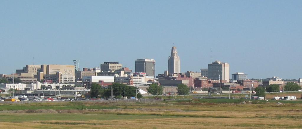
City of Lincoln — City — Lincoln skyline

SealNickname(s): Star City Location in Nebraska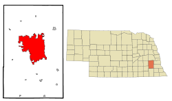
Coordinates: 40°48′35″N 96°40′31″W / 40.80972°N 96.67528°W Country United States State Nebraska County Lancaster Founded[1]
Renamed
Incorporated1856
July 29, 1867
April 1, 1869Government – Mayor Chris Beutler (D) – Legislature Legislature list– U.S. Congress Jeff Fortenberry (R) Area – City 75.4 sq mi (195.2 km2) – Land 74.7 sq mi (193.3 km2) – Water 0.7 sq mi (1.9 km2) Elevation 1,176 ft (358 m) Population (2000) – City 258,379 – Density 3,022.2/sq mi (1,166.9/km2) – Metro 302,157 [2] Time zone CST (UTC-6) – Summer (DST) CDT (UTC-5) Area code(s) 402, 531 FIPS code 31-28000[3] GNIS feature ID 0837279[4] Website www.lincoln.ne.gov The City of Lincoln is the capital and the second-most populous city of the US state of Nebraska. Lincoln is also the county seat of Lancaster County and the home of the University of Nebraska. Lincoln's 2010 Census population was 258,379.
Lincoln was founded in 1856 as the village of Lancaster, and became the county seat of the newly created Lancaster County in 1859. The capital of Nebraska Territory had been Omaha since the creation of the territory in 1854; however, most of the territory's population lived south of the Platte River. After much of the territory south of the Platte considered annexation to Kansas, the legislature voted to move the capital south of the river and as far west as possible. The village of Lancaster was chosen, in part due to the salt flats and marshes.[citation needed]
Omaha interests attempted to derail the move by having Lancaster renamed after the recently assassinated President Abraham Lincoln. Many of the people south of the river had been sympathetic to the Confederate cause in the recently concluded Civil War, and it was assumed that the legislature would not pass the measure if the future capital were named after Lincoln. The ploy did not work, as Lancaster was renamed Lincoln and became the state capital upon Nebraska's admission to the Union on March 1, 1867.[citation needed] The choice to name the capital city "Lincoln" caused quite a stir among constituents, whose sentiments were mixed regarding who should have won the Civil War.[5]
Contents
Geography
Lincoln is located at 40°48′35″N 96°40′31″W / 40.80972°N 96.67528°W (40.809868, −96.675345).[6] According to the United States Census Bureau, the city has a total area of 75.4 square miles (195 km2). 74.6 square miles (193 km2) of it is land and 0.7 square miles (1.8 km2) of it (0.98%) is water.
Lincoln is one of the few large cities of Nebraska not located along either the Platte River or the Missouri River. The city was originally laid out near Salt Creek and among the nearly flat saline wetlands of northern Lancaster County. The city's growth over the years has led to development of the surrounding land, much of which is composed of gently rolling hills. In recent years, Lincoln's northward growth has encroached on the habitat of the endangered Salt Creek tiger beetle.
Metropolitan area
The Lincoln metropolitan area consists of Lancaster County and Seward County, which was added to the metropolitan area in 2003. Lincoln has very little development outside its city limits and has no contiguous suburbs (the largest town that can be considered a suburb of Lincoln is Waverly.) This is due primarily to the fact that most land that would otherwise be developed as a suburban town has already been annexed by the city of Lincoln itself.
Neighborhoods
- Arnold Heights: Located in far northwest Lincoln, this neighborhood, also known as Airpark, began as base housing for the adjacent Lincoln Air Force Base during the Cold War. The area originally consisted of 1,000 housing units and was annexed by Lincoln in 1966, after the base closed. All 1,000 units were originally managed by the Lincoln Housing Authority, but about half of the homes in the neighborhood have been sold to private owners. The area was also formerly known as both "Capehart Housing" when completed in 1960 (north housing) and the "Military Construction Area" when built during 1956 (south housing). Additional housing subdivisions were built in the area in the 1980s and 1990s. More recent additions include a mix of duplexes and single family homes of various sizes, an IGA grocery store, and a strip mall. As of May 2009, the area is continually being developed.
- Belmont: The Belmont neighborhood lies just north of Cornhusker Highway and south of Superior Street between Interstate 180 and 14th Street.
- Bethany: Bethany is located along Cotner Blvd. and Holdrege St. Originally laid out as a separate village by the Disciples of Christ, it was annexed by Lincoln in the late 1920s.
- Capitol Beach: This area is north of West O Street, just west of Downtown, and North of BNSF's Hobson Yard. It is home to Capitol Beach Lake, and Lakeview Elementary School.[7]
- Clinton: Located north of 27th and O Streets, Clinton is the target of ongoing revitalization efforts by the City.
- College View: College View is located along 48th St. and near Calvert St., adjacent to and surrounding the Union College campus. Originally College View was a separate village. The area is anchored by Union College but has many buildings resembling those of a small town. This business area serves the college and surrounding neighborhood. It has an eclectic mix of mostly local businesses.
- Cripple Creek (Cripple Creek North) North of Pine Lake Blvd., this neighborhood is a fairly new one, with several middle to upper-class homes.
 Downtown Lincoln
- Downtown: Lincoln's business district has a mix of offices, bars, restaurants and some retail. Events, housing, and other information about Downtown Lincoln can be found on the Downtown Lincoln Association's website at www.downtownlincoln.org.
- East Campus Located just south of the University of Nebraska East Campus, from Holdrege to Vine and from 33rd to 48th Street, this neighborhood includes a historic district, commonly referred to as "Professor Row," and McAdams Park, which borders the Mo-Pac bike trail.
- Eastridge Developed during the city's eastward expansion and development of the Gateway Mall as the nucleus of Lincoln's retail as the department stores were closing downtown and opening there. It contains mostly single-level, ranch style homes with build on garages and has maintained a well-kept appearance by residents.
- Everett Located near downtown Lincoln, from 9th to 13th Streets between G Street and South Street. The area is known for its historic apartment buildings and converted houses.
- Fallbrook: Located east of the airport and north of I-80, this new, developing community features office parks, diverse housing, and a town center, all growing rapidly only five minutes from downtown.
- Fox Hollow: Located in southeast Lincoln, from 70th to 84th Streets between Van Dorn Street and Pioneers Boulevard. Middle to upper class neighborhoods near Holmes Lake. Fox Hollow is a planned subdivision and was constructed during the 1970s to present.
- Gaslight Village[8]
- Havelock: Havelock is located along Havelock Ave. east of 56th St. in northeast Lincoln; originally a separate town. It has many shops and restaurants and its own farmers market on Tuesday afternoons.
- Hartley: One of Lincoln's earliest suburbs, Hartley is located east of the downtown proper, east of 27th St and north of O St. It is a mainly residential neighborhood of houses built 1890–1940.
- Hawley: Located directly east of UNL's downtown campus, the Hawley Historic District is home to a diverse population living in houses built in the early 20th century. Many of its houses were demolished to make way for the antelope creek valley project and many of the lower income and non-working population is shifting eastward, causing a housing strain and significant increase($50-$100/month increase within a two year period) in rental housing rates throughout the city due to the increased demand.
- Haymarket: One of Lincoln's oldest neighborhoods, the Haymarket is a historic warehouse and industrial district. In recent decades, it has become a dining, specialty shopping, and urban living district, with a variety of visual and performing arts and nightlife. The Haymarket has a weekly, Saturday morning, farmer's market from May to October. With the growth of both local and national shops increasing, the area has gained importance and seen various recent redevelopments. The area's website can be found at www.historichaymarket.info.
- Highlands: The Highlands is a newer residential neighborhood in northwest Lincoln, located north of I-80 and near Lincoln Airport.
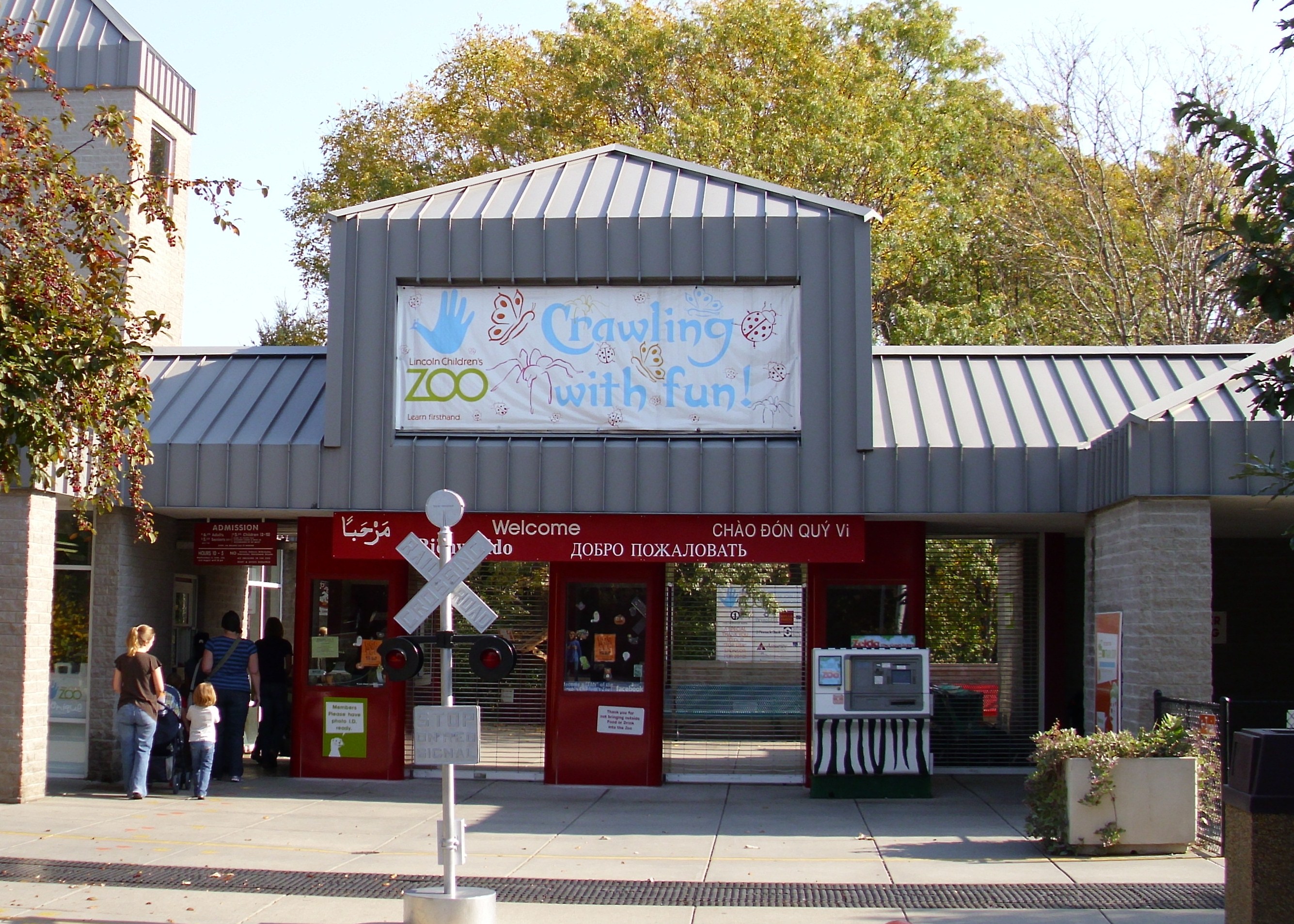
 Entrance to Lincoln Children's Zoo.
- Historic Bungalow District The Historic Bungalow District is the neighborhood also known as Woods Park and is bound by 33rd Street to the East, 27th street to the West, "A" Street to the South, and "O" Street to the North. Some state the West boundary to be further west by only a few blocks. It is known for the large number of Bungalow style homes built around the 1910s and 1920s. Named for the large park in the area, Woods Park, the neighborhood is centrally located and contains a great deal of architecturally unique homes. This neighborhood is also home to the Lincoln Children's Zoo (formerly Folsom Children's Zoo) & Botanical Gardens, a major tourist attraction.
- Huskerville: A now non-existent neighborhood built north of Arnold Heights. Constructed during World War II, Huskerville was once the Lincoln Army Air Field hospital area from 1942 until 1945. After the war the area was converted into college housing and was most noted for a polio outbreak in 1952. The area was either removed or demolished in the late 1960s. The chapel, now protected by the National Register of Historic Places, is all that remains of Huskerville. A new development is underway here however including the construction of a new elementary school as of 2009.
- Indian Village: The Indian Village neighborhood is located from Van Dorn St. on the north to Highway 2 on the south, from 9th St on the west to 20th St on the east. Many of the Streets in the area are named in honor of Native American Tribes. The Indian Village Shopping Center is a centrally located commercial block.
- Irvingdale: The Irvingdale neighborhood is located from South St. on the North, and Van Dorn on the South, from 9th St from the west to 22nd St on the east. The neighborhood has a mix of homes built in the early 1900s to more modern homes built in the 1950s, and is home to Irving Middle School, and the Stransky Park concert series.
- Meadowlane 66th to 84th from O St to Vine St and 70th to 84th from Vine St to Holdrege St.
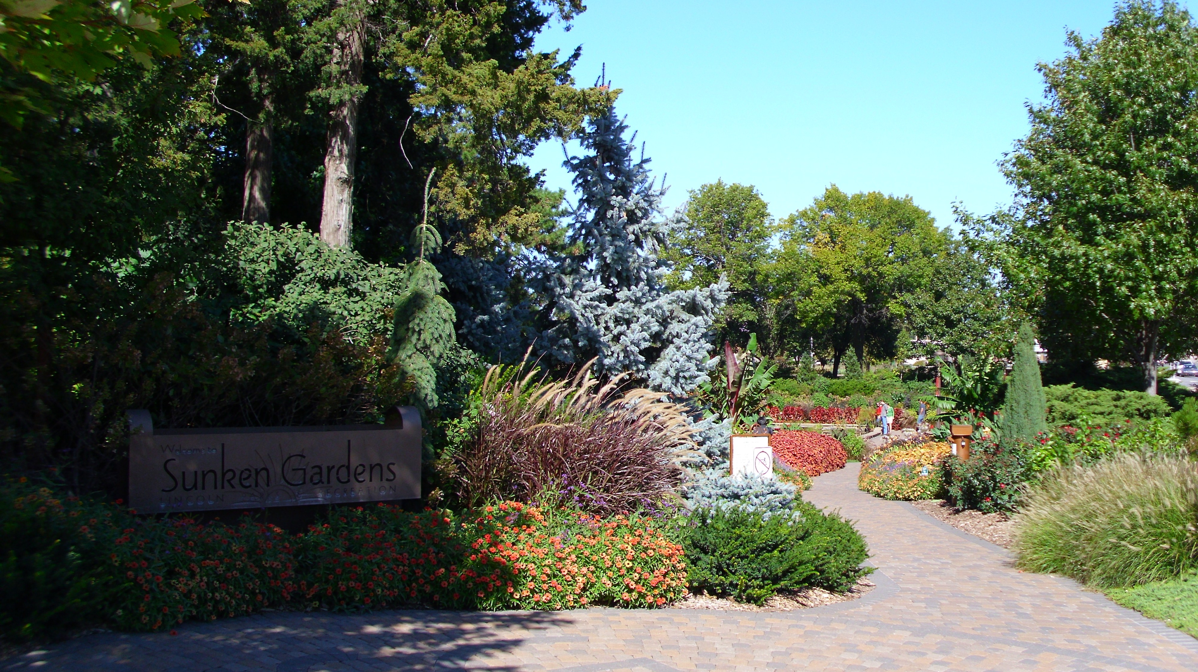
 Sunken Gardens entrance in Lincoln, NE.
- Near South The Near South neighborhood is located from G Street on the north to South Street on the south, and from 13th Street from the west to 27th on the east. The neighborhood is home to many of Lincoln's grand historic homes and is currently experiencing a strong revitalization effort by the neighborhood association and city officials. Many home-owners are reconverting properties that were once divided into apartments back into single-family homes. The areas is also popular among college students and artists. The area is spotted with various homes of significant historical and architectural value. The area is widespread and architecturally diverse with a variety of sizes and values of homes. It houses some of what is considered the worst(west of Lincoln High and east of the capitol) and nicest (Mount Emerald Historic District) within blocks of each other. The area has many places of worship including historic First Plymouth, whose bell tower can be seen and heard from miles away. The Near South features coffee shops, restaurants, banks, and many other businesses. It is also home to a communal garden called Sunken Gardens.
- North Bottoms: Directly north of UNL's downtown campus, the North Bottoms is an area in the floodplain of Salt Creek that holds many smaller houses now rented by a large number of UNL students. Its proximity to Memorial stadium combined with a high student population makes it one of the main tailgating headquarters during NE college football home games. It was originally the northern part of the "German" or "Russian" bottoms settled by Volga-German refugees from Russia.
- Piedmont Higher-end neighborhood in what is now the middle of Lincoln(and was then the eastern fringe). The area is known for its many unique and custom homes encompassing many embellished architectural styles and large lot sizes. There is also a park and community shopping district of the same namesake nearby, though the shopping district has been known for a high percentage of vacancies for the past 20 years.
- The Ridge Located in Southwest Lincoln north of 27th St. and Pine lake road. This neighborhood contains many large, high priced homes.
- Salt Valley
- Seven Oaks
- Sheridan: This neighborhood is located along and around Sheridan Boulevard in south-central Lincoln. Known for its beautiful homes, this neighborhood is very exclusive in parts and features many old, expensive homes along, arguably, the most beautifully landscaped street in town. It was the first addition to Lincoln that stepped away from the "grid pattern" into the winding side streets that characterize most modern residential areas. It is listed under the National Registrar of Historic Places as the "Boulevards" district.
- South Bottoms: South of the Haymarket district, the South Bottoms, like the North Bottoms, was a neighborhood founded by Germans from Russia. Today, the neighborhood is noted for its architecture, bike paths, and family atmosphere. The low-density residential zoning, small historic houses, and proximity to the downtown, has made the area highly desirable for young families, downtown professionals, and retirees. Part of the original plate of Lincoln, the area is within walking distance to the Haymarket district and contains some of the oldest residences in the town with several dating from the 1870's. The area is also know for its many small churches, Lincoln's first park(Cooper Park), and the proximity to the trains and salt creek.
- University Place: University Place is located along 48th St. between Leighton Ave. and Adams St., near Nebraska Wesleyan University and UNL's East Campus. It was an incorporated community before its annexation by Lincoln in 1926. The has its own historic shopping district and is characterized by homes with wrap around porches near the University's Old Main. The town has a 10k+ population base within the historic 68504 zip code.
- Village Gardens: South of 56th and Pine Lake, this "pedestrian-style"(though distant from the city nucleus), contemporary neighborhood features diverse housing styles and a European-style shopping center in development, boasting a hotel, art and culinary classes, and a church. Still in development, this new neighborhood is anchored to the North by Campbell's Nursery next to the shopping center. The concept is essentially the same as the existing layout of older areas such as Hartley, which were designed to be within walking distance of everything essential. Only by building new and on the opposite side of town, however, the higher costs and location essentially discriminate out working-class minorities and furthers the movement of wealth away from the older areas essentially contributing to urban decay.
- Williamsburg: Located at 40th and Old Cheney, this upscale neighborhood has a colonial style shopping center and many parks, trails, and apartments. Though designed to reflect colonial style architecture, the area is known more so for the 1990's take on colonialism with homogeneous looking buildings of false shutters, white vinyl trim, and uniformed brick facades. Strict codes make it difficult for people unfamiliar with the area to find shops/restaurants.
- West Lincoln: Located along West Cornhusker Hwy., the area was founded in 1887 and was an incorporated community before its annexation by Lincoln in 1966.
Parks
Lincoln has an extensive park system, with over 100 individual parks. The largest parks in Lincoln's park system are: Antelope Park (which contains the Lincoln Children's Zoo and the Sunken Gardens), Woods Park, Holmes Park, Oak Lake Park, Pioneers Park and Pioneers Park Nature Center, Tierra Park, and Wilderness Park. The parks are connected by a 159 km (99 mi) system of recreational trails. The MoPac Trail extends through Lincoln.
Climate
Lincoln, located on the Great Plains far from the moderating influence of mountains or large bodies of water, possesses a highly variable four-season humid continental climate (Koppen Dfa): winters are cold but relatively dry, summers are hot and occasionally humid. With little precipitation falling during winter, precipitation is concentrated in the warmer months, when thunderstorms frequently roll in, often producing tornadoes. Snow tends to fall in light amounts, though blizzards are possible. Snow cover is not very reliable due to both the dryness and the frequent thaws during winter.
Monthly averages range from 22.4 °F (−5.3 °C) in January to 77.8 °F (25.4 °C) in July. However, the city is subject both to episodes of bitter cold in winter and heat waves during summer, with 14 nights below 0 °F (−18 °C), 40 days above 90 °F (32 °C), and 5 days above 100 °F (38 °C).[9] Temperature extremes have ranged from −33 °F (−36 °C) in January 1974 to 108 °F (42 °C) in July 1995.[9]
Climate data for Lincoln, Nebraska Month Jan Feb Mar Apr May Jun Jul Aug Sep Oct Nov Dec Year Record high °F (°C) 73
(23)84
(29)89
(32)97
(36)99
(37)107
(42)108
(42)107
(42)106
(41)94
(34)85
(29)70
(21)108
(42)Average high °F (°C) 33.2
(0.7)39.3
(4.1)51.2
(10.7)63.5
(17.5)73.8
(23.2)84.9
(29.4)89.6
(32.0)87.1
(30.6)78.8
(26.0)66.5
(19.2)49.1
(9.5)36.8
(2.7)62.8 Average low °F (°C) 11.5
(−11.4)17.2
(−8.2)27.5
(−2.5)38.8
(3.8)50.1
(10.1)60.4
(15.8)65.9
(18.8)63.7
(17.6)53.2
(11.8)40.4
(4.7)27.0
(−2.8)16.2
(−8.8)39.3 Record low °F (°C) −33
(−36)−24
(−31)−19
(−28)3
(−16)24
(−4)39
(4)42
(6)41
(5)26
(−3)8
(−13)−5
(−21)−27
(−33)−33
(−36)Precipitation inches (mm) 0.67
(17)0.66
(16.8)2.21
(56.1)2.90
(73.7)4.23
(107.4)3.51
(89.2)3.54
(89.9)3.35
(85.1)2.92
(74.2)1.94
(49.3)1.58
(40.1)0.86
(21.8)28.37
(720.6)Snowfall inches (cm) 5.8
(14.7)4.7
(11.9)4.7
(11.9)1.8
(4.6)0
(0)0
(0)0
(0)0
(0)0
(0)0.3
(0.8)2.8
(7.1)5.7
(14.5)25.8
(65.5)Avg. precipitation days (≥ 0.01 in) 5.6 5.6 8.4 9.0 12.0 9.0 9.3 8.7 7.7 6.3 5.3 5.7 92.6 Avg. snowy days (≥ 0.1 in) 5.5 3.8 2.9 1.1 0 0 0 0 0 0.2 2.4 4.3 20.2 Sunshine hours 176.7 169.5 210.8 237.0 272.8 315.0 328.6 294.5 237.0 217.0 156.0 145.7 2,760.6 Source no. 1: NOAA (normals 1971–2000, extremes 1948–2001)[9] Source no. 2: HKO (sun only, 1961–1990)[10] Law and government
Lincoln has a mayor-council government. The mayor and a seven-member city council are selected in nonpartisan elections. Four members are elected from city council districts; the remaining three members are elected at-large. Lincoln's health, personnel, and planning departments are joint city/county agencies; most city and Lancaster County offices are located in the County/City Building.
Since Lincoln is the state capital, many Nebraska state agencies and offices are located in Lincoln, as are several United States Government agencies and offices. The city lies within the Lincoln Public Schools school district; the primary law enforcement agency for the city is the Lincoln Police Department. The Lincoln Fire and Rescue Department shoulders the city's fire fighting and ambulatory services while outlying areas of the city are supported by volunteer fire fighting units.
The city's public library system is Lincoln City Libraries, which has eight branches. Lincoln City Libraries circulates more than three million items per year to the residents of Lincoln and Lancaster County. Lincoln City Libraries is also home to Polley Music Library and the Jane Pope Geske Heritage Room of Nebraska authors.
Economy
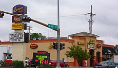 Amigos Restaurant on N 48th & Leighton in Lincoln, NE
Lincoln's economy is fairly typical of a mid-sized American city; most economic activity is derived from service industries. The state government and the University of Nebraska-Lincoln are both large contributors to the local economy. Other prominent industries in Lincoln include medical, banking, information technology, education, call centers, insurance (such as Allstate Insurance subsidiary Lincoln Benefit Life), and rail and truck transport.
One of the largest employers is the BryanLGH Medical Center which consists of two major hospitals and several large outpatient facilities located across the city. Healthcare and medical jobs account for a substantial portion of Lincoln's employment: as of 2009, full-time healthcare employees in the city included 9,010 healthcare practitioners in technical occupations, 4,610 workers in healthcare support positions, 780 licensed and vocational nurses, and 150 medical and clinical laboratory technicians.[11]
There are a number of businesses which were founded in Lincoln including, Fort Western Stores, HobbyTown USA, and Nelnet. Also four regional restaurant chains began in Lincoln: Amigos/Kings Classic, Runza Restaurants, DaVinci's and Valentino's. B&R Stores, Inc. is also headquartered in Lincoln.
Transportation
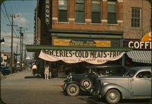 The Eagle Fruit Store and Capitol Hotel in downtown Lincoln during the 1940s.
Rail
Amtrak, the national passenger rail system, provides service to Lincoln, operating its California Zephyr daily in each direction between Chicago and Emeryville, California, across the bay from San Francisco.
Bus
A public bus transit system, StarTran, operates in Lincoln. StarTran's fleet consists of 60 full-sized buses and 9 Handi-Vans.[12]
Air
The Lincoln Airport provides passengers with daily non-stop service to United Airlines hubs O'Hare International Airport and Denver International Airport as well as Delta Air Lines hub Minneapolis-Saint Paul International Airport. Regional jet service on Delta Air Lines to Salt Lake City and Atlanta was discontinued in 2009. In the past Allegiant Air departed Wednesdays and Saturdays to McCarran International Airport in Las Vegas aboard their fleet of MD-80s. However, this service has ended in Lincoln and has been transferred to the Central Nebraska Regional Airport. The Lincoln Airport is also among the emergency landing sites for the NASA Space Shuttle.
Demographics
Historical populations Census Pop. %± 1870 2,441 — 1880 13,003 432.7% 1890 55,164 324.2% 1900 40,169 −27.2% 1910 43,973 9.5% 1920 54,948 25.0% 1930 75,933 38.2% 1940 81,984 8.0% 1950 98,884 20.6% 1960 128,521 30.0% 1970 149,518 16.3% 1980 171,932 15.0% 1990 191,972 11.7% 2000 225,581 17.5% 2010 258,379 14.5% source:[13][14] As of the census of 2010, there were 258,379 people, 103,546 households, and 60,300 families residing in the city. The racial makeup of the city was 86.0% White, 3.8% Black or African American, 0.8% American Indian and Alaska Native, 3.8% Asian, 0.1% Pacific Islander, 2.5% from other races, and 3.0% from two or more races. Hispanic or Latino of any race were 6.3% of the population.
There were 103,546 households out of which 27.7% had children under the age of 18 living with them, 44.0% were married couples living together, 10.2% had a female householder with no husband present, and 41.8% were non-families. 29.6% of all householders lived alone.[15]
In the city the population was spread out with 23.0% under the age of 18, 16.4% from 18 to 24, 30.7% from 25 to 44, 19.5% from 45 to 64, and 10.4% who were 65 years of age or older. The median age was 31 years. For every 100 females there were 99.2 males. For every 100 females age 18 and over, there were 98.0 males.
The median income for a household in the city was $40,605, and the median income for a family was $52,558. Men had a median income of $33,899 versus $25,402 for women. The per capita income for the city was $20,984. About 5.8% of families and 10.1% of the population were below the poverty line, including 10.7% of those under age 18 and 6.0% of those age 65 or over.
The U.S. Government designated Lincoln as a refugee-friendly city due to its stable economy, educational institutions, and size. Since then, refugees from Vietnam settled in Lincoln, and further waves came from other countries.[16]
Sites of interest
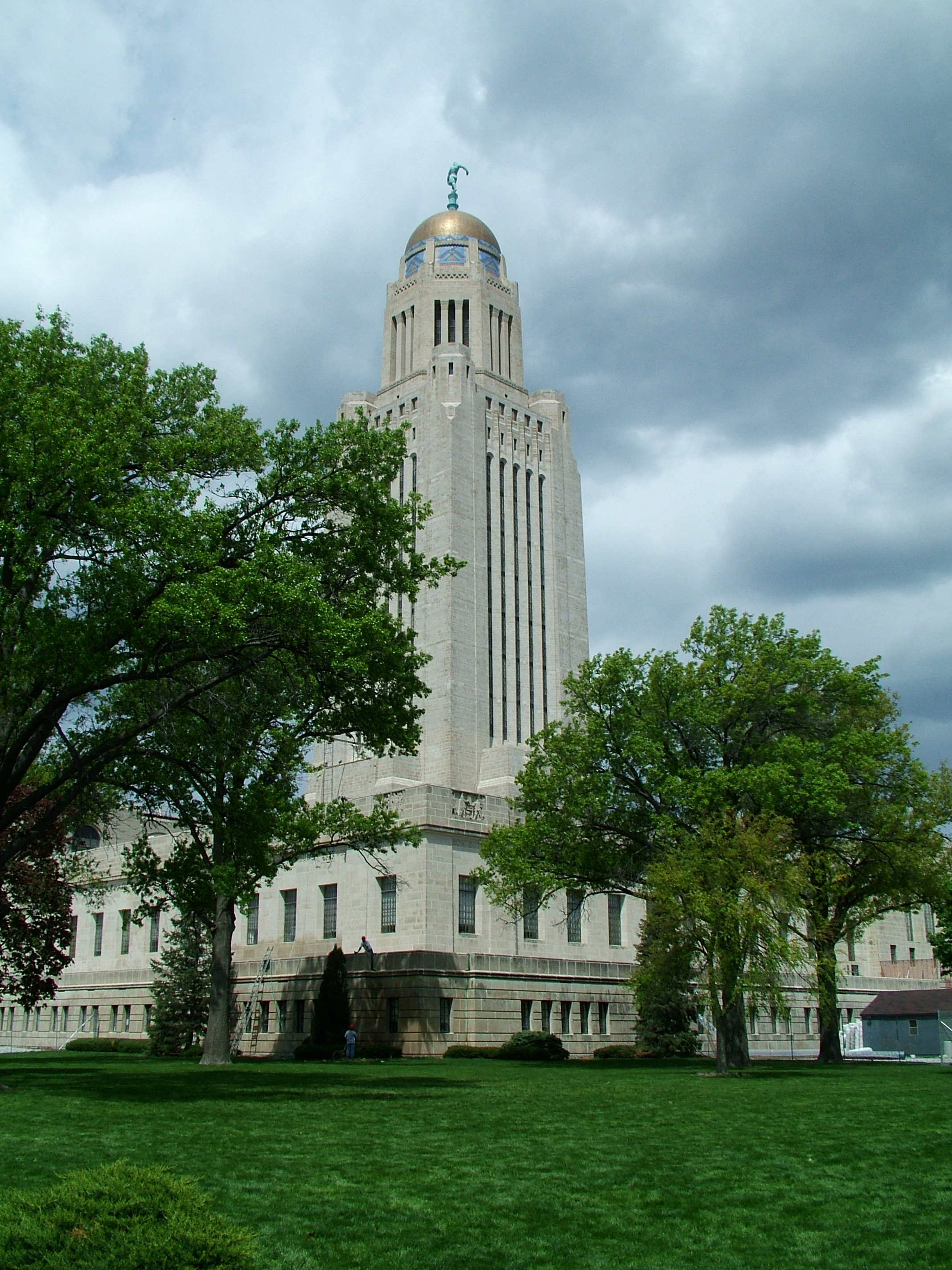
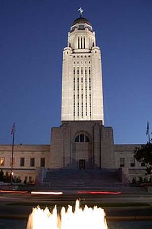 The Capitol at night
- Nebraska State Capitol: designed by Bertram Grosvenor Goodhue and constructed between 1922 and 1932. The capitol building is a skyscraper topped by a golden dome. The tower is crowned by a 6-meter (20 ft) statue of a farmer sowing grain on a pedestal of wheat and corn (sculptor: Lee Lawrie), to represent the state's agricultural heritage. City zoning rules prevent any other building from rivaling it in height, making it a landmark not only within the city but for the surrounding area. Inside, there are many paintings and iridescent murals depicting the Native American heritage and the history and culture of the early pioneers who settled Nebraska. It is the second tallest U.S. State Capitol building behind the Louisiana State Capitol building in Baton Rouge.[17]
- Alice Abel Arboretum
- American Historical Society of Germans from Russia Museum
- Lincoln Children's Museum[18]
- Lincoln Children's Zoo[19]
- Fairview Home, home of William Jennings Bryan
- Frank H. Woods Telephone Museum
- Governor's Mansion
- Haymarket Park
- Historic Haymarket
- Hyde Observatory
- Ice Box
- Iron Horse Park in the Haymarket
- James Arthur Vineyards
- Joshua C. Turner Arboretum
- Maxwell Arboretum
- Museum of American Speed[20]
- National Museum of Roller Skating and the offices of USA Roller Sports
- Museum of Nebraska History
- Thomas P. Kennard House
- Nebraska Statewide Arboretum
- Pioneers Park Nature Center
- Schleich Red Wing Pottery Museum[21]
- State Fair Park Arboretum
- Sunken Gardens (Nebraska)[22]
- Downtown Lincoln (Nebraska)[23]
- Veterans Memorial Garden
- Wyuka Cemetery
University of Nebraska–Lincoln
- Bob Devaney Sports Center
- Great Plains Art Museum
- International Quilt Study Center & Museum
- The Kruger Collection in the College of Architecture
- Lentz Center for Asian Culture
- Lester F. Larsen Tractor Test & Power Museum
- Lied Center for Performing Arts
- Mary Riepma Ross Media Arts Center, aka The Ross
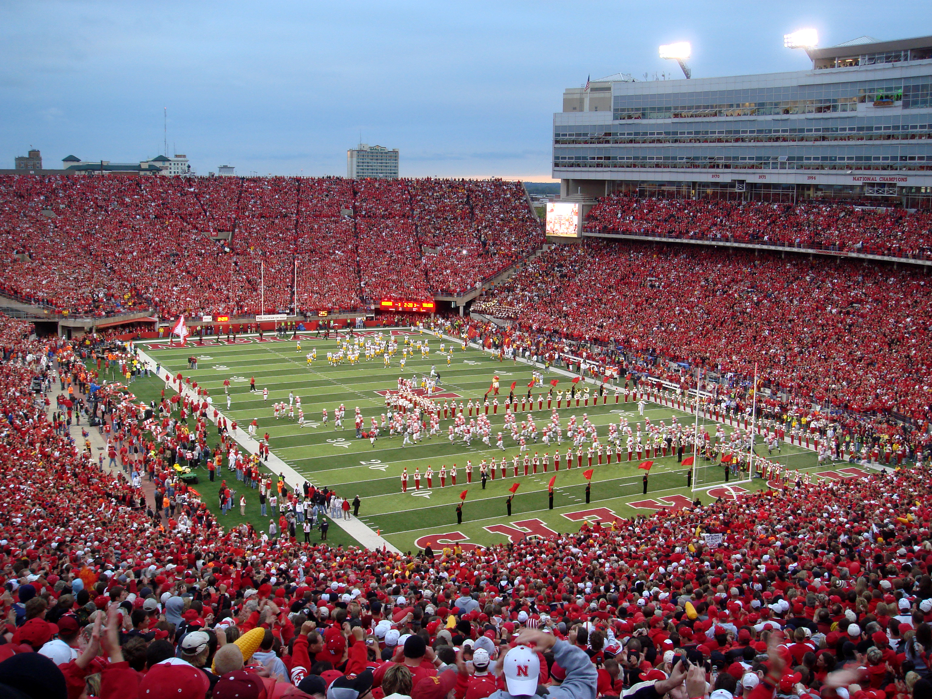
- Memorial Stadium: Home of the Cornhuskers football team, the stadium was built in 1923.
- The Robert Hillestad Textiles gallery [1]
- Sheldon Memorial Art Gallery: built in the early 1960s; architect Philip Johnson.
- UNL Dairy Store
- University of Nebraska State Museum: home to an extensive collection of Nebraska fossils
Education
Primary and secondary education
Lincoln Public Schools is the sole public school district in the city. There are six traditional high schools in the district: Lincoln High, East, Northeast, North Star, Southeast, and Southwest. Additionally, Lincoln Public Schools is home to special interest high schools including the Arts and Humanities Focus Program, the Zoo School, the Information Technology Focus Program, and the Entrepreneurship Focus Program.
There are several private parochial elementary and middle schools located throughout the community. These schools, like Lincoln Public Schools, are broken into districts, but most will allow attendance outside of boundary lines.
Private high schools located in Lincoln are College View Academy, Lincoln Christian, Lincoln Lutheran, Parkview Christian and Pius X High School.
Colleges and universities
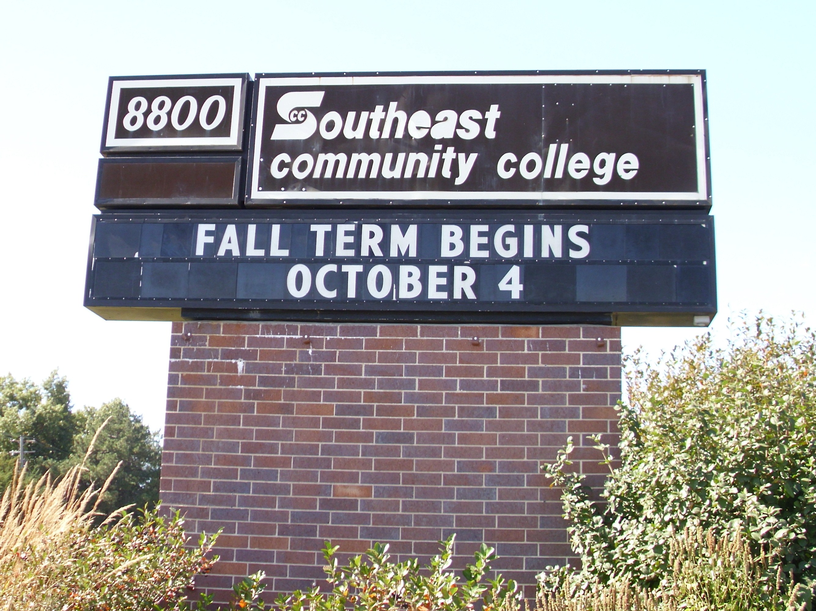
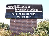 Southeast Community College sign in Lincoln, NE.
The University of Nebraska–Lincoln, the flagship campus of the University of Nebraska system, is the largest university in Nebraska. Other colleges and universities based in Lincoln are: BryanLGH College of Health Sciences, Nebraska Wesleyan University, Southeast Community College and Union College.
Colleges and universities with satellite locations in Lincoln are Bellevue University, Concordia University, Nebraska, College of Saint Mary, Doane College, and Kaplan University.
Sports teams
Lincoln is best known for the university's football team, the Nebraska Cornhuskers. In total, the University of Nebraska fields 21 men's and women's teams in 14 NCAA Division I sports. Other sports teams are the Lincoln Saltdogs, an American Association independent minor league baseball team; the Lincoln Stars, a USHL junior ice hockey team. Lincoln is also home to the No Coast Derby Girls, a member of the Women's Flat Track Derby Association.
Arts, entertainment and culture
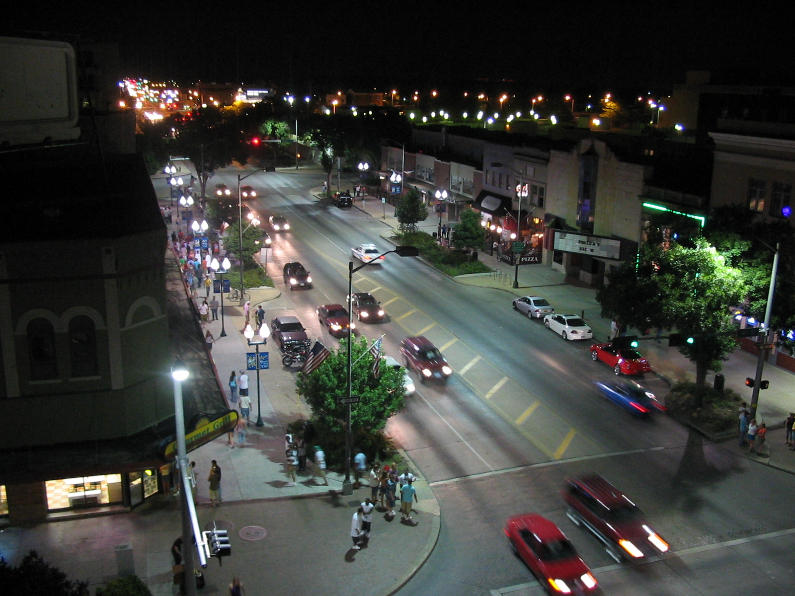
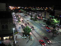 Downtown Lincoln at night (14th and O Streets)
Lincoln's primary venues for live music include: Pershing Auditorium (large tours and national acts), Bourbon Theatre, Duffy's Tavern, Red9 (opened in 2009, previously P.O. Pears), Knickerbockers, Duggan's Pub (local and regional acts; smaller venues), and the Zoo Bar (blues). The Pla-Mor Ballroom is a staple of Lincoln's music and dance scene, featuring its house band, the award-winning Sandy Creek Band.
The Lied Center is a venue for national tours of Broadway productions, concert music, and guest lectures. Lincoln has several performing arts venues. Plays are staged by UNL students in the Temple Building; community theater productions are held at the Lincoln Community Playhouse, the Loft at The Mill, and the Haymarket Theater.
For movie viewing, Marcus Theatres owns 32 screens at four locations, and the University of Nebraska's Mary Riepma Ross Media Arts Center shows independent and foreign films. Standalone cinemas in Lincoln include the Joyo Theater and Rococo Theater. The Rococo Theater also hosts benefits and other engagements.
The downtown section of O Street is Lincoln's primary bar and nightclub district.
Lincoln is the hometown of Zager and Evans, known for their international #1 hit record, "In the Year 2525". It is also the home town of several notable musical groups, such as Remedy Drive, VOTA, the Bathtub Dogs, For Against, Lullaby for the Working Class, Ideal Cleaners, Matthew Sweet, Dirtfedd and The Show is the Rainbow. Lincoln is also home to Maroon 5 guitarist James Valentine.
Annual events
- March: Nebraska high school state boys' and girls' basketball tournaments
- Mid April: ConStellation Science Fiction convention
- First Sunday in May: Lincoln Marathon
- May 13 – July 17: Live thoroughbred horse racing at Lincoln Race Course [24]
- Early May- Late October: The Farmers' Market in the Haymarket district.
- Early June: Cornhusker Boys' State and Cornhusker Girls' State
- Mid July: Shrine Bowl state high school All-Star football game in Memorial Stadium.
- Tuesday evenings in June: Jazz in June, an outdoor summer concert series
- Third Friday in June, July, and August: Dock Stock [25]
- Late June: International Thespian Festival of the International Thespian Society at the University of Nebraska-Lincoln
- Thursday evenings in July: Movies on the Green, movies shown on the green space near Kimball Hall
- Early August: Lancaster County Fair
- Second weekend in August: Capital City Ribfest
- Late August to late November: Nebraska Cornhuskers football
- Early September: Sports Car Club of America Solo National Championship[26] Autocross
- Late September/Early October: Lincoln Calling – Music Festival.
- Early November: Nebraska high school state football championships at Memorial Stadium
- Early to mid-November: Anime NebrasKon (has since moved to Omaha, Nebraska)
- First Saturday in December: Star City Parade
Local media
Television
Lincoln has four licensed broadcast television stations:
- KLKN (Channels 8 and 31; 8.1 DT) – ABC; RTV affiliate 8.2
- KOLN (Channel 10; 10.1 DT) – CBS affiliate; MyTV 10.2
- KUON (Channel 12) – PBS affiliate, NET Television flagship station
- KFXL (Channel 51) – Fox
The headquarters of Nebraska Educational Telecommunications (NET), which is affiliated with the Public Broadcasting Service, National Public Radio and Public Radio International, are in Lincoln.
Lincoln is one of the few cities without its own NBC affiliate; Omaha's WOWT-TV serves as the city's default NBC affiliate on cable, while Hastings' KHAS-TV is available in satellite locals packages. Most of Omaha's other television stations can also be picked up in Lincoln with an antenna, and all are available on cable.
Lincoln also has analog TV translators for 3ABN on channel 27 and TBN on channel 29.
Radio
There are 22 radio stations in Lincoln.
FM stations include:
- KLCV (88.5) – Religious talk
- KNBE (88.9) – Religious talk and gospel
- KZUM (89.3) – Independent Community Radio
- KFLV (89.9) – Contemporary Christian
- KRNU (90.3) – Alternative / College radio UNL
- KUCV (91.1) – National Public Radio
- K220GT (91.9) – Contemporary Christian
- KTGL (92.9) – Classic Rock
- KJFT-LP (93.7) – Chinese-language Religious
- KNTK (93.7) - Sports
- K233AN (94.5) – Contemporary Christian
- KRKR (95.1) – Contemporary Christian
- KZKX (96.9) – Country
- KFGE (98.1) – Country
- KOOO (101.9) – Classic pop (Licensed to Lincoln; targeting Omaha)
- KVSS (102.7) – Catholic Radio
- KIBZ (104.1) – Active Rock
- KLNC (105.3) – Adult Hits
- KFRX (106.3) – Top-40
- KBBK (107.3) – Hot AC
AM stations include:
Most areas of Lincoln also receive radio signals from Omaha and other surrounding communities.
Print
The Lincoln Journal Star is the city's major daily newspaper. The Daily Nebraskan is the official campus paper of the University of Nebraska-Lincoln. The DailyER Nebraskan is the University of Nebraska-Lincoln's biweekly satiric paper. The Clocktower is the official campus paper of Union College.
People
- Michael Biehn, actor.
- Dan Brown, video blogger and entertainer with an audience of over 250,000 daily subscribers.
- Nancy Coover Andreasen, prominent neuroscientist and neuropsychiatrist, was born in Lincoln.
- Johnny Carson, television host and comedian, was raised in Norfolk, Nebraska, but attended college at the University of Nebraska–Lincoln.
- Joba Chamberlain, pitcher for the New York Yankees, was born in Lincoln and graduated from Lincoln Northeast High School.
- Dick Cheney, Vice President of the United States under George W. Bush, Secretary of Defense under George H. W. Bush, and former CEO of Halliburton, was born in Lincoln but raised in Casper, Wyoming.
- Amasa Cobb, U.S. Representative from Wisconsin.
- Amy Sue Cooper, U.S. Model, and Playboy Cyber Girl of the Year 2005.
- Richard Cowan, United States Army soldier during World War II and posthumous recipient of the Medal of Honor.
- Mary Doyle, theatre actress who appeared on TV between TV credits from 1956 to 1982. She was born in Lincoln and was the sister of the late TV actor David Doyle.
- Mignon G. Eberhart, author of mystery novels.
- Loren Eiseley, anthropologist, science writer, ecologist, and poet. He published books of essays, biographies, and general science in the 1950s through the 1970s.
- Alex Gordon, MLB player, was born and raised in Lincoln.
- Lars Krutak, tattoo anthropologist, writer, photographer.
- Louise Le Baron Opera singer and Lincoln voice teacher.
- Verne Lewellen, NFL player for the Green Bay Packers.
- Gilbert N. Lewis, physical chemist known for the discovery of the covalent bond.
- Gordon MacRae, actor.
- Dirk Obbink, Lecturer in Papyrology and Greek Literature at Oxford University and head of the Oxyrhynchus Papyri Project.
- Roscoe Pound, distinguished legal scholar and educator.
- Shawn Redhage, basketball player for the Perth Wildcats, grew up in Lincoln but represented Australia at the 2008 Summer Olympics.
- Barrett Ruud, NFL linebacker for the Tampa Bay Buccaneers.
- Bo Ruud, NFL linebacker for the Cleveland Browns.
- Brandon Sanderson, fantasy author.
- Lindsey Shaw, actress known for her starring roles as Jennifer Mosely on Nickelodeon's sitcom, Ned's Declassified School Survival Guide, and Claire Tolchuck in Aliens in America.
- Ted Sorensen, President John F. Kennedy’s special counsel and adviser, legendary speechwriter, and alter ego, whom Kennedy once called his “intellectual blood bank.”
- VOTA, contemporary Christian rock band signed to INO records.
- Alex Stivrins, NBA player for the Seattle SuperSonics, Phoenix Suns, Los Angeles Clippers, Milwaukee Bucks, and Atlanta Hawks.
- Charles Starkweather, spree killer who murdered 11 victims in Nebraska and Wyoming during a road trip with his underage girlfriend Caril Ann Fugate.
- Hilary Swank, two-time Academy Award–winning actress, was born in Lincoln.
- Matthew Sweet, solo pop rock artist.
- Samuel K. Sloan, pioneer news director for the award-winning Slice of SciFi podcast and Sirius – XM satellite program.
- James Valentine, guitarist for the band Maroon 5, was born and raised in Lincoln.
- Ryland Steen, drummer for the ska punk band Reel Big Fish.
- Robert Van Pelt, U.S. District Judge in the District of Nebraska.
- Don Wilson, announcer and occasional actor in radio and television.
- William N. Weins, Distinguished Professor and Metallurgist for the University of Nebraska. Noted for his restoration projects on the U.S.S. Arizona and the C.S.S. Hunley. Helped pioneer E85 Ethanol.
- Mary Zimmerman, award-winning theatre director and playwright.
- Brandon Teena, transgender murder victim.
- Janine Turner, actress on Northern Exposure, was born in Lincoln.
- Tosca Lee, award-winning Christian fiction author of Demon: A Memoir and Havah: The Story of Eve.
- Milton I. Wick, organized a book business in Lincoln, Nebraska, that employed college students to sell books to farmers during the summer months. The enterprise was so successful that it was expanded to Iowa, Missouri and Kansas, employing more than 500 students during the three years of its existence. Mr. Wick later founded Wick Communications Company.
- Ira J. McDonald, treasurer of the former Havelock, Nebraska
See also
- Category:Buildings and structures in Lincoln, Nebraska
- List of people from Lincoln, Nebraska
References
- ^ Founded as "Lancaster".
- ^ "Annual Estimates of the Population of Metropolitan and Micropolitan Statistical Areas: April 1, 2000 to July 1, 2006 (CBSA-EST2006-01)" (CSV). 2006 Population Estimates. United States Census Bureau, Population Division. April 5, 2007. http://www.census.gov/population/www/estimates/metro_general/2006/CBSA-EST2006-01.csv. Retrieved April 8, 2007.
- ^ "American FactFinder". United States Census Bureau. http://factfinder.census.gov. Retrieved 2008-01-31.
- ^ "US Board on Geographic Names". United States Geological Survey. 2007-10-25. http://geonames.usgs.gov. Retrieved 2008-01-31.
- ^ "Lincoln Convention and Visitors Bureau | Why Visit Lincoln? | History". Lincoln.org. http://www.lincoln.org/visiting/whyvisit/history. Retrieved 2011-08-29.
- ^ "US Gazetteer files: 2010, 2000, and 1990". United States Census Bureau. 2011-02-12. http://www.census.gov/geo/www/gazetteer/gazette.html. Retrieved 2011-04-23.
- ^ "Capitol Beach, Lincoln, Nebraska Zip Code Boundary Map (NE)". Zipmap.net. http://www.zipmap.net/Nebraska/Lancaster_County/Z_Capitol_Beach.htm. Retrieved 2011-08-29.
- ^ "Gaslight Village Populated Place Profile / Lancaster County, Nebraska Data". Nebraska.hometownlocator.com. http://nebraska.hometownlocator.com/ne/lancaster/gaslight-village.cfm. Retrieved 2011-08-29.
- ^ a b c "Climatology of the United States No. 20: LINCOLN AP, NE 1971–2000" (PDF). National Oceanic and Atmospheric Administration. July 2011. http://cdo.ncdc.noaa.gov/climatenormals/clim20/ne/254795.pdf. Retrieved March 13, 2010.
- ^ "Climatological Normals of Lincoln". Hong Kong Observatory. http://www.weather.gov.hk/wxinfo/climat/world/eng/n_america/us/lincoln_e.htm. Retrieved June 7, 2010.
- ^ "Lincoln Career, Salary & Employment Info". http://www.collegedegreereport.com/cities/lincoln.
- ^ "InterLinc: StarTran Fact Sheet". Lincoln.ne.gov. http://www.lincoln.ne.gov/city/pworks/startran/factsht.htm. Retrieved 2011-08-29.
- ^ Moffatt, Riley. Population History of Western U.S. Cities & Towns, 1850–1990. Lanham: Scarecrow, 1996, 146.
- ^ "Subcounty population estimates: Nebraska 2000–2007" (CSV). United States Census Bureau, Population Division. March 18, 2009. http://www.census.gov/popest/cities/files/SUB-EST2007-31.csv. Retrieved May 11, 2009.
- ^ "American FactFinder". U.S. Census Bureau. http://factfinder2.census.gov/faces/nav/jsf/pages/index.xhtml. Retrieved 6 June 2011.
- ^ "'We've Found Peace in This Land'." Parade. October 10, 2010. Retrieved on August 17, 2011.
- ^ "Nebraska State Capitol, Lincoln, U.S.A.". Emporis.com. http://www.emporis.com/en/wm/bu/?id=126253. Retrieved 2011-08-29.
- ^ (nd) Lincoln Children's Museum website. Retrieved July 6, 2007.
- ^ (nd) Lincoln Children's Zoo website. Retrieved July 6, 2007.
- ^ (nd) Museum of American Speed website. Retrieved July 6, 2007.
- ^ (nd) Schleich Red Wing Pottery Museum website. Retrieved July 6, 2007.
- ^ (nd) Sunken Gardens webpage. City of Lincoln. Retrieved July 6, 2007.
- ^ (nd) Downtown Lincoln Association webpage. Downtown Lincoln Association. Retrieved 3/6/08.
- ^ "Lincoln Race Course - Lincoln, Nebraska". Lincolnracing.com. 2011-05-13. http://www.lincolnracing.com/lrc/index.asp. Retrieved 2011-08-29.
- ^ "Historic Haymarket". Historichaymarket.info. http://www.historichaymarket.info/events/dock_stock.asp. Retrieved 2011-08-29.
- ^ Sports Car Club of America Website, Sports Car Club of America, Inc.
External links
- City of Lincoln, Nebraska
- Lincoln Convention and Visitors Bureau
- Lincoln travel guide from Wikitravel
- ExploreLincoln
- A Virtual Tour of The Nebraska State Capitol Building on Roundus
- Downtown Lincoln
Municipalities and communities of Lancaster County, Nebraska Cities 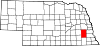
Villages Unincorporated
communitiesMartell | Prairie Home
State capitals of the United States AL Montgomery AK Juneau AZ Phoenix AR Little Rock CA Sacramento CO Denver CT Hartford DE Dover FL Tallahassee GA Atlanta HI Honolulu ID Boise IL Springfield IN Indianapolis IA Des Moines KS Topeka KY Frankfort LA Baton Rouge ME Augusta MD Annapolis MA Boston MI Lansing MN Saint Paul MS Jackson MO Jefferson City MT Helena NE Lincoln NV Carson City NH Concord NJ Trenton NM Santa Fe NY Albany NC Raleigh ND Bismarck OH Columbus OK Oklahoma City OR Salem PA Harrisburg RI Providence SC Columbia SD Pierre TN Nashville TX Austin UT Salt Lake City VT Montpelier VA Richmond WA Olympia WV Charleston WI Madison WY Cheyenne DC Washington1
Territories:AS Pago Pago GU Hagåtña MP Saipan PR San Juan VI Charlotte Amalie Categories:- Cities in Nebraska
- Lincoln, Nebraska
- Populated places in Lancaster County, Nebraska
- Populated places established in 1856
- County seats in Nebraska
- Lincoln metropolitan area


Wikimedia Foundation. 2010.