- Northern Mariana Islands
-
This article is about the Commonwealth of the Northern Mariana Islands. For the Mariana Archipelago, see Mariana Islands.
Commonwealth of the Northern Mariana Islands Sankattan Siha Na Islas Mariånas

Flag Seal Anthem: Gi Talo Gi Halom Tasi (Chamorro)
Satil Matawal Pacifiko (Carolinian)
Capital Capital Hill
17°11′N 146°45′E / 17.183°N 146.75°EOfficial language(s) English, Chamorro, Carolinian, Spanish Government Presidential representative democracy - President Barack Obama[1] - Governor Benigno R. Fitial - Lt. Governor Eloy S. Inos - Delegate to U.S. Congress Gregorio Sablan Commonwealth in union with United States - Covenant 1975 - Commonwealth status 1978 - end of trusteeship 1986 Area - Total 463.63 km2 (195th)
179.01 sq mi- Water (%) negligible Population - 2007 estimate 77,000 (198th) - 2010 census 53,883 - Density 168/km2 (n/a)
63.8/sq miCurrency United States dollar ( USD)Time zone (UTC+10) ISO 3166 code MP Internet TLD .mp Calling code +1-670 The Northern Mariana Islands, officially the Commonwealth of the Northern Mariana Islands (CNMI), is a commonwealth in political union with the United States, occupying a strategic region of the western Pacific Ocean. It consists of 15 islands about three-quarters of the way from Hawaii to the Philippines. The United States Census Bureau reports the total land area of all islands as 179.01 square miles (463.63 km2).
The Northern Mariana Islands has a population of 53,883 (2010 census).[2] More than 90% of the population lives on the island of Saipan. Of the fourteen other islands, only two — Tinian and Rota — have a significant population. The islands of Agrihan and Alamagan have fewer than ten residents each, and the remaining islands are unpopulated.
The Commonwealth's center of government is in the village of Capital Hill on Saipan. As the island is governed as a single municipality, most publications name Saipan as the Commonwealth's capital.
Contents
Geography
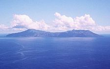
See also: Extreme points of the Northern Mariana IslandsThe Northern Mariana Islands, together with Guam to the south, compose the Mariana Islands. The southern islands are limestone, with level terraces and fringing coral reefs. The northern islands are volcanic, with active volcanoes on Anatahan, Pagan and Agrihan. The volcano on Agrihan has the highest elevation at 3,166 feet (965 m). Anatahan Volcano is a small volcanic island 80 miles (130 km) north of Saipan. It is about 6 miles (10 km) long and 2 miles (3 km) wide. Anatahan began erupting suddenly from its east crater on May 10, 2003, at about 6 p.m. (0800 UTC). It has since alternated between eruptive and calm periods. On April 6, 2005, approximately 1,800,000 cubic feet (50,970 m3) of ash and rock were ejected, causing a large, black cloud to drift south over Saipan and Tinian.
Climate
The islands have a tropical marine climate moderated by seasonal northeast trade winds. There is little seasonal temperature variation. The dry season runs from December to June, and the rainy season from July to November and can include typhoons. The Guinness Book of World Records has cited Saipan as having the most equable temperature in the world.[3]
History
Spanish possession
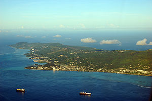 The island of Saipan.
The first European exploration of the area was in 1521 by Ferdinand Magellan, who landed on nearby Guam and claimed the islands for Spain. The Spanish ships were met offshore by the native Chamorros, who delivered refreshments and then helped themselves to a small boat belonging to Magellan's fleet. This led to a cultural clash, since in Chamorro tradition there was little private property and taking something one needed, such as a boat for fishing, was not considered stealing. The Spanish did not understand this custom. The Spanish fought against the local Chamorros until the boat was recovered. The Spanish then gave the archipelago the name Islas de los Ladrones ("Islands of the Thieves").[citation needed]
Three days after he had been welcomed on his arrival, Magellan fled the archipelago under attack. In 1565 Miguel López de Legazpi arrived in Guam and took possession of the islands in the name of the Spanish Crown. The islands were to be ruled from the Philippines as part of the Spanish East Indies until 1898. A Royal Palace was built in Guam for the Spanish governor of the islands. Its ruins can still be seen.[citation needed]
Guam was an important stop-over for the Manila Galleons, a convoy of ships carrying passengers and cargo such as silver, plants and animals from Acapulco (Mexico) to Manila. On the return trip from the Philippines to Mexico, the galleons did not call at Guam as the eastern winds were farther north, near the coast of Japan.
In 1668 Padre Diego Luis de San Vitores renamed the islands Las Marianas after Queen Mariana of Austria, widow of Spain's Philip IV.[citation needed]
Most of the islands' native population (90%-95%)[4] died from Spanish diseases or married non-Chamorro settlers under Spanish rule. New settlers, primarily from the Philippines and the Caroline Islands, were brought to repopulate the islands. The Chamorro population did gradually recover, and Chamorro, Filipino and Carolinian language and ethnic differences remain basically distinct in the Marianas.
Spanish colonists forced the Chamorros to be concentrated on Guam to encourage assimilation and conversion to Christianity. By the time Chamorros were allowed to return to the Northern Marianas, Carolinians (from present-day eastern Yap State and western Chuuk State) had settled in the Marianas. Carolinians and Chamorros now are both considered as indigenous and both languages are official in the commonwealth (though not on Guam).
German and Japanese possession
Following the Spanish–American War of 1898, Spain ceded Guam to the United States and sold the remainder of the Marianas (along with the Caroline and Marshall Islands) to Imperial Germany.
Early in World War I, Japan took the opportunity to declare war on Germany and invaded the Northern Marianas, hoping to annex them. In 1919, the League of Nations, precursor of the United Nations, awarded the islands to Japan by a mandate. During Japan's occupation, sugar cane became the main industry of the islands, and labor was imported from Japan and associated colonies (especially Okinawa and Korea). In the census of December 1939, the total population of the South Pacific Mandate was 129,104, of which 77,257 were Japanese (including ethnic Taiwanese and Koreans).
Hours after the Attack on Pearl Harbor, Japanese forces from the Marianas launched an invasion of Guam on December 8, 1941. Chamorros from the Northern Marianas, then under Japanese rule for more than two decades, were brought to Guam to assist the Japanese administration. This, combined with the harsh treatment of Guamanian Chamorros during the 31-month occupation, created a rift that would become the main reason Guamanians rejected the reunification referendum approved by the Northern Marianas in the 1960s.
American Invasion
Near the end of World War II, the United States military invaded the Mariana Islands on June 15, 1944, beginning with the Battle of Saipan, which ended on July 9 with the Japanese commander committing seppuku (a traditional Japanese form of ritual suicide). Of the 30,000 Japanese troops that defended Saipan, fewer than 1,000 remained alive at battle's end.[5] U.S. forces then recaptured Guam beginning July 21 and invaded Tinian (see Battle of Tinian) on July 24, which provided the take off point for the Enola Gay, the plane dropping the atomic bomb on Hiroshima a year later. Rota was left untouched (and isolated) until the Japanese surrender in August 1945, due to its military insignificance.
The war did not end for everyone with the signing of the armistice. The last group of Japanese soldiers surrendered on Saipan on December 1, 1945. On Guam, Japanese soldier Shoichi Yokoi, unaware that the war had ended, hid out in a jungle cave in the Talofofo area until 1972.
Between the end of the invasion and the Japanese surrender, the Saipan and Tinian populations were kept in concentration camps. Japanese nationals were eventually repatriated, and the indigenous Chamorro and Carolinians returned to the land.
Commonwealth
After Japan's defeat, the islands were administered by the United States as part of the United Nations Trust Territory of the Pacific Islands; thus, defense and foreign affairs are the responsibility of the United States. The people of the Northern Mariana Islands decided in the 1970s not to seek independence, but instead to forge closer links with the United States. Negotiations for territorial status began in 1972. A covenant to establish a commonwealth in political union with the U.S. was approved in 1975. A new government and constitution went into effect in 1978. Similar to other U.S. territories, the islands do not have representation in the U.S. Senate, but are represented in the U.S. House of Representatives by a delegate (beginning January 2009 for the CNMI) who may vote in committee but not on the House floor.[6]
Demographics
Main article: Demographics of the Northern Mariana IslandsSee also: List of U.S. states and territories by populationHistorical populations Census Pop. %± 1960 6,000 — 1970 9,436 57.3% 1980 16,780 77.8% 1990 43,345 158.3% 2000 69,221 59.7% 2010 53,883 −22.2% According to the 2010 census, the population of the CNMI as of April 1, 2010 was 53,883, down from 69,221 in 2000, a decrease of 22.2%.[7] The decrease was reportedly due to a combination of factors including the demise of the garment industry (the vast majority of whose employees were females from China), economic crises, and a decline in tourism, one of the CNMI's primary sources of revenue.[8]
Politics
Main article: Politics of the Northern Mariana IslandsThe Northern Mariana Islands have a presidential representative democratic system, in which the governor is head of government, with a multi-party system. The Northern Mariana Islands are a commonwealth of the United States. Federal funds to the Commonwealth are administered by the Office of Insular Affairs of the U.S. Department of the Interior.
Repeating the separation of powers in other U.S. territories and state governments, executive power is exercised by the Governor of the Northern Mariana Islands. Legislative power is vested in the bicameral Northern Mariana Islands Commonwealth Legislature. Senate President [Paul A. Manglona] is the longest serving elected official in the history of the CNMI]. The judiciary is independent of the executive and the legislative branches.
However, politics in the Northern Mariana Islands is often "more a function of family relationships and personal loyalties" where the size of one's extended family is more important than a candidate's personal qualifications. Some critics, including the author of the political website Saipan Sucks, charge that this is nepotism carried out within the trappings of democracy.[9][10]
Further information: Political party strength in the Northern Mariana IslandsPolitical status
In 1947, the Northern Mariana Islands became part of the post–World War II United Nations Trust Territory of the Pacific Islands (TTPI). The United States became the TTPI's administering authority under the terms of a trusteeship agreement. In 1976, Congress approved the mutually negotiated Covenant to Establish a Commonwealth of the Northern Mariana Islands (CNMI) in Political Union with the United States. The CNMI Government adopted its own constitution in 1977, and the constitutional government took office in January 1978. The Covenant was fully implemented November 3, 1986, pursuant to Presidential Proclamation no. 5564, which conferred United States citizenship on legally qualified CNMI residents.
On December 22, 1990, the United Nations Trusteeship Council terminated the TTPI as it applied to the CNMI and five other of the TTPI's original seven districts (the Marshall Islands and the Federated States of Micronesia (Chuuk, Kosrae, Pohnpei and Yap)), this was acknowledged in under United Nations Security Council Resolution 683 passed on the same day.
Under the Covenant, in general, United States federal law applies to CNMI. However, the CNMI is outside the customs territory of the United States and, although the internal revenue code does apply in the form of a local income tax, the income tax system is largely locally determined. According to the Covenant, the federal minimum wage and federal immigration laws "will not apply to the Northern Mariana Islands except in the manner and to the extent made applicable to them by the Congress by law after termination of the Trusteeship Agreement."[11] The local control of minimum wage was superseded by the United States Congress in 2007.
Prior to November 28, 2009, the INA did not apply in the CNMI. Rather, a separate immigration system existed in the CNMI. This system was established under the Covenant to Establish a Commonwealth of the Northern Mariana Islands in Political Union with the United States of America (“Covenant”), which was signed in 1975 and codified as 48 U.S.C. § 1801. The Covenant was unilaterally amended by the Consolidated Natural Resources Act of 2008 (“CNRA”) approved by the U.S. Congress on May 8, 2008, thus altering the CNMI’s immigration system. Specifically, CNRA § 702(a) amended the Covenant to state that “the provisions of the ‘immigration laws’ (as defined in section 101(a)(17) of the Immigration and Nationality Act (8 U.S.C. 1101(a)(17))) shall apply to the Commonwealth of the Northern Mariana Islands.”2 Further, under CNRA § 702(a), the “immigration laws,” as well as the amendments to the Covenant, “shall . . . supersede and replace all laws, provisions, or programs of the Commonwealth relating to the admission of aliens and the removal of aliens from the Commonwealth.”[12]
Transition to U.S. Immigration Law began November 28, 2009 in the Commonwealth of the Northern Mariana Islands (CNMI). CNMI's immigration laws have been replaced by the Immigration and Nationality Act (INA) and other U.S. immigration laws.[13] [14]
The CNMI has a United States district court which exercises jurisdiction over the District of the Northern Mariana Islands (DNMI), which is coterminous with the CNMI. The United States District Court for the Northern Mariana Islands was established by act of Congress in 1977 and began operations in January 1978. The court sits on the island of Saipan, but may sit other places within the Commonwealth. The district court has the same jurisdiction as all other United States district courts, including diversity jurisdiction and bankruptcy jurisdiction. Appeals are taken to the Ninth Circuit. The district court's local rules specifically require lawyers to wear shoes to court.[15]
The CNMI was founded in January 1978. Following the foundation of the Commonwealth its qualified residents were granted U.S. citizenship in November 1986, after which it was represented in the United States (and especially Washington, D.C.) by a Resident Representative who was elected at-large by CNMI voters and whose office was paid for by the CNMI government. In 2008, Congress enacted Pub.L. 110-229, title VII of which established a CNMI delegate's seat. Democrat Gregorio Sablan was elected in November 2008 as the first CNMI delegate and took office in the 111th Congress.
Economy
Main article: Economy of the Northern Mariana IslandsThe Commonwealth of the Northern Mariana Islands benefits from substantial subsidies and development assistance from the federal government of the United States. The economy also relies heavily on tourism, especially from Japan, and the rapidly dwindling garment manufacturing sector. The tourism industry has also been dwindling since late 2005. Since late 2006, tourist arrivals fell 15.23% (73,000 potential visitors) from the eleven months prior.[16]
The Northern Mariana Islands had successfully used its position as a free trade area with the U.S., while at the same time not being subject to the same labor laws. For example, the $3.05 per hour minimum wage in the Commonwealth, which lasted from 1997 to 2007, was lower than in the U.S. and some other worker protections are weaker, leading to lower production costs. That allowed garments to be labeled "Made in USA" without having to comply with all U.S. labor laws. However, the U.S. minimum wage law signed by President Bush on May 25, 2007, would result in stepped increases in the Northern Marianas' minimum wage to reach U.S. level by 2015.[17] The first step (to $3.55) became effective July 25, 2007, and a yearly increase of $0.50 will take effect every May thereafter until the CNMI minimum wage equals the nationwide minimum wage. However, a law signed in December 2009 delayed the yearly increase from May to September. As of September 30, 2010, the minimum wage is $5.05 per hour.[18]
In the extreme, the island's exemption from U.S. labor laws had led to many alleged exploitations including recent claims of sweatshops, child labor, child prostitution, and even forced abortions.[19][20]
An immigration system mostly outside of federal U.S. control (which ended on November 28, 2009) resulted in a large number of Chinese migrant workers (about 15,000 during the peak years) employed in the islands' garment trade. However, the lifting of World Trade Organization restrictions on Chinese imports to the U.S. in 2005 had put the Commonwealth-based trade under severe pressure, leading to a number of recent factory closures. Adding to the U.S.-imposed scheduled wage increases, the garment industry became extinct by 2009.[21]
Agricultural production, primarily of tapioca, cattle, coconuts, breadfruit, tomatoes, and melons, exists, but is relatively unimportant in the economy.[citation needed]
Exemptions from some federal regulations
See also: Jack Abramoff CNMI scandalAlthough the CNMI is part of the United States, several members of Congress have fought hard to keep labor regulation out of the CNMI.
Some extreme labor practices, not common elsewhere in the United States, had occurred. Some of these labor practices include forcing women to have abortions, as exposed in the March 18, 1998, episode of ABC News' 20/20, and enslaving women and forcing them into prostitution, as the U.S. Department of Justice conviction of several CNMI traffickers in 1999 attests. In 2005 and 2006, the issue of these regulatory exemptions in the CNMI was brought up during the American political scandals of Congressman Tom DeLay and lobbyist Jack Abramoff.
Non-native islanders are not allowed to own land, but can lease it.
Transportation and communication
The islands have over 220 miles (350 km) of highways, three airports with paved runways (one about 9,800 feet [3,000 m] long; two around 6,600 feet [2,000 m]), three airports with unpaved runways, and one heliport.
Mail service for the islands is provided by the U.S. Postal Service (USPS). Each major island has its own zip code in the 96950-96952 range, and the USPS state abbreviation for the CNMI is "MP".[22][23] For phone service, the islands are included in the North American Numbering Plan, using area code 670.[22]
Television service is provided by KPPI-LP, Channel 7, which simulcasts Guam's ABC affiliate KTGM, as well as WSZE, Channel 10, which simulcasts Guam's NBC affiliate KUAM-TV. About 10 radio stations broadcast within the CNMI.
Education
The Commonwealth of the Northern Mariana Islands Public School System operates public schools in the commonwealth and there are numerous private schools. Northern Marianas College is accredited by the Western Association of Schools and Colleges and offers a range of programs similar to other small U.S. community colleges.
Islands, island groups and municipalities
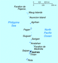
The islands total 179.01 square miles (463.63 km2). The table gives an overview, with the individual islands from north to south:
No. Island Area Population
(2010
census)Height Highest peak Location sq mi km2 feet m Northern Islands (Northern Islands Municipality) 1 Farallon de Pajaros (Urracas) 0.985 2.55 — 1,047 319 20°33′N 144°54′E / 20.55°N 144.9°E 2 Maug Islands[n 1] 0.822 2.13 — 745 227 (North Island) 20°02′N 145°19′E / 20.033°N 145.317°E 3 Asuncion 2.822 7.31 — 2,923 891 19°43′N 145°41′E / 19.717°N 145.683°E 4 Agrihan (Agrigan)[n 2] 16.80 43.51 9 3,166 965 Mount Agrihan 18°46′N 145°40′E / 18.767°N 145.667°E 5 Pagan[n 3] 18.24 47.24 — 1,900 579 Mount Pagan 18°08′36″N 145°47′39″E / 18.14333°N 145.79417°E 6 Alamagan 4.29 11.11 6 2,441 744 Alamagan 17°35′N 145°50′E / 17.583°N 145.833°E 7 Guguan 1.494 3.87 — 988 301 17°20′N 145°51′E / 17.333°N 145.85°E 8 Zealandia Bank >0.0 >0.0 — >0 >0 16°45′N 145°42′E / 16.75°N 145.7°E 9 Sarigan[n 4] 1.92 4.97 — 1,801 549 — 16°43′N 145°47′E / 16.717°N 145.783°E 10 Anatahan[n 2] 12.05 31.21 — 2,582 787 16°22′N 145°40′E / 16.367°N 145.667°E 11 Farallon de Medinilla 0.328 0.85 — 266 81 16°01′N 146°04′E / 16.017°N 146.067°E Southern Islands (3 municipalities) 12 Saipan 44.55 115.38 48,220, 1,555 474 Mount Tapochau 15°11′06″N 145°44′28″E / 15.185°N 145.74111°E 13 Tinian 39.00 101.01 3,136 558 170 Kastiyu (Lasso Hill) 14°57′12″N 145°38′54″E / 14.95333°N 145.64833°E 14 Aguijan (Agiguan)[n 5] 2.74 7.10 — 515 157 Alutom 14°42′N 145°18′E / 14.7°N 145.3°E 15 Rota 32.97 85.39 2,527 1,611 491 Mt. Manira 14°08′37″N 145°11′08″E / 14.14361°N 145.18556°E Northern Mariana Islands 179.01 463.63 53,883 3,166 965 Mount Agrihan 14°08' to 20°33'N,
144°54° to 146°04'E- Notes
Administratively, the CNMI is divided into four municipalities:
The Northern Islands (north of Saipan) form the Northern Islands Municipality. The three main islands of the Southern Islands form the municipalities of Saipan, Tinian, and Rota, with uninhabited Aguijan forming part of Tinian municipality.
Because of volcanic threat, the northern islands have been largely evacuated. Human habitation is limited to Agrihan, Pagan, and Alamagan, but population varies due to various economic factors, including children's education. The Census of April 2000 registered just six people in all of the Northern Islands municipality (then residing on Alamagan), and the Northern Islands' mayor office is located in "exile" on Saipan.
Saipan, Tinian, and Rota have the only ports and harbors, and are the only permanently populated islands.
See also
- Outline of the Northern Mariana Islands
- Index of Northern Mariana Islands-related articles
- Commonwealth (U.S. insular area)
- List of National Register of Historic Places in the Northern Mariana Islands
- Mariana Islands
- Micronesia
- Pacific Ocean
Notes and references
- ^ As President of the United States CIA World Factbook - Northern Mariana Islands
- ^ 2010 Census
- ^ net.saipan.com
- ^ "Culture of Commonwealth of the Northern Mariana Islands". www.everyculture.com. http://www.everyculture.com/No-Sa/Commonwealth-of-the-Northern-Mariana-Islands.html/. Retrieved 2007-09-17.
- ^ "Battle of Saipan". Historynet.com.
- ^ Pacific Magazine: Sablan WIll Stand For NMI Delegate Position
- ^ "Census 2010 News | U.S. Census Bureau Releases 2010 Census Population Counts for the Northern Mariana Islands"
- ^ "2010 CENSUS RESULT | CNMI population down 22.2 pct."
- ^ worldcatlibraries.org
- ^ Charles P. Reyes Jr. (March 30, 1999). "Primitive tribalism". Saipan Tribune. http://www.saipantribune.com/newsstory.aspx?newsID=1594&cat=3. Retrieved 2008-09-01.
- ^ doi.gov
- ^ U.S. Department of Justice Memorandum
- ^ A Lesser-Known Immigration Crisis: Federal Immigration Law in the Commonwealth of the Northern Mariana Islands
- ^ CNMI loses immigration control in 2009
- ^ DNMI Local Rule 83.3
- ^ Mar-Vic Cagurangan (September 19, 2007). "Guam senators oppose NMI federalization". Marianas Variety. http://www.mvariety.com/calendar/september/19/frontpage/front01.htm.[dead link]
- ^ Jayvee L. Vallejera (May 27, 2007). "NMI minimum wage hike OK'd". Saipan Tribune. http://www.saipantribune.com/newsstory.aspx?cat=1&newsID=68875.
- ^ $5.05 hourly minimum wage today, Saipan Tribune, September 30, 2010
- ^ Rebecca Clarren (May 9, 2006). "Sex, Greed And Forced Abortions". TomPaine.com. http://www.tompaine.com/articles/2006/05/09/sex_greed_and_forced_abortions.php. Retrieved 2008-02-20.
- ^ Rebecca Clarren (Spring 2006). "Paradise Lost: Greed, Sex Slavery, Forced Abortions and Right-Wing Moralists". Ms.. http://www.msmagazine.com/spring2006/paradise.asp.
- ^ Ferdie de la Torre (May 30, 2007). "Dotts: It's the end for all CNMI garment factories". Saipan Tribune. http://www.saipantribune.com/newsstory.aspx?cat=1&newsID=68959.
- ^ a b "About the CNMI". CNMI Commonwealth Law Revision Commission. http://cnmilaw.org/aboutcnmi.htm. Retrieved 2010-01-24.
- ^ "Official USPS Abbreviations". United States Postal Service. http://www.usps.com/ncsc/lookups/usps_abbreviations.html. Retrieved 2010-01-24.
- The World Factbook 2000.
- Land areas and population data from United States Census Bureau.
- Northern Mariana Islands and constituent municipalities, United States Census Bureau
External links
- Government
- Northern Mariana Islands official government website
- The CNMI Covenant
- The CNMI Constitution
- CNMI Office of Resident Representative Pedro A. Tenorio
- H.R. 873 - the Northern Mariana Islands Delegate Act
- H.R. 5550 - The United States-Commonwealth of the Northern Marianas Human Dignity Act
- General information
- U.S. Census Bureau: Island Areas Census 2000
- Northern Mariana Islands entry at The World Factbook
- Northern Mariana Islands at the Open Directory Project]
- Wikimedia Atlas of Northern Mariana Islands
- Northern Mariana Islands travel guide from Wikitravel
- News media
- KSPN2 News
- Saipan Tribune
- Marianas Variety
- The Pacific Times
- Food for Thought - Weekly commentary on CNMI society by KZMI and KCNM manager Harry Blalock
- Other
- The Insular Empire: America in the Mariana Islands, PBS documentary film & website
- Northern Mariana Islands Online Encyclopedia
- Pascal Horst Lehne and Christoph Gäbler: Über die Marianen. Lehne-Verlag, Wohldorf in Germany 1972.
 Commonwealth of Northern Mariana Islands
Topics - The archipelago
- Geography
- Politics
- Economy
- Campaign
- Radio stations
- Television stations
Islands - Agrihan (Agrigan)
- Aguijan (Agiguan)
- Alamagan
- Anatahan
- Asuncion
- Farallon de Medinilla
- Farallon de Pajaros (Uracas)
- Guguan
- Mañagaha
- Maug Islands (Ma'ok)
- Pagan
- Rota (Luta)
- Saipan
- Sarigan
- Tinian
- Zealandia Bank
Municipalities Countries and territories of Oceania Sovereign states Australia · Chile (Easter Island · Juan Fernández Islands) · East Timor (Timor-Leste) · Fiji · Indonesia · Kiribati · Marshall Islands · Federated States of Micronesia · Japan (Bonin Islands) · Nauru · New Zealand · Palau · Papua New Guinea · Samoa · Solomon Islands · Tonga · Tuvalu · United States (Hawaii · Palmyra Atoll) · Vanuatu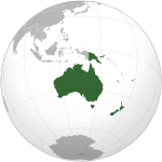
Dependencies and other territories AustraliaFranceNew ZealandUnited KingdomUnited StatesAmerican Samoa · Baker Island · Guam · Howland Island · Jarvis Island · Johnston Atoll · Kingman Reef · Midway Atoll · Northern Mariana Islands · Wake IslandAustronesian-speaking countries and territories Formosan Malayo-Polynesian American Samoa · Brunei · Burma (Myanmar) · Cambodia · Christmas Island · Cocos (Keeling) Islands · Cook Islands · Easter Island · East Timor · Fiji · French Polynesia · Guam · Hainan · Indonesia · Kiribati · Madagascar · Malaysia · Marshall Islands · FS Micronesia · Nauru · New Caledonia · New Zealand · Niue · Northern Mariana Islands · Orchid Island · Palau · Papua New Guinea · Philippines · Samoa · Singapore · Solomon Islands · Sri Lanka · Suriname · Tokelau · Tonga · Tuvalu · United States (Hawaii) · Vanuatu · Vietnam · Wallis and FutunaFormer German colonies and protectorates Colonies AfricaPacificGerman New Guinea (Solomon Islands · Marshall Islands · Caroline Islands (Federated States of Micronesia) · Northern Mariana Islands · Nauru · Palau) · German SamoaNorth AmericaGerman Caribbean

Concessions ChinaUnrecognised AntarcticaCoordinates: 17°N 146°E / 17°N 146°E
History of the United States by political division States - Alabama
- Alaska
- Arizona
- Arkansas
- California
- Colorado
- Connecticut
- Delaware
- Florida
- Georgia
- Hawaii
- Idaho
- Illinois
- Indiana
- Iowa
- Kansas
- Kentucky
- Louisiana
- Maine
- Maryland
- Massachusetts
- Michigan
- Minnesota
- Mississippi
- Missouri
- Montana
- Nebraska
- Nevada
- New Hampshire
- New Jersey
- New Mexico
- New York
- North Carolina
- North Dakota
- Ohio
- Oklahoma
- Oregon
- Pennsylvania
- Rhode Island
- South Carolina
- South Dakota
- Tennessee
- Texas
- Utah
- Vermont
- Virginia
- Washington
- West Virginia
- Wisconsin
- Wyoming
Federal district Insular areas - American Samoa
- Guam
- Northern Mariana Islands
- Puerto Rico
- U.S. Virgin Islands
Outlying islands - Bajo Nuevo Bank
- Baker Island
- Howland Island
- Jarvis Island
- Johnston Atoll
- Kingman Reef
- Midway Atoll
- Navassa Island
- Palmyra Atoll
- Serranilla Bank
- Wake Island
History of Oceania Sovereign states Dependencies and
other territories- American Samoa
- Christmas Island
- Cocos (Keeling) Islands
- Cook Islands
- Easter Island
- French Polynesia
- Guam
- Hawaii
- New Caledonia
- Niue
- Norfolk Island
- Northern Mariana Islands
- Pitcairn Islands
- Tokelau
- Wallis and Futuna
Categories:- Northern Mariana Islands
- Insular areas of the United States
- Micronesia
- Island countries
- Archipelagoes of the Pacific Ocean
- Former German colonies
- Former Spanish colonies
- Former Japanese colonies
- English-speaking countries and territories
- States and territories established in 1898
- World War II sites
Wikimedia Foundation. 2010.

