- Kiribati
-
This article is about the island nation. For other uses, see Kiribati (disambiguation).Not to be confused with Kiritimati, an island in the Line Islands and part of Kiribati.
Republic of Kiribati Ribaberiki Kiribati

Flag Coat of arms Motto: Te Mauri, Te Raoi ao Te Tabomoa
(English: Health, Peace and Prosperity)Anthem: Teirake Kaini Kiribati
("Stand up, Kiribati")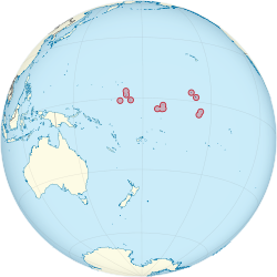
Capital Tarawa[1]
1°28′N 173°2′E / 1.467°N 173.033°ELargest city South Tarawa Official language(s) English, Gilbertese Demonym I-Kiribati Government Parliamentary republic - President Anote Tong - Vice President Teima Onorio Independence - from United Kingdom 12 July 1979 Area - Total 811 km2 (186th)
313 sq miPopulation - 2010 estimate 103,500 (197th) - 2010 census 103,500 - Density 135/km2 (73rd)
350/sq miGDP (PPP) 2010 estimate - Total $618 million[2] - Per capita $6,209[2] GDP (nominal) 2010 estimate - Total $147 million[2] - Per capita $1,479[2] HDI (1998) .515 (medium) (unranked) Currency Kiribati dollar
Australian dollar (AUD)Time zone (UTC+12, +13, +14) Drives on the left ISO 3166 code KI Internet TLD .ki Calling code 686 1 Supplemented by a nearly equal amount from external sources. Kiribati (
 i/ˈkɪrɨbæs/ kirr-i-bas[3] or ˌkɪrəˈbɑdi;[4] Gilbertese: [ˈkiɾibas]), officially the Republic of Kiribati, is an island nation located in the central tropical Pacific Ocean. The permanent population exceeds just over 100,000 (2011),[5] and is composed of 32 atolls and one raised coral island, dispersed over 3.5 million square kilometres, (1,351,000 square miles) straddling the equator, and bordering the International Date Line at its easternmost point.
The name Kiribati is the local pronunciation of "Gilberts", derived from the main island chain, the Gilbert Islands. The capital of South Tarawa consists of a number of islets connected through a series of causeways, located in the Tarawa archipelago. Kiribati became independent from the United Kingdom in 1979. It is a member of the Commonwealth of Nations, the IMF and the World Bank, and became a full member of the United Nations in 1999.
Contents
Etymology
Kiribati was named in French by captains Krusenstern and Louis Isidore Duperrey "îles Gilbert",[6] Gilbert Islands, after the British Captain Thomas Gilbert, who sighted the islands in 1788. The current name, Kiribati, is an adaptation of "Gilberts", from the former European name the "Gilbert Islands". Although the indigenous Gilbertese language name for the Gilbert Islands proper is Tungaru, the new state chose the name "Kiribati", the Gilbertese rendition of "Gilberts", as an equivalent of the former colony to acknowledge the inclusion of islands which were never considered part of the Gilberts chain.[7]
History
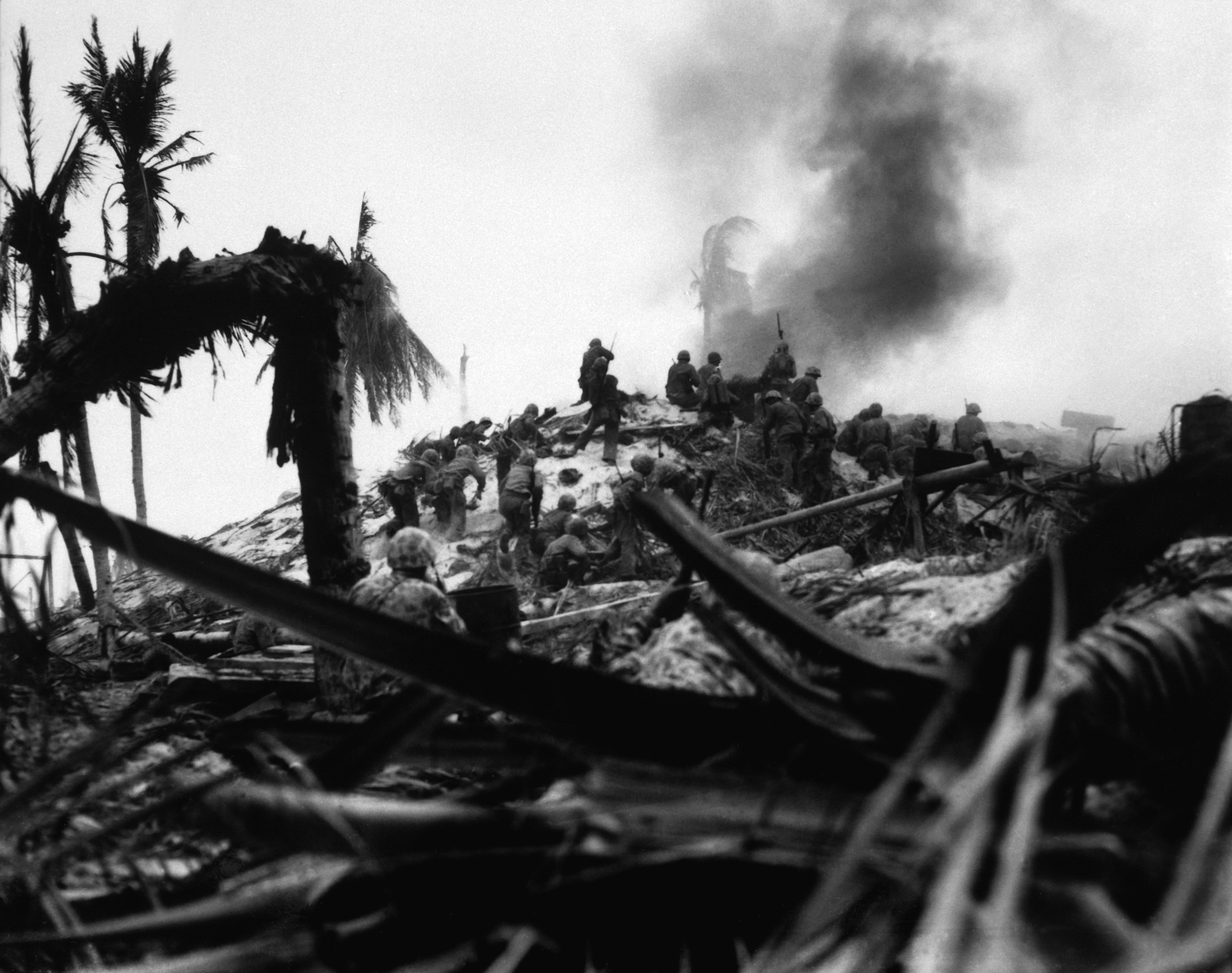
 American marines assault a Japanese bunker during the Battle of Tarawa, November 1943.
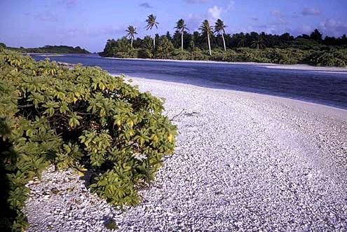
 Caroline Atoll channel between west side of Long Island and Nake Island.Main article: History of Kiribati
Early history
The area now called Kiribati has been inhabited by Micronesians speaking the same Oceanic language since sometime between 3000 BC[8] and AD 1300. The area was not isolated; invaders from Tonga, Samoa, and Fiji later introduced Polynesian and Melanesian cultural aspects, respectively. Intermarriage tended to blur cultural differences and resulted in a significant degree of cultural homogenisation.[9]
Colonial era
The islands were first sighted by British and American ships in the late 18th and early 19th centuries. The main island chain was named the Gilbert Islands in 1820 by a Russian admiral, Adam von Krusenstern, and French captain Louis Duperrey, after a British captain named Thomas Gilbert, who crossed the archipelago in 1788 when sailing from Australia to China.[10]
From the early 19th century, Western whalers, merchant vessels and slave traders visited the islands, introducing diseases and firearms.[11] The first British settlers arrived in 1837. In 1892 the Gilbert Islands consented to become a British protectorate together with the nearby Ellice Islands. They were administered by the Western Pacific High Commission based in Fiji.[10] Together they became the crown colony of the Gilbert and Ellice Islands in 1916. Christmas Island (or Kiritimati) became part of the colony in 1919 and the Phoenix Islands were added in 1937. Sir Arthur Grimble was a cadet administrative officer based at Tarawa (1913-1919) and became Resident Commissioner of the Gilbert and Ellice Islands colony in 1926.[12]
Tarawa Atoll and others of the Gilbert group were occupied by Japan during World War II. Tarawa was the site of one of the bloodiest battles in US Marine Corps history. Marines landed in November 1943; the Battle of Tarawa was fought at Kiribati's former capital Betio on Tarawa Atoll.
Some of the islands of Kiribati, especially in the remote Line Islands, were formerly used by the United States and United Kingdom for nuclear weapons testing including hydrogen bombs in the late 1950s and early 1960s.
Independence to present day
The Gilbert and Ellice Islands gained self-rule in 1971, and were separated in 1975 and granted internal self-government by Britain. In 1978 the Ellice Islands became the independent nation of Tuvalu. The Gilbert Islands became independent as Kiribati on 12 July 1979. Although the indigenous Gilbertese language name for the Gilbert Islands proper is "Tungaru", the new state chose the name "Kiribati", the Gilbertese rendition of "Gilberts", as an equivalent of the former colony to acknowledge the inclusion of Banaba, the Line Islands, and the Phoenix Islands, which were never considered part of the Gilberts chain.[13] In the Treaty of Tarawa, signed shortly after independence and ratified in 1983, the United States relinquished all claims to the sparsely inhabited Phoenix Islands and those of the Line Islands that are part of Kiribati territory.
Overcrowding has been a problem. In 1988 it was announced that 4,700 residents of the main island group would be resettled onto less-populated islands. Teburoro Tito was elected president in 1994. Kiribati's 1995 act of moving the international date line far to the east to encompass the Line Islands group, so that it would no longer be divided by the date line, courted controversy. The move, which fulfilled one of President Tito's campaign promises, was intended to allow businesses all across the expansive nation to keep the same business week. This also enabled Kiribati to become the first country to see the dawn of the third millennium, an event of significance for tourism. Tito was reelected in 1998. Kiribati gained UN membership in 1999.[14]
In 2002 Kiribati passed a controversial law enabling the government to shut down newspapers. The legislation followed the launching of Kiribati's first successful nongovernment-run newspaper. President Tito was reelected in 2003, but was removed from office in March 2003 by a no-confidence vote and replaced by a Council of State. Anote Tong of the opposition party Boutokaan Te Koaua was elected to succeed Tito in July 2003. He was re-elected in 2007.[15]
In the summer of 2008, Kiribati officials asked Australia and New Zealand to accept Kiribati citizens as permanent refugees. Kiribati is expected to be the first country in which all land territory disappears due to global climate change. In June 2008, the Kiribati president Anote Tong said that the country has reached "the point of no return"; he added: "To plan for the day when you no longer have a country is indeed painful but I think we have to do that."[16][17][18][19]
Politics
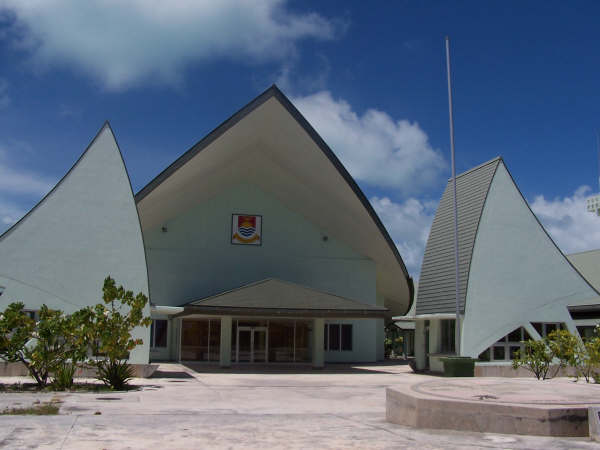
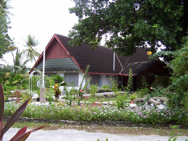
Main article: Politics of Kiribati Kiribati Parliament House.
 The Presidential residence.
The Kiribati Constitution, promulgated 12 July 1979, provides for free and open elections. The executive branch consists of a president (te Beretitenti), a vice president and a cabinet (the president is also chief of the cabinet and has to be an MP). Under the constitution, the president, nominated from among the elected legislators, is limited to three 4-year terms. The cabinet is composed of the president, vice president and 10 ministers (appointed by the president) who are members of the House of Assembly.
The legislative branch is the unicameral Maneaba Ni Maungatabu (House of Assembly). It has elected members, including by constitutional mandate a representative of the Banaban people in Fiji (Banaba Island, former Ocean Island), in addition to the attorney general, who serves as an ex-officio member. Legislators serve for a four-year term.
The constitutional provisions governing administration of justice are similar to those in other former British possessions in that the judiciary is free from governmental interference. The judicial branch is made up of the High Court (in Betio) and the Court of Appeal. The president appoints the presiding judges.
Local government is through island councils with elected members. Local affairs are handled in a manner similar to town meetings in colonial America. Island councils make their own estimates of revenue and expenditure and generally are free from central government controls.
Kiribati has formal political parties but their organisation is quite informal. Ad hoc opposition groups tend to coalesce around specific issues. Today the only recognisable parties are the Boutokaan te Koaua Party, Maneaban te Mauri Party, Maurin Kiribati Party and Tabomoa Party. There is universal suffrage at age 18.
In government terms, Kiribati has a police force, which carries out law enforcement functions and paramilitary duties, and which has small police posts on all islands, but no military. The police have one patrol boat.[20]
Island groups
Main article: Districts of KiribatiKiribati was formally divided into districts until its independence. The country is now divided into three island groups which have no administrative function, including a group which unites the Line Islands and the Phoenix Islands (ministry at London, Christmas). Each inhabited island has its own council (three councils on Tarawa: Betio, South-Tarawa, North-Tarawa; two councils on Tabiteuea). The original districts used to be:
- Banaba
- Tarawa Atoll
- Northern Gilbert Islands
- Central Gilbert Island
- Southern Gilbert Islands
- Line Islands
The island groups include:
- Gilbert Islands
- Phoenix Islands, the second largest protected marine reserve in the world [21][22] since the establishment of the Chagos Archipelago as a marine reserve.
- Line Islands
Four of the former districts (including Tarawa) lie in the Gilbert Islands, where most of the country's population lives. Five of the Line Islands are uninhabited (Malden Island, Starbuck Island, Caroline Island, Vostok Island and Flint Island). The Phoenix Islands are uninhabited except for Kanton, and have no representation. Banaba itself is sparsely inhabited now. There is also a non-elected representative of the Banabans on Rabi Island in Fiji. Each of the 21 inhabited islands has a local council that takes care of the daily affairs. Tarawa Atoll has three councils: Betio Town Council, Te Inainano Urban Council (for the rest of South Tarawa) and Eutan Tarawa Council (for North Tarawa).
Foreign relations
Main article: Foreign relations of KiribatiKiribati was admitted as the 186th member of the United Nations in September 1999.
Regional relations
Kiribati maintains cordial relations with most countries and has close relations with its Pacific neighbours, Japan, Australia and New Zealand, which provide the majority of the country's foreign aid. Taiwan and Japan also have specified-period licences to fish in Kiribati's waters.[citation needed]
In November 1999 it was announced that Japan's National Space Development Agency planned to lease land on Kiritimati (Christmas Island) for 20 years, on which to build a spaceport.[citation needed] The agreement stipulated that Japan was to pay US$840,000 per year and would also pay for any damage to roads and the environment. A Japanese-built downrange tracking station operates on Kiritimati[23] and an abandoned airfield on the island was designated as the landing strip for a proposed reusable unmanned space shuttle called HOPE-X. HOPE-X, however, was eventually cancelled by Japan in 2003.[citation needed]
International relations of climate change
As one of the world's most vulnerable nations in terms of the effects of climate change, Kiribati has been an active participant in international diplomatic efforts relating to climate change, most importantly the UNFCCC conferences of the parties (COP). Kiribati is a member of the Alliance of Small Island States (AOSIS), an intergovernmental organization of low-lying coastal and small Island countries. Established in 1990, the main purpose of the alliance is to consolidate the voices of Small Island Developing States (SIDS) to address global warming. AOSIS has been very active from its inception, putting forward the first draft text in the Kyoto Protocol negotiations as early as 1994.
In 2009 President Tong attended the Climate Vulnerable Forum (V11) in the Maldives, along with 10 other countries that are vulnerable to climate-change, and signed the Bandos Island declaration on Nov. 10 2009, pledging to show moral leadership and commence greening their economies by voluntarily committing to achieving carbon neutrality. In November 2010, Kiribati hosted the Tarawa Climate Change Conference (TCCC), the purpose of which was to support the initiative of the President of Kiribati to hold a consultative forum between vulnerable states and their partners with a view of creating an enabling environment for multi-party negotiations under the auspices of the UNFCCC. The conference was a successor event to the Climate Vulnerable Forum.[24] The ultimate objective of TCCC was to reduce the number and intensity of various fault lines between parties to the COP process, explore elements of agreement between the parties and thereby to support Kiribati's and other parties' contribution to COP16 held in Cancun, Mexico, from 29 November to 10 December 2010.
Geography
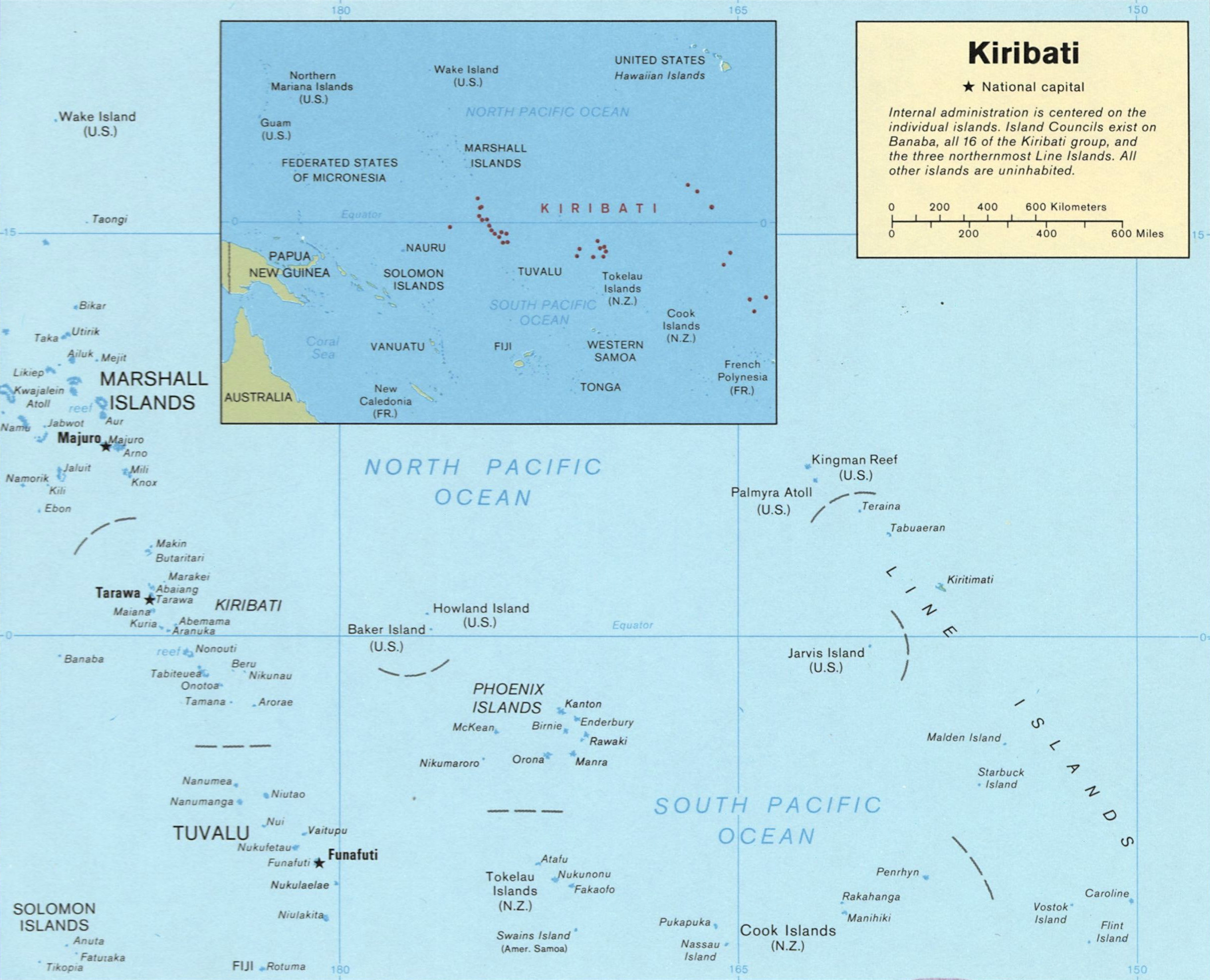
Main article: Geography of Kiribati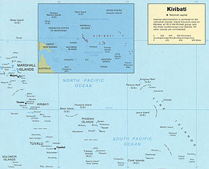 Map of Kiribati.
Kiribati consists of about 32 atolls and one solitary island (Banaba), extending into both the eastern and western hemispheres. The groups of islands are:
- Banaba: an isolated island between Nauru and the Gilbert Islands
- Gilbert Islands: 16 atolls located some 1,500 kilometres (932 mi) north of Fiji
- Phoenix Islands: 8 atolls and coral islands located some 1,800 kilometres (1,118 mi) southeast of the Gilberts
- Line Islands: 8 atolls and one reef, located about 3,300 kilometres (2,051 mi) east of the Gilberts
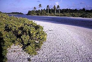
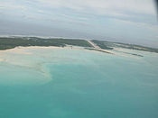
Banaba (or Ocean Island) is a raised-coral island which was once a rich source of phosphates, but it was mostly mined out before independence. The rest of the land in Kiribati consists of the sand and reef rock islets of atolls or coral islands which rise but a few metres (half a dozen feet or so) above sea level.
The soil is thin and calcareous, making agriculture very difficult.
Kiritimati (Christmas Island) in the Line Islands is the world's largest atoll. Based on a 1995 realignment of the International Date Line, Kiribati is now the easternmost country in the world, and the Line Islands are the first area to enter into a new year, including year 2000. For that reason, Caroline Island has been renamed Millennium Island.[25] The majority of Kiribati, including the capital, is not first, for example New Zealand (UTC+13 in January) has an earlier new year.
According to the Pacific Regional Environment Programme(previously South Pacific Regional Environment Programme (SPREP)), two small uninhabited Kiribati islets, Tebua Tarawa and Abanuea, disappeared underwater in 1999.[26] The United Nations Intergovernmental Panel on Climate Change predicts that sea levels will rise by about half a metre (20 in) by 2100 due to global warming and a further rise would be inevitable. It is thus likely that within a century the nation's arable land will become subject to increased soil salination and will be largely submerged.[27]
However, sea-level rise may not necessarily mean Kiribati will be inundated. Paul Kench at the University of Auckland in New Zealand and Arthur Webb at the South Pacific Applied Geoscience Commission in Fiji released a study in 2010 on the dynamic response of reef islands to sea level rise in the central Pacific. Kiribati was mentioned in the study, and Webb and Kench found that the three major urbanised islands in Kiribati - Betio, Bairiki and Nanikai - increased by 30 per cent (36 hectares), 16.3 per cent (5.8 hectares) and 12.5 per cent (0.8 hectares), respectively.[28]
The Kiribati Adaptation Program (KAP) is a US $5.5 million initiative that was originally enacted by the national government of Kiribati with the support of the Global Environment Facility (GEF), the World Bank, the United Nations Development Program, and the Japanese Government. Australia later joined the coalition, donating US $1.5 million to the effort. The program aims to take place over 6 years, supporting measures that reduce Kiribati’s vulnerability to the effects of climate change and sea level rise by raising awareness of climate change, assessing and protecting available water resources, and managing inundation. At the start of the Adaptation Program, representatives from each of the inhabited atolls identified key climatic changes that had taken place over the past 20-40 years, and proposed coping mechanisms to deal with these changes under 4 categories of urgency of need. The program is now focusing on the country’s most vulnerable sectors in the most highly populated areas. Initiatives include improving water supply management in and around Tarawa; coastal management protection measures such as mangrove re-plantation and protection of public infrastructure; strengthening laws to reduce coastal erosion; and population settlement planning to reduce personal risks.[29]
Kiribati is the only country in all four hemispheres.[30]
Economy
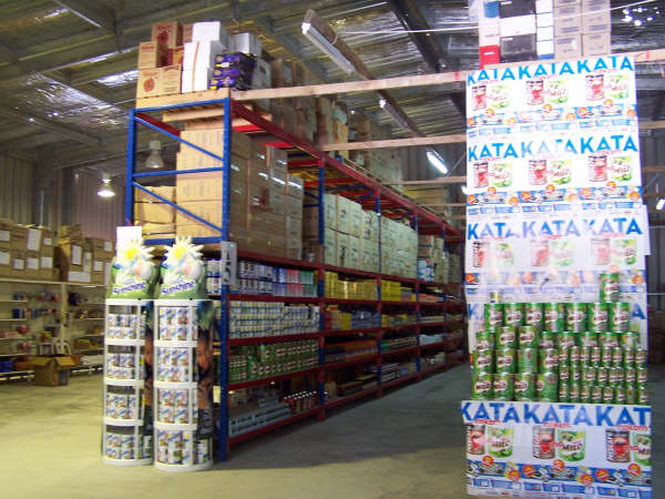
Main article: Economy of Kiribati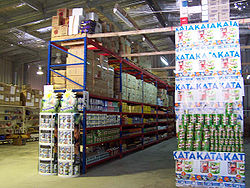 A Bosj's warehouse in Kiribati.
Kiribati is one of the world's poorest countries. It has few natural resources. Commercially viable phosphate deposits on Banaba were exhausted at the time of independence. Copra and fish now represent the bulk of production and exports. Kiribati is considered one of the least developed countries in the world. In one form or another, Kiribati gets a large portion of its income from abroad. Examples include fishing licenses, development assistance, worker remittances, and tourism. Given Kiribati's limited domestic production ability, it must import nearly all of its essential foodstuffs and manufactured items; it depends on these external sources of income for financing.
The economy of Kiribati benefits from international development assistance programs. The multilateral donors providing development assistance in 2009 were the European Union (A$9 million), the United Nations Development Program (A$3.7 million), and the World Health Organisation (A$100,000).[31] The bilateral donors providing development assistance in 2009 were Australia (A$11 million), Japan (A$2 million), New Zealand (A$6.6 million), Taiwan (A$10.6 million), and other donors providing A$16.2 million, including technical assistance grants from the Asian Development Bank.[5] [31]
The major donors in 2010/2011 were Australia (A$15 million), Taiwan (A$11 million); New Zealand (A$6 million), the World Bank (A$4 million), and the Asian Development Bank.[32]
In 1956 Kiribati established a sovereign wealth fund to act as a store of wealth for the country's earnings from phosphate mining. In 2008, the Revenue Equalization Reserve Fund was valued at US$ 400 million.[33] The RERF assets declined from A$637 million (420 percent of GDP) in 2007 to A$570.5 million (350 percent of GDP) in 2009.[31] As the result of the Global Financial Crisis (GFC) the RERF was exposure to failed Icelandic banks, as well drawdowns were made by the government of Kiribati to finance budgetary shortfalls.[5]
In May 2011 the IMF country report assessment of the Economy of Kiribati is that: “After two years of contraction, the economy recovered in the second half of 2010 and inflation pressure dissipated. It is estimated to have grown by 1¾ percent for the year. Despite a weather-related drop in copra production, private sector activity appears to have picked up, especially in retail. Tourist arrivals rebounded by 20 percent compared to 2009, although from a very low base. Despite the rise in world food and fuel prices, inflation has bounced from 2008 crisis-highs into negative territory, reflecting the strong appreciation of the Australian dollar, which is used as the domestic currency, and a decline in the world price of rice. Credit growth in the overall economy declined in 2009 as economic activity stalled. But it started to pick up in the second half of 2010 as the recovery gained traction.”[5]
Demographics
Main article: Demographics of KiribatiThe native people of Kiribati are called I-Kiribati. The word Kiribati is the local spelling of the word Gilbert and the original name of this British colony was the Gilbert Islands. The indigenous format of the name was adopted when independence was gained in 1979.
Ethnically, the I-Kiribati are Micronesians. Recent archaeological evidence indicates that Austronesians originally settled the islands thousands of years ago. Around the 14th century, Fijians, Samoans, and Tongans invaded the islands, thus diversifying the ethnic range and introducing Polynesian linguistic traits. Intermarriage among all ancestral groups, however, has led to a population reasonably homogeneous in appearance and traditions.
The people of Kiribati speak an Oceanic language called "Gilbertese". Although English is the official language, it is not used very often outside the island capital of Tarawa. It is more likely that English is mixed in its use with Gilbertese. Older generations of I-Kiribati tend to use more complicated versions of the language.
Christianity is the major religion, having been introduced by missionaries in the 19th century. The population is predominantly Roman Catholic, although a substantial portion of the population is Congregationalist Protestant. Many other Protestant denominations, including more evangelical types, are also represented. The Bahá'í religion also exists in Kiribati, along with Jehovah's Witnesses and the Church of Jesus Christ of Latter-day Saints (Mormons), the latter numbering 11,511 at the end of 2005.[34]
Human development
The Kiribati Census in 2010 estimated the population at 103,500. The people of Kiribati mostly live in villages with populations between 50 and 3,000 on the outer islands. Most houses are made of materials obtained from coconut and pandanus trees. Frequent droughts hinder reliable large-scale agriculture, so the islanders have largely turned to the sea for livelihood and subsistence. Most are outrigger sailors and fishers. Copra plantations serve as a second source of employment. In recent years, large numbers of citizens have moved to the more urban island capital of Tarawa.[5]
Health
The population of Kiribati has a life expectancy at birth of 60 years (57 for males, and 63 for females) and an infant mortality rate of 54 deaths per 1,000 live births.[5] Tuberculosis is present in the country.[35] Government expenditure on health was at US$268 per capita (PPP) in 2006.[36] In 1990-2007, there were 23 physicians per 100,000 persons.[37] Since the arrival of Cuban doctors, the infant mortality rate has decreased significantly.[38]
Education
Primary education is free and compulsory for the first six years, now being extended to nine years. Mission schools are slowly being absorbed into the government primary school system. Higher education is expanding; students may seek technical, teacher or marine training, or study in other countries. To date, most choosing to do the latter have gone to Fiji, and those wishing to complete medical training have been sent to Cuba.[39]
Transport
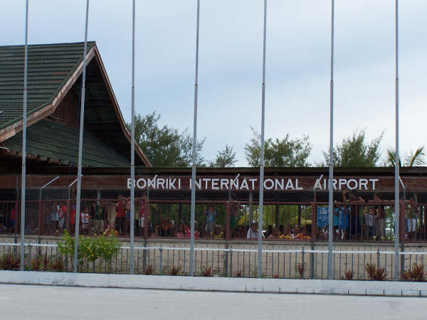
 Bonriki International AirportMain article: List of airports in Kiribati
Beginning in January 2009, Kiribati has two domestic airlines: Air Kiribati and Coral Sun Airways. Both airlines are based in Tarawa's Bonriki International Airport and serve destinations across the Gilbert Islands only.
Neither the Phoenix nor Line Islands are served by the domestic carriers. Fiji's national carrier Air Pacific provides an international service to Cassidy International Airport on Kiritimati from Fiji's main airport, Nadi International Airport.
Internationally, Our Airline, the national airline of Nauru, also provides a weekly service on behalf of Air Kiribati from Tarawa to Nadi International Airport, as well as a service to Nauru International Airport, connecting to Honiara, the capital of the Solomon Islands, and further to Brisbane, Australia.
Culture
Main article: Culture of KiribatiSongs (te anene) and above all dances (te mwaie) are held in high regard.
Music
Kiribati folk music is generally based on chanting or other forms of vocalising, accompanied by body percussion. Public performances in modern Kiribati are generally performed by a seated chorus, accompanied by a guitar. However, during formal performances of the standing dance (Te Kaimatoa) or the hip dance (Te Buki) a wooden box is used as a percussion instrument. This box is constructed so as to give a hollow and reverberating tone when struck simultaneously by a chorus of men sitting around it. Traditional songs are often love-themed, but there are also competitive, religious, children's, patriotic, war and wedding songs[citation needed]. There are also stick dances (which accompany legends and semi-historical stories[citation needed]. These stick dances or 'tirere' (pronounced seerere) are only performed during major festivals.
See also: Music of KiribatiDance
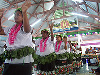 A welcome display
The uniqueness of Kiribati when compared with other forms of Pacific island dance is its emphasis on the outstretched arms of the dancer and the sudden birdlike movement of the head. The Frigate bird (Fregata minor) on the Kiribati flag refers to this bird-like style of Kiribati dancing. Most dances are in the standing or sitting position with movement limited and staggered. Smiling whilst dancing is generally considered vulgar within the context of Kiribati dancing. This is due to its origin of not being solely as a form of entertainment but as a form of storytelling and a display of the skill, beauty and endurance of the dancer.[40]
See also: Dance in KiribatiOutside perspectives
Edward Carlyon Eliot, who was Resident Commissioner of the Gilbert & Ellice Islands (now Kiribati & Tuvalu) from 1913 to 1920 describes this period in his book "Broken Atoms" (autobiographical reminiscences) Pub. G. Bles, London, 1938.
Sir Arthur Grimble wrote about his time working in the British colonial service in Kiribati (then the Gilbert Islands) from 1914 to 1932 in two popular books A Pattern of Islands (1952) and Return to the Islands (1957). He also undertook academic studies of Gilbertese culture.
J. Maarten Troost's more recent autobiographical experiences on the Tarawa Atoll are documented in his book The Sex Lives of Cannibals (2004).
Further Reading
- Cinderellas of the Empire: towards a history of Kiribati and Tuvalu, by Barrie Macdonald, Institute of Pacific Studies, University of the South Pacific, Suva, Fiji, 2001. ISBN 982-02-0335-X (Australian National University Press, first published 1982)
- A Pattern of Islands by Sir Arthur Grimble, John Murray & Co, London, 1952; republished 2011 by Eland, London, ISBN 978-1906011-45-1
- Return to the Islands by Sir Arthur Grimble, John Murray & Co, London, 1957
- The Sex Lives of Cannibals by J. Maarten Troost, Broadway, 2004, ISBN 0767915305 ISBN 978-0767915304
- Kiribati existe Pp. 29–43; y De Abemama a Madrid Pp. 43–54 en Son los mares del Sur, by Luis Pancorbo: Maeva, Madrid, 1997, ISBN 84-86478-60-X
- Lonely Planet Guide: South Pacific & Micronesia by various
See also
- Communications in Kiribati
- Kiribati Scout Association
- Law enforcement in Kiribati
- LGBT rights in Kiribati
- Tarawa Climate Change Conference
- Transportation in Kiribati
References
- ^ "Kiribati government website". Government of Kiribati. http://www.kiribatitourism.gov.ki/index.php/aboutkiribati/aboutkiribatioverview. Retrieved 24 Jun. 2010.
- ^ a b c d "Kiribati". International Monetary Fund. http://www.imf.org/external/pubs/ft/weo/2011/01/weodata/weorept.aspx?sy=2008&ey=2011&scsm=1&ssd=1&sort=country&ds=.&br=1&c=826&s=NGDPD%2CNGDPDPC%2CPPPGDP%2CPPPPC%2CLP&grp=0&a=&pr.x=59&pr.y=4. Retrieved 30 April 2011.
- ^ "kiribati - Definition from the Merriam-Webster Online Dictionary". M-w.com. 25 Apr. 2007. http://m-w.com/dictionary/kiribati. Retrieved 14 May 2010.
- ^ New Oxford American Dictionary 3rd edition © 2010 by Oxford University Press, Inc.
- ^ a b c d e f "Kiribati: 2011 Article IV Consultation-Staff Report, Informational Annexes, Debt Sustainability Analysis, Public Information Notice on the Executive Board Discussion, and Statement by the Executive Director for Kiribati". International Monetary Fund Country Report No. 11/113. 24 May 2011. https://www.imf.org/external/pubs/cat/longres.aspx?sk=24871.0. Retrieved 4 Oct. 2011.
- ^ Both maps, published in 1820, were written in French. In English, the archipelago was named Kingsmill during most of the XIXth Century and its name start to be Gilberts only in 1892.
- ^ Ernest Sabatier. Dictionnaire gilbertin-français Tabuiroa, 1954 says that "Kiribati" is already the meaning for all the Gilberts District of GEIC. But Reilly Ridgell. Pacific Nations and Territories: The Islands of Micronesia, Melanesia, and Polynesia. 3rd Edition. Honolulu: Bess Press, 1995. p. 95
- ^ "Cinderellas of the Empire", Barrie Macdonald, IPS, University of the South Pacific, 2001, p. 1
- ^ I-Kiribati Ministry of Finance and Economic Development: "History"[dead link]
- ^ a b "BBC Timeline:Kiribati". BBC. 15 May 2008. http://news.bbc.co.uk/1/hi/world/asia-pacific/country_profiles/2944816.stm. Retrieved 29 Jul. 2008.
- ^ see reference note n°3
- ^ Grimble, Sir Arthur (1952). "A Pattern of Islands". Early New Zealand Books (NZETC). http://www.nzetc.org/tm/scholarly/tei-GriPatt.html. Retrieved 16 Oct. 2011.
- ^ Reilly Ridgell. "Pacific Nations and Territories: The Islands of Micronesia, Melanesia, and Polynesia". 3rd Edition. Honolulu: Bess Press, 1995. p. 95
- ^ "Kiribati". Un.org. 1 Oct. 2003. http://www.un.org/webcast/ga/58/statements/kirieng031001.htm. Retrieved 14 May 2010.
- ^ "IFES Election Guide - Country Profile: Kiribati". Electionguide.org. http://www.electionguide.org/country.php?ID=113. Retrieved 14 May 2010.
- ^ "Leader of disappearing island nation says climate change an issue of survival, not economics", International Herald Tribune, 5 June 2008
- ^ "Kiribati's President: 'Our Lives Are At Stake': For the Islands of Kiribati, Global Warming Poses Immediate Dangers", Australian Broadcasting Corporation, 2 April 2007
- ^ "Paradise lost: climate change forces South Sea islanders to seek sanctuary abroad", The Independent, 6 June 2008
- ^ "Tiny atoll in Pacific cries out for help", The Times of India, 6 June 2008
- ^ "Pacific Forum class patrol boat". Hazegray.org. 25 Mar. 2002. http://www.hazegray.org/worldnav/asiapac/asiapac.htm#5. Retrieved 14 May 2010.
- ^ "Reuters". Reuters. 14 February 2008. http://www.reuters.com/article/latestCrisis/idUSSP231103. Retrieved 14 May 2010.
- ^ Russell, Christine (2 2009). "First Wave". Science News 175 (5): 25–29. doi:10.1002/scin.2009.5591750125.
- ^ "FDSN Station Info - XMAS". Fdsn.org. 22 Aug. 1997. http://www.fdsn.org/station_book/IU/XMAS/xmas.html. Retrieved 14 May 2010.
- ^ Government of Kiribati announces the Tarawa Climate Change Conference
- ^ Harris, Aimee (April 1999). "Millennium: Date Line Politics". Honolulu Magazine. http://www.trussel.com/kir/dateline.htm. Retrieved 14 Jun. 2006.
- ^ "Islands disappear under rising seas". BBC News. 14 Jun. 1999. http://news.bbc.co.uk/2/hi/science/nature/368892.stm. Retrieved 14 May 2010.
- ^ Eilperin, Juliet (29 Jan. 2006). "Debate on Climate Shifts to Issue of Irreparable Change". The Washington Post. http://www.washingtonpost.com/wp-dyn/content/article/2006/01/28/AR2006012801021.html. Retrieved 7 May 2010.
- ^ Wendy Zukerman (02 June 2010). Shape-shifting islands defy sea-level rise. New Scientist Magazine; issue 2763.
- ^ Government of Kiribati Climate Change Strategies
- ^ http://www.worldatlas.com/aatlas/infopage/eastwestco.htm
- ^ a b c "Kiribati: Statistical Appendix". International Monetary Fund Country Report No. 11/114. 24 May 2011. https://www.imf.org/external/pubs/cat/longres.aspx?sk=24872.0. Retrieved 10 September 2011.
- ^ "New Zealand Ministry of Foreign Affairs and Trade (MFAT)". http://www.mfat.govt.nz/Countries/Pacific/Kiribati.php. Retrieved 10 Sept. 2010.
- ^ Sovereign Wealth Fund Institute
- ^ Global Mormonism » Kiribati at globalmormonism.byu.edu
- ^ http://apps.who.int/globalatlas/predefinedReports/TB/PDF_Files/kir.pdf
- ^ "Human Development Report 2009 - Kiribati". Hdrstats.undp.org. http://hdrstats.undp.org/en/countries/data_sheets/cty_ds_KIR.html. Retrieved 14 May 2010.
- ^ "Public Health: Physicians per 100,000 people". Earthtrends.wri.org. http://earthtrends.wri.org/text/population-health/variable-1297.html. Retrieved 14 May 2010.
- ^ Posted at 07:20 on 19 July 2007 UTC (19 Jul. 2007). "Cuban doctors reduce Kiribati infant mortality rate by 80 percent". Rnzi.com. http://www.rnzi.com/pages/news.php?op=read&id=33793. Retrieved 14 May 2010.
- ^ Pacific Magazine: I-Kiribati Students Perform Well In Cuba
- ^ See Robert Louis Stevenson's In the South Seas and the Montana New Zealand Book Awards winner Akekeia! by Tony & Joan Whincup, Wellington, 2001.
External links
- Kiribati National Tourism Office
- Parliament of Kiribati
- Kiribati National Climate Change Portal
- Chief of State and Cabinet Members
- General information
- Kiribati entry at The World Factbook
- Kiribati from UCB Libraries GovPubs
- Kiribati at the Open Directory Project
- Wikimedia Atlas of Kiribati
- Kiribati travel guide from Wikitravel
- Phoenix Islands Protected Area
- Paradise Lost? (A recent PBS/NOW program on global warming)
- Exhibit: The Alfred Agate Collection: The United States Exploring Expedition, 1838-1842 from the Navy Art Gallery
Kiribati Gilbert Islands 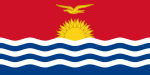
Phoenix Islands Line Islands West of Gilberts Reefs  Kiribati topics
Politics Elections · Political parties · President · Cabinet · Parliament · Foreign relations · Law enforcement · MilitaryHistory Thomas Gilbert · Gilbert and Ellice Islands · Battle of Tarawa · Treaty of Tarawa · Former subdivisionsGeography Islands (Gilbert Islands · Line Islands · Phoenix Islands · Banaba) · Towns and villages · Climate · WildlifeEconomy Culture Demographics · Language · Education · Music · Religion · Football · Public holidays · Coat of arms · Flag · AnthemCountries and territories of Oceania Sovereign states Australia · Chile (Easter Island · Juan Fernández Islands) · East Timor (Timor-Leste) · Fiji · Indonesia · Kiribati · Marshall Islands · Federated States of Micronesia · Japan (Bonin Islands) · Nauru · New Zealand · Palau · Papua New Guinea · Samoa · Solomon Islands · Tonga · Tuvalu · United States (Hawaii · Palmyra Atoll) · Vanuatu
Dependencies and other territories AustraliaFranceNew ZealandUnited KingdomUnited StatesAustronesian-speaking countries and territories Formosan Malayo-Polynesian American Samoa · Brunei · Burma (Myanmar) · Cambodia · Christmas Island · Cocos (Keeling) Islands · Cook Islands · Easter Island · East Timor · Fiji · French Polynesia · Guam · Hainan · Indonesia · Kiribati · Madagascar · Malaysia · Marshall Islands · FS Micronesia · Nauru · New Caledonia · New Zealand · Niue · Northern Mariana Islands · Orchid Island · Palau · Papua New Guinea · Philippines · Samoa · Singapore · Solomon Islands · Sri Lanka · Suriname · Tokelau · Tonga · Tuvalu · United States (Hawaii) · Vanuatu · Vietnam · Wallis and FutunaCategories:- Kiribati
- English-speaking countries and territories
- Island countries
- Member states of the Commonwealth of Nations
- Micronesia
- Least developed countries
- Liberal democracies
- Oceanian countries
- Republics
- States and territories established in 1979
- Member states of the United Nations


Wikimedia Foundation. 2010.