- Bonriki International Airport
-
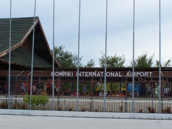
Bonriki International Airport 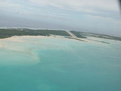
IATA: TRW – ICAO: NGTA Location of airport in Kiribati
 TRW
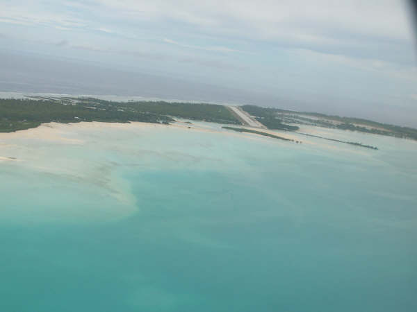
TRWSummary Airport type Public Operator Government Serves Tarawa, Kiribati Location Bonriki, South Tarawa Hub for Elevation AMSL 9 ft / 3 m Coordinates 01°22′54″N 173°08′49″E / 1.38167°N 173.14694°ECoordinates: 01°22′54″N 173°08′49″E / 1.38167°N 173.14694°E Runways Direction Length Surface m ft 09/27 2,011 6,598 Asphalt Source: DAFIF[1][2] Bonriki International Airport (IATA: TRW, ICAO: NGTA) is an international airport in Kiribati, serving as the main gateway to the country. It is located in its capital, South Tarawa, which a group of islets in the atoll of Tarawa in the Gilbert Islands.
Fiji's national carrier, Air Pacific, and Kiribati's state-owned airline, Air Kiribati, both connect Kiribati with Nadi, which is Air Pacific's hub and Fiji's main international gateway. Our Airline, the national airline of Nauru, provides service to Nauru International Airport, connecting to Honiara, the capital of the Solomon Islands, and further to Brisbane, Australia. This service was suspended from July 2008[3] to November 2009.
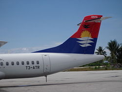
The airport is the hub of the only two Kiribati airlines, flag carrier Air Kiribati and the 2009-established Coral Sun Airways, with both airlines mainly flying domestic routes within the Gilbert Islands. Air Kiribati and Coral Sun Airways both serve all 16 other airports in the Gilbert Islands, but not all these destinations are flown directly from Tarawa. Coral Sun Airways is considering buying another, larger aircraft, capable of flying to the Phoenix Islands and Line Islands, which are, as of 2010, served by neither domestic nor international scheduled flights.
Contents
History
The airport was built in December 1943 by United States Navy Seebees and was named "Mullinix Field", in honor of Rear Admiral Henry M. Mullinix, who died in the sinking of the USS Liscombe Bay on 24 November 1943 after it was torpedoed by a Japanese submarine off the Gilbert Islands.
Almost immediately after the completion of the runway, it became the nexus of United States Army Air Forces (USAAF) operations from Tarawa, as the runway at nearby Hawkins Field on Betio was too short for safe bomber operations. The longer runway at Mullinix became the base for the VII Bomber Command Headquarters, which directed operations against Japanese forces in the Marshall Islands. In addition, the USAAF stationed the B-24 Liberator-equipped 11th Bombardment Group and B-25 Mitchell-equipped 41st Bombardment Group at the airfield.
In April 1944, the land-based units moved forward to Kwajalein Airfield in the Marshall Islands, and shortly thereafter, Mullinix was reduced to an emergency airfield. By the end of the war, the Americans abandoned the facilities and the airfield was turned into a civilian airport. [4] [5] [6]
Facilities
 Bonriki International Airport
The airport resides at an elevation of 9 feet (3 m) above mean sea level. It has one runway designated 09/27 with an asphalt surface measuring 2,011 by 41 metres (6,598 × 135 ft).[1]
Airlines and destinations
Airlines Destinations Air Kiribati Abaiang, Abemama, Butaritari, Kuria, Maiana, Nadi, Nonouti, Tabiteuea North Air Pacific Nadi Coral Sun Airways Abaiang, Abemama, Aranuka[note 1], Arorae[note 2], Butaritari[note 3], Kuria[note 4], Makin[note 5], Maiana[note 6], Marakei, Nikunau[note 7], Nonouti[note 8], Tabiteuea North[note 9], Tabiteua South[note 10] Our Airline Brisbane, Nauru, Honiara[note 11] See also
- USAAF in the Central Pacific
Notes
- ^ Only way back; way there is via Kuria.
- ^ Only way back; way there is via Tabiteuea North, Onotoa and Tamana.
- ^ Only way back, way there is via Marakei or Makin.
- ^ Only way there; way back is via Aranuka.
- ^ Only way there; way back is via Butaritari.
- ^ Only way there; way back is via Abemama.
- ^ Only way back; way there is via Tabiteuea North and Beru.
- ^ Only way there; way back is via Tabiteuea North and Tabiteua South.
- ^ Only way there; way back is via Onotoa, Tamana and Arorae, via Beru and Nikunau, or via Tabiteuea South.
- ^ Only way back; way there is via Tabiteuea North.
- ^ Only way back.
References
- ^ a b Airport information for NGTA from DAFIF (effective October 2006)
- ^ Airport information for TRW at Great Circle Mapper. Source: DAFIF (effective Oct. 2006).
- ^ "Nauru’s airline cooperates with Solomons as fuel price hikes bite". Radio New Zealand International. http://www.rnzi.com/pages/news.php?op=read&id=40540. Retrieved 2008-07-23.
- ^
 This article incorporates public domain material from websites or documents of the Air Force Historical Research Agency.
 - ^ Maurer, Maurer (1983). Air Force Combat Units Of World War II. Maxwell AFB, Alabama: Office of Air Force History. ISBN 0-89201-092-4.
- ^ www.pacificwrecks.com
External links
- Current weather for Tarawa, Kiribati (NGTA) at NOAA/NWS
- Accident history for TRW / NGTA at Aviation Safety Network
Previously: Hawaiian Air Force (1940-1942)Airfields Hawaii Okinawa Ie Shima · YontanPacific USAAF in the Central Pacific · USAAF in the Southwest Pacific
Units Commands VII Bomber · VII FighterWings 7th FighterGroups Bombardment 5th Bombardment · 11th Bombardment · 30th Bombardment · 41st Bombardment · 307th Bombardment · 494th BombardmentFighter Troop Carrier 419th Troop CarrierSquadrons Reconnaissance 28th Reconnaissance · 41st Reconnaissance · 43d ReconnaissanceTransport Night Fighter Categories:- Airports in Kiribati
- Gilbert Islands
- Airfields of the United States Army Air Forces in the Pacific Ocean theatre of World War II
- USAAF Air Transport Command Airfields - Pacific


Wikimedia Foundation. 2010.