- Brisbane
-
This article is about the Australian metropolis. For the local government area, see City of Brisbane. For other uses, see Brisbane (disambiguation).
Brisbane
Queensland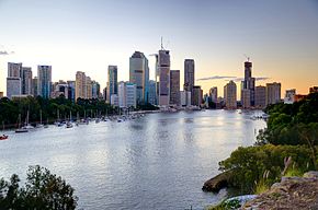
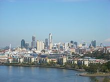
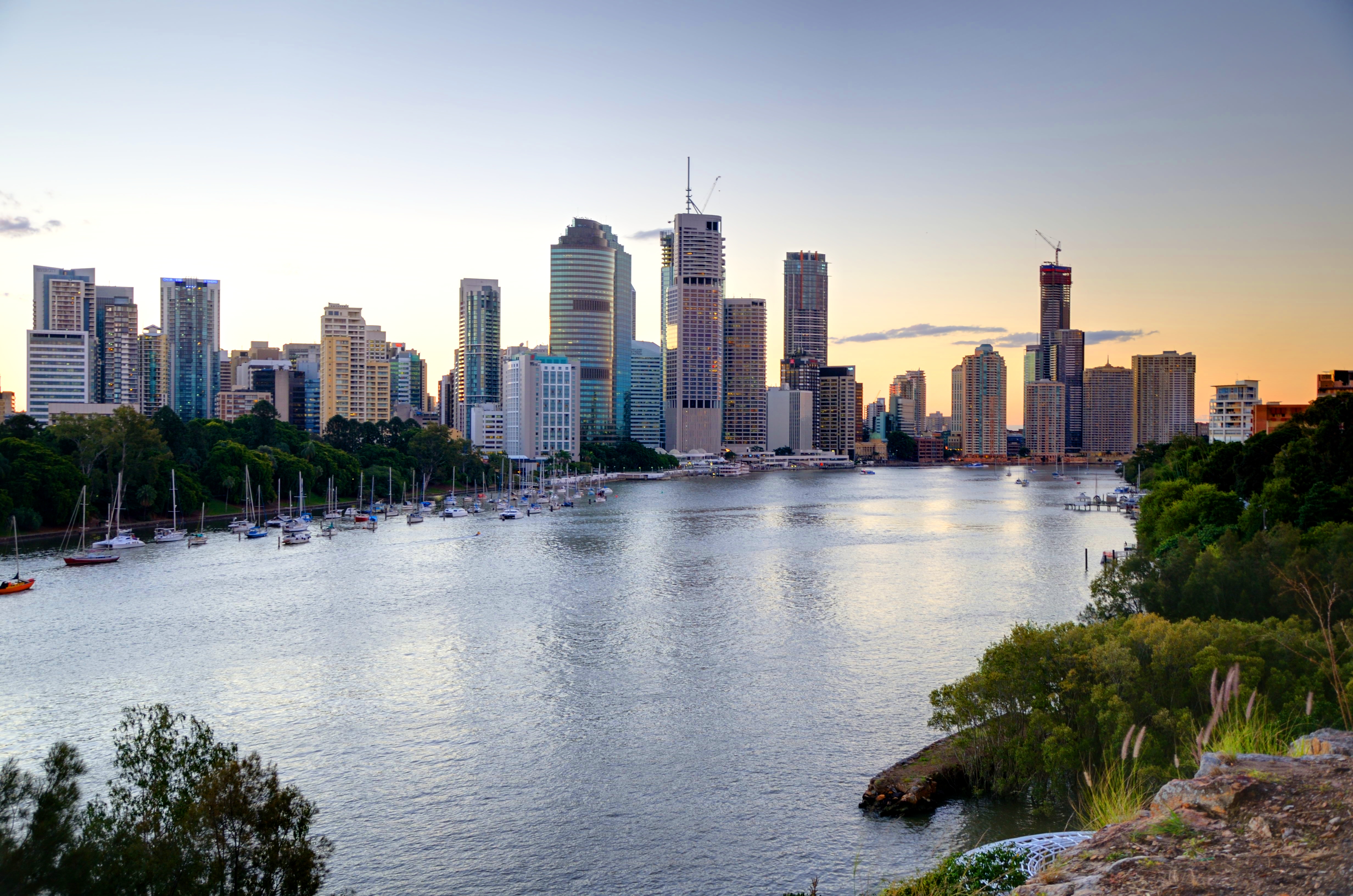
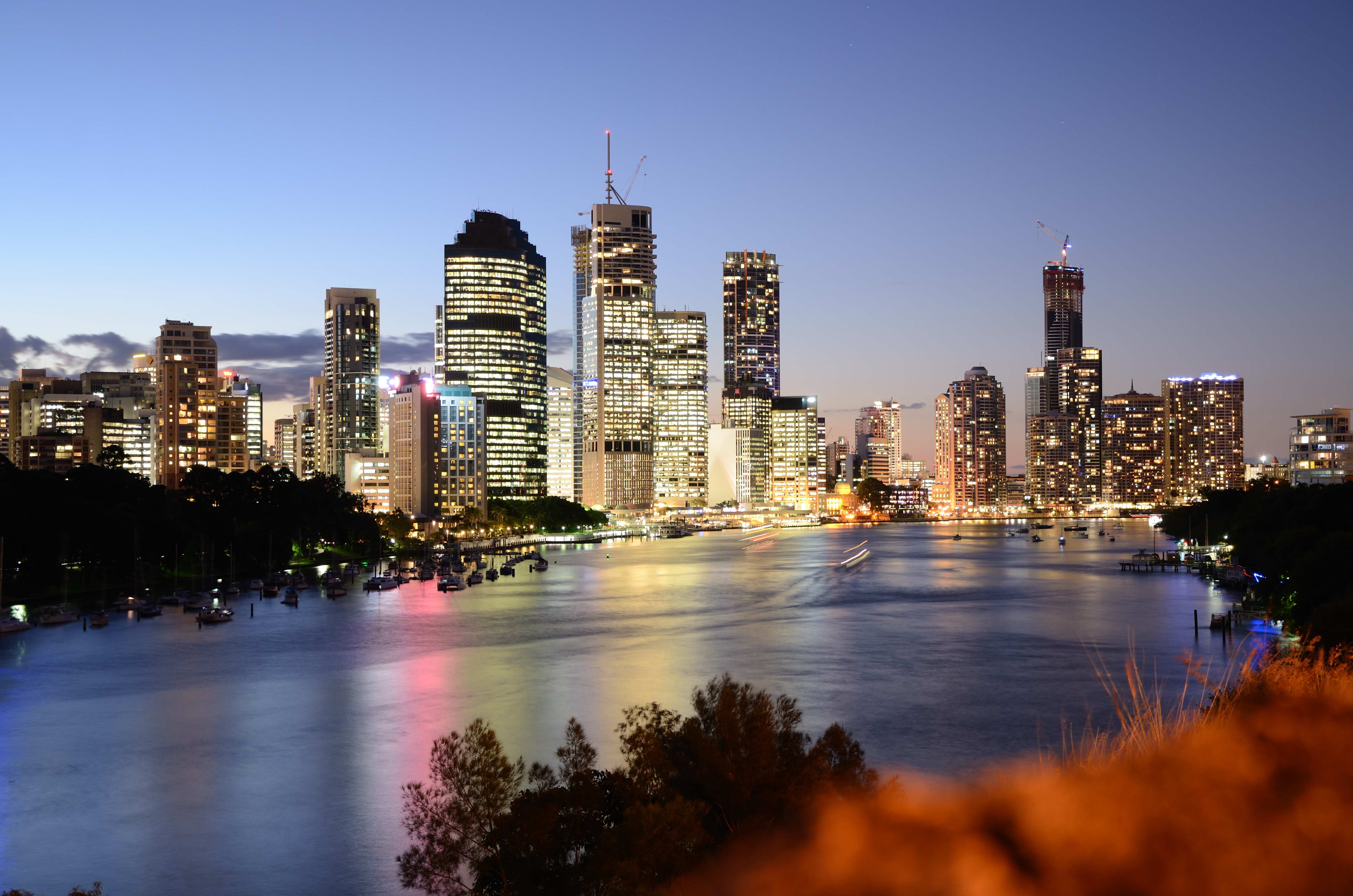
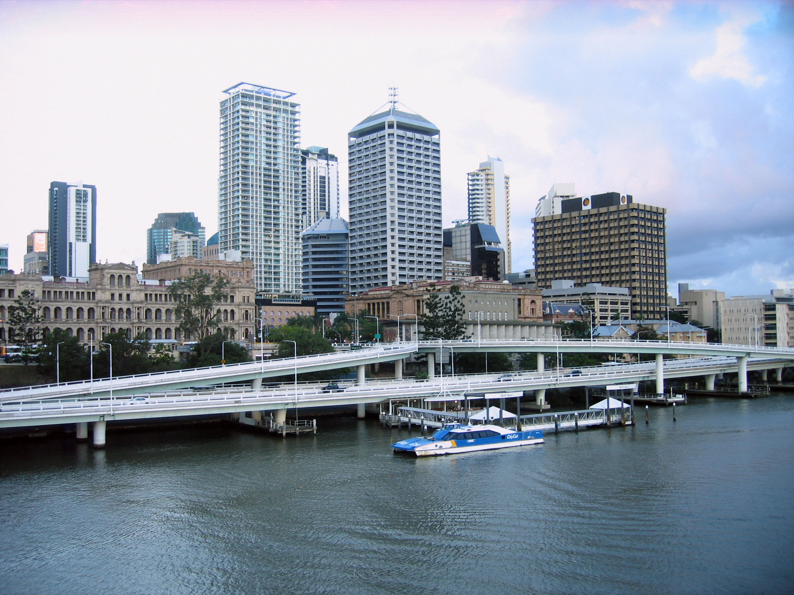
The Brisbane skyline from Kangaroo Point
 Brisbane
Population: 2,043,185 (2010)[1] (3rd) • Density: 918/km² (2,377.6/sq mi) (2006)[2] Established: 1824 Coordinates: 27°28′04″S 153°01′40″E / 27.46778°S 153.02778°ECoordinates: 27°28′04″S 153°01′40″E / 27.46778°S 153.02778°E Area: 5904.8 km² (2,279.9 sq mi) [3] Time zone: AEST (UTC+10) Location: LGA: - Brisbane
- Ipswich
- Logan
- Moreton Bay
- Redland
- Scenic Rim (part)
Region: South East Queensland County: Stanley State District: various (38) Federal Division: Mean max temp Mean min temp Annual rainfall 26.4 °C
80 °F16.2 °C
61 °F1,149.1 mm
45.2 inBrisbane (
 /ˈbrɪzbən/)[4] is the capital and most populous city in the Australian state of Queensland and the third most populous city in Australia. Brisbane's metropolitan area has a population of over 2 million and constitutes the core of the South East Queensland agglomeration, encompassing more than 3 million people and consisting of roughly 3 quarters of Queensland's population, and is the fastest growing agglomeration in Australia, encompassing the Gold Coast, Logan, Ipswich, Toowoomba and the Sunshine Coast. Brisbane once had the title of the fastest growing city in any developed country, but is now the second fastest growing city in Australia, after Perth.[5] The Brisbane central business district stands on the original European settlement and is situated inside a bend of the Brisbane River approximately 23 kilometres from its mouth at Moreton Bay. The metropolitan area extends in all directions along the floodplain of the Brisbane River valley between the bay and the Great Dividing Range. While the metropolitan area is governed by several municipalities, a large proportion of central Brisbane is governed by the Brisbane City Council which is Australia's largest Local Government Area by population.
Brisbane is named after the river on which it sits which, in turn, was named after Scotsman Sir Thomas Brisbane, the Governor of New South Wales from 1821 to 1825. The first European settlement in Queensland was a penal colony at Redcliffe, 28 kilometres (17 mi) north of the Brisbane central business district, in 1824. That settlement was soon abandoned and moved to North Quay in 1825. Free settlers were permitted from 1842. Brisbane was chosen as the capital when Queensland was proclaimed a separate colony from New South Wales in 1859.
The city played a central role in the Allied campaign during World War II as the South West Pacific headquarters for General Douglas MacArthur. Brisbane has hosted many large cultural and sporting events including the 1982 Commonwealth Games, World Expo '88 and the final Goodwill Games in 2001. Brisbane is the largest economy between Sydney and Singapore and in 2008 it was classified as a Beta− world city in the World Cities Study Group’s inventory by Loughborough University.[6] It was also rated the 16th most livable city in the world in 2009 by The Economist.
Contents
History
Main article: History of BrisbanePrior to European settlement, the Brisbane area was inhabited by the Turrbal and Jagera people,.[7] They knew the area as Mian-jin, meaning "place shaped as a spike".[8] The Moreton Bay area was initially explored by Matthew Flinders. On 17 July 1799, Flinders landed at what is now known as Woody Point, which he named "Red Cliff Point", after the red-coloured cliffs visible from the bay.[9] In 1823, Governor of New South Wales, Thomas Brisbane, instructed that a new northern penal settlement be developed, and an exploration party led by John Oxley further explored Moreton Bay.[10]
Oxley discovered, named and explored the Brisbane River as far as Goodna, 20 kilometres (12 mi) upstream from the Brisbane central business district.[10] Oxley recommended Red Cliff Point for the new colony, reporting that ships could land at any tide and easily get close to the shore.[11] The party settled in Redcliffe on 13 September 1824, under the command of Lieutenant Henry Miller with 14 soldiers; some with wives and children; and 29 convicts. However, this settlement was abandoned after a year, and the colony was moved to a site on the Brisbane River now known as North Quay, 28 kilometres (17 mi) south, that offered a more reliable water supply. Chief Justice Forbes gave the new settlement the name of Edenglassie before it was named Brisbane.[12] Non-convict European settlement of the Brisbane region commenced in 1838.[13] German missionaries settled at Zions Hill, Nundah, as early as 1837, five years before Brisbane was officially declared a free settlement. The band consisted of two ministers, Christopher Eipper (1813–1894) and Carl Wilhelm Schmidt, and lay missionaries Haussmann, Johann Gottried Wagner, Niquet, Hartenstein, Zillman, Franz, Rode, Doege and Schneider.[14] They were allocated 260 hectares and set about establishing the mission, which became known as German Station.[15]
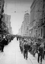 RAAF recruits marching along Queen Street, August 1940.
Free settlers entered the area over the following five years and by the end of 1840 Robert Dixon began work on the first plan of Brisbane Town in anticipation of future development.[16] Queensland was proclaimed a separate colony on 6 June 1859,[17] with Brisbane chosen as its capital, although it was not incorporated as a city until 1902. Over twenty small municipalities and shires were amalgamated in 1925, to form the City of Brisbane which is governed by the Brisbane City Council.[18][19] 1930 was a significant year for Brisbane, with the completion of Brisbane City Hall, then the city's tallest building and the Shrine of Remembrance, in ANZAC Square, which has become Brisbane's main war memorial.[20] These historic buildings along with the Story Bridge, opened in 1940[21] are key landmarks that help define the character of the city.
During World War II, Brisbane became central to the Allied campaign when the AMP Building (now called MacArthur Central) was used as the South West Pacific headquarters for General Douglas MacArthur, chief of the Allied Pacific forces, until his headquarters were moved to Hollandia in August 1944. MacArthur had previously rejected use of the University of Queensland complex as his headquarters, as the distinctive bends in the river at St Lucia could have aided enemy bombers. Also used as a headquarters by the American troops during World War II was the T & G Building.[22] Approximately 1 million US troops passed through Australia during the war, as the primary coordination point for the South West Pacific.[23] In 1942 Brisbane was the site of a violent clash between visiting US military personnel and Australian servicemen and civilians which resulted in one death and several injuries. This incident became known colloquially as the Battle of Brisbane.[24]
Postwar Brisbane had developed a "big country town" stigma, an image the city's politicians and marketers were very keen to remove.[25] In the late 1950's an anonymous poet known as The Brisbane Bard generated much attention on the city which helped to shake this stigma.[26][27] Despite steady growth, Brisbane's development was punctuated by infrastructure problems. The State government under Joh Bjelke-Petersen began a major program of change and urban renewal, beginning with the central business district and inner suburbs. Trams in Brisbane were a popular mode of public transport, until the network was closed in 1969, leaving Melbourne as the last Australian city to operate a tram network. The 1974 Brisbane flood was a major disaster which temporarily crippled the city. During this era, Brisbane grew and modernised rapidly becoming a destination of interstate migration. Some of Brisbane's popular landmarks were lost, including the Bellevue Hotel in 1979 and Cloudland in 1982, demolished in controversial circumstances by the Deen Brothers demolition crew. Major public works included the Riverside Expressway, the Gateway Bridge, and later, the redevelopment of South Bank, starting with the Queensland Art Gallery.
Brisbane hosted the 1982 Commonwealth Games and the 1988 World Exposition (known locally as World Expo 88). These events were accompanied by a scale of public expenditure, construction and development not previously seen in the state of Queensland.[28][29] Brisbane's population growth has exceeded the national average every year since 1990 at an average rate of around 2.2% per year. Brisbane was again hit by a major flood in January 2011. The Brisbane River did not reach the same height as the previous 1974 flood but still caused extensive damage and disruption to the city.[30][31]
-

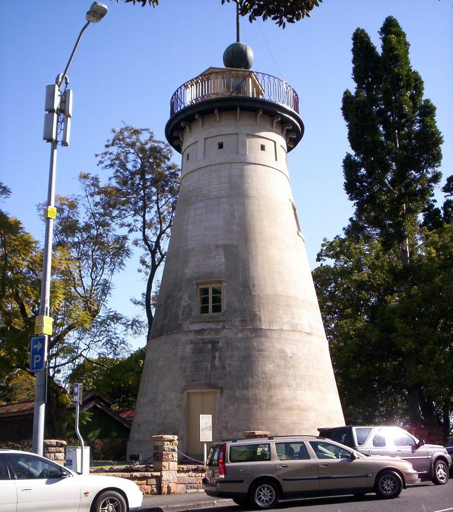
The Old Windmill in Wickham Park in Brisbane. Built by convicts in 1824, it is one of Brisbane's most significant and oldest heritage landmarks.
-
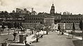
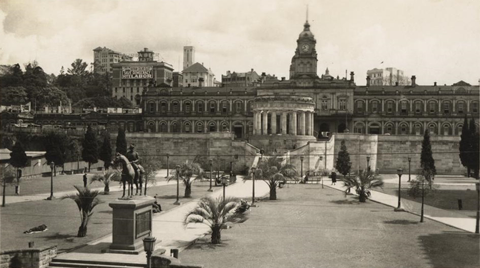
ANZAC Square and the Shrine of Remembrance, Brisbane (c1930).
-
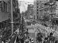
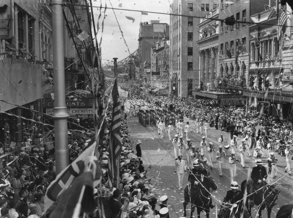
American Fleet Marching Down Queen Street, March 1941.
-
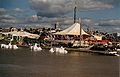
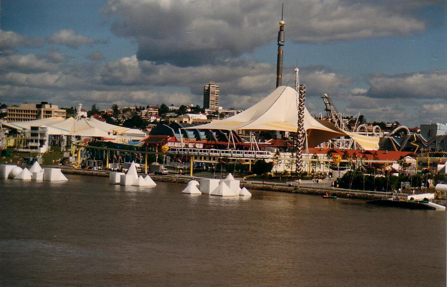
World Expo 88 as seen from the Brisbane River.
-
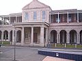
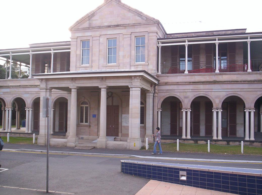
Queensland's first Government House was completed in 1862 and is located within the grounds of the Queensland University of Technology near the City Botanic Gardens
Geography
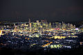
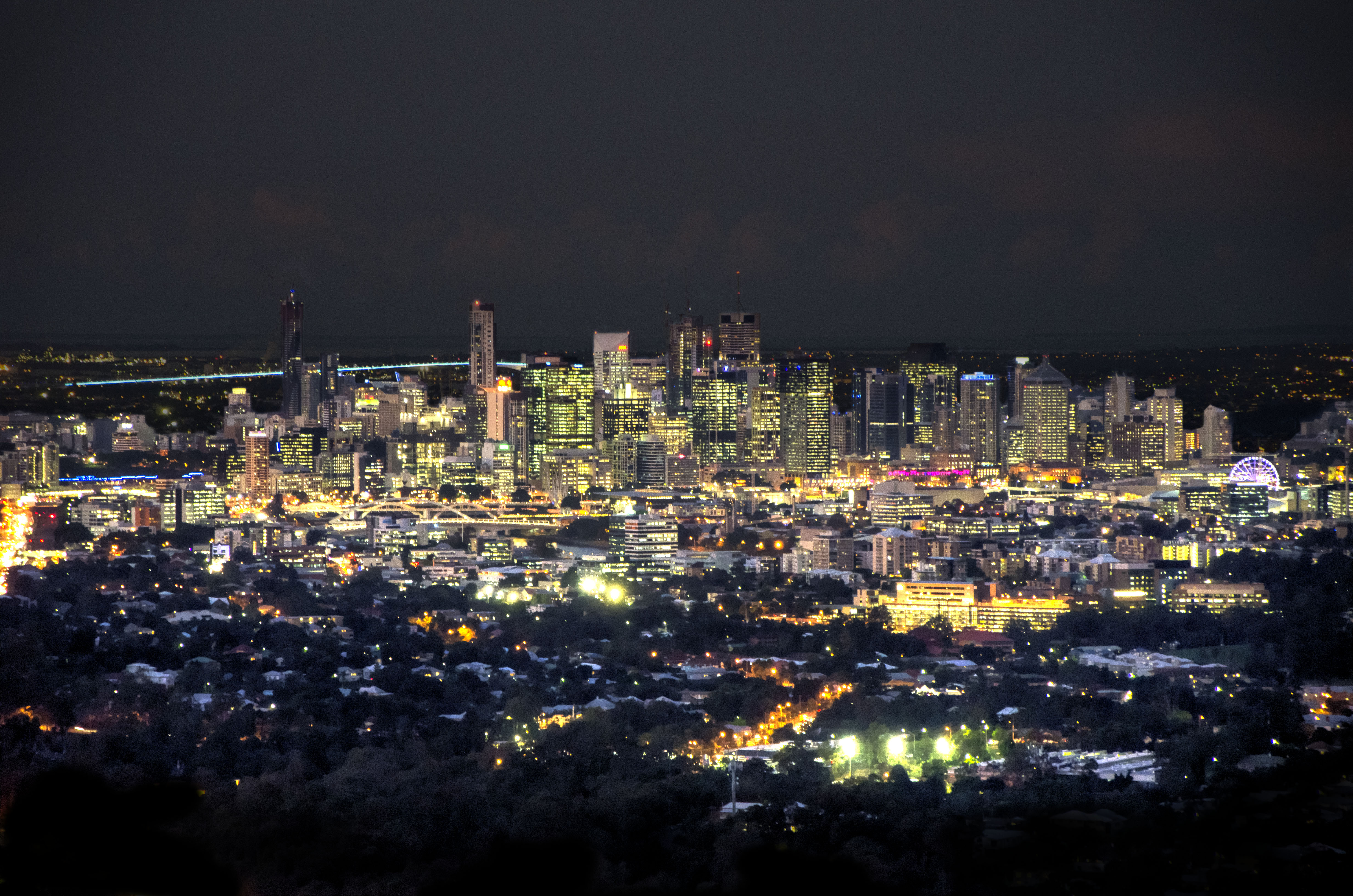
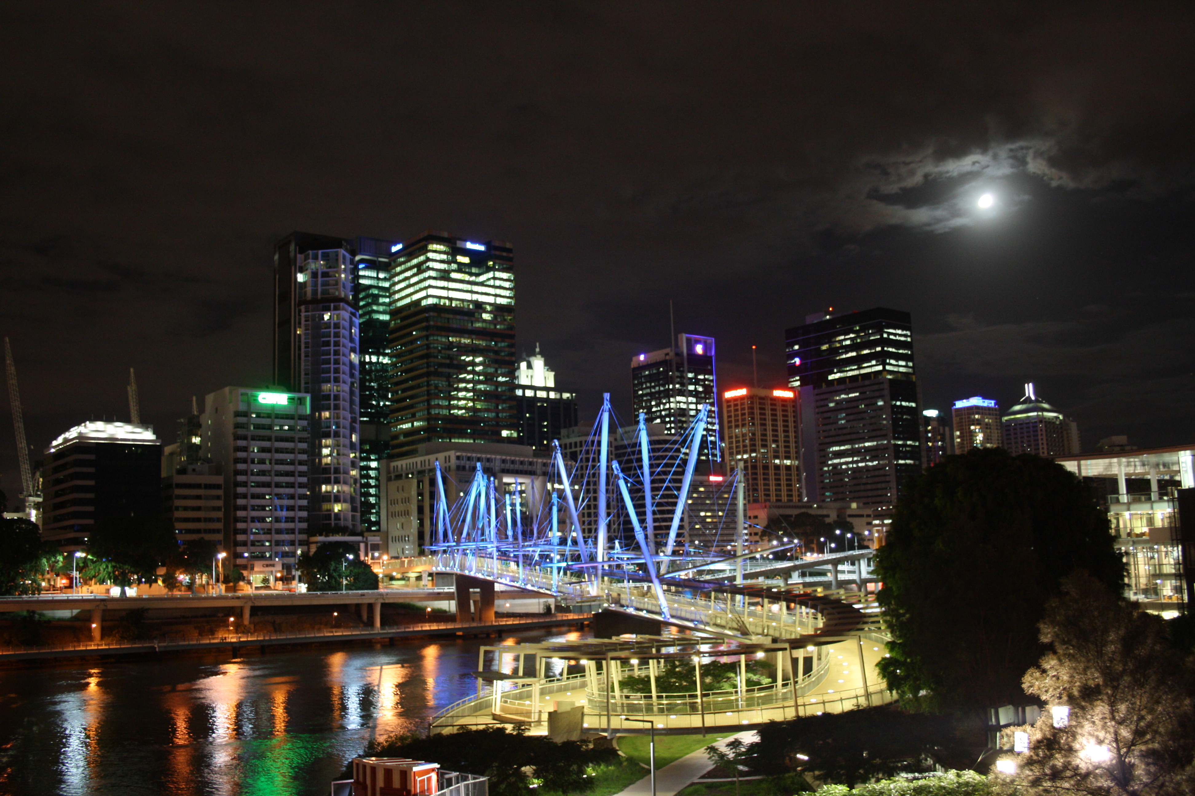
 The Brisbane cityscape at night
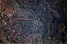
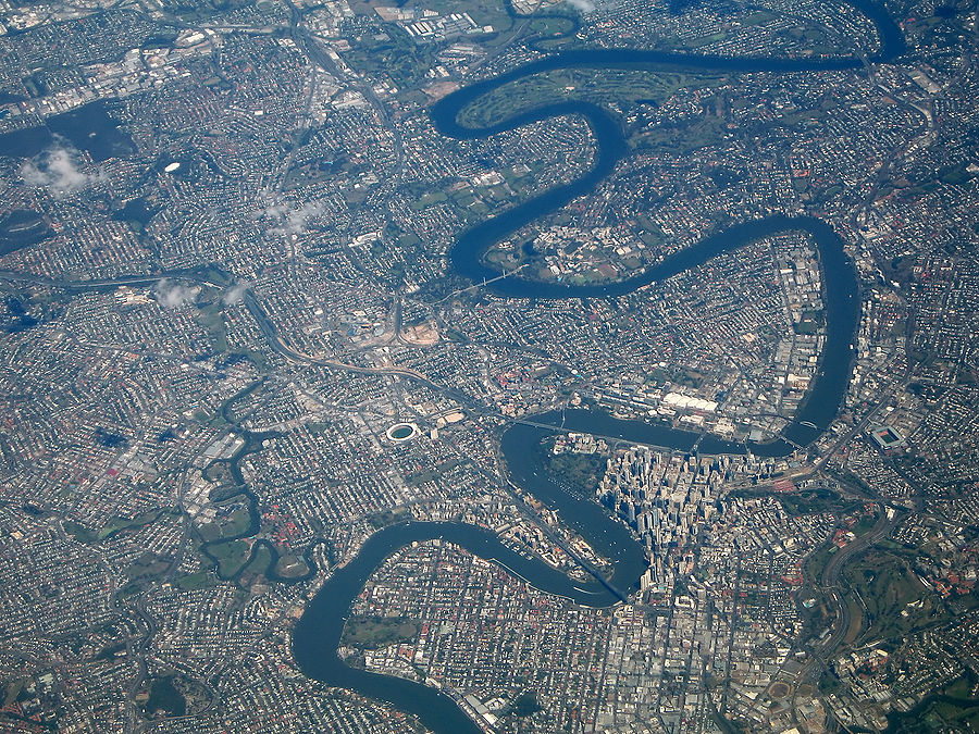
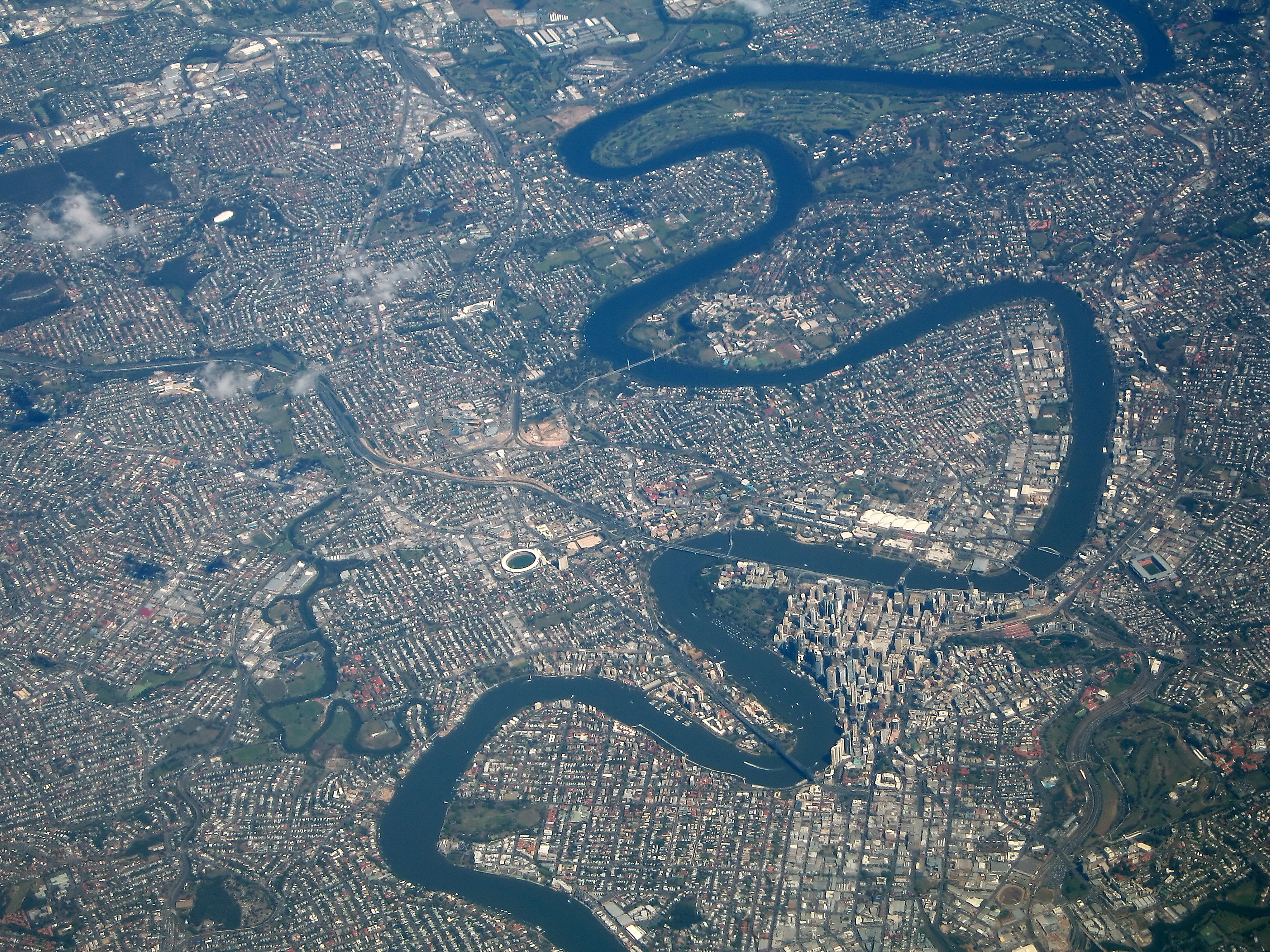
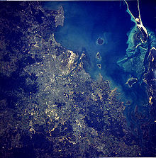 Satellite image of Brisbane Metropolitan Area.
Brisbane is in the southeast corner of Queensland, Australia. The city is centred along the Brisbane River, and its eastern suburbs line the shores of Moreton Bay. The greater Brisbane region is on the coastal plain east of the Great Dividing Range. Brisbane's metropolitan area sprawls along the Moreton Bay floodplain from Caboolture in the north to Beenleigh in the south, and across to Ipswich in the south west.
The city of Brisbane is hilly.[32] The urban area, including the central business district, are partially elevated by spurs of the Herbert Taylor Range, such as the summit of Mount Coot-tha, reaching up to 300 metres (980 ft) and the smaller Enoggera Hill. Other prominent rises in Brisbane are Mount Gravatt and nearby Toohey Mountain. Mount Petrie at 170 metres (560 ft) and the lower rises of Highgate Hill, Mount Ommaney, Stephens Mountain and Whites Hill are dotted across the city.
The city is on a low-lying floodplain.[33] Many suburban creeks criss-cross the city, increasing the risk of flooding. The city has suffered three major floods since colonisation, in February 1893, January 1974, and January 2011. The 1974 Brisbane flood occurred partly as a result of "Cyclone Wanda". Heavy rain had fallen continuously for three weeks before the Australia Day weekend flood (26 – 27 January 1974).[34] The flood damaged many parts of the city, especially the suburbs of Oxley, Bulimba, Rocklea, Coorparoo, Toowong and New Farm. The City Botanic gardens were inundated, leading to a new colony of mangroves forming in the City Reach of the Brisbane River.[35]
Urban structure
 Medium density housing along the Brisbane River at Newstead.
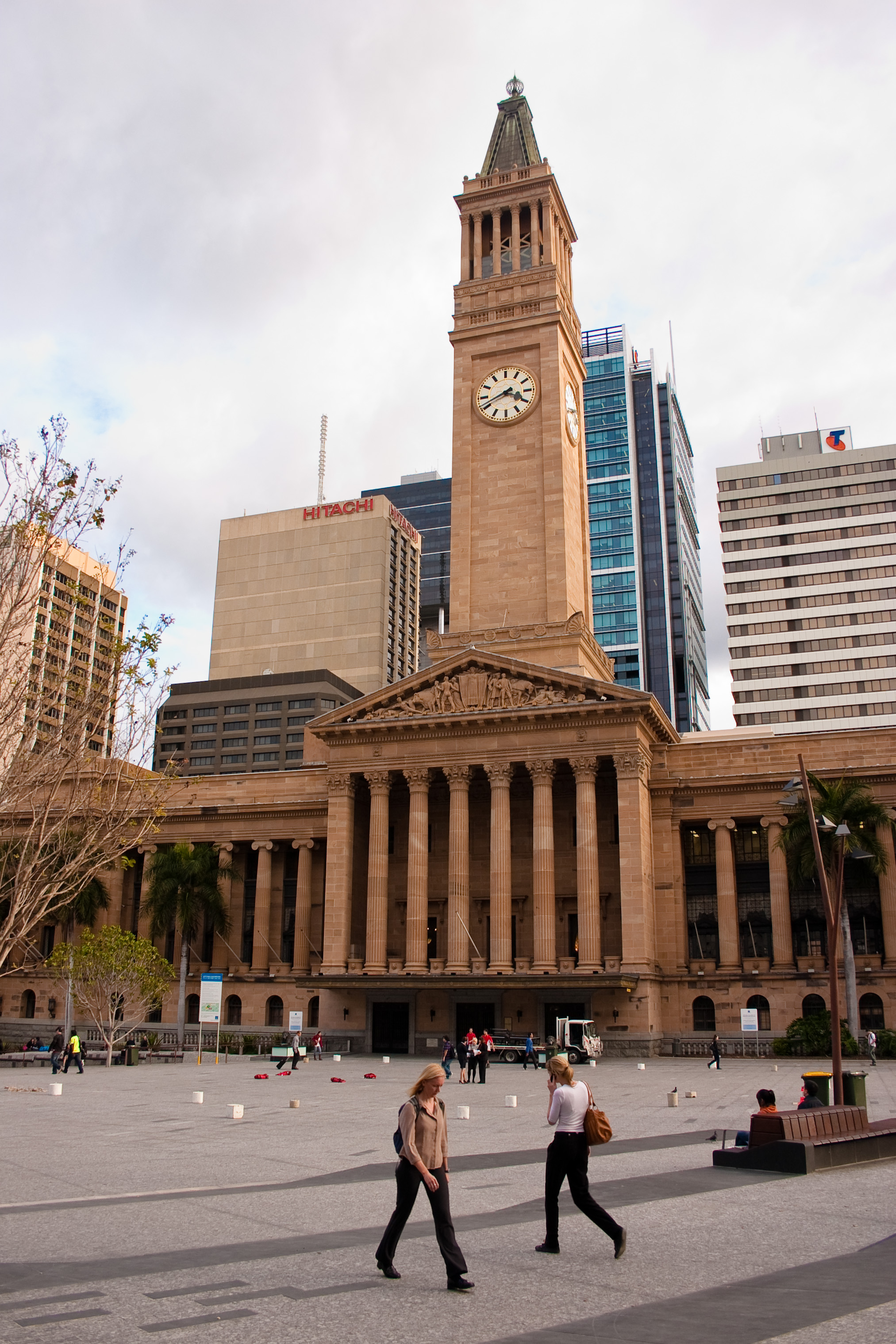
The Brisbane central business district (CBD) lies in a curve of the Brisbane river. The CBD covers only 2.2 km2 (0.8 sq mi) and is walkable. Central streets are named after members of the royal family. Queen Street is Brisbane's traditional main street. Streets named after female members (Adelaide, Alice, Ann, Charlotte, Elizabeth, Margaret, Mary) run parallel to Queen Street and Queen Street Mall (named in honour of Queen Victoria) and perpendicular to streets named after male members (Albert, Edward, George, William). The city has retained some heritage buildings dating back to 1820's. The Old Windmill, in Wickham Park, built by convict labour in 1824,[36][37] is the oldest surviving building in Brisbane. The Old Windmill was originally used for the grinding of grain and a punishment for the convicts who manually operated the grinding mill. The Old Windmill tower’s other significant claim to fame, largely ignored, is that the first television signals in the southern hemisphere were transmitted from it by experimenters in April 1934 – long before TV commenced in most places. These experimental TV broadcasts continued until World War II.[36]
The Old Commissariat Store, on William Street, built by convict labour in 1828, was originally used partly as a grainhouse, has also been a hostel for immigrants and used for the storage of records. Built with Brisbane tuff from the nearby Kangaroo Point Cliffs and sandstone from a quarry near today's Albion Park Racecourse, it is now the home of the Royal Historical Society of Brisbane. It contains a museum and can also be hired for small functions.[38][39][40] The city has a density of 379.4 people per square kilometre, which is high for an Australian city and comparable to that of Sydney. However like many western cities, Brisbane sprawls into the greater metropolitan area. This results from the fact that most of Brisbane's housing stock consists of detached houses.
Early legislation decreed a minimum size for residential blocks resulting in few terrace houses being constructed in Brisbane. Recently the density of the city and inner city neighbourhoods has increased with the construction of apartments, with the result that the population of the central business district has doubled over the last 5 years.[41] The high density housing that historically existed came in the form of miniature Queenslander-style houses which resemble the much larger traditional styles but are sometimes only one quarter the size. These miniature Queenslanders are becoming scarce but can still be seen in the inner city suburbs. Multi residence accommodations (such as apartment blocks) are relatively new to Brisbane, with few such blocks built before 1970, other than in inner suburbs such as New Farm.
Pre-1950 housing was often built in a distinctive architectural style known as a Queenslander, featuring timber construction with large verandahs and high ceilings. The relatively low cost of timber in South-East Queensland meant that until recently most residences were constructed of timber, rather than brick or stone. Many of these houses are elevated on stumps (also called "stilts"), that were originally timber, but are now frequently replaced by steel or concrete.
Brisbane is home to several of Australia's tallest buildings. Brisbane's tallest buildings are Soleil at 243 metres, Aurora Tower at 207 metres, Riparian Plaza at 200 metres, One One One Eagle Street at 195 metres, and Infinity, at 249 metres, which is currently under construction.[42]
Climate
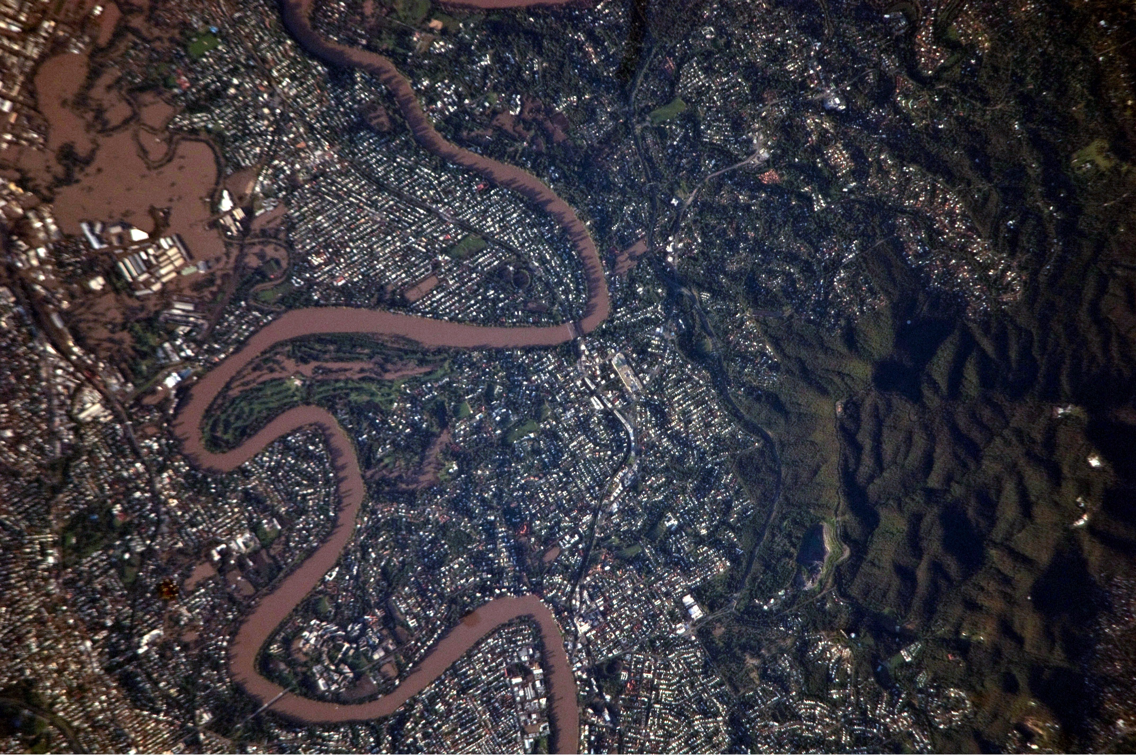
 This detailed astronaut photograph illustrates flooding in suburbs of the Brisbane metropolitan region during early 2011.
Brisbane has a humid subtropical climate (Köppen climate classification Cfa) with warm to hot and humid summers and dry, moderately warm winters.[43][44] From November to March, thunderstorms are common over Brisbane, with the more severe events accompanied by large damaging hail stones, torrential rain and destructive winds.
The city's highest recorded temperature was 43.2 °C (110 °F) on 26 January 1940. On 19 July 2007, Brisbane's temperature fell below the freezing point for the first time since records began, registering −0.1 °C (31.8 °F) at the airport.[45] In 2009 Brisbane recorded its hottest winter day at 35.4 °C (95.7 °F) on 24 August.[46]
Brisbane's wettest day was 21 January 1887, when 465 millimetres (18.3 in) of rain fell on the city, the highest maximum daily rainfall of Australia's capital cities.
From 2001 until 2010, Brisbane and surrounding temperate areas had been experiencing the most severe drought in over a century, with dam levels dropping to 16.9% of their capacity on 10 August 2007. Residents were mandated by local laws to observe level 6 water restrictions on gardening and other outdoor water usage. Per capita water usage is below 140 litres per day, giving Brisbane one of the lowest per capita usages of water of any Western city in the world.[47] On Sunday January 9th 2011, a weak cyclone crossed north of Brisbane and dropped rainfull on the already saturated South East Coast of Qld, resulting in severe flooding and damage in Brisbane and the surrounding area[48], ironically the same storm season also resulted in the water storage climbing to over 98% of maximum capacity and breaking the drought.[49] Water restrictions have been replaced with water conservation measures that aim at a target of 200 litres per day/per person, but consumption is rarely over 160 litres.
Dust storms in Brisbane are extremely rare; on 23 September 2009, however, a severe dust storm blanketed Brisbane, as well as other parts of eastern Australia.[50][51]
Brisbane also lies in the Tropical Cyclone risk area. Although cyclones hitting Brisbane are rare, they have happened in the past. The last cyclone to affect Brisbane but not directly cross the city was Tropical Cyclone Hamish in March 2009, although the cyclone remained approx 350 km (220 mi) north of Brisbane[52] but caused significant damage to beaches and caused the worst oil spill in Moreton Bay.[53]
Average annual temperature of the sea is 24 °C (75 °F), from 21 °C (70 °F) in July to 27 °C (81 °F) in February.[54]
Climate data for Brisbane Month Jan Feb Mar Apr May Jun Jul Aug Sep Oct Nov Dec Year Record high °C (°F) 40.0
(104.0)41.7
(107.1)37.9
(100.2)33.7
(92.7)30.7
(87.3)29.0
(84.2)28.2
(82.8)35.4
(95.7)35.1
(95.2)38.7
(101.7)34.8
(94.6)40.0
(104.0)41.7
(107.1)Average high °C (°F) 30.3
(86.5)30.0
(86.0)28.9
(84.0)27.1
(80.8)24.4
(75.9)22.0
(71.6)21.9
(71.4)23.1
(73.6)25.7
(78.3)26.9
(80.4)27.7
(81.9)29.3
(84.7)26.4 Average low °C (°F) 21.4
(70.5)21.4
(70.5)19.9
(67.8)17.3
(63.1)13.5
(56.3)11.6
(52.9)10.0
(50.0)10.6
(51.1)13.8
(56.8)16.3
(61.3)18.5
(65.3)20.4
(68.7)16.2 Record low °C (°F) 17.0
(62.6)16.5
(61.7)12.2
(54.0)10.0
(50.0)5.0
(41.0)5.0
(41.0)3.0
(37.4)4.1
(39.4)7.0
(44.6)9.7
(49.5)10.8
(51.4)14.0
(57.2)3.0
(37.4)Precipitation mm (inches) 114.3
(4.5)127.7
(5.028)89.3
(3.516)56.3
(2.217)63.6
(2.504)59.6
(2.346)23.0
(0.906)41.9
(1.65)33.3
(1.311)83.6
(3.291)110.9
(4.366)157.7
(6.209)966.9
(38.067)Avg. precipitation days 12 11.8 12.5 11.8 9.5 9.1 6.0 5.7 7.8 9.9 12.9 13.7 122.7 Sunshine hours 269.7 226.2 238.7 237.0 235.6 201.0 244.9 266.6 276.0 275.9 264.0 269.7 3,005.3 Source: Bureau of Meteorology[55] 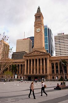
Governance
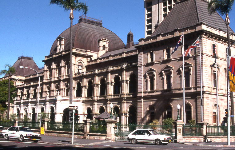
Main articles: City of Brisbane and Government of Queensland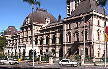 Parliament House is where Queensland's Parliament meets.
Unlike other Australian capital cities, a large portion of the greater metropolitan area of Brisbane is controlled by a single local government entity, the Brisbane City Council, inside the City of Brisbane LGA. Since the creation of the Brisbane City Council in 1925 the urban areas of Brisbane have expanded considerably past the City Council boundaries.[56] Prior to that, a far smaller area (comprising the inner suburbs of Brisbane today) was controlled by the Brisbane Municipal Council.
The City is the largest local government body (in terms of population and budget) in Australia. It was formed by the merger of twenty smaller LGAs in 1925, and covers an area of 1,367 km2 (528 sq mi). The Council's annual budget is approximately AUD 1.6 billion, and it has an asset base of AUD 13 billion.[57]
The remainder of the metropolitan area falls into the LGAs of Logan City to the south, Moreton Bay Region in the northern suburbs, the City of Ipswich to the south west, Redland City to the south east on the bayside, with a small strip to the far west of the Scenic Rim Region.
Economy
Brisbane has the largest economy of any city between Sydney and Singapore, which includes cities like Jakarta, Darwin, Townsville and Cairns, and has seen consistent economic growth in recent years as a result of the resources boom. White-collar industries include information technology, financial services, higher and public sector administration generally concentrated in and around the central business district and recently established office areas in the inner suburbs. Blue-collar industries, including petroleum refining, stevedoring, paper milling, metalworking and QR railway workshops, tend to be located on the lower reaches of the Brisbane River and in new industrial zones on the urban fringe. Tourism is an important part of the Brisbane economy, both in its own right and as a gateway to other areas of Queensland.[58]
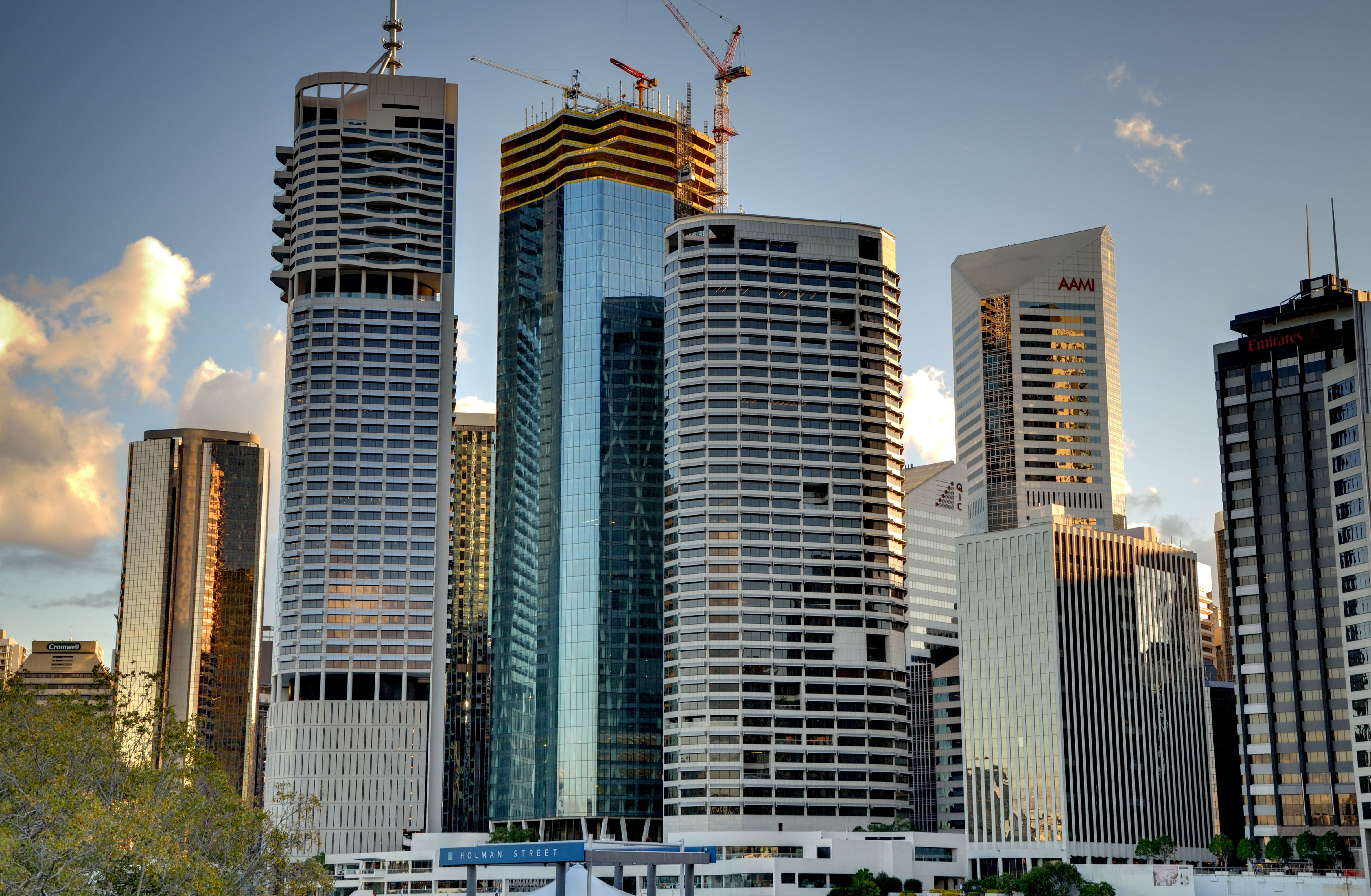
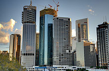 Skyscrapers in Brisbane's CBD
Since the late 1990s and early 2000s, the Queensland State Government has been developing technology and science industries in Queensland as a whole, and Brisbane in particular, as part of its "Smart State" initiative.[59] The government has invested in several biotechnology and research facilities at several universities in Brisbane. The Institute for Molecular Bioscience at the University of Queensland (UQ) Saint Lucia Campus is a large CSIRO and Queensland state government initiative for research and innovation that is currently being emulated at the Queensland University of Technology (QUT) Campus at Kelvin Grove with the establishment of the Institute of Health and Biomedical Innovation (IHBI).[60]
Brisbane is one of the major business hubs in Australia.[61] Most major Australian companies, as well as numerous international companies, have contact offices in Brisbane, while numerous electronics businesses have distribution hubs in and around the city. DHL Global's Oceanic distribution warehouse is located in Brisbane, as is Asia Pacific Aerospace's headquarters. Home grown major companies include Suncorp-Metway Limited, Flight Centre, Sunsuper, Orrcon, Credit Union Australia, Boeing Australia, Donut King, Wotif.com, WebCentral, PIPE Networks, Krome Studios, NetBox Blue, Mincom Limited, TechnologyOne and Virgin Australia. Brisbane has the fourth highest median household income of the Australian capital cities at AUD 57,772.[62]
Port of Brisbane
The Port of Brisbane is on the lower reaches of the Brisbane River and on Fisherman's Island at the rivers mouth, and is the 3rd most important port in Australia for value of goods.[63] Container freight, sugar, grain, coal and bulk liquids are the major exports. Most of the port facilities are less than three decades old and some are built on reclaimed mangroves and wetlands.
The Port is a part of the Australia TradeCoast, the country's fastest-growing economic development area.[64] Geographically, Australia TradeCoast occupies a large swathe of land around the airport and port. Commercially, the area has attracted a mix of companies from throughout the Asia Pacific region.[64]
Retail
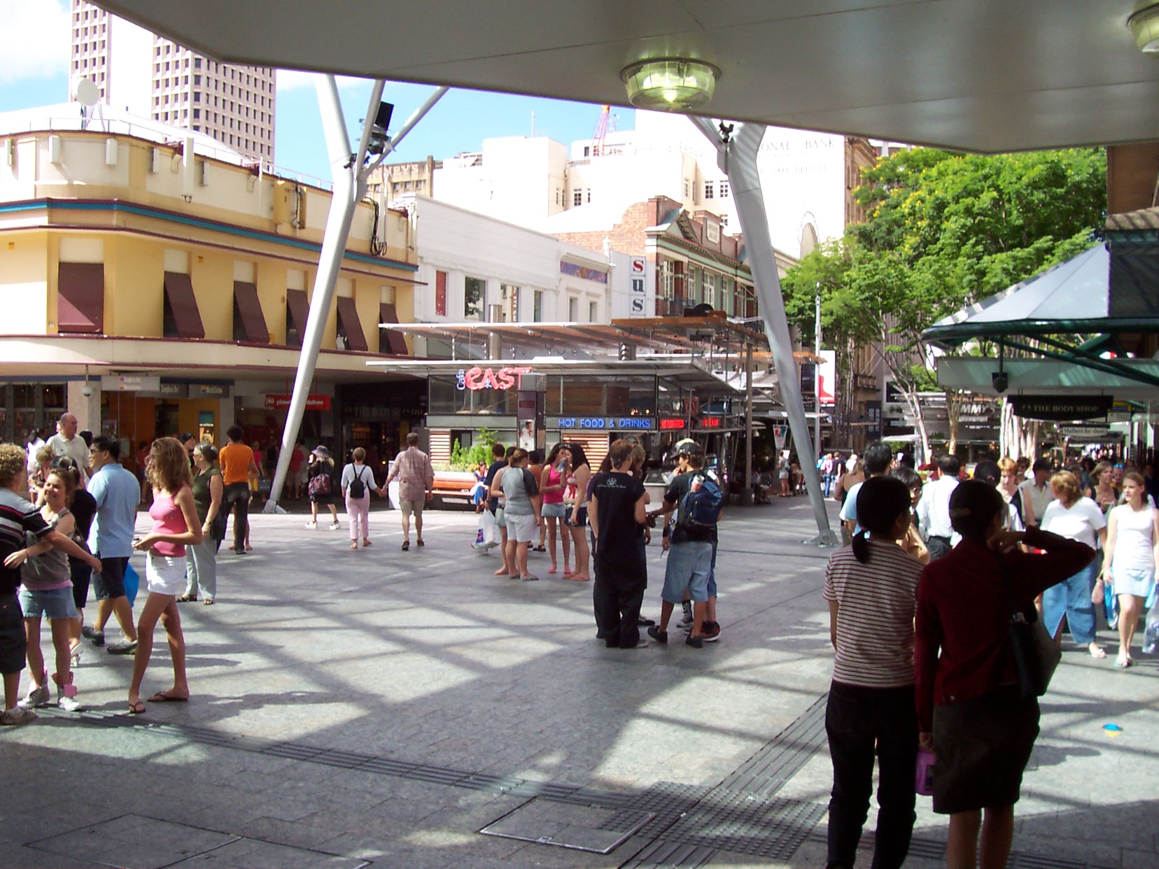
Brisbane has a range of retail precincts, both in the Central Business District and in surrounding suburbs. The Queen Street Mall has a vast array of cafes, restaurants, cinemas, gift shops and shopping centres including: Wintergarden, Broadway on the Mall, QueensPlaza, Brisbane Arcade, Queen Adelaide Building, Tattersalls Arcade and The Myer Centre. Edward St, in the city, is home to many luxury international retailers, such as MaxMara, Gucci, Bally, Chanel, Prada, Canali, Mont Blanc, Louis Vuitton, Tiffany and Co., Oroton, Polo Ralph Lauren, Bvlgari, Hugo Boss, Hermes, and more. The majority of retail business is done within the suburbs of Brisbane in shopping centres which include major department store chains. There are 3 major Westfield shopping centres in Brisbane located in the suburbs of Chermside (Westfield Chermside), Mount Gravatt (Westfield Garden City) and Carindale (Westfield Carindale).[65]
Other large shopping centres exist at Indooroopilly (Indooroopilly Shopping Centre), Toombul (Centro Toombul) and Mitchelton (Brookside Shopping Centre). Other major shopping centres through-out the metropolitan area include North Lakes (Westfield North Lakes), Strathpine (Westfield Strathpine) and Loganholme (Logan Hyperdome).
Demographics
Significant overseas born populations[66] Country of birth Population (2006)  United Kingdom
95,315  New Zealand
73,128  South Africa
12,824  Vietnam
11,857  China
China11,418  Spain
Spain10,880  Philippines
9,871  Germany
8,645  India
India7,549  Netherlands
7,014  Fiji
Fiji6,791  Papua New Guinea
6,706  Italy
Italy6,704  Malaysia
6,686  United States
6,057  Hong Kong
6,036  South Korea
4,841  Sri Lanka
4,806 Brisbane
population by year1859 6,000 1942 750,000 2010 2,043,185[67] Estimate 2026 2,681,100[67] Projected 2056 3,979,300[67] Projected The statistical division of Brisbane includes much of Brisbane's Local Government Area as well as the cities of Ipswich, Moreton Bay, Logan City and Redland City which demographically are part of a single conurbation. The 2006 census reported 1,763,131 residents within the Brisbane Statistical Division, making it the third largest city in Australia.[68] Brisbane recorded the largest growth rate of all capital cities in the last Census, with an annual growth rate of 2.2%.[69] The median age across the city was 35 years.[3]
The 2006 census showed that 1.7% of Brisbane's population were of indigenous origin and 21.7% were born overseas. Of those born outside of Australia, the three main countries of birth were New Zealand, South Africa, and the United Kingdom.
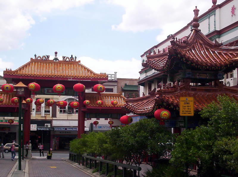
Approximately 16.1% of households spoke a language other than English, with the most common languages being Mandarin 1.1%, Vietnamese 0.9%, Cantonese 0.9%, Italian 0.6% and Samoan 0.5%. Areas of significant overseas populations include the southern suburbs of Brisbane. Moorooka is home to many residents of African descent. Most of the Vietnamese population reside in the suburbs of Darra and Inala. Sunnybank is where the majority of Brisbane's Chinese population reside, consisting mainly of people from Republic of China (Taiwan) and Hong Kong, while those from China, Malaysia and other Southeast Asian countries are often found not in one particular area but all around Brisbane, especially in the southern suburbs. Brisbane has the highest population of Taiwanese Australian citizens. It has been estimated that the population has grown to an estimated 35 000+, making them the highest Asian population in Brisbane. Consequently, Sunnybank and its surrounding suburbs have often been dubbed as the "Real Chinatown" and "Taiwan Town".
The inner southern suburbs were considered the most densely populated areas of people with Southern European heritage, primarily Greece and Italy, as well as Cyprus and other nations in Southeastern Europe. New Farm was historically home to many of Brisbane's early Italian community. There are also a major number of Indians, Filipinos, Dutch, Hispanics, Germans, Koreans, Papua New Guineans, Fijians and other Pacific Islander communities in the city.
Education
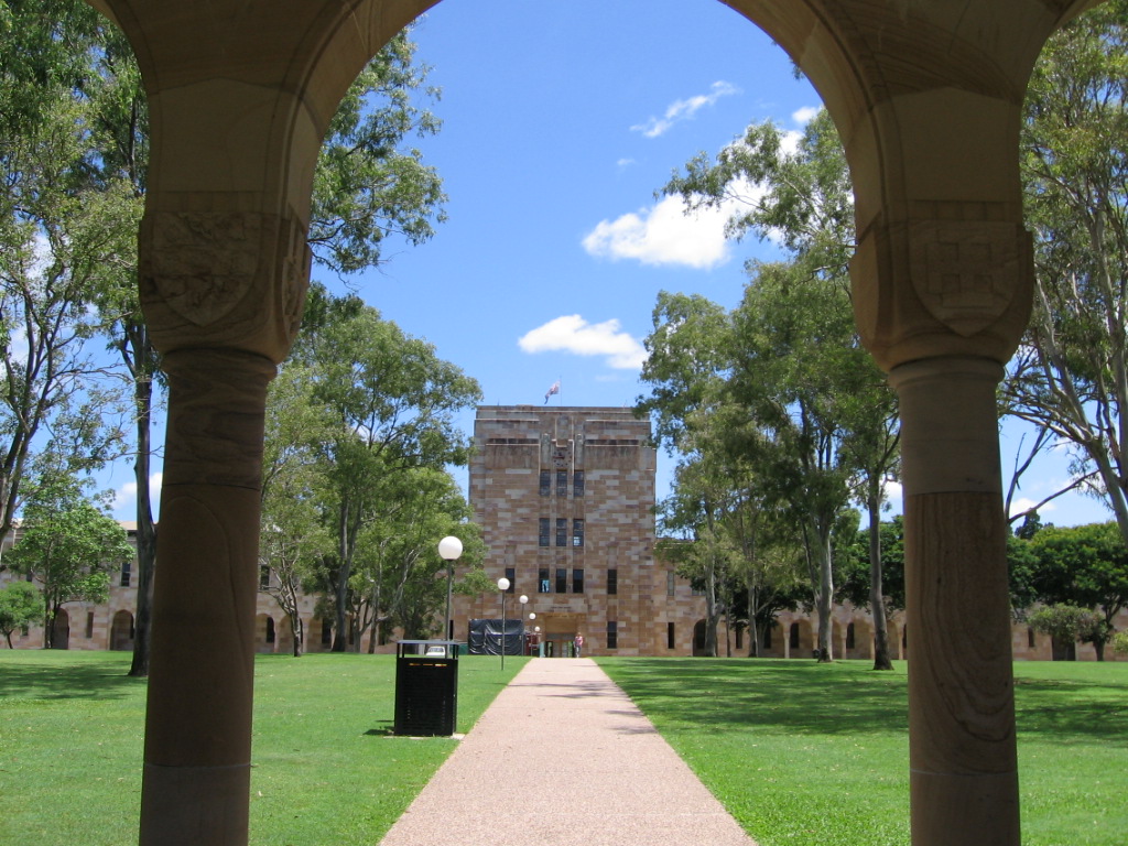
See also: List of schools in Queensland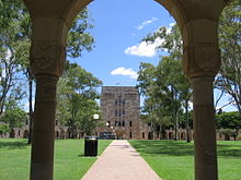 The Forgan Smith Building and the Great Court, University of Queensland.
Brisbane has multi-campus universities and colleges including Griffith University, Queensland University of Technology and the University of Queensland. Other universities which have campuses in Brisbane include the Australian Catholic University, Central Queensland University, James Cook University, JMC Academy, University of Southern Queensland and the University of the Sunshine Coast.
There are three major TAFE colleges in Brisbane; the Brisbane North Institute of TAFE, the Metropolitan South Institute of TAFE, and the Southbank Institute of TAFE.[70] Brisbane is also home to numerous other independent tertiary providers, including the Australian College of Natural Medicine, the Brisbane College of Theology, QANTM, as well as Jschool: Journalism Education & Training.
The majority of Brisbane's preschool, primary, and secondary schools are run under the jurisdiction of Education Queensland, a branch of the Queensland Government.[71] There are also a large number of independent and Roman Catholic run schools.
Culture
Arts and entertainment
Main article: Arts and culture in BrisbaneMain article: Popular entertainment in BrisbaneBrisbane has a growing live music scene, both popular and classical. The Queensland Performing Arts Centre (QPAC), which is located at South Bank, consists of the Lyric Theatre, a Concert Hall, Cremorne Theatre and the Playhouse Theatre. The Queensland Ballet, Opera Queensland, Queensland Theatre Company and other performance art groups stage performances in the different venues. It is also the major performing venue for The Queensland Orchestra, Brisbane's only professional symphony orchestra and Queensland's largest performing arts company. The Queensland Conservatorium, in which professional companies and Conservatorium students also stage performances, is located within the South Bank Parklands.
Numerous choirs present performances across the city annually. These choirs include the Brisbane Chorale, Queensland Choir, Brisbane Chamber Choir, Canticum Chamber Choir, Brisbane Concert Choir, Imogen Children's Chorale and Brisbane Birralee Voices. Due to the lack of a suitable purpose built performance venue for choral music, these choirs typically perform in the city's many churches. The Queensland Gallery of Modern Art (GOMA), opened in December 2006, is one of the latest additions to the South Bank precinct and houses some of the most well-known pieces of modern art from within and outside Australia. GOMA is the largest modern art gallery in Australia. GOMA holds the Asia Pacific Triennial (APT) which focuses on contemporary art from the Asia and Pacific in a variety of media from painting to video work. In Addition, its size enables the gallery to exhibit particularly large shows — the Andy Warhol exhibition being the largest survey of his work in Australia. GOMA also boasts Australia's largest purpose-built Cinémathèque. The Gallery of Modern Art is located next to the State Library of Queensland and the Queensland Art Gallery. Along with Beijing, Berlin, Birmingham and Marseille, Brisbane was nominated as one of the Top 5 International Music Hotspots by Billboard in 2007. There are also popular entertainment pubs and clubs within both the City and Fortitude Valley.[72][73]
The Brisbane Powerhouse in New Farm and the Judith Wright Centre of Contemporary Arts on Brunswick Street in Fortitude Valley also feature diverse programs featuring exhibitions and festivals of visual art, music and dance. The La Boite Theatre Company performs at the Roundhouse Theatre at Kelvin Grove. Twelfth Night Theatre at Bowen Hills is also a professional theatre. The Powerhouse complex stages a range of productions. There are numerous amateur theatre groups in Brisbane. The oldest is the Brisbane Arts Theatre which was founded in 1936. It has a regular adult and children's theatre and is located in Petrie Terrace.
Annual events
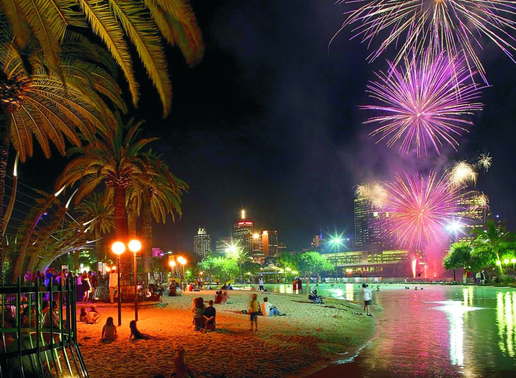
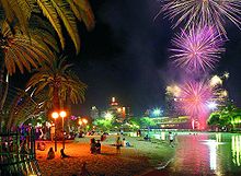 Fireworks over the South Bank Parklands man-made beach – a.k.a Streets Beach.
Major cultural events in Brisbane include the Ekka (the Royal Queensland Show), held each August, and the Riverfestival, held each September at South Bank Parklands and surrounding areas. Warana, (meaning Blue Skies), was a former spring festival which began in 1961 and was held in September each year. Run as a celebration of Brisbane, Warana was similar to Melbourne's Moomba festival. In 1996 the annual festival was changed to a biennial Brisbane Festival.[74]
The Brisbane International Film Festival (BIFF) is held in July/August in a variety of venues around Brisbane including the Regent Cinema in Queen Street Mall. Brisbane's historic Regent Cinema, on the Queen Street Mall, closed on Monday 14 June 2010. BIFF features new films and retrospectives by domestic and international filmmakers along with seminars and awards.
The Paniyiri festival at Musgrave Park (corner of Russell and Edmondstone Streets, South Brisbane) is an annual Greek cultural festival held on the first weekend in May. The Brisbane Medieval Fayre and Tournament is held each June in Musgrave Park.
The Valley Fiesta is an annual three-day event organised by the Valley Chamber of Commerce. It was launched by Brisbane Marketing in 2002 to promote Fortitude Valley as a hub for arts and youth culture. It features free live music, market stalls, food and drink from many local restaurants and cafés, and other entertainment.
The Bridge to Brisbane fun run has become a major annual charity event for Brisbane.
Tourism and recreation
Main article: Tourism in Brisbane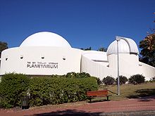
Tourism plays a major role in Brisbane's economy, being the third-most popular destination for international tourist after Sydney and Melbourne.[75] Popular tourist and recreation areas in Brisbane include the South Bank Parklands, Roma Street Parkland, the City Botanic Gardens, Brisbane Forest Park and Portside Wharf. The Lone Pine Koala Sanctuary opened in 1927 and was the world's first koala sanctuary.[76]
The suburb of Mount Coot-tha is home to a popular state forest, and the Brisbane Botanic Gardens which houses the Sir Thomas Brisbane Planetarium and the "Tsuki-yama-chisen" Japanese Garden (formerly of the Japanese Government Pavilion of Brisbane's World Expo '88).
Brisbane has over 27 km (16.8 mi) of bicycle pathways, mostly surrounding the Brisbane river and city centre, extending to the west of the city. The river itself was popular with bathers, and it permitted boating excursions to Moreton Bay when the main port was in the city reaches.[76] Today fishing and boating are more common. Other popular recreation activities include the Story Bridge adventure climb and rock climbing at the Kangaroo Point cliffs.
Sport
Main article: Sport in Brisbane
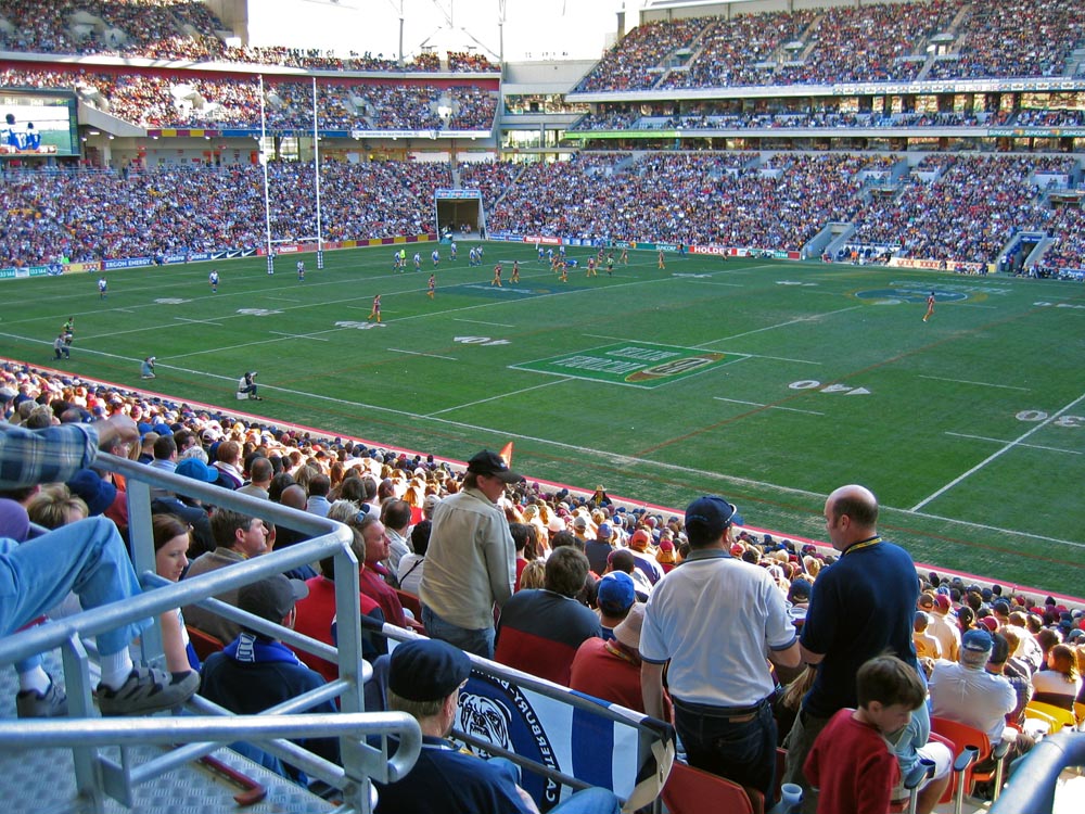
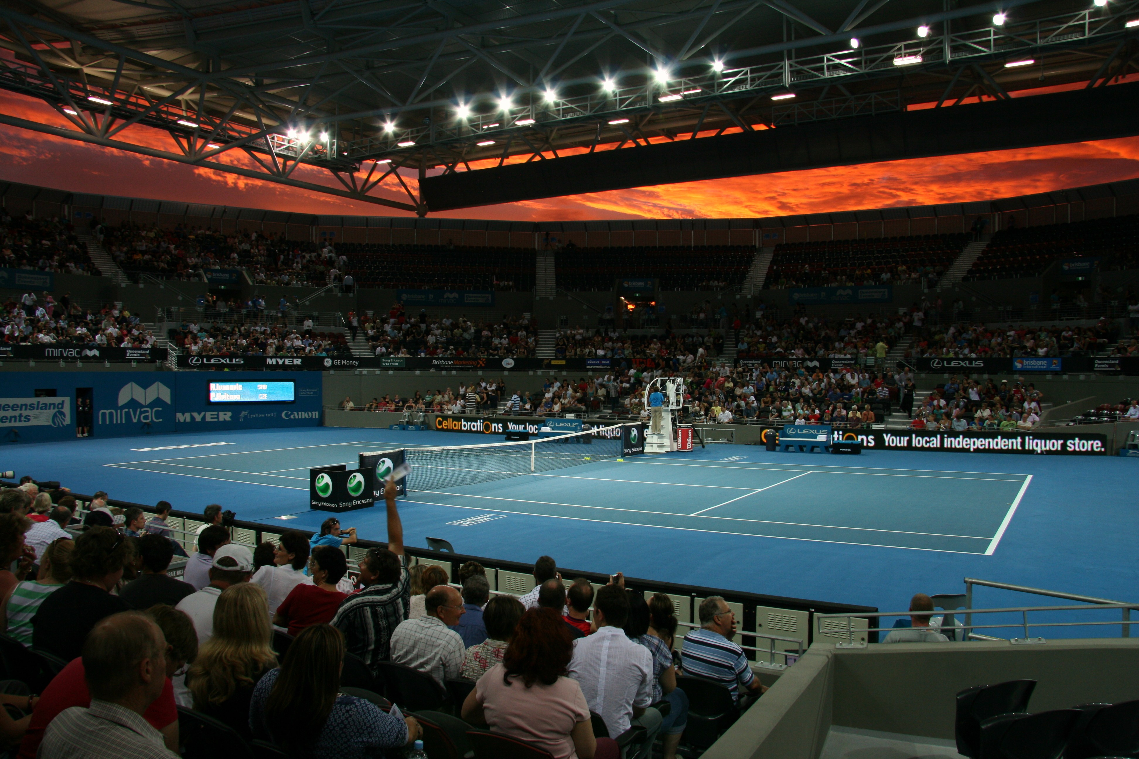
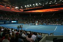 Queensland Tennis Centre at Brisbane International is a professional tennis tournament.
Brisbane has hosted several major sporting events including the 1982 Commonwealth Games and the 2001 Goodwill Games. The city also hosted events during the 1987 Rugby World Cup, 1992 Cricket World Cup, 2000 Sydney Olympics, the 2003 Rugby World Cup and hosted the Final of the 2008 Rugby League World Cup and will host along with the Gold Coast, some events for the 2018 Commonwealth Games. In 2005, then Premier Peter Beattie announced plans for Brisbane to bid to host the 2024 Olympic Games,[77] which in August 2008 received in principle Australian Olympic Committee support, including that of the Queensland Premier Anna Bligh and Brisbane Lord Mayor Campbell Newman.[78] Brisbane is also home to a professional football (soccer) team named Brisbane Roar Football Club. They are in the Hyundai A-League.
The city's major sporting venues include Brisbane Cricket Ground, Sleeman Centre at Chandler, Suncorp Stadium, Ballymore Stadium and the stadium facilities of the Queensland Sport and Athletics Centre in Nathan. With the closure of the Milton Tennis grounds in 1994, Brisbane lacked a major tennis facility. In 2005, the State Government approved the State Tennis Centre a new A$65 million tennis stadium. The construction was completed in 2008. The Brisbane International is held here from January 2009.
Brisbane has teams in all major interstate competitions, excluding the National Basketball League.
Sport Team Name League Stadium Reference Rugby League Queensland State of Origin Suncorp Stadium [79] Brisbane Broncos National Rugby League [80] Rugby Union Queensland Reds Super Rugby [81] Football Brisbane Roar A-League [82] Cricket Queensland Bulls Sheffield Shield
Ryobi One Day Cup
KFC Twenty20 Big BashThe Gabba [83] Australian rules football Brisbane Lions Australian Football League [84] Netball Queensland Firebirds ANZ Championship Brisbane Convention and Exhibition Centre [85] Baseball Brisbane Bandits Australian Baseball League Brisbane Exhibition Ground Media
The main newspapers of Brisbane are The Courier-Mail and The Sunday Mail, both owned by News Corporation. Brisbane receives the national daily, The Australian, and the Weekend Australian, together with Fairfax papers Australian Financial Review, the Sydney Morning Herald and The Age, and Fairfax website Brisbane Times. There are community and suburban newspapers throughout the metropolitan and regional areas, including Brisbane News and City News, many of which are produced by Quest Community Newspapers. mX, a free daily commuter newspaper, was launched in 2007, following the newspaper's success in Melbourne and Sydney.
Brisbane is served by all five major television networks in Australia, which broadcast from the summit of Mount Coot-tha. The three commercial stations, Seven, Nine, and Ten, are accompanied by two government networks, ABC and SBS, with all five providing digital television. New digital-only channels available in addition to ABC1, Seven, Nine, Ten and SBS One include One HD, Eleven, ABC2, ABC3, ABC News 24, SBS Two, 7Two, 7mate, GEM HD and GO!. 31, a community station, also broadcasts in Brisbane. Optus, Foxtel and Austar all operate PayTV services in Brisbane, via cable and satellite means.
The ABC transmits all five of its radio networks to Brisbane; 612 ABC Brisbane, ABC Classic FM, ABC NewsRadio, Radio National, and Triple J. SBS broadcasts its national radio network. Brisbane is serviced by major commercial radio stations, including 4KQ, 4BC, 4BH, 97.3 FM, B105 FM, Nova 106.9, and Triple M. Brisbane is also serviced by major community radio stations such as 96five Family FM, 4MBS Classic FM 103.7, 4EB FM and 4ZZZ 102.1.
Infrastructure
Health
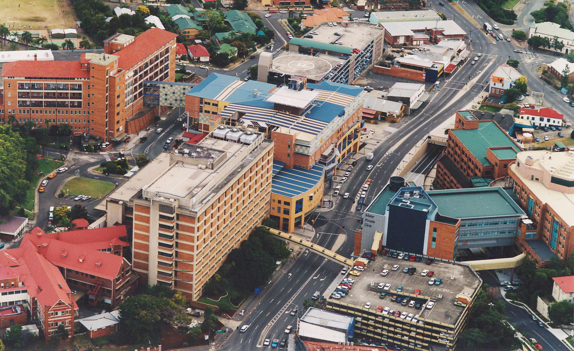
 Aerial of part of Mater Health Services campus at South Brisbane.
Brisbane is covered by Queensland Health's "Northside" and "Southside" health service areas.[86] Within the greater Brisbane area there are 8 major public hospitals, 4 major private hospitals, and smaller public and private facilities. Specialist and general medical practices are located in the CBD, and most suburbs and localities.
Transport
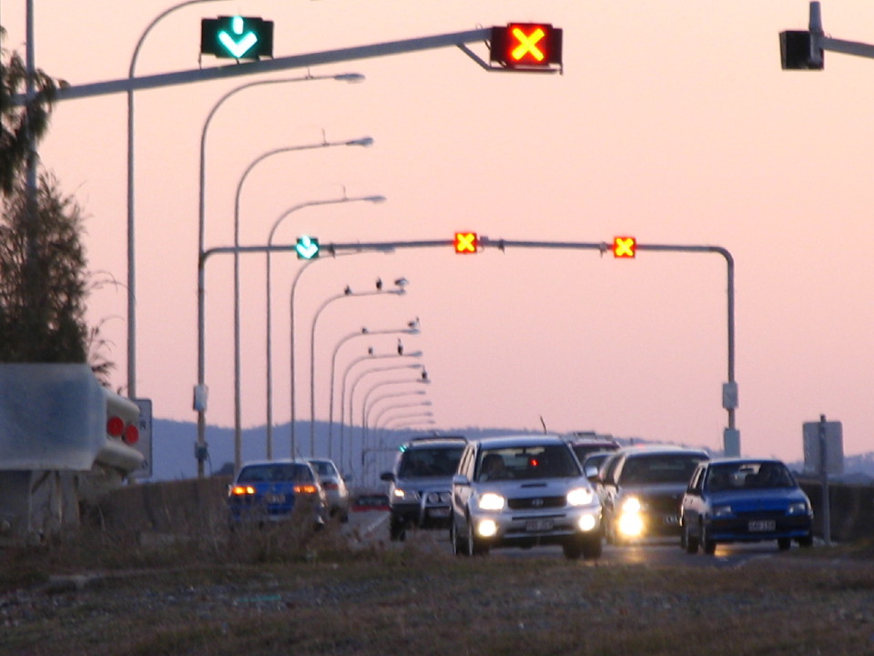
Main article: Transport in Brisbane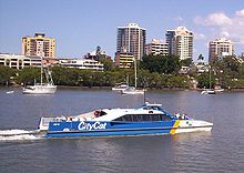
 Suburban Multiple Unit at Nambour Station.
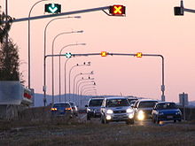 Houghton Highway, the longest bridge in Australia.
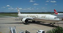 International Terminal at Brisbane Airport.
Brisbane has an extensive transportation network within the city, as well as connections to regional centres, interstate and to overseas destinations. The use of urban public transport is still only a small component of total passenger transport, the largest component being travel by private car.[87]
Public transport is provided by bus, rail and ferry services. Bus services are operated by public and private operators whereas trains and ferries are operated by public agencies. The Brisbane central business district (CBD) is the central hub for all public transport services with services focusing on Queen Street Bus Station, Roma Street and Central railway stations, and various city ferries wharves. Brisbane's CityCat high speed ferry service, popular with tourists and commuters, operates services along the Brisbane River between the University of Queensland and Apollo Road.
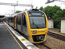
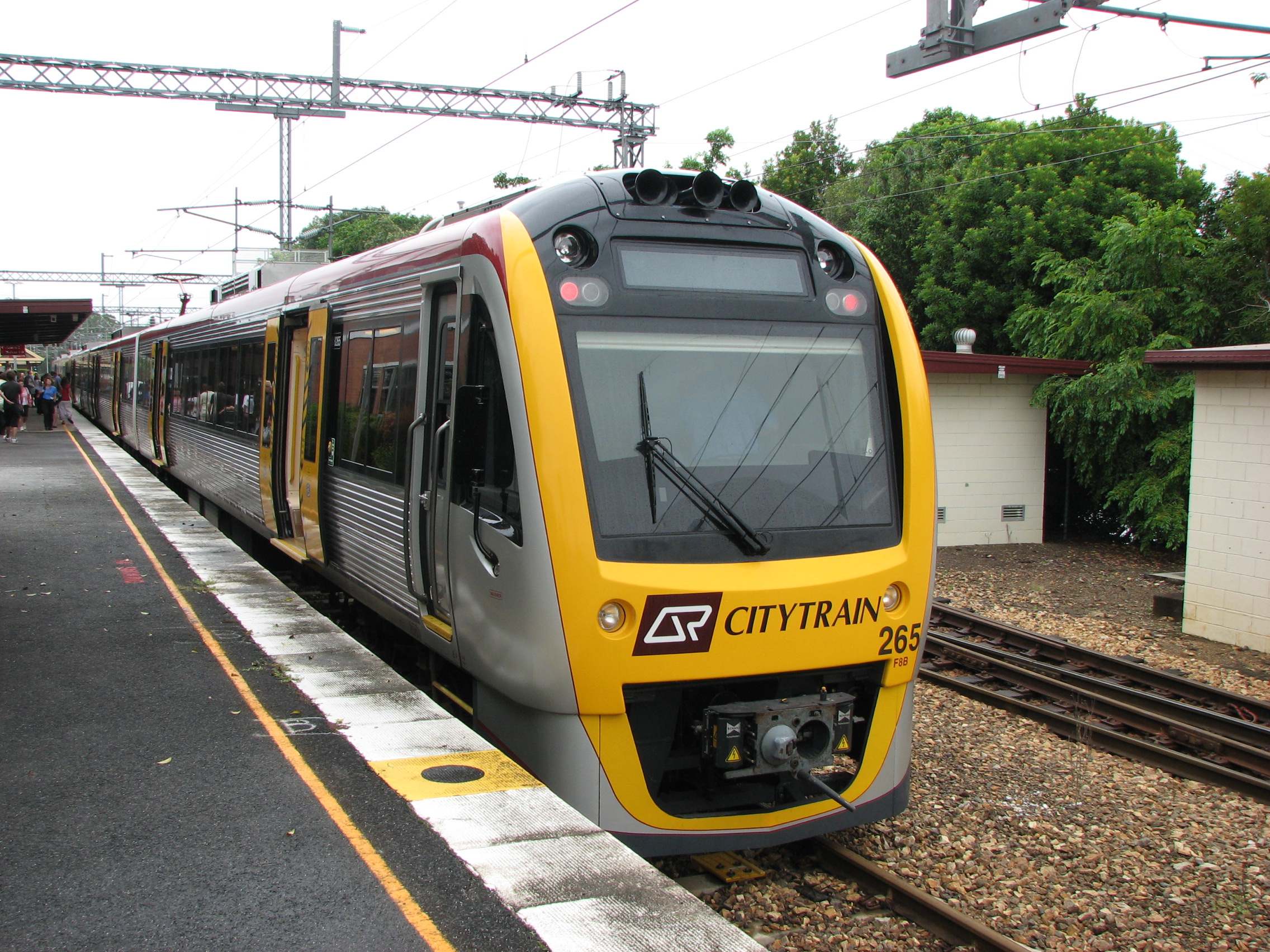
The Citytrain urban rail network consists of 10 suburban lines and covers mostly the west, north and east sides of the city. It also provides the route for an Airtrain service under joint public/private control between the City and Brisbane Airport. Since 2000, Brisbane has been developing a network of busways, including the South East Busway and the Inner Northern Busway, to provide faster bus services. TransLink operates an integrated ticketing system across the public transport network.
The Brisbane River has created a barrier to some road transport routes. In total there are ten road bridges, mostly concentrated in the inner city area. This has intensified the need for transport routes to focus on the inner city. There are also three railway bridges and two pedestrian bridges. The Eleanor Schonell Bridge (originally named, and still generally known as, The Green Bridge) between the University of Queensland and Dutton Park is for use by buses, pedestrians and cyclists. There are currently multiple tunnel and bridge projects underway as part of the TransApex plan.
An extensive network of pedestrian and cyclist pathways have been created along the banks of the Brisbane River to form a Riverwalk network.[88]
Brisbane is served by several urban and inter-urban motorways. The Pacific Motorway connects the central city with the Gold Coast to the south. The Ipswich Motorway connects the city with Ipswich to the west via the southern suburbs, while the Western Freeway and the Centenary Motorway provide a connection between Brisbane's inner-west and the outer south-west, connecting with the Ipswich Motorway south of the Brisbane River. The Bruce Highway is Brisbane's main route north of the city to the rest of the State. The Bruce Highway terminates 1,700 km (1,056 mi) away in Cairns and passes through most major cities along the Queensland coast. The Gateway Motorway is a private toll road which connects the Gold Coast and Sunshine Coasts by providing an alternate route via the Gateway Bridge avoiding Brisbane's inner city area. The Port of Brisbane Motorway links the Gateway to the Port of Brisbane, while Inner City Bypass and the Riverside Expressway act as the inner ring freeway system to prevent motorists from travelling through the city's congested centre.[89]
Brisbane's population growth placed strains on South East Queensland's transport system. The State Government and Brisbane City Council have responded with infrastructure plans and increased funding for transportation projects, such as the South East Queensland Infrastructure Plan and Program. Most of the focus has been placed on expanding current road infrastructure, particularly tunnels and bypasses, as well as improving the public transport system.
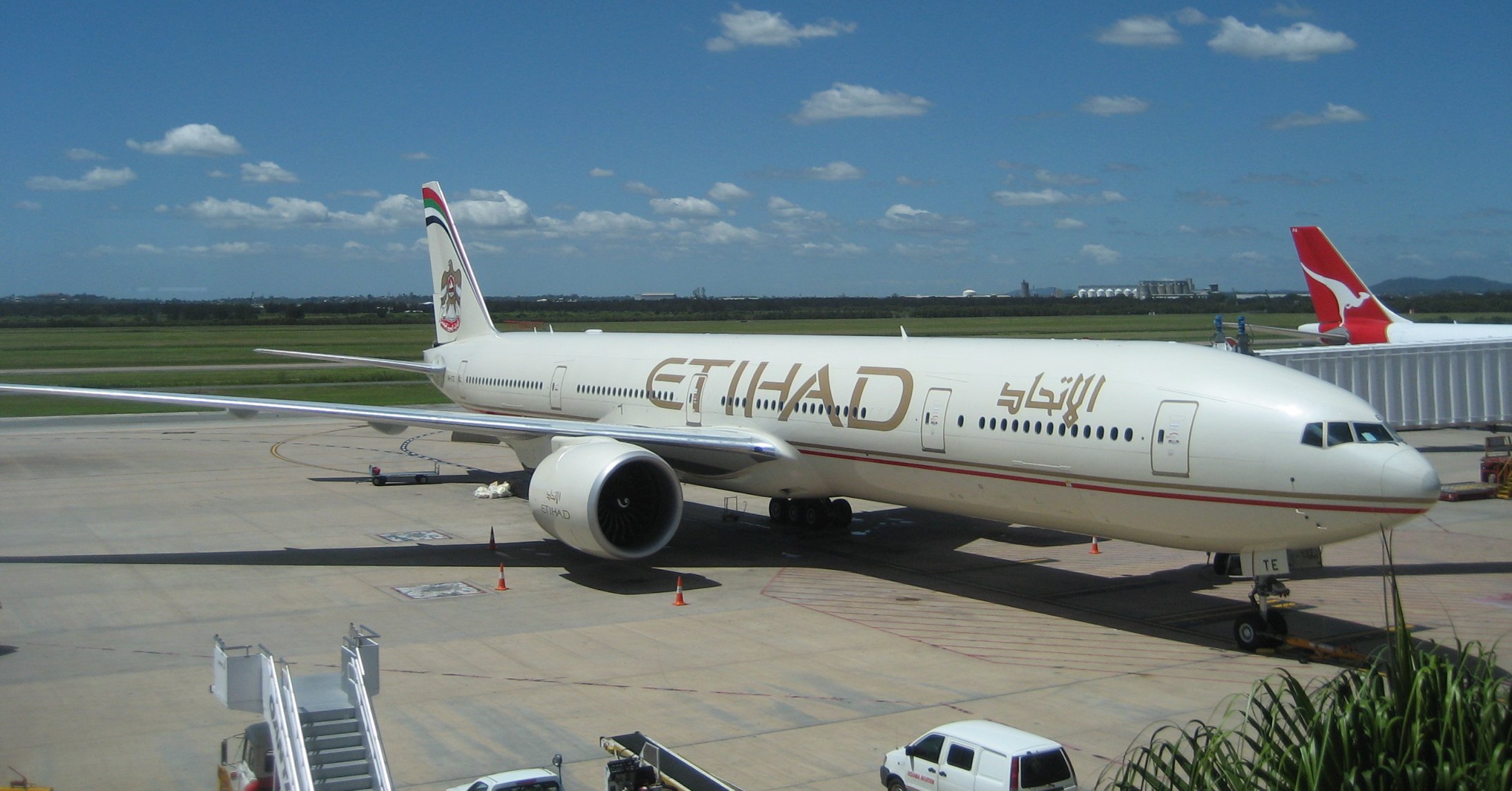
Brisbane Airport (IATA code: BNE) is the city's main airport, the third busiest in Australia after Sydney Airport and Melbourne Airport. It is located north-east of the city centre and provides domestic and international passenger services. In the 2008–2009 year, Brisbane Airport handled over 18.5 million passengers. The airport is serviced by the Brisbane Airtrain which provides a rail service from Brisbane's city centre to and from the airport. Archerfield Airport (in Brisbane's southern suburbs) acts as a general aviation airport.
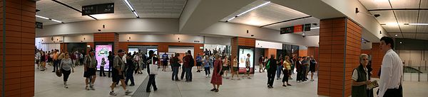 King George Square Busway Station, an underground bus station.
Utilities
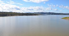 Lake Wivenhoe, Brisbane's primary water reserve.
Water storage, treatment and delivery for Brisbane is handled by SEQ Water, which sells on to Queensland Urban Utilities (previously Brisbane Water) for distribution to the greater Brisbane area. Water for the area is stored in one of three dams; Wivenhoe, Somerset and North Pine. Since 13 May 2005, Brisbane has enforced water restrictions due to drought.[90] This has also led to the State Government announcing that purified recycled water would be pumped into the dams once the pipeline was complete in 2009.[91] More recently, restrictions were lifted and water conservation is no longer a major concern of council, although residents are asked to follow permanent conservation measures.
Electricity and gas grids in Brisbane are handled by Energex (electricity), and Origin Energy (gas), with each company previously holding a monopoly on domestic retail supply. Since 1 July 2007 Queensland regulation changes have opened up the retail energy market, allowing multiple companies to resell both gas and electricity.[92]
Metropolitan Brisbane is serviced by all major and most minor telecommunications companies and their networks. Brisbane has the largest number of enabled DSL telephone exchanges in Queensland. An increasing number are also enabled with special hardware (DSLAMs) which enable high speed ADSL2+ internet access. The Brisbane CBD also features a complete underground fibre optics network, with numerous connections to the inner suburbs provided by various service providers.
Telstra and Optus provide both high speed internet as well as Pay TV through their cable services for the bulk of the city's metropolitan area. Both of these providers also host wireless networks with hotspots within both the inner and suburban areas. In addition, 3 Mobile, Telstra, Optus and Vodafone all operate both 2.5G, 3G and 3.5G mobile phone networks citywide.[93]
In popular culture
Three ships and a naval base of the Royal Australian Navy named HMAS Brisbane are named after the city.
Music references
Brisbane is featured in music including The Saints "Brisbane (Security City)" (1978); "Love You Brisbane" theme single from the 1980s; "Footpaths Of Brunswick Street" – The Natives Of Bedlam (1993); Powderfinger's album "Vulture Street" (2003); R.E.M.'s "Parakeet" (from "Up") (1999); The Stranglers "Nuclear Device" (1979); The Go-Betweens' first single "Lee Remick" (1978); Evil Eddie's "Queensland" (2010); and John Kennedy’s "Brisvegas" (2007).
Bris Vegas
"Bris Vegas" is a nickname given to the city. This has been attributed to an Elvis Presley tribute CD[94] and the city's growing live music scene.[95] It is believed to have been first used in print in a 1996 edition of The Courier-Mail,[94] also approximately the time of the opening of the Treasury Casino in Brisbane and the popularisation of poker machines in Brisbane bars and clubs, a play on the popular gaming ground of Las Vegas. The name has also been attributed to the city's nightlife,[96] compact size of the central business district and previous lack of sophistication when compared with more populated Australian cities[97][98] and also to Las Vegas.[99]
In Television
Brisbane is also the setting for the Australian TV series "Slide" and the American sci-fi series "Terra Nova".
Tegan Jovanka, a companion to the Fifth Doctor on Doctor Who, is a native of Brisbane.
See also
Gallery
-
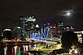
Brisbane Skyline at night.
-

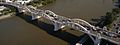
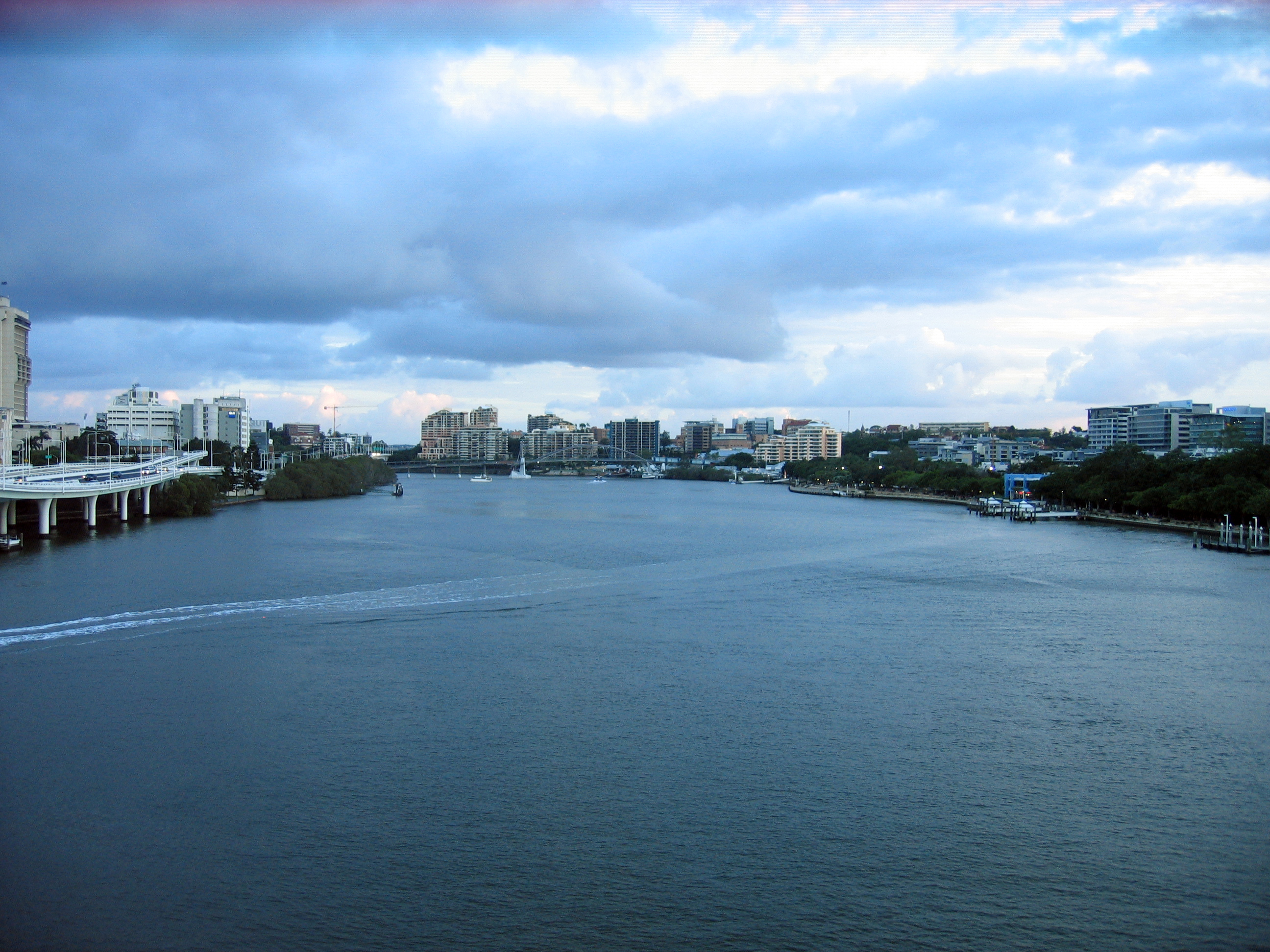
View of Brisbane River from Victoria Bridge.
-
William Jolly Bridge.
-

View of Brisbane from Victoria Bridge.
-
Kurilpa Bridge at night, April 2010
References
- ^ "3218.0 – Regional Population Growth, Australia, 2009–10". Australian Bureau of Statistics. 31 March 2011. http://www.abs.gov.au/ausstats/abs@.nsf/Products/3218.0~2009-10~Main+Features~Main+Features?OpenDocument. Retrieved 31 March 2011.
- ^ Australian Bureau of Statistics (17 March 2008). "Explore Your City Through the 2006 Census Social Atlas Series". http://abs.gov.au/websitedbs/d3310114.nsf/4a256353001af3ed4b2562bb00121564/45b3371f4a681356ca25740e007c92bf!OpenDocument. Retrieved 19 May 2008.
- ^ a b Australian Bureau of Statistics (25 October 2007). "Community Profile Series : Brisbane (Statistical Division)". 2006 Census of Population and Housing. http://www.censusdata.abs.gov.au/ABSNavigation/prenav/ProductSelect?newproducttype=Community+Profiles&collection=Census&period=2006&areacode=305&breadcrumb=LP¤taction=201&action=401. Retrieved 21 January 2008. Map
- ^ Macquarie ABC Dictionary. The Macquarie Library Pty Ltd. 2003. p. 121. ISBN 0 876429 37 2.
- ^ [1] Preliminary population estimates for local government areas, 2009. Local government areas included in the calculation of the South East Queensland population are: Shire of Beaudesert, Shire of Boonah, City of Brisbane, Shire of Caboolture, City of Caloundra, Shire of Esk, Shire of Gatton, Gold Coast City, City of Ipswich, Shire of Kilcoy, Shire of Laidley, Logan City, Shire of Maroochy, Shire of Noosa, Shire of Pine Rivers, Redcliffe City, and Redland City.
- ^ "The World According to GaWC 2010". Globalization and World Cities (GaWC) Study Group and Network. Loughborough University. http://www.lboro.ac.uk/gawc/world2010.html. Retrieved 2011-09-15.
- ^ "Tom Petrie's Early Reminiscences of Early Queensland". http://www.seqhistory.com/index.php?option=com_content&view=article&id=95%3Apart1chpt1&catid=42%3Atom-petrie&Itemid=67&limitstart=4. Retrieved 24 November 2008.
- ^ Our Brisbane – Our shared vision – Brisbane City Council Page 2
- ^ "Redcliffe". The Sydney Morning Herald. 8 February 2004. http://www.smh.com.au/articles/2005/02/17/1108500203689.html. Retrieved 17 May 2008.
- ^ a b "John Oxley Governor Report". http://www.seqhistory.com/john-oxley/139-john-oxley-1823-governorreport?start=2. Retrieved 1 February 2010.
- ^ Potter, Ron. "Place Names of South East Queensland". Piula Publications. http://www.dovenetq.net.au/~piula/Placenames/page55.html. Retrieved 17 May 2008.
- ^ compiled by Royal Automobile Club of Queensland. (1980). Seeing South-East Queensland (2 ed.). RACQ. p. 7. ISBN 0-909518-07-6.
- ^ "About Redcliffe". Redcliffe City Council. http://www.redcliffe.qld.gov.au/about_us.htm. Retrieved 1 December 2007.
- ^ Lybaek, Lena; Konrad Raiser, Stefanie Schardien (2004). Gemeinschaft der Kirchen und gesellschaftliche Verantwortung. Münster: LIT. p. 114. ISBN 978-3825870614.
- ^ "Christopher Eipper (1813–1894)". Street Signs — And What They Mean. Pelican Waters Shire Council. Archived from the original on 18 November 2007. http://web.archive.org/web/20071118093456/http://www.pelicanwaters.com/pelicanwaters-streetsigns.php. Retrieved 20 December 2007.
- ^ de Strzelecki, Paul Edmond (1845). Physical Description of New South Wales and Van Diemen's Land: Accompanied by a Geological Map, Sections, and Diagrams. London, United Kingdom: Longman, Brown, Green, and Longmans.
- ^ Establishing Queensland's borders
- ^ "Organisation chart". Brisbane City Council. Archived from the original on 22 May 2008. http://web.archive.org/web/20080522132144/http://www.brisbane.qld.gov.au/BCC:STANDARD:827799619:pc=PC_95. Retrieved 20 December 2007.
- ^ "Jolly, William Alfred (1881–1955)". Australian Dictionary of Biography. http://www.adb.online.anu.edu.au/biogs/A090501b.htm. Retrieved 20 December 2007.
- ^ "Brisbane". ANZAC Day Commemoration Committee (Qld) Incorporated. 1998. http://www.anzacday.org.au/education/tff/memorials/queensland.html. Retrieved 28 December 2007.
- ^ http://en.wikipedia.org/wiki/Story_Bridge
- ^ Peter Dunn (2 March 2005). "Hirings Section". Australia @ War. http://home.st.net.au/~dunn/ausarmy/hiringsno1lofc.htm. Retrieved 7 January 2008.
- ^ "QM Supply in the Pacific during WWII". Quartermaster Professional Bulletin. Spring 1999. Archived from the original on 20 May 2008. http://web.archive.org/web/20080520050058/http://www.quartermaster.army.mil/OQMG/professional_bulletin/1999/spring1999/QM+Supply+in+the+Pacific+During+WWII.htm. Retrieved 7 January 2008.
- ^ Peter Dunn (27 August 2005). "The Battle Of Brisbane — 26 & 27 November 1942". Australia @ War. http://home.st.net.au/~dunn/ozatwar/bob.htm. Retrieved 7 January 2008.
- ^ Brisbane’s last in but best-dressed, Brooke Falvey, City news, 11 July 2008.
- ^ http://www.couriermail.com.au/ipad/filmmakers-to-honour-brisbane-bard/story-fn6ck51p-1225969834655
- ^ She picked me up at a dance one night, Joan and Bill Bentson, Queensland Government.
- ^ "ACGA Past Games 1982". Commonwealth Games Australia. http://www.commonwealthgames.org.au/Templates/Games_PastGames_1982.htm. Retrieved 28 December 2007.
- ^ Rebecca Bell. "Expo 88 / Brisbane". OZ Culture. http://www.ozbird.com/oz/OzCulture/expo88/brisbane/default.htm. Retrieved 28 December 2007.
- ^ Berry, Petrina (13 January 2011). "Brisbane braces for flood peak as Queensland's flood crisis continues". Courier Mail. http://www.couriermail.com.au/news/breaking-news/brisbane-braces-for-flood-peak-as-queenslands-flood/story-fn7ik8u2-1225986784487. Retrieved 14 January 2011.
- ^ Before and after photos of the floods in Brisbane
- ^ Gregory, Helen (2007). Brisbane Then and Now. Wingfield, South Australia: Salamander Books. p. 60. ISBN 9781741730111.
- ^ Flood-proof road destroyed in deluge – ABC News (Australia)
- ^ Gunn, Angus M. (1978). Habitat: Human Settlements in an Urban Age. Pergamon Press. p. 178. ISBN 0080214878.
- ^ "Timeline for Brisbane River" (PDF). Coastal CRC. http://www.coastal.crc.org.au/pdf/HistoricalCoastlines/App_3_Timeline_BrisbaneRiver.pdf. Retrieved 4 January 2008.
- ^ a b Campbell Newman, "bmag", 3 November 2009
- ^ "TimeWalks Brisbane — Windmill". Queensland Government. 24 March 2008. http://www.slq.qld.gov.au/oh/treasures/timewalks/bris/1870/windmill. Retrieved 10 April 2008.
- ^ Statham-Drew, Pamela (1990). The Origin of Australia's Capital Cities. Cambridge University Press. p. 257. ISBN 978-0521408325.
- ^ Pike, Jeffrey (2002). Australia. Insight. ISBN 978-9812347992.
- ^ "The Commissariat Stores". http://www.queenslandhistory.org.au/comm.html. Retrieved 24 February 2008.
- ^ Population Growth Australian Bureau of Statistics – Accessed 28 December 2007
- ^ http://buildingdb.ctbuh.org/?do=create>
- ^ Tapper, Andrew; Tapper, Nigel (1996). Gray, Kathleen. ed. The weather and climate of Australia and New Zealand (First ed.). Melbourne, Australia: Oxford University Press. p. 300. ISBN 0195533933.
- ^ Linacre, Edward; Geerts, Bart (1997). Climates and Weather Explained. London: Routledge. p. 379. ISBN 0-415-12519-7. http://books.google.com/?id=mkZa1KLHCAQC&lpg=PA379&pg=PA379#v=onepage&q=.
- ^ Daniel Sankey and Tony Moore (19 July 2007). "Coldest day on record for Brisbane". The Brisbane Times. http://www.brisbanetimes.com.au/articles/2007/07/19/1184559902397.html. Retrieved 5 January 2008.
- ^ Unknown (24 August 2009). "Hot August day as Records Fall". The Brisbane Times. http://www.brisbanetimes.com.au/queensland/hot-august-day-as-records-fall-20090824-evxp.html. Retrieved 31 August 2010.
- ^ "Brisbane residents best water savers in world: Newman". ABC News. http://www.abc.net.au/news/stories/2007/08/27/2016895.htm. Retrieved 19 March 2008.
- ^ ."Raging floods bear down on Brisbane". http://www.abc.net.au/news/2011-01-11/raging-floods-bear-down-on-brisbane/1901406.
- ^ "SEQWater latest dam levels". http://seqwater.com.au/public/dam-levels.
- ^ Cubby, Ben (23 September 2009). "Global warning: Sydney dust storm just the beginning". Brisbane Times (Brisbane). http://www.brisbanetimes.com.au/opinion/society-and-culture/global-warning-sydney-dust-storm-just-the-beginning-20090923-g1fi.html. Retrieved 25 September 2009.
- ^ Brisbane on alert as dust storms sweep east
- ^ "Severe Tropical Cyclone Hamish". Australian Bureau of Meteorology. 2010. http://www.bom.gov.au/announcements/sevwx/qld/qldtc20090304.shtml. Retrieved 11 August 2010.
- ^ Staff Writer (11 March 2009). "Ship spills chemicals in waters off Australia". Cable News Network. http://edition.cnn.com/2009/WORLD/asiapcf/03/11/aus.chemicalspill/. Retrieved 11 March 2009.
- ^ "Brisbane Climate Guide". http://www.weather2travel.com/climate-guides/australia/queensland/brisbane.php. Retrieved October 2011.
- ^ "Brisbane". Climate statistics for Australian locations. Bureau of Meteorology. http://www.bom.gov.au/climate/averages/tables/cw_040913_All.shtml. Retrieved 6 February 2011.
- ^ "Brisbane City Council". NetCat. http://www.netcat.com.au/NETCAT/STANDARD/PC_4.html. Retrieved 28 December 2007.
- ^ "Annual Report and Financial Statements". Brisbane City Council. Archived from the original on 30 September 2007. http://web.archive.org/web/20070930015350/http://www.brisbane.qld.gov.au/BCC:STANDARD:1658601192:pc=PC_1297. Retrieved 5 January 2008.
- ^ Department of Tourism, Regional Development and Industry (14 December 2007). "Brisbane's business visitors drive $412 million domestic tourism increase". Brisbane Marketing. http://www.brisbanemarketing.com.au/%5Cnews-and-events%5Cnews-article.aspx?id=171. Retrieved 29 December 2007.[dead link]
- ^ "What is the Smart State". Queensland Government. http://www.smartstate.qld.gov.au/strategy/index.shtm#what. Retrieved 29 December 2007.
- ^ Peter Beattie (4 December 2007). "Brain power drives Smart State". The Courier Mail. News.com.au. http://www.news.com.au/couriermail/story/0,23739,22867846-27197,00.html. Retrieved 29 December 2007.
- ^ "Brisbane business visitor numbers skyrocket". Brisbane Marketing Convention Bureau. e-Travel Blackboard. 3 January 2008. http://www.etravelblackboard.com/index.asp?id=73027&nav=13. Retrieved 13 January 2008.
- ^ "2006 Census QuickStats by Location". Australian Bureau of Statistics. http://www.censusdata.abs.gov.au/ABSNavigation/prenav/PopularAreas?ReadForm&prenavtabname=Popular%20Locations&type=popular&&navmapdisplayed=true&javascript=true&textversion=false&collection=Census&period=2006&producttype=QuickStats&method=&productlabel=&breadcrumb=PL&topic=&. Retrieved 19 July 2008.
- ^ "Brisbane Container Terminal, Australia". Port Technology. http://72.14.253.104/search?q=cache:OpXT0QTpjWEJ:www.port-technology.com/projects/brisbane/index.html+http://www.port-technology.com/projects/brisbane/index.html&hl=en&ct=clnk&cd=1&gl=au. Retrieved 29 December 2007.
- ^ a b "About Us". Australia TradeCoast. Archived from the original on 8 January 2008. http://web.archive.org/web/20080108210134/http://www.australiatradecoast.com.au/AboutAustraliaTradeCoast/index.aspx. Retrieved 13 January 2008.
- ^ "History". Westfield Group. http://www.westfield.com/corporate/about/history.html. Retrieved 29 December 2007.
- ^ Australian Bureau of Statistics (25 October 2007). "Community Profile Series : Brisbane (Major Statistical Region)". 2006 Census of Population and Housing. http://www.censusdata.abs.gov.au/ABSNavigation/prenav/ProductSelect?newproducttype=Community+Profiles&collection=Census&period=2006&areacode=31&breadcrumb=LP¤taction=201&action=401. Retrieved 27 December 2009. refer "Basic Community Profile – Brisbane" sheet B10
- ^ a b c "Growth in Melbourne". 3218.0 – Regional Population Growth, Australia, 2007–08. Australian Bureau of Statistics. 23 April 2009. http://www.abs.gov.au/ausstats/abs@.nsf/Products/3218.0~2007-08~Main+Features~Victoria?OpenDocument. Retrieved 11 September 2009.
- ^ Australian Bureau of Statistics (25 October 2007). "2006 Census QuickStats: Brisbane (Statistical Division)". 2006 Census QuickStats. http://www.censusdata.abs.gov.au/ABSNavigation/prenav/LocationSearch?collection=Census&period=2006&areacode=305&producttype=QuickStats&breadcrumb=PL&action=401. Retrieved 21 March 2008.
- ^ "3218.0 – Regional Population Growth, Australia, 1996 to 2006". Australian Bureau of Statistics. http://www.abs.gov.au/AUSSTATS/abs@.nsf/Latestproducts/3218.0Main%20Features31996%20to%202006?opendocument&tabname=Summary&prodno=3218.0&issue=1996%20to%202006&num=&view=#CAPITAL%20CITY%20GROWTH. Retrieved 3 March 2008.
- ^ "TAFE Queensland". Queensland Government. http://www.tafe.qld.gov.au/dds/search/browseLocations.do?call_centre_mode=false&externalCallMode=false&breadCrumbsBase=%3Ca+href%3D%22%2F%22+title%3D%22Home%22%3EHome%3C%2Fa%3E&ins_spec=false. Retrieved 2 December 2007.
- ^ "Education Queensland". Queensland Government. http://education.qld.gov.au/eq/. Retrieved 2 December 2007.
- ^ "Billboard Loves Brisbane". Music News. Triple J. http://www.abc.net.au/triplej/musicnews/s1838651.htm. Retrieved 15 November 2007.
- ^ "Beijing, Berlin among music hot spots in 2007". Music News. Reuters. 1 January 2007. http://www.reuters.com/article/musicNews/idUSN0126189720070102?pageNumber=2&virtualBrandChannel=0&sp=true. Retrieved 29 December 2007.
- ^ "History". Brisbane Festival. Archived from the original on 20 February 2008. http://web.archive.org/web/20080220023411/http://www.brisbanefestival.com.au/history.html. Retrieved 2 March 2008.
- ^ "International Market Tourism Facts" (PDF). Tourism Australia. http://www.tourismaustralia.com/content/Research/Factsheets/TopTen_Regions_Dec2006.pdf.
- ^ a b Gregory, Helen (2007). Brisbane Then and Now. Wingfield, South Australia: Salamander Books. p. 140. ISBN 9781741730111.
- ^ Eleanor Hall (1 April 2005). "Brisbane keen to bid for 2024 Olympics". The World Today. ABC. http://www.abc.net.au/worldtoday/content/2005/s1336250.htm. Retrieved 5 January 2008.
- ^ Brisbane could host Olympics in 2024
- ^ "Club Info". National Rugby League. http://www.nrl.com/Clubs/Broncos/tabid/10255/default.aspx. Retrieved 30 December 2007.
- ^ "Origin of State Colours Queensland Maroons & NSW Blues". RL1908. http://www.rl1908.com/Origin/colours.htm. Retrieved 30 December 2007.
- ^ "Our History". Queensland Rugby Union. Archived from the original on 23 January 2008. http://web.archive.org/web/20080123125252/http://www.queenslandreds.com.au/qru/qru.rugby/page/62650. Retrieved 30 December 2007.
- ^ "History". Brisbane Roar FC. http://www.brisbaneroar.com.au/. Retrieved 30 December 2007.
- ^ "Introduction". Queensland Bulls. http://www.qldcricket.com.au/default.asp?PageID=2. Retrieved 30 December 2007.
- ^ "All About the Brisbane Lions". Brisbane Lions. http://www.lions.com.au/TheClub/History/BrisbaneLions/tabid/5161/Default.aspx. Retrieved 30 December 2007.
- ^ "History of Netball Queensland". Netball Queensland. http://www.netballq.org.au/extra.asp?id=78&OrgID=3. Retrieved 30 December 2007.
- ^ "Profiles — Hospitals". Queensland Health. http://www.health.qld.gov.au/wwwprofiles/default.asp. Retrieved 26 March 2008.
- ^ "Year Book Australia, 2005". ABS. http://www.abs.gov.au/Ausstats/abs@.nsf/94713ad445ff1425ca25682000192af2/d81efef6e2252cf4ca256f7200833049!OpenDocument. Retrieved 19 February 2008.
- ^ "About RiverWalk". Brisbane City Council. Archived from the original on 22 May 2008. http://web.archive.org/web/20080522142648/http://www.brisbane.qld.gov.au/BCC:STANDARD::pc=PC_1217. Retrieved 5 January 2008.
- ^ "The upgrade". Gateway Upgrade Project. http://www.gatewayupgradeproject.com.au/asp/index.asp?sid=5&page=upgradeIntro. Retrieved 5 January 2008.
- ^ Emma Chalmers, Jeremy Pierce and Neil Hickey (8 February 2008). "Queensland Water Commission retain restrictions". The Courier Mail. http://www.news.com.au/couriermail/story/0,23739,23178059-952,00.html. Retrieved 2 March 2008.
- ^ Peter Beattie. "SEQ Will Ave Purified Recycled Water But No Vote: Premier" (Ministerial media statement). Queensland Government. http://statements.cabinet.qld.gov.au/MMS/StatementDisplaySingle.aspx?id=50056. Retrieved 29 February 2008.
- ^ "Full Retail Competition". Queensland Department of Mines and Energy. Archived from the original on 2 November 2007. http://web.archive.org/web/20071102094936/http://www.energy.qld.gov.au/frc.cfm. Retrieved 2 March 2008.
- ^ Roland Tellzen (1 April 2008). "Mobile broadband takes off". The Australian. news.com.au. http://www.australianit.news.com.au/story/0,24897,23460734-5013037,00.html. Retrieved 17 April 2008.
- ^ a b Tilston, John. Meanjin to Brisvegas: Brisbane Comes of Age. pp. 147–148. ISBN 1-4116-5216-9..
- ^ "Billboard Backs Brisvegas". The Age. 25 January 2007. http://www.theage.com.au/news/music/billboard-backs-brisvegas/2007/01/25/1169594410115.html?page=fullpage#contentSwap1. Retrieved 4 April 2008.
- ^ "City Guide: Brisbane". BBC Sport. 25 September 2003. http://news.bbc.co.uk/sport1/hi/rugby_union/rugby_world_cup/venues_guide/2982769.stm. Retrieved 4 April 2008.
- ^ "QLD: From Brisvegas to Brismanhattan". AAP General News. 9 September 2004. http://www.highbeam.com/doc/1P1-98858942.html. Retrieved 4 April 2008.
- ^ "Brisbane Residents Embrace City Living". The Age. 2 November 2005. http://www.theage.com.au/news/National/Brisbane-residents-embrace-city-living/2005/11/02/1130823270850.html. Retrieved 4 April 2008.
- ^ Amanda Horswill (15 May 2007). "What's in a Name?". The Courier Mail. http://www.news.com.au/couriermail/story/0,23739,21727715-27197,00.html. Retrieved 4 April 2008.
External links
- Brisbane travel guide from Wikitravel
- City of Brisbane
- Brisbane street map
- Official tourism website of Brisbane
Capital cities of Australia Cities of Queensland, Australia
Capital: BrisbaneRegional: Bundaberg · Cairns · Gladstone · Gympie · Hervey Bay · Mackay · Maryborough · Mount Isa · Rockhampton · Toowoomba · Townsville
Cities of Australia Australian Capital Territory Canberra (national capital)New South Wales Albury · Armidale · Bathurst · Broken Hill · Cessnock · Coffs Harbour · Dubbo · Gosford · Goulburn · Grafton · Griffith · Lake Macquarie · Lismore · Lithgow · Maitland · Newcastle · Nowra · Orange · Queanbeyan · Sydney · Tamworth · Wagga Wagga · WollongongNorthern Territory Queensland Brisbane · Bundaberg · Cairns · Caloundra · Gladstone · Gold Coast · Gympie · Hervey Bay · Mackay · Maryborough · Mount Isa · Rockhampton · Sunshine Coast · Toowoomba · TownsvilleSouth Australia Adelaide · Mount Gambier · Murray Bridge · Port Augusta · Port Lincoln · Port Pirie · Victor Harbor · WhyallaTasmania Victoria Western Australia Commonwealth Games host cities 1930: Hamilton • 1934: London • 1938: Sydney • 1950: Auckland • 1954: Vancouver • 1958: Cardiff • 1962: Perth • 1966: Kingston • 1970: Edinburgh • 1974: Christchurch • 1978: Edmonton • 1982: Brisbane • 1986: Edinburgh • 1990: Auckland • 1994: Victoria • 1998: Kuala Lumpur • 2002: Manchester • 2006: Melbourne • 2010: Delhi • 2014: Glasgow • 2018: "Gold Coast •
Categories:- Host cities of the Commonwealth Games
- Brisbane
- Australian capital cities
- Coastal cities in Australia


Wikimedia Foundation. 2010.