- Victoria (Australia)
-
Coordinates: 37°0′S 144°0′E / 37°S 144°E
Victoria 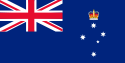

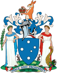
Flag Coat of arms Slogan or nickname: "Garden State" Motto(s): "Peace and Prosperity" 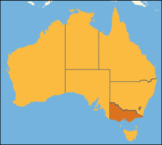
Other Australian states and territoriesCapital Melbourne Demonym Victorian Government Constitutional monarchy - Governor Alex Chernov - Premier Ted Baillieu (LP) Australian State - Established as Colony 1850 - Responsible Government 1856 - Became State 1901 - Constitution Constitution Act (Vic) 1975 - Australia Act 3 March 1986 Area - Total 237,629 km2 (6th)
91,749 sq mi- Land 227,416 km2
87,806 sq mi- Water 10,213 km2 (4.3%)
3,943 sq miPopulation (June 2010) - Population 5,547,527[1] (2nd) - Density 24.39/km2 (2nd)
63.2 /sq miElevation - Highest Mt Bogong
1,986 m (6,516 ft)Gross State Product (2009–10) - Product ($m) $293,313[2] (2nd) - Product per capita $52,872 (6th) Time zone UTC+10 (AEST)
UTC+11 (AEDT)Federal representation - House seats 37 - Senate seats 12 Abbreviations - Postal VIC - ISO 3166-2 AU-VIC Emblems - Floral Pink Heath[3] - Animal Leadbeater's possum - Bird Helmeted Honeyeater - Fish Weedy Seadragon - Colours Navy Blue and Silver[4] Web site www.vic.gov.au/ Victoria is the second most populous state in Australia.[1] Geographically the smallest mainland state, Victoria is bordered by New South Wales, South Australia, and Tasmania on Boundary Islet to the north, west and south respectively.
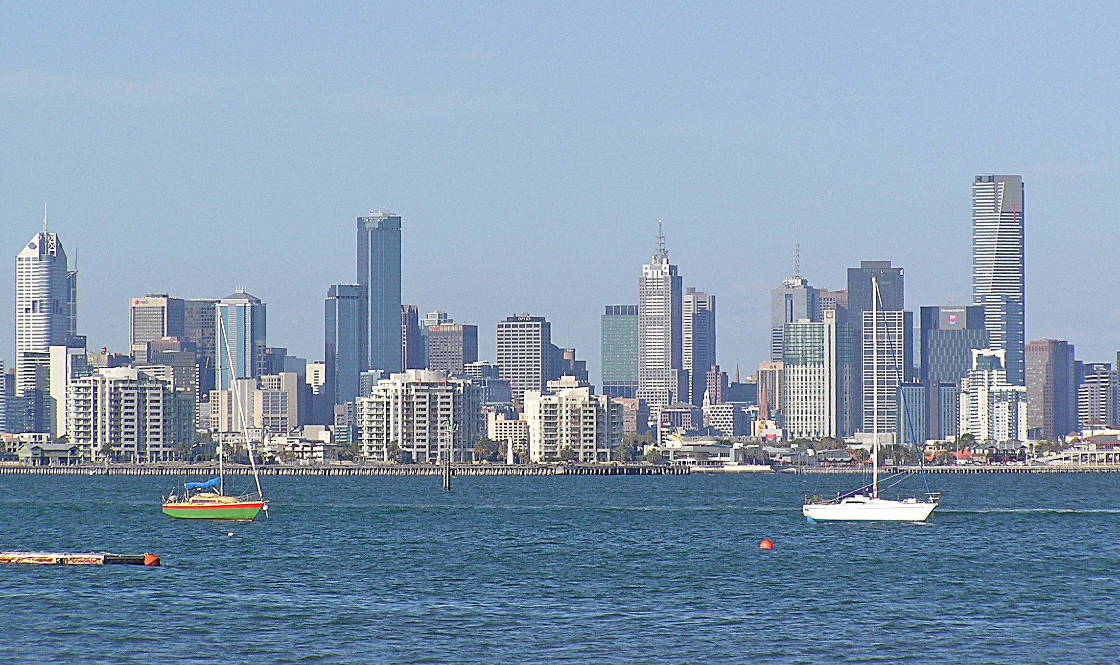
Victoria is Australia's most densely populated state, and has a highly centralised population, with almost 75% of Victorians living in Melbourne, the state capital and largest city.
Contents
Etymology
Victoria, like Queensland, was named after Queen Victoria, the monarch at the time.
History
Main article: History of VictoriaAfter the founding of the colony of New South Wales in 1788, Australia was divided into an eastern half named New South Wales and a western half named New Holland, under the administration of the colonial government in Sydney. The first European settlement in the area later known as Victoria was established in October 1803 under Lieutenant-Governor David Collins at Sullivan Bay, Victoria on Port Phillip. It consisted of 308 convicts, 51 marines, 17 free settlers, 12 civil officers, a missionary and his wife. They had been sent from England in HMS Calcutta under the command of Captain Daniel Woodriff, principally out of fear that the French, who had been exploring the area, might establish their own settlement and thereby challenge British rights to the continent.
Victoria's next settlement was at Portland, on the west coast of what is now Victoria. Edward Henty settled Portland Bay in 1834.[5] Shortly after arriving from Tasmania in December 1834, Henty (aged 24 yrs) set off for thickly-populated country inland from Portland, with resident whalers, an Aboriginal woman abducted by one of them and 14 hunting dogs (a cross between greyhound and wolfhound}. On spotting a single Aboriginal man, the men set the dogs on him.[6]
Melbourne was founded in 1835 by John Batman. From settlement the region around Melbourne was known as the Port Phillip District, a separately administered part of New South Wales.
Impact of colonisation on Aborigines
At the start of colonisation, what is now Victoria, was already settled and well populated by Aboriginal groups. The problem was that this was not recognised—legally or in practice—by the British Crown. With pastoral land in the colony of Van Diemen's Land fully allocated to colonists, and Batman himself already a significant land-owner, he turned his attention to mainland land speculation at Port Phillip Bay, which began in 1835 without the consent of the British Crown and at an enormous cost in the lives and livelihoods of its Aboriginal land-owners. With no legal recognition or protection of the Aboriginal land-owners, violence ensued. For example, in August 1836, Aborigines killed the squatter Charles Franks and an unnamed shepherd, at Franks' station on the Werribee River (near Melbourne). In response, Henry Batman (John Batman's brother) led an indiscriminate punitive expedition against 70–80 Aborigines (men, women and children) living in nine large huts on the Werribee River, killing an unrecorded number.[7] In spite of this, in May 1837, Henry Batman ". . . was appointed acting Commissioner of Crown Lands, the official charged with overseeing the squatters".[8] Earlier, on 4 March 1837, Governor Bourke in his visit to Melbourne addressed 120 Aborigines, ". . . whom he exhorted . . . to good conduct and attention to the Missionary". The Kulin were given blankets and four favoured men, who had been recommended for "honorary distinctions" by [Police Magistrate Captain William] Lonsdale, were awarded brass plates.[9]
By 1839, large numbers of homeless, dispossessed Aborigines, refugees from surrounding pastoral districts, were ". . . surviving whenever and however they could on the geographic, social and economic margins of the town [i.e. Melbourne]." [10] When George Augustus Robinson arrived in the town in the winter of 1839, " . . . four to five hundred blacks of the Port Phillip tribes . . ." were gathering at a camp site on the south bank of the Yarra River, suffering hunger and disease.[11] By 1840, Robinson still ". . . had no stores allocated to him . . ." by Captain William Lonsdale (colonist), the Police Magistrate in Melbourne, even though ". . . it was patently obvious that the Aborigines were starving, and many were ill and near death . . .".[12] With land in the hinterland overrun by ". . . vast numbers of sheep and cattle . . ." and ". . . conditions in the countryside becoming intolerable, the blacks swarmed into Melbourne looking for food and blankets".[13]
Between 1836 and 1842, Victorian Aboriginal groups were largely dispossessed of territory bigger than England. [14] By January 1844, there were said to be 675 Aborigines resident in squalid camps in Melbourne. [15] Although the British Colonial Office appointed 5 "Aboriginal Protectors" for the entire Aboriginal population of Victoria, arriving in Melbourne in 1839, they worked ". . . within a land policy that nullified their work, and there was no political will to change this".[16] "It was government policy to encourage squatters to take possession of whatever [Aboriginal] land they chose, . . . that largely explains why almost all the original inhabitants of Port Phillip's vast grasslands were dead so soon after 1835".[17] By 1845, fewer than 240 wealthy Europeans held all the pastoral licences then issued in Victoria and became the patriarchs " . . . that were to wield so much political and economic power in Victoria for generations to come".[18]
Creation of separate colony of Victoria
With the Aboriginal population dispossessed of their lands and their management of fire having been disrupted for almost 15 years, the Colony experienced for the first time its largest ever bushfires, burning about 25% of the land area of Victoria on Black Thursday (1851) on 6 February 1851.
On 15 November 1851, the British Government separated the area from New South Wales, proclaiming a new Colony of Victoria. Days later, still in 1851 gold was discovered near Ballarat, and subsequently at Bendigo. Later discoveries occurred at many sites across Victoria. This triggered one of the largest gold rushes the world has ever seen. The colony grew rapidly in both population and economic power. In ten years the population of Victoria increased sevenfold from 76,000 to 540,000. All sorts of gold records were produced including the "richest shallow alluvial goldfield in the world" and the largest gold nugget. Victoria produced in the decade 1851–1860 20 million ounces of gold, one third of the world's output[citation needed].
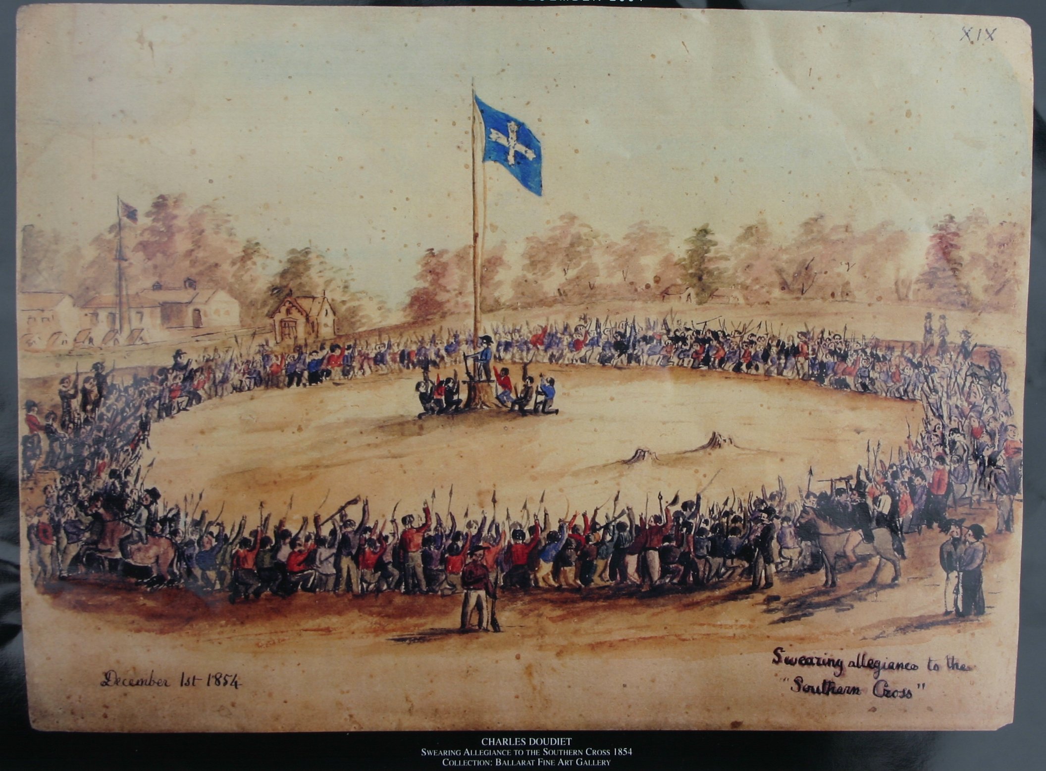
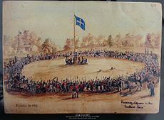 Swearing Allegiance to the Southern Cross at the Eureka Stockade on 1 December 1854 – watercolour by Charles Doudiet
Immigrants arrived from all over the world to search for gold, especially from Ireland and China. Many Chinese miners worked in Victoria, and their legacy is particularly strong in Bendigo and its environs. Although there was some racism directed at them, there was not the level of anti-Chinese violence that was seen at the Lambing Flat riots in New South Wales. However, there was a riot at Buckland Valley near Bright in 1857. Conditions on the gold fields were cramped and unsanitary; an outbreak of typhoid at Buckland Valley in 1854 killed over 1,000 miners.
In 1854 at Ballarat there was an armed rebellion against the government of Victoria by miners protesting against mining taxes (the "Eureka Stockade"). This was crushed by British troops, but the discontents prompted colonial authorities to reform the administration (particularly reducing the hated mining licence fees) and extend the franchise. Within a short time, the Imperial Parliament granted Victoria responsible government with the passage of the Colony of Victoria Act 1855. Some of the leaders of the Eureka rebellion went on to became members of the Victorian Parliament.
The first foreign military action by the colony of Victoria was to send troops and a warship to New Zealand as part of the Māori Wars. Troops from New South Wales had previously participated in the Crimean War.
In 1901 Victoria became a state in the Commonwealth of Australia. As a result of the gold rush, Melbourne had by then become the financial centre of Australia and New Zealand. Between 1901 and 1927, Melbourne was the capital of Australia while Canberra was under construction. It was also the largest city in Australia at the time.[citation needed]
On Saturday 7 February 2009 ("Black Saturday"), the state was affected by the 2009 Victorian bushfires, resulting in 173 deaths.[19][20]
Government
Main article: Government of Victoria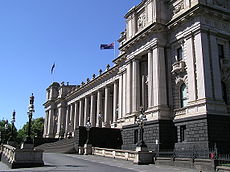
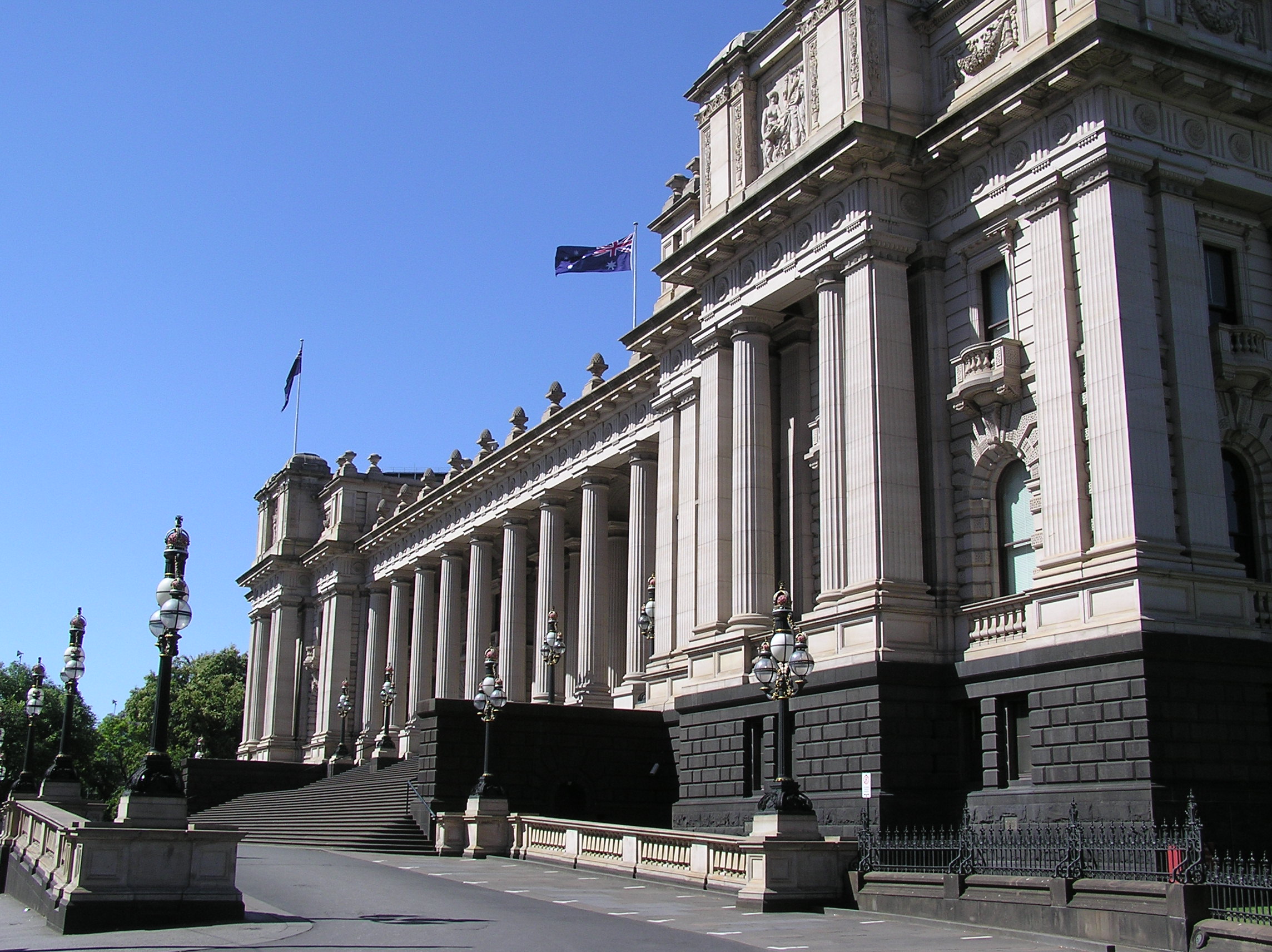
 The Legislative Council Chamber, as photographed in 1878
 One of many local government seats, Geelong Town Hall
Composition of the Parliament of Victoria Political
PartyLegislative
AssemblyLegislative
CouncilALP 43 16 Liberal 35 18 National 10 3 Greens 0 3 Source: Victorian Electoral Commission Parliament
Main articles: Parliament of Victoria, Victorian Legislative Assembly, and Victorian Legislative CouncilVictoria has a parliamentary form of government based on the Westminster System. Legislative power resides in the Parliament consisting of the Governor (the representative of the Queen), the executive (the Government), and two legislative chambers. The Parliament of Victoria consists of the lower house Legislative Assembly, the upper house Legislative Council and the Queen of Australia.
Eighty-eight members of the Legislative Assembly are elected to four-year terms from single-member electorates.
In November 2006, the Victorian Legislative Council elections were held under a new multi-proportional representation system. The State of Victoria was divided into eight electorates with each electorate represented by five representatives elected by Single Transferable Vote proportional representation. The total number of upper house members was reduced from 44 to 40 and their term of office is now the same as the lower house members—four years. Elections for the Victorian Parliament are now fixed and occur in November every four years. Prior to the 2006 election, the Legislative Council consisted of 44 members elected to eight-year terms from 22 two-member electorates.
Premier and cabinet
The Premier of Victoria is the leader of the political party or coalition with the most seats in the Legislative Assembly. The Premier is the public face of government and, with cabinet, sets the legislative and political agenda. Cabinet consists of representatives elected to either house of parliament. It is responsible for managing areas of government that are not exclusively the Commonwealth's, by the Australian Constitution, such as education, health and law enforcement. The current Premier of Victoria is Ted Baillieu.
Governor
Main article: Governors of VictoriaExecutive authority is vested in the Governor of Victoria who represents and is appointed by Queen Elizabeth II. The post is usually filled by a retired prominent Victorian. The governor acts on the advice of the premier and cabinet. The current Governor of Victoria is Alex Chernov.
Constitution
Victoria has a written constitution. Enacted in 1975, but based on the 1855 colonial constitution[dead link], it establishes the parliament as the state's law-making body for matters coming under state responsibility. The Victorian Constitution can be amended by the parliament of Victoria. Under new provisions to be enacted, changes to the Victorian Constitution will be subjected to a plebiscite of votes, voting in a referendum.
Politics
Main article: Politics of VictoriaPremier Ted Baillieu leads a Liberal/National Coalition that won the November 2010 Victorian state election.
The centre-left Australian Labor Party (ALP), the centre-right Liberal Party of Australia and the rural-based National Party of Australia are Victoria's major political parties. Traditionally, Labor is strongest in Melbourne's inner, working class and western and northern suburbs, Morwell, Ballarat, Bendigo and Geelong. The Liberals' main support lies in Melbourne's more affluent eastern and outer suburbs, and some rural and regional centres. The Nationals are strongest in Victoria's North Western and Eastern rural regional areas.
Federal government
Victorian voters elect 49 representatives to the Parliament of Australia, including 37 members of the House of Representatives and 12 members of the Senate. Since 2010, the ALP has held 22 Victorian house seats, the Liberals 12, the Nationals two and the Greens one. As of 1 July 2008, the Liberals have held six senate seats, the ALP five and the Family First Party one.
Local government
Main article: Local Government Areas of VictoriaVictoria is incorporated into 79 municipalities for the purposes of local government, including 39 shires, 32 cities, seven rural cities and one borough. Shire and city councils are responsible for functions delegated by the Victorian parliament, such as city planning, road infrastructure and waste management. Council revenue comes mostly from property taxes and government grants.
Source: Victorian Parliamentary Library, Department of Victorian Communities, Australian Electoral Commission Demographics
See also: Demographics of Australia Melbourne, the state capital, is home to more than seven in ten Victorians.
The 2006 Australian census reported that Victoria had 4,932,422 people resident at the time of the census, an increase of 6.2% on the 1996 figure. The Australian Bureau of Statistics estimates that in June 2010 the state's population reached 5,547,500, an increase of 1.8% from the previous year and may well reach 7.2 million by 2050.
Victoria's founding Anglo-Celtic population has been supplemented by successive waves of migrants from southern and eastern Europe, Southeast Asia and, most recently, the Horn of Africa and the Middle East. Victoria's population is ageing in proportion with the average of the remainder of the Australian population.
About 72% of Victorians are Australian-born. This figure falls to around 66% in Melbourne but rises to higher than 95% in some rural areas in the north west of the state. Around two-thirds of Victorians claim Australian, Scottish, English or Irish ancestry. Less than 1% of Victorians identify themselves as Aboriginal. The largest groups of people born outside Australia came from the British Isles, China, Italy, Vietnam, Greece and New Zealand.
More than 70% of Victorians live in Melbourne, located in the state's south. The greater Melbourne metropolitan area is home to an estimated 3.9 million people.[21] Leading urban centres include Geelong, Ballarat, Bendigo, Shepparton, Mildura, Warrnambool, Wodonga and the Latrobe Valley.
Population growth
estimates for Victoria2007 5,087,000 2011 5,500,000 2016 6,000,000 2021 6,400,000 2026 6,800,000 2031 7,300,000 Source: Dept of Planning and
Community DevelopmentVictoria is Australia's most urbanised state: nearly 90% of residents living in cities and towns. State Government efforts to decentralise population have included an official campaign run since 2003 to encourage Victorians to settle in regional areas,[22] however Melbourne continues to rapidly outpace these areas in terms of population growth.[23]
Age structure and fertility
The government predicts that nearly a quarter of Victorians will be aged over 60 by 2021. The 2006 census reveals that Australian average age has crept upward from 35 to 37 since 2001, which reflects the population growth peak of 1969–72.[citation needed] In 2007, Victoria recorded a TFR of 1.87, the highest after 1978. [24]
Crime
The state of Victoria is divided into four geographical regions; North-West Metropolitan Region, Southern Metropolitan Region, Eastern Region, Western Region. In 2010-2011 there were 152 homicides within the state of Victoria.[25]
Religion
About 60.5% of Victorians describe themselves as Christian. Roman Catholics form the single largest religious group in the state with 27.5% of Victorian population, followed by Anglicans and members of the Uniting Church. Catholics and Protestants (including Anglicans) in Victoria each form around 30% of the population. Buddhism, the state's largest non-Christian religion, is also the fastest growing with 132,634. Victoria is also home of 109,370 Muslims and 41,105 Jews. Around 20% of Victorians claim no religion, and even amongst those who declare a religious affiliation, church attendance is low.[26]
In 2008, the levels of couples choosing to marry in a church had dropped to 36%; the other 64% chose to register their marriage with a civil celebrant.[27]
Education
Main article: Education in VictoriaPrimary and secondary
Victoria's state school system dates back to 1872, when the colonial government legislated to make schooling both free and compulsory. The state's public secondary school system began in 1905. Before then, only private secondary schooling was available. Today, a Victorian school education consists of seven years of primary schooling (including one preparatory year) and six years of secondary schooling.
The final years of secondary school are optional for children aged over 17. Victorian children generally begin school at age five or six. On completing secondary school, students earn the Victorian Certificate of Education. Students who successfully complete their secondary education also receive a tertiary entrance ranking, or ATAR score, to determine university admittance.
Victorian schools are either publicly or privately funded. Public schools, also known as state or government schools, are funded and run directly by the Victoria Department of Education [2]. Students do not pay tuition fees, but some extra costs are levied. Private fee-paying schools include parish schools run by the Roman Catholic Church and independent schools similar to English public schools. Independent schools are usually affiliated with Protestant churches. Victoria also has several private Jewish and Islamic primary and secondary schools. Private schools also receive some public funding. All schools must comply with government-set curriculum standards. In addition, Victoria has four government selective schools, Melbourne High School for boys, MacRobertson Girls' High School for girls, the coeducational schools John Monash Science School, Nossal High School and Suzanne Cory High School, and The Victorian College of the Arts Secondary School. Students at these schools are exclusively admitted on the basis of a selective entry test.
As of August 2010, Victoria had 1,548 public schools, 489 Catholic schools and 214 independent schools. Just under 540,800 students were enrolled in public schools, and just over 311,800 in private schools. Over 61 per cent of private students attend Catholic schools. More than 462,000 students were enrolled in primary schools and more than 390,000 in secondary schools. Retention rates for the final two years of secondary school were 77 per cent for public school students and 90 per cent for private school students. Victoria has about 63,519 full-time teachers.[28]
Tertiary education
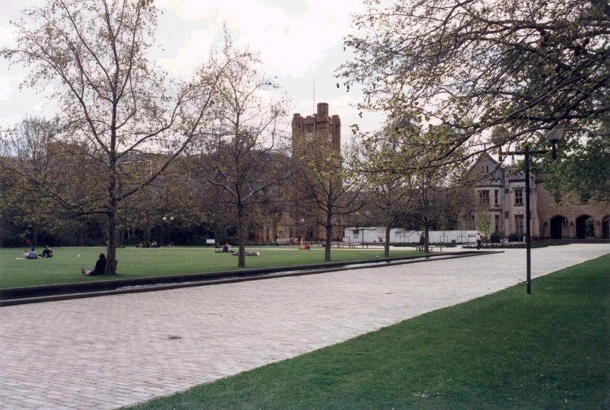
 The University of Melbourne is Victoria's oldest university.
Victoria has nine universities. The first to offer degrees, the University of Melbourne, enrolled its first student in 1855. The largest, Monash University, has an enrolment of nearly 56,000 students—more than any other Australian university. Both the University of Melbourne and Monash University are purportedly ranked highly among the world's best universities requiring a fairly high entry score, passing of mature age entrance exams or direct payment for student admission into their courses.
The number of students enrolled in Victorian universities was 241,755 at 2004, an increase of 2% on the previous year. International students made up 30% of enrolments and account for the highest percentage of pre-paid university tuition fees. The largest number of enrolments were recorded in the fields of business, administration and economics, with nearly a third of all students, followed by arts, humanities, and social science, with 20% of enrolments.
Victoria has 18 government-run institutions of “technical and further education” (TAFE). The first vocational institution in the state was the Melbourne Mechanics' Institute (established in 1839), which is now the Melbourne Athenaeum. More than 1,000 adult education organisations are registered to provide recognised TAFE programs. In 2004, there were about 480,700 students enrolled in vocational education programs in the state.
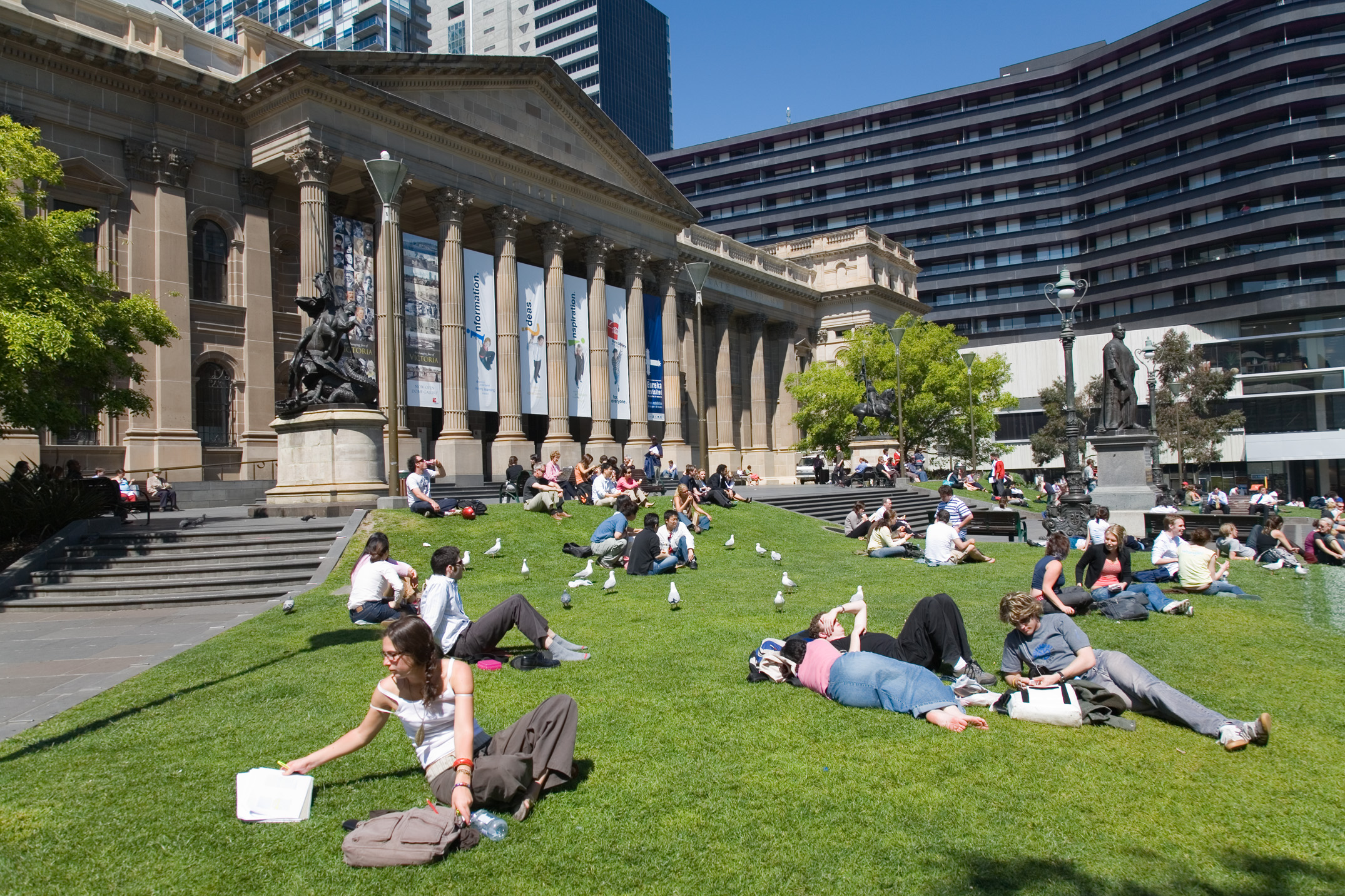
Source: Australian Bureau of Statistics, Department of Education and Training (Victoria), Department of Education, Science and Training (Commonwealth), National Centre for Vocational Education Research  The State Library of Victoria forecourt
Libraries
The State Library of Victoria is the State's research and reference library. It is responsible for collecting and preserving Victoria's documentary heritage and making it available through a range of services and programs. Material in the collection includes books, newspapers, magazines, journals, manuscripts, maps, pictures, objects, sound and video recordings and databases.
In addition, local governments maintain local lending libraries, typically with multiple branches in their respective municipal areas.
Economy
See also: Australian economyVictorian production and
workers by economic activitiesEconomic
sectorGSP
producedNumber of
workersPercentage
of workersFinance, insurance
and property30.5% 319,109 15.3% Community, social
and personal services16.6% 562,783 27.4% Manufacturing 15.4% 318,218 15.3% Wholesale and
retail trade12.1% 423,328 20.3% Transport, utilities
and communications10.6% 133,752 6.4% Construction 6.2% 136,454 6.6% Government 4% 62,253 3% Agriculture 3.3% 72,639 3.5% Mining 1.3% 4,472 0.2% Other – 49,208 2% Source: Australian Bureau of Statistics. Figures are for 2004–2005 The state of Victoria is the second largest economy in Australia after New South Wales, accounting for a quarter of the nation's gross domestic product. The total gross state product (GSP) at current prices for Victoria was at just over A$293 billion, with a GSP per capita of A$52,872. The economy grew by 2.0 per cent in 2010, less than the Australian average of 2.3 per cent.
Finance, insurance and property services form Victoria's largest income producing sector, while the community, social and personal services sector is the state's biggest employer. Despite the shift towards service industries, the troubled manufacturing sector remains Victoria's single largest employer and income producer. As a result of job losses in declining sectors such as manufacturing, Victoria has the highest unemployment rate in Australia as of September 2009.[29]
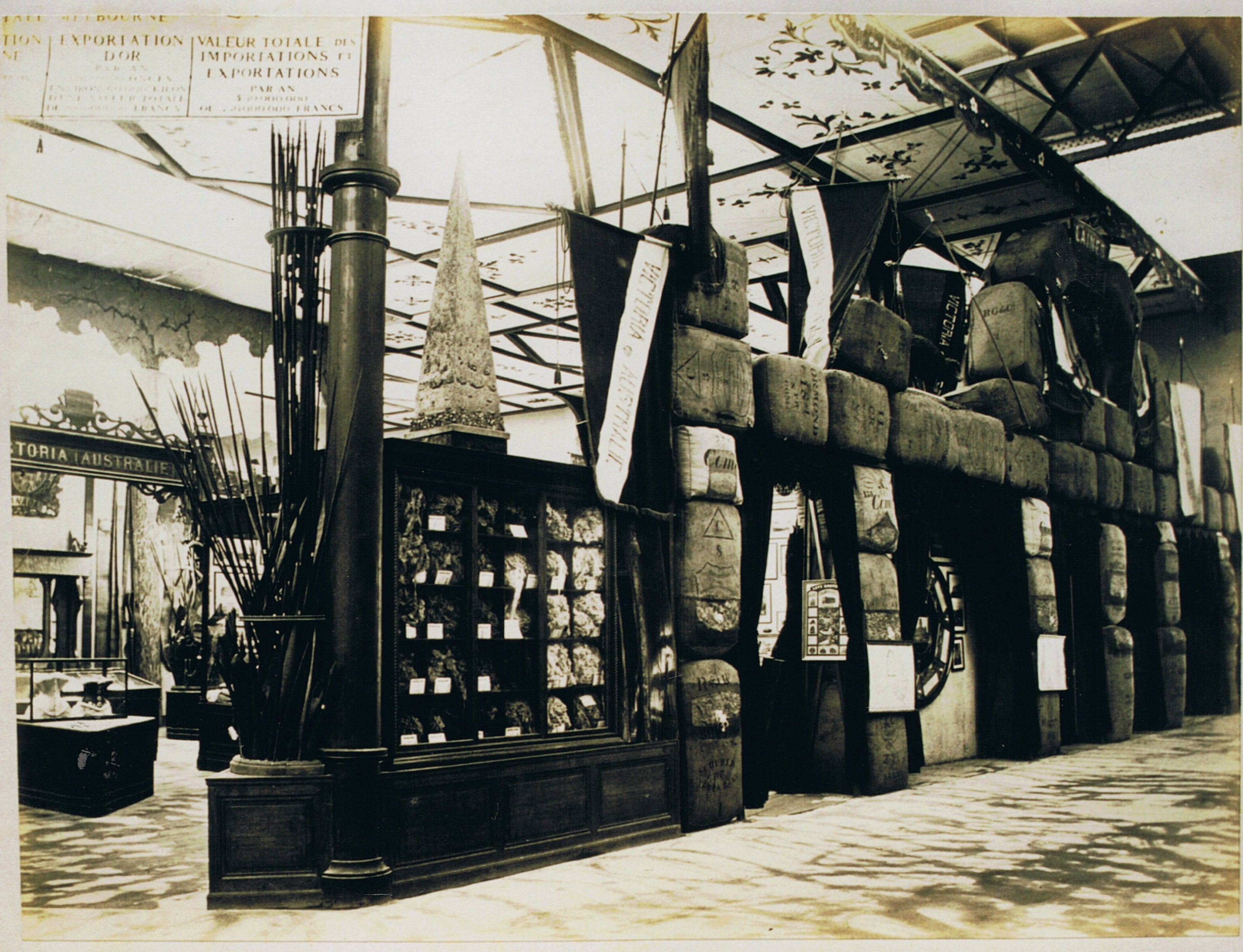
Agriculture
 Victoria's stand at the Paris Exhibition Universal of 1867, showing bales of wool
During 2003–04, the gross value of Victorian agricultural production increased by 17% to $8.7 billion. This represented 24% of national agricultural production total gross value. As of 2004, an estimated 32,463 farms occupied around 136,000 square kilometres (52,500 sq mi) of Victorian land. This comprises more than 60% of the state's total land surface. Victorian farms range from small horticultural outfits to large-scale livestock and grain productions. A quarter of farmland is used to grow consumable crops.
More than 26,000 square kilometres (10,000 sq mi) of Victorian farmland are sown for grain, mostly in the state's west. More than 50% of this area is sown for wheat, 33% for barley and 7% for oats. A further 6,000 square kilometres (2,300 sq mi) is sown for hay. In 2003–04, Victorian farmers produced more than 3 million tonnes of wheat and 2 million tonnes of barley. Victorian farms produce nearly 90% of Australian pears and third of apples. It is also a leader in stone fruit production. The main vegetable crops include asparagus, broccoli, carrots, potatoes and tomatoes. Last year, 121,200 tonnes of pears and 270,000 tonnes of tomatoes were produced.
More than 14 million sheep and 5 million lambs graze over 10% of Victorian farms, mostly in the state's north and west. In 2004, nearly 10 million lambs and sheep were slaughtered for local consumption and export. Victoria also exports live sheep to the Middle East for meat and to the rest of the world for breeding. More than 108,000 tonnes of wool clip was also produced—one-fifth of the Australian total.
Victoria is the centre of dairy farming in Australia. It is home to 60% of Australia's 3 million dairy cattle and produces nearly two-thirds of the nation's milk, almost 6.4 million litres. The state also has 2.4 million beef cattle, with more than 2.2 million cattle and calves slaughtered each year. In 2003–04, Victorian commercial fishing crews and aquaculture industry produced 11,634 tonnes of seafood valued at nearly A$109 million. Blacklipped abalone is the mainstay of the catch, bringing in A$46 million, followed by southern rock lobster worth A$13.7 million. Most abalone and rock lobster is exported to Asia.
Manufacturing
Machinery and equipment manufacturing is the state's most valuable manufacturing activity, followed by food and beverage manufacturing and petroleum, coal and chemical manufacturing. More than 15% Victorian workers are employed in manufacturing industries. Victoria has 318,000 manufacturing workers. The state is marginally behind New South Wales in the value of manufacturing output.
Major industrial plants belong to the car manufacturers Ford, Toyota and Holden; Alcoa's Portland and Point Henry aluminium smelters; oil refineries at Geelong and Altona; and a major petrochemical facility at Laverton.
Victoria also plays an important role in providing goods for the defence industry. Melbourne is the centre of manufacturing in Victoria, followed by Geelong. Energy production has aided industrial growth in the Latrobe Valley.
Mining
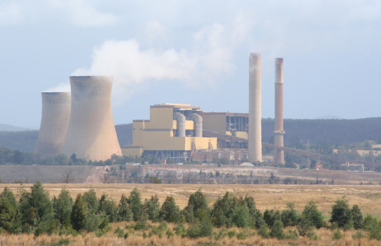
 Yallourn Power Station in the Latrobe ValleySee also: Energy in Victoria
Mining in Victoria contributes around A$3 billion to the gross state product (~1%) but employs less than 1% of workers. The Victorian mining industry is concentrated on energy producing minerals, with brown coal, petroleum and gas accounting for nearly 90% of local production. The oil and gas industries are centred off the coast of Gippsland in the state's east, while brown coal mining and power generation is based in the Latrobe Valley.
In the 2005/2006 fiscal year, the average gas production was over 700 million cubic feet (20,000,000 m3) per day (M cuft/d) and represented 18% of the total national gas sales, with demand growing at 2% per year.[30]
In 1985, oil production from the offshore Gippsland Basin peaked to an annual average of 450,000 barrels (72,000 m3) per day. In 2005–2006, the average daily oil production declined to 83,000 bbl (13,200 m3)/d, but despite the decline Victoria still produces almost 19.5% of crude oil in Australia.[31]
Brown coal is Victoria's leading mineral, with 66 million tonnes mined each year for electricity generation in the Latrobe Valley, Gippsland.[32] The region is home to the world's largest known reserves of brown coal.
Despite being the historic centre of Australia's gold rush, Victoria today contributes a mere 1% of national gold production. Victoria also produces limited amounts of gypsum and kaolin.
Service industry
The service industries sector is the fastest growing component of the Victorian economy. It includes the wide range of activities generally classified as community, social and personal services; finances, insurance and property services, government services, transportation and communication, and wholesale and retail trade. Most service industries are located in Melbourne and the state's larger regional centres.
As of 2004–05, service industries employed nearly three-quarters of Victorian workers and generated three-quarters of the state's GSP. Finance, insurance and property services, as a group, provide a larger share of GSP than any other economic activity in Victoria. More than a quarter of Victorian workers are employed by the community, social and personal services sector.[33]
Geology and geography
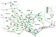 Victorian cities, towns, settlements and road networkMain articles: Geology of Victoria and Geography of Victoria
Victoria's northern border is the southern bank of the Murray River. It also rests at the southern end of the Great Dividing Range, which stretches along the east coast and terminates west of Ballarat. It is bordered by South Australia to the west and shares Australian's shortest land border with Tasmania. The official border between Victoria and Tasmania is at 39°12' S, which passes through Boundary Islet in the Bass Strait for 85 metres.[34][35] Victoria contains many topographically, geologically and climatically diverse areas, ranging from the wet, temperate climate of Gippsland in the southeast to the snow-covered Victorian alpine areas which rise to almost 2,000 metres (6,500 ft), with Mount Bogong the highest peak at 1,986 m; (6,516 ft). There are extensive semi-arid plains to the west and northwest.
There is an extensive series of river systems in Victoria. Most notable is the Murray River system. Other rivers include: Ovens River, Goulburn River, Patterson River, King River, Campaspe River, Loddon River, Wimmera River, Elgin River, Barwon River, Thomson River, Snowy River, Latrobe River, Yarra River, Maribyrnong River, Mitta River, Hopkins River, Merri River and Kiewa River.
The state symbols include the Pink Heath (state flower), Leadbeater's Possum (state animal) and the Helmeted Honeyeater (state bird).
The state's capital, Melbourne, contains approximately 70% of the state's population and dominates its economy, media, and culture. For other cities and towns, see List of localities (Victoria) and Local Government Areas of Victoria.
Transport
See also: Transport in Melbourne and Rail transport in VictoriaVictoria has the highest population density in any state in Australia, with population centres spread out over most of the state; only the far northwest and the Victorian Alps lack permanent settlement.
The Victorian road network services the population centres, with highways generally radiating from Melbourne and other major cities and rural centres with secondary roads interconnecting the highways to each other. Many of the highways are built to freeway standard ("M" freeways), while most are generally sealed and of reasonable quality.
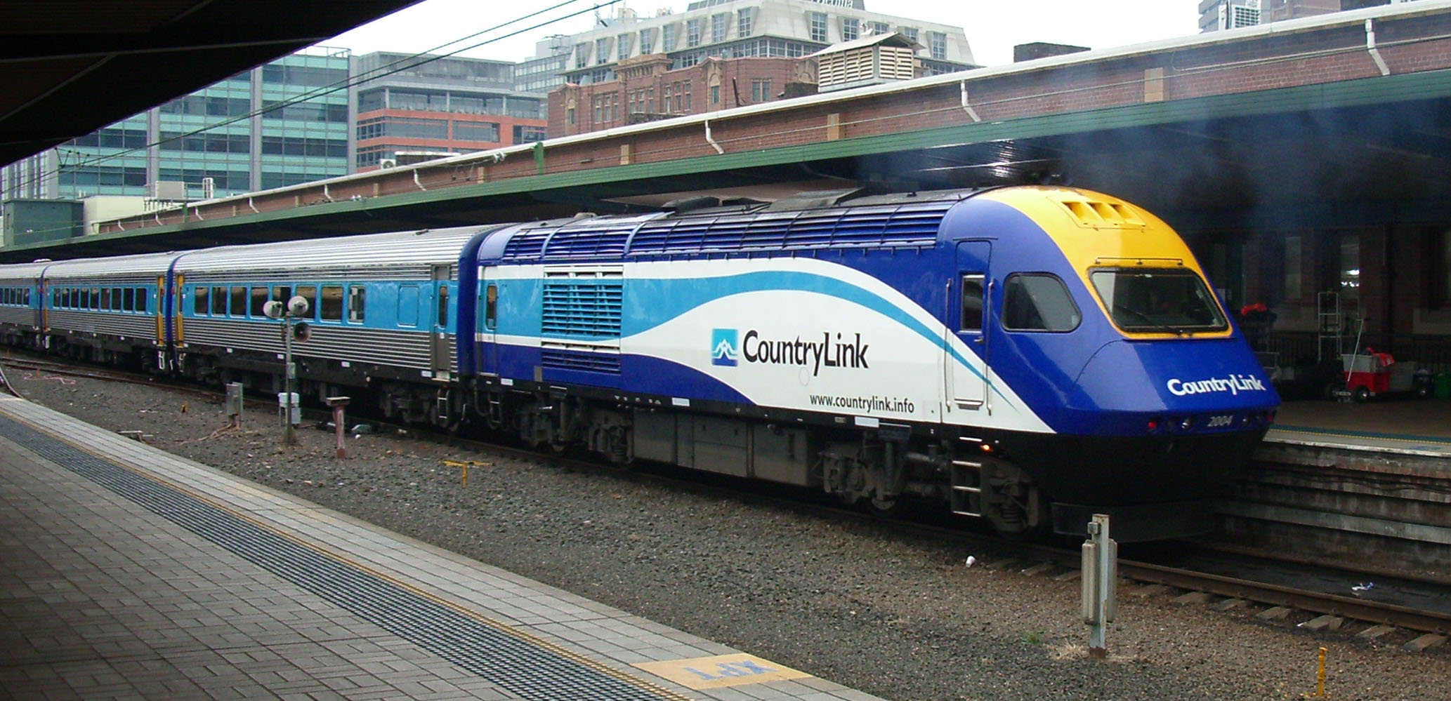
Rail transport in Victoria is provided by several private and public railway operators who operate over government-owned lines. Major operators include: Metro Trains Melbourne which runs an extensive, electrified, passenger system throughout Melbourne and suburbs; V/Line which is now owned by the Victorian Government, operates a concentrated service to major regional centres, as well as long distance services on other lines; Pacific National, CFCLA, El Zorro which operate freight services; Great Southern Railway which operates The Overland Melbourne—Adelaide; and CountryLink which operates XPTs Melbourne—Sydney.
There are also several smaller freight operators and numerous tourist railways operating over lines which were once parts of a state-owned system. Victorian lines mainly use the 5 ft 3 in (1,600 mm) broad gauge. However, the interstate trunk routes, as well as a number of branch lines in the west of the state have been converted to 4 ft 8 1⁄2 in (1,435 mm) standard gauge. Two tourist railways operate over 2 ft 6 in (762 mm) narrow gauge lines, which are the remnants of five formerly government-owned lines which were built in mountainous areas.
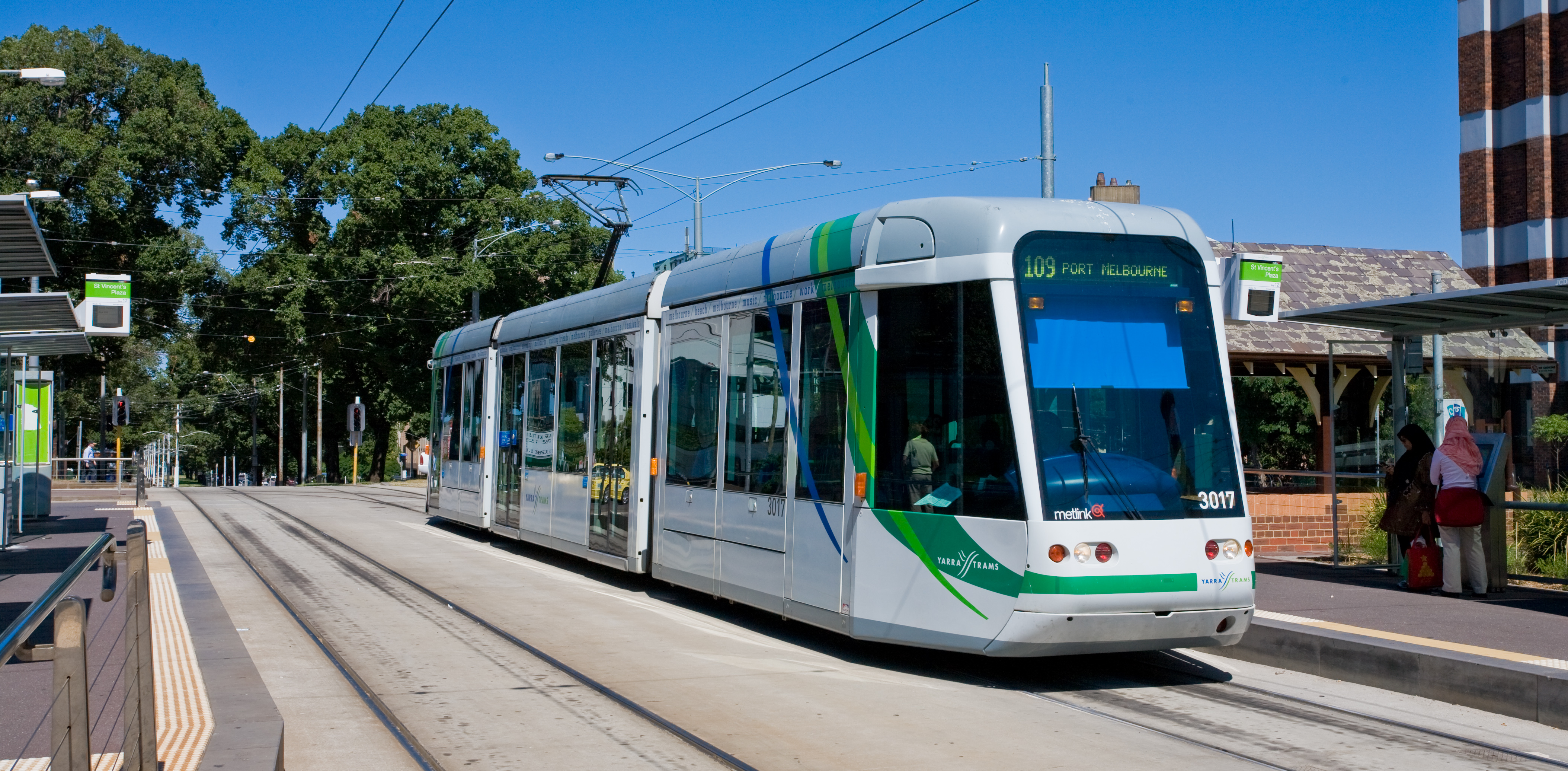
Melbourne has the world's largest tram network,[36] currently operated by Yarra Trams. As well as being a popular form of public transport, over the last few decades trams have become one of Melbourne's major tourist attractions. There are also tourist trams operating over portions of the former Ballarat and Bendigo systems. There are also tramway museums at Bylands and Haddon.
Melbourne Airport is the major domestic and international gateway for the state. Avalon Airport is the state's second busiest airport, which is complements Essendon and Moorabbin Airports to see the remainder of Melbourne's air traffic. Hamilton Airport, Mildura Airport, Mount Hotham and Portland Airport are the remaining airports with scheduled domestic flights. There are no fewer than 27 other airports in the state with no scheduled flights.
The Port of Melbourne is the largest port for containerised and general cargo in Australia,[37] and is located in Melbourne on the mouth of the Yarra River, which is at the head of Port Phillip. Additional seaports are at Westernport, Geelong, and Portland.
 CountryLink is an interstate train and coach service provider which provides twice-daily services from Melbourne to Sydney.
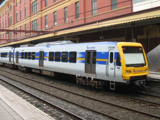
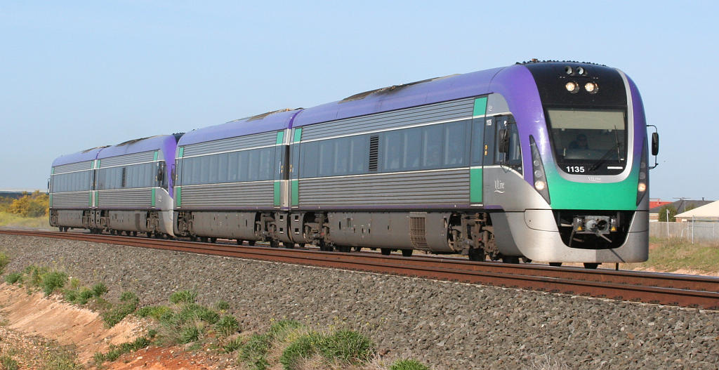
 An 'X'Trapolis' in livery of former commuter-service provider Connex, now succeeded by Metro Trains Melbourne
 V/Line is a government-owned train and coach service provider in Victoria. The enterprise provides inter-city services to a number of regional cities in the state.
Utilities
Energy
Victoria's major utilities include a collection of brown-coal-fired power stations, particularly in the Latrobe Valley. One of these is Hazelwood Power Station, which is number 1 in the worldwide List of least carbon efficient power stations.
Water
Victoria's water infrastructure includes a series of dams and reservoirs, predominantly in Central Victoria, that hold and collect water for much of the state. The water collected is of a very high quality and requires little chlorination treatment, giving the water a taste more like water collected in a rainwater tank. In regional areas however, such as in the west of the state, chlorination levels are much higher.
The Victorian Water Grid consists of a number of new connections and pipelines being built across the State. This allows water to be moved around Victoria to where it is needed most and reduces the impact of localised droughts in an era thought to be influenced by climate change. Major projects already completed as part of the Grid include the Wimmera Mallee Pipeline and the Goldfields Superpipe.[38]
Climate
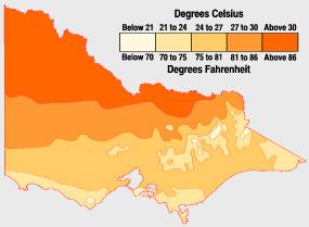
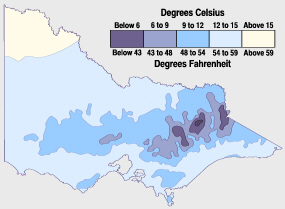
Average monthly maximum
temperature in VictoriaMonth Melbourne Mildura January 25.8 °C 32.8 °C February 25.8 °C 32.7 °C March 23.8 °C 29.3 °C April 20.2 °C 24.1 °C May 16.6 °C 19.6 °C June 14.0 °C 16.0 °C July 13.4 °C 15.4 °C August 14.9 °C 17.7 °C September 17.2 °C 21.1 °C October 19.6 °C 25.0 °C November 21.8 °C 29.0 °C December 24.1 °C 31.7 °C Source: Bureau of Meteorology Victoria has a varied climate despite its small size. It ranges from semi-arid and hot in the north-west, to temperate and cool along the coast. Victoria's main land feature, the Great Dividing Range, produces a cooler, mountain climate in the centre of the state.
Victoria's southernmost position on the Australian mainland means it is cooler and wetter than other mainland states and territories. The coastal plain south of the Great Dividing Range has Victoria's mildest climate. Air from the Southern Ocean helps reduce the heat of summer and the cold of winter. Melbourne and other large cities are located in this temperate region.
The Mallee and upper Wimmera are Victoria's warmest regions with hot winds blowing from nearby deserts. Average temperatures top 30 °C (86 °F) during summer and 15 °C (59 °F) in winter. Victoria's highest maximum temperature of 48.8 °C (119.9 °F) was recorded in Hopetoun on 7 February 2009, during the 2009 southeastern Australia heat wave.[39]
The Victorian Alps in the northeast are the coldest part of Victoria. The Alps are part of the Great Dividing Range mountain system extending east-west through the centre of Victoria. Average temperatures are less than 9 °C (48 °F) in winter and below 0 °C (32 °F) in the highest parts of the ranges. The state's lowest minimum temperature of −11.7 °C (10.9 °F) was recorded at Omeo on 13 June 1965, and again at Falls Creek on 3 July 1970.[39]
Rainfall
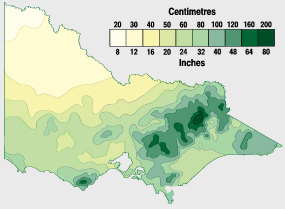
Victoria is the wettest Australian state after Tasmania. Rainfall in Victoria increases from north to south, with higher averages in areas of high altitude. Median annual rainfall exceeds 1,800 millimetres (71 in) in some parts of the northeast but is less than 250 millimetres (10 in) in the Mallee.
Rain is heaviest in the Otway Ranges and Gippsland in southern Victoria and in the mountainous northeast. Snow generally falls only in the mountains and hills in the centre of the state. Rain falls most frequently in winter, but summer precipitation is heavier. Rainfall is most reliable in Gippsland and the Western District, making them both leading farming areas. Victoria's highest recorded daily rainfall was 375 millimetres (14.7 in) at Tanybryn in the Otway Ranges on 22 March 1983.[39]
- Average temperatures and precipitation for Victoria
-

Average January temperatures:
Victoria's north is almost always hotter than coastal and mountainous areas. -

Average July temperatures:
Victoria's hills and ranges are coolest during winter. Snow also falls there. -
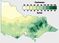
Average yearly precipitation:
Victoria's rainfall is concentrated in the mountainous north-east and coast.
Source: Bureau of Meteorology, Department of Primary Industries, Australian Natural Resources Atlas Tourism
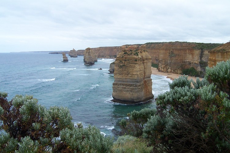
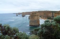 The Twelve Apostles
Some major tourist destinations in Victoria are:
- The metropolis of Melbourne, particular its inner city suburbs (known also for shopping tourism) and the attractions of the city centre such as Crown Casino, Melbourne Zoo, Melbourne Museum, the Melbourne Aquarium, ScienceWorks, Healesville Sanctuary, Werribee Open Range Zoo, tourism precincts such as Melbourne Docklands, Southbank and St Kilda as well as cultural and sporting tourist icons such as The Arts Centre, National Gallery of Victoria, the Melbourne Cricket Ground, also known as the MCG, and the Eureka Tower, tallest building in the Southern Hemisphere, with its Skydeck 88.
- Victoria has more than 2000 kilometres of coastline with hundreds of beaches.[40]
- The Goldfields region featuring the historic cities of Ballarat, Beechworth, Bendigo, Castlemaine, Maldon and Daylesford.
- Natural attractions, such as The Twelve Apostles, Wilsons Promontory, The Grampians, the Fairy Penguins (particularly at Phillip Island and St Kilda), the Buchan Caves and the Gippsland Lakes.
- The Dandenong Ranges (in particular the Puffing Billy Railway).
- Towns along the Murray River and Riverina including Echuca and Mildura including waterskiing.
- Geelong and the Australian International Airshow
- The Bellarine Peninsula which features historic resort towns such as Queenscliff.
- The Surf Coast which features famous beaches such as Bells Beach, Torquay and Lorne
- Mornington Peninsula, particularly for its wineries and secluded beaches, Arthur's Seat and the coastal attractions of Portsea and Sorrento.
- Yarra Valley (in particular Healesville Sanctuary and wineries).
- Great Ocean Road, which features The Twelve Apostles, historic towns of Port Fairy and Portland, cliffs and whale watching and resort towns such as Lorne.
- The Victorian Alpine Region, part of the Australian Alps, particularly for skiing
- The Central Victorian Highlands, 'Highcountry' are very well known for winter sports and bushwalking
- Wine regions across the entire state.
Other popular tourism activities are gliding, hang-gliding, hot air ballooning and scuba diving.
Major events also play a big part in tourism in Victoria, particularly cultural tourism and sports tourism. Most of these events are centred around Melbourne, but others occur in regional cities, such as the V8 Supercars and Australian Motorcycle Grand Prix at Phillip Island, the Grand Annual Steeplechase at Warrnambool and the Australian International Airshow at Geelong and numerous local festivals such as the popular Port Fairy Folk Festival, Queenscliff Music Festival, Bells Beach SurfClassic and the Bright Autumn Festival.
Sport
Main article: Sport in Victoria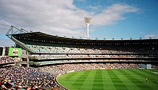
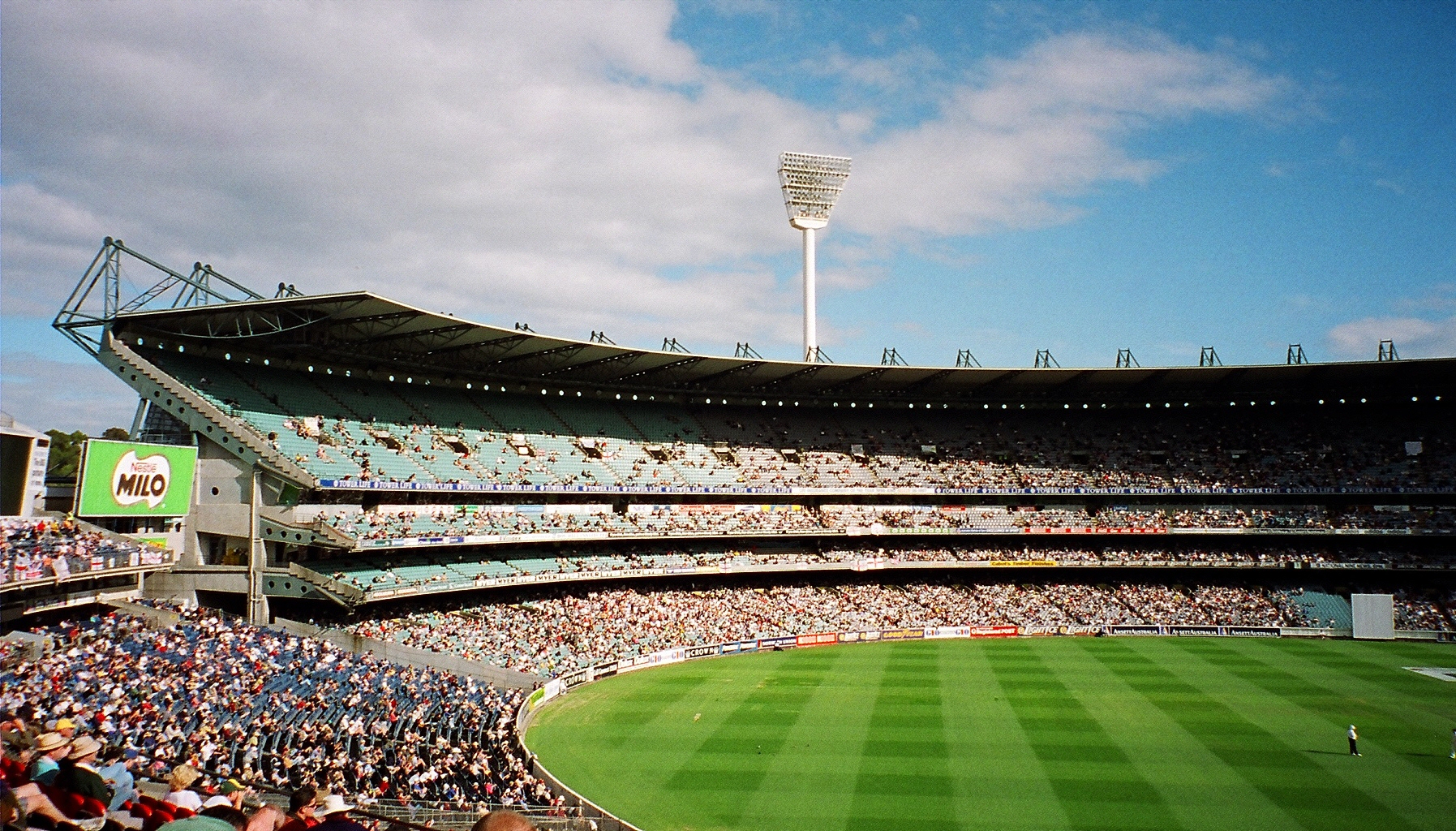
Victoria is the home of Australian rules football, with ten of the seventeen clubs of the Australian Football League based in Victoria, and the traditional Grand Final held at the Melbourne Cricket Ground usually on the last Saturday in September.
Victoria's cricket team, the Victorian Bushrangers play in the national Sheffield Shield cricket competition. Victoria is represented in the National Rugby League by the Melbourne Storm and in Super Rugby by the Melbourne Rebels. It is also represented in Football (soccer) by Melbourne Victory and Melbourne Heart in the A-League.
Melbourne has held the 1956 Summer Olympics, 2006 Commonwealth Games and the FINA World Swimming Championship.
Melbourne is also home to the Australian Open tennis tournament in January each year, the first of the world's four Grand Slam tennis tournaments, and the Australian Formula One Grand Prix.
Victoria's Bells Beach hosts one of the world's longest-running surfing competition, the Bells Beach SurfClassic, which is part of The ASP World Tour.
Netball is a big part of sport in Victoria. The Melbourne Vixens represent Victoria in the ANZ Championship. Some of the worlds best netballers such as Sharelle McMahon, Renae Hallinan, Madison Browne, Julie Corletto and Bianca Chatfield come from Victoria.
Possibly Victoria's most famous island, Phillip Island, is home of the Phillip Island Grand Prix Circuit which hosts the Australian motorcycle Grand Prix which features MotoGP (the world's premier motorcycling class), as well as the Australian round of the World Superbike Championship and the domestic V8 Supercar racing, which also visits Sandown Raceway and the rural Winton Motor Raceway circuit.
Australia's most prestigious footrace, the Stawell Gift, is an annual event.
Victoria is also home to the Aussie Millions poker tournament, the richest in the Southern hemisphere.
The Melbourne Spring Racing Carnival is one of the biggest horse racing events in the world and is one of the world's largest sporting events. The main race is for the $6 million Melbourne Cup, and crowds for the carnival exceed 700,000.
See also
- 2003 Melbourne thunderstorm
- Atlas of Victorian Birds
Geography:
- Goombala Road
- Victorian Alps
- Vicmap Topographic Map Series
Lists:
- List of highways in Victoria
- List of localities (Victoria)
- Protected areas of Victoria (Australia)
References
- ^ a b 3101.0 – Australian Demographic Statistics, June 2010, Australian Bureau of Statistics
- ^ 5220.0 – Australian National Accounts: State Accounts, 2009–10.
- ^ "Floral Emblem of Victoria". www.anbg.gov.auhi. http://www.anbg.gov.au/emblems/vic.emblem.html. Retrieved 26 March 2008.
- ^ "Victoria". Parliament@Work. http://www.parliament.curriculum.edu.au/vic.php3. Retrieved 27 February 2008.[dead link]
- ^ James Boyce (2011) 1835: The Founding of Mebourne and the Conquest of Australia, Black Inc, p.12
- ^ James Boyce (2011) 1835: The Founding of Mebourne and the Conquest of Australia, Black Inc, p.14
- ^ James Boyce, 1835: The Founding of Melbourne and the Conquest of Australia, Black Inc, 2011, pp.105–109
- ^ James Boyce, (2008) 1835: The Founding of Melbourne and the Conquest of Australia, Black Inc., p.149
- ^ James Boyce, (2008) 1835: The Founding of Melbourne and the Conquest of Australia, Black Inc., p.148
- ^ James Boyce, 1835: The Founding of Melbourne and the Conquest of Australia, Black Inc. p.186
- ^ Vivienne Rae-Ellis (1988) Black Robinson: Protector of Aborigines, University of Melbourne Press, Melbourne, p.172
- ^ Vivienne Rae-Ellis (1988) Black Robinson: Protector of Aborigines, University of Melbourne Press, Melbourne, p.178
- ^ Vivienne Rae-Ellis (1988) Black Robinson: Protector of Aborigines, University of Melbourne Press, Melbourne, p.179
- ^ James Boyce, 1835: The Founding of Melbourne and the Conquest of Australia, Black Inc, 2011, page 151 citing Richard Broome, "Victoria" in McGrath (ed.), Contested Ground: 129
- ^ James Boyce, 1835: The Founding of Melbourne and the Conquest of Australia, Black Inc, 2011, p.186
- ^ James Boyce, 1835: The Founding of Melbourne and the Conquest of Australia, Black Inc, 2011, p.177
- ^ James Boyce, 1835: The Founding of Melbourne and the Conquest of Australia, Black Inc, 2011, p.199
- ^ James Boyce, 1835: The Founding of Melbourne and the Conquest of Australia, Black Inc, 2011, p.163
- ^ Vic bushfires death toll – Vic Police[dead link]
- ^ "Victoria under siege as fires rage across state". Herald Sun (News Limited). 2009-02-07. http://www.news.com.au/heraldsun/story/0,21985,25022560-2862,00.html. Retrieved 7 February 2009.[dead link]
- ^ "3218.0 – Regional Population Growth, Australia, 2007–08". ABS website. Australian Bureau of Statistics. 23 April 2009. http://www.abs.gov.au/ausstats/abs@.nsf/Products/3218.0~2007-08~Main+Features~Victoria?OpenDocument. Retrieved 4 November 2009.
- ^ Provincial Victoria – About
- ^ Colebatch, Tim (24 April 2009). "Pressure grows as Melbourne rockets to 4 million". The Age (Australia). http://www.theage.com.au/national/pressure-grows-as-melbourne-rockets-to-4-million-20090423-agt5.html.
- ^ 3301.0 – Births, Australia, 2009
- ^ http://resources.news.com.au/files/2011/08/30/1226125/188901-hs-news-file-2011-crime-statistics.pdf
- ^ 2006 Census Community Profile Series : Victoria
- ^ Statistics report for 2008 from the Victorian Registry of Births, Deaths and Marriages
- ^ 4221.0 Schools, Australia 2010, Australian Bureau of Statistics, 17 March 2011.
- ^ Business & Finance News – Yahoo!7 Finance
- ^ Department of Primary Industries[dead link]
- ^ DEPARTMENT OF PRIMARY INDUSTRIES: Oil and Gas[dead link]
- ^ Australian Bureau of Statistics: Year Book Australia, 2004 – Profile of major commodities
- ^ Australian Bureau of Statistics, Department of Primary Industries
- ^ "Victoria Tasmania border". Archived from the original on 2 January 2006. http://web.archive.org/web/20060102184417/http://www.ga.gov.au/education/facts/dimensions/borders.htm. Retrieved 7 March 2006.
- ^ Boundary Islet on street-directory.com.au
- ^ DoI (2008). [1]. Retrieved 28 April 2008.[dead link]
- ^ "DoI media release – 'GOVERNMENT OUTLINES VISION FOR PORT OF MELBOURNE FREIGHT HUB' – 14 August 2006". http://www.legislation.vic.gov.au/domino/Web_Notes/newmedia.nsf/798c8b072d117a01ca256c8c0019bb01/1b374a6d8cae09e9ca2571cb0003c23a!OpenDocument. Retrieved 26 July 2007.
- ^ "Department of Sustainability & Environment, "Expansion of the Water Grid", http://www.ourwater.vic.gov.au/programs/water-grid, accessed 27 January 2011".
- ^ a b c "Rainfall and Temperature Records: National" (PDF). Bureau of Meteorology. http://www.bom.gov.au/climate/extreme/records/national.pdf. Retrieved 14 November 2009.
- ^ WA Today: Waves of fancy: Victoria's best beaches
Further Reading—Victorian Frontier History
- Jan Critchett, (1990), A distant field of murder: Western district frontiers, 1834-1848, Melbourne University Press (Carlton, Vic. and Portland, Or.) ISBN 052284389
- Ian D Clark (1990) Aboriginal languages and clans: An historical atlas of western and central Victoria, 1800-1900, Dept. of Geography & Environmental Science, Monash University (Melbourne), ISBN 090968541X
- Ian D Clark (1995), Scars in the landscape: A register of massacre sites in western Victoria, 1803-1859, Australian Institute of Aboriginal and Torres Strait Islander Studies (Canberra), ISBN 0855752815
- Ian D Clark (2003) ‘That’s my country belonging to me’ - Aboriginal land tenure and dispossession in nineteenth century Western Victoria, Ballarat Heritage Services, Ballarat.
External links
- State Government of Victoria website
- Official Government tourism website
- Tourism Victoria's Online Image Library
Categories:- Victoria (Australia)
- Former British colonies
- States and territories of Australia
- States and territories established in 1851


Wikimedia Foundation. 2010.