- Dandenong Ranges
-
For other uses of the name Dandenong, see Dandenong (disambiguation).
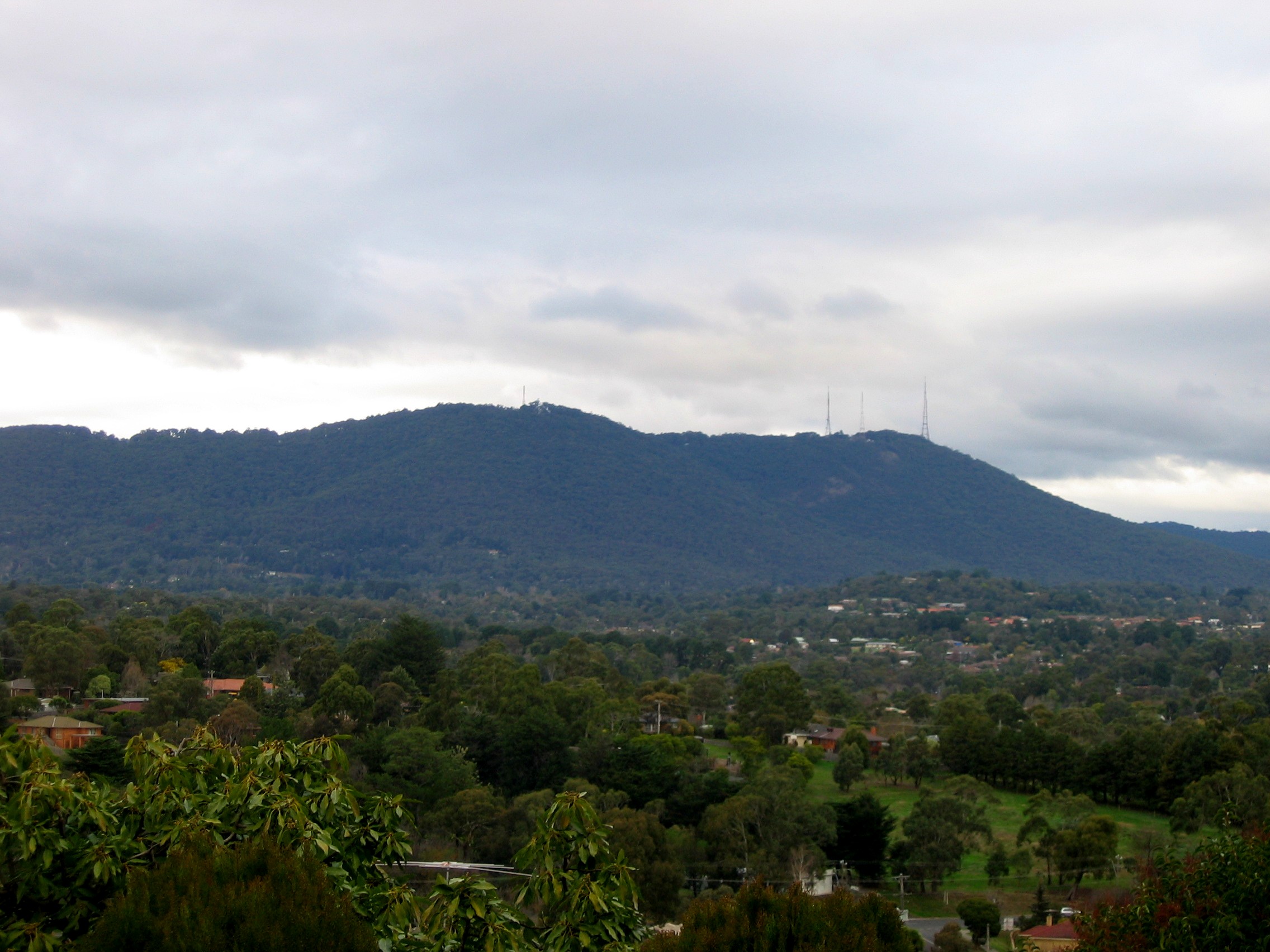
Dandenong Ranges Carhanwarrabul, The Dandenongs Mountain range 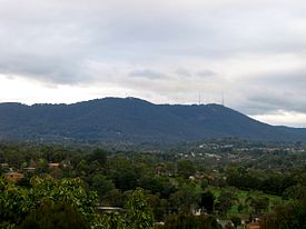 Left - Mount Dandenong (633m) and right - Mount Corhanwarrabul (628m), viewed from Mooroolbark
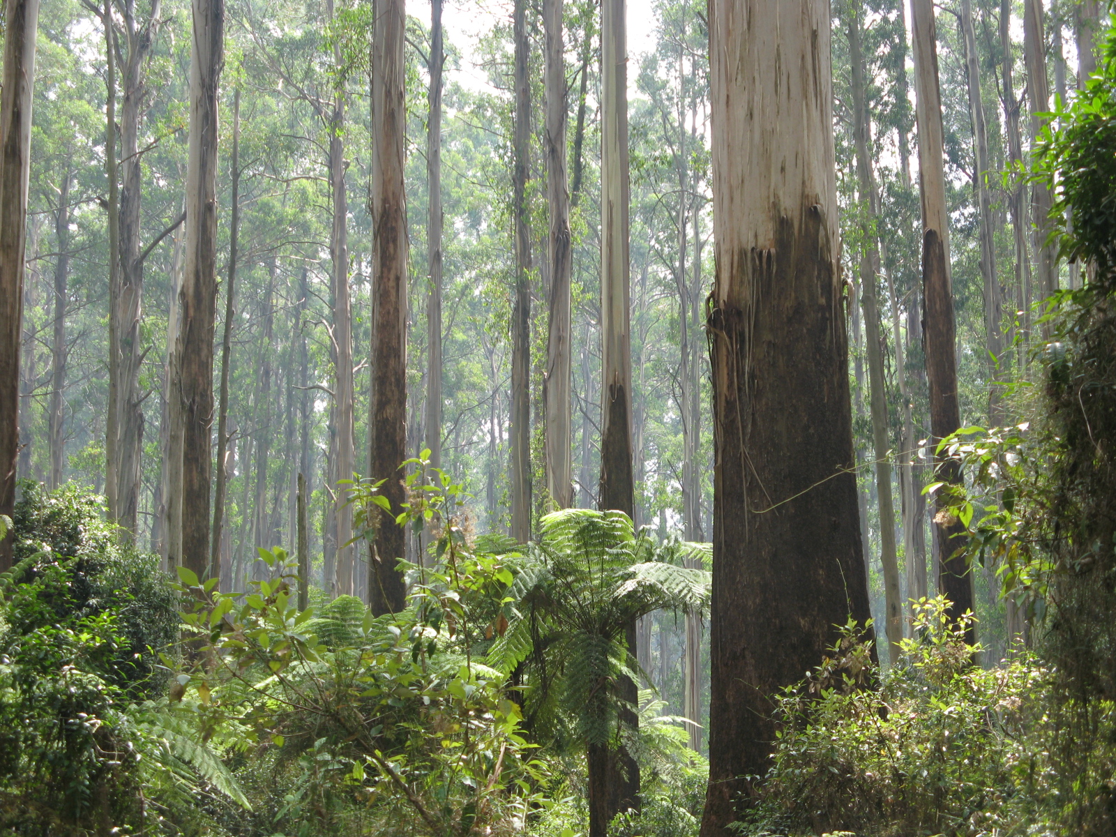
Country Australia Region Victoria Part of Great Dividing Range Highest point Mount Dandenong - elevation 633 m (2,077 ft) Geology Igneous, Sedimentary, Metamorphic Period Devonian The Dandenong Ranges (commonly just the Dandenongs) are a set of low mountain ranges, rising to 633 metres at Mount Dandenong, approximately 35 km east of Melbourne, Victoria, Australia. The ranges consists mostly of rolling hills, steeply weathered valleys and gullies covered in thick temperate rainforest, predominantly consisting of tall Mountain Ash trees and dense ferny undergrowth.
After European settlement in the region, the range was used as a main source of timber for Melbourne. The ranges were popular with day-trippers from the 1870s onwards. Much of the Dandenongs were protected by parklands as early as 1882 and by 1987 these parklands were amalgamated to form the Dandenong Ranges National Park, which was added to again in 1997. The range experiences light to moderate snow falls a few times most years, frequently between late winter and late spring.
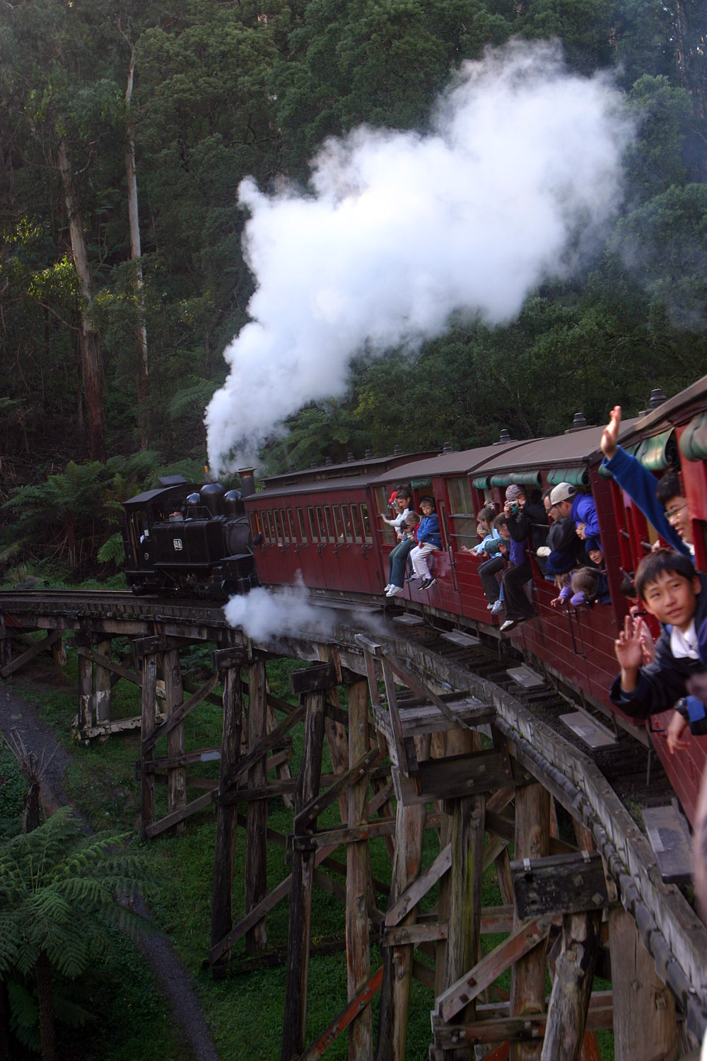
Today, the Dandenongs are home to over 100,000 residents and the area is popular amongst visitors, many of which stay for the weekend at the various Bed & Breakfasts through the region. The popular Puffing Billy Railway, a heritage steam railway, runs through the southern parts of the Dandenongs.
Contents
Etymology
 Mount Corhanwarrabul summit from the northern face of One Tree Hill
The etymology of the Dandenongs is a complicated one. Two names have been used to refer to the ranges; Corhanwarrabul and Dandenong, both derived from the Woiwurrung language of the Wurundjeri people.
It is suspected that the name Dandenong was applied to the ranges because Dandenong Creek originates there, however, the original name for Dandenong Creek was Narra Narrawong. It is not known where the name Dandenong came from nor what it means, or even its correct spelling, other variations include; Tanjenong, Tangynon and Bangeong. In any case, both names relate at least to watercourses in general, and not to mountains or ranges, as indicated by the ong ending.
So as the name Dandenong may not actually apply to anything in the immediate area, the relevance of the name Corhanwarrabul becomes apparent. Carhanwarrabul (pronounced either "corhan-warrabul" with a silent "h", or "cor-hana-warrabul") was the original name for one of the two main summits, perhaps both or perhaps the entire range. The name applied to the main summits and was in continued use up until around 1900, when the name Dandenong appeared. At any rate, Corhanwarrabul remains the most relevant name for the ranges to date.
Geography
 Olinda Forest, west of Olinda Falls
Consisting predominantly of Devonian dacite and rhyodacite, the topography consists of a series of ridges dissected by deeply-cut streams. Sheltered gullies in the south of the range are home to temperate rain forest, fern gullies and Mountain Ash forest Eucalyptus regnans, whereas the drier ridges and exposed northern slopes are covered by dry sclerophyll forest of stringybarks and box. The entire range is highly prone to bushfires, the most recent of which have been the 1983 Ash Wednesday bushfires, the 1997 Dandenong Ranges bushfires and small fires during the Black Saturday bushfires in 2009.
A number of watercourses originate in the Dandenongs, these include:
- Cardinia Creek
- Clematis Creek
- Dandenong Creek
- Emerald Creek
- Ferny Creek
- Menzies Creek
- Monbulk Creek
- Muddy Creek
- Olinda Creek
- Sassafras Creek
- Sherbrooke Creek
- Stringy Bark Creek
- Wandin Yallock Creek
- Woori Yallock Creek
Waterfalls
- Olinda Falls
- Sherbrooke Falls
Summits
 Mount Corhanwarrabul summit, 2005
- Mount Dandenong—633m
- Mount Corhanwarrabul—628m (location of transmission towers)
- Ferny Creek Summit—561m
- Spur—Tremont Hill—396m
- One Tree Hill—502m
- Spur—Chandlers Hill
- Sassafras Summit—488m
- Sherbrooke Summit—488m
- Black Hill
- Johns Hill
- Nobelius Hill
- Lewis Hill
Settlements in the Dandenong Ranges
Around 120,000 people live in and around the Dandenong Ranges, depending on the definition. The following settlements are located in the Dandenongs themselves (72,500~):
- Belgrave—8,000[dubious ]
- Belgrave Heights—1,500
- Belgrave South—1,500
- Clematis—3,800
- Emerald—6,000
- Ferntree Gully—9,000
- Ferny Creek—1,500
- Kallista—1,000
- Kalorama—1,100
- Kilsyth—10,000
- Menzies Creek—1,300
- Monbulk—2,700
- Montrose—6, 500
- Mount Dandenong—1,300
- Olinda—1,500
- Sassafras—1,000
- Selby—1,400
- Tecoma—2,200
- The Patch—800
- Upper Ferntree Gully—4,000
- Upwey—6,800
Some settlements located on and around the plateau to the east of the ranges are sometimes included (14,200~):
- Cockatoo—4,500
- Gembrook—1,600
- Macclesfield—1,600
- Seville—2,000
- Seville East—600
- Silvan—1,900
- Wandin East—500
- Wandin North—1,600
Settlements in the western foothills are also sometimes included (34,500~):
- The Basin—4,100
- Boronia—20,500
- Mount Evelyn—9,100
Human History
 The Monbulk Creek Trestle Bridge, part of the Puffing Billy Railway
The ranges are located near the boundary between the Wurundjeri and Bunurong nations territories. The two nations were part of the Kulin alliance and were most often on friendly terms. The mountain range however was not often frequented by either nations people as mountainous areas were often considered one of many resting places for various spirits.
In 1938, the aircraft Kyeema crashed on the western face of Mount Corhanwarrabul due to heavy fog and poor navigation, 18 people died.
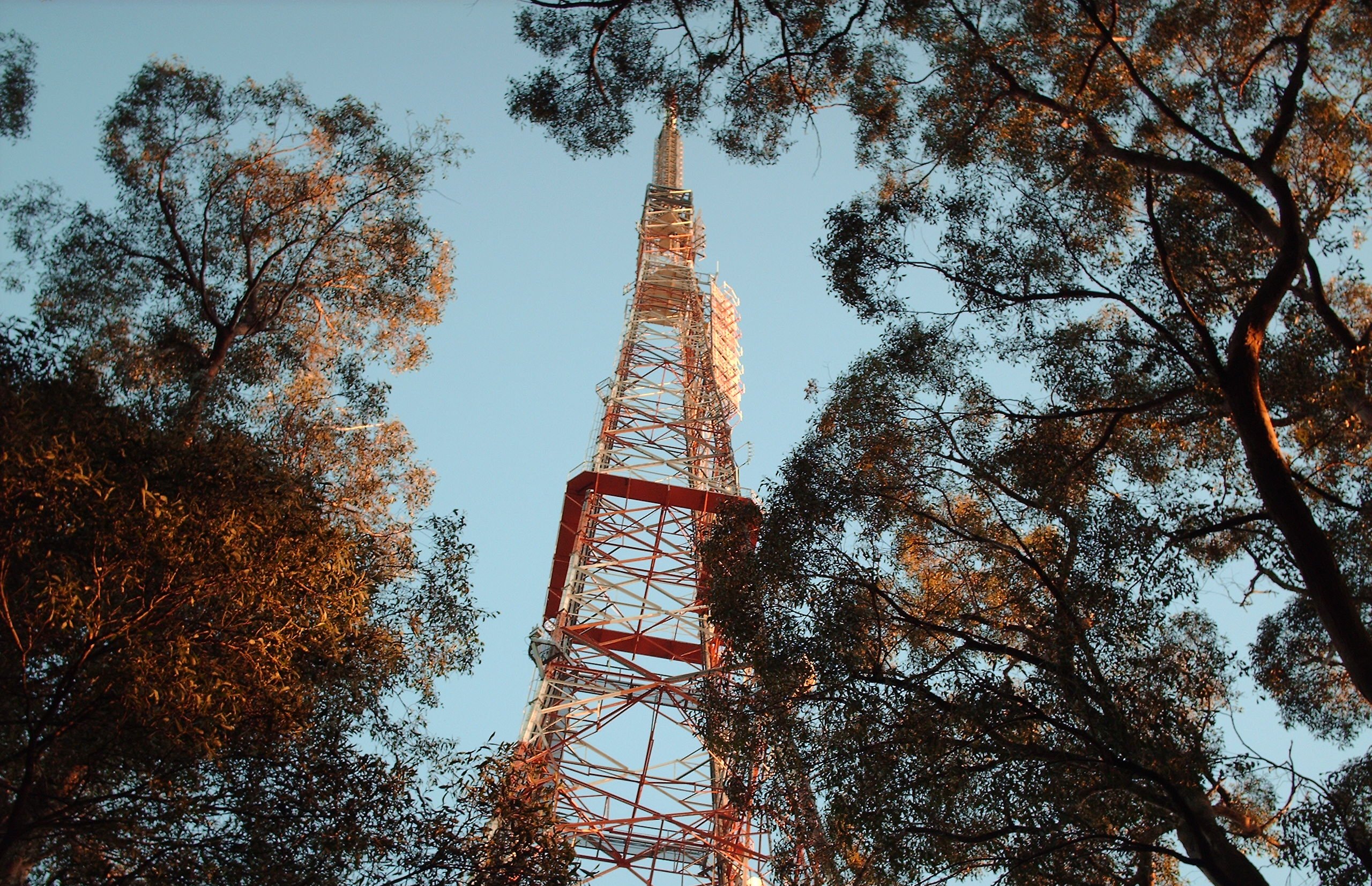
Utilities
Transmission towers
There are several large television transmission towers on various summits that were initially constructed to broadcast TV to Central Victoria
- Channel 10/Channel 0, 204m high—Mount Corhanwarrabul (628m), (highest frequency)
- Channel 9, 131m high—Mount Corhanwarrabul (628m)
- Channel 7, 131m high—Mount Corhanwarrabul (628m), this tower is from interesting design, as it is a partially guyed tower, consisting of a free-standing lattice tower as basement and a guyed mast as pinnacle.
- Channel 2—Ferny Creek Summit (561m), (lowest frequency)
Tourism and Attractions
- Scenic drives—popular for many years on the abundance of winding roads throughout the ranges
- Picnics—dedicated picnic areas can be found in Fern Tree Gully Picnic Ground or at One Tree Hill or in Sherbrooke Forest
- The various coffee shops and restaurants, bed and breakfasts, craft shops, antique shops and gardens
- Puffing Billy Railway—a narrow-gauge heritage steam railway, from Belgrave to Gembrook
- Lookouts & Views—There are several locations throughout the ranges that offer excellent views on both sides of the range. On a clear day, features as far as Mount Macedon, the You Yangs and Port Phillip can be seen simultaneously.
- Walking & Hiking—various tracks and trails are available at a variety of lengths and difficulties
- Cycling—the Dandenong Ranges are one of Melbourne's most popular cycling areas. Popular road cycling climbs include the "1 in 20" on the Mountain Highway, "The Wall", a steeper route between Monbulk and Olinda, and the also-steep "Devil's Elbow", heading north from Upper Ferntree Gully along the Mount Dandenong Tourist Road to Ferny Creek.
Regulations
Camping is not permitted within the National Park and fire restrictions may apply during the summer months. There are no rubbish bins in the national parks and visitors must leave with all items that they arrived with.
Bushfires
Due to the climate of the region, the type of vegetation and the typography, the Dandenong Ranges periodically experience bushfires. Some of the recent occurrences included:
- 1851—Black Thursday
- 1905
- 1926
- 1962
- 1968
- 1983—Ash Wednesday, 27 deaths in the Dandenong ranges
- 1997—3 deaths in the ranges
- 2009—Black Saturday, no deaths in the ranges
 The Dandenong Ranges, viewed from Heidelberg looking east over Doncaster Hill, through smoke haze after the Black Saturday bushfires
Gallery
-

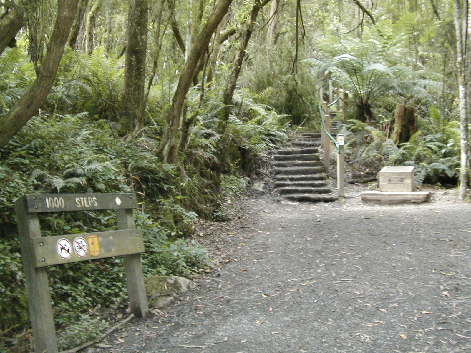
The 1000 steps
-

Puffing Billy on the Trestle Bridge
-

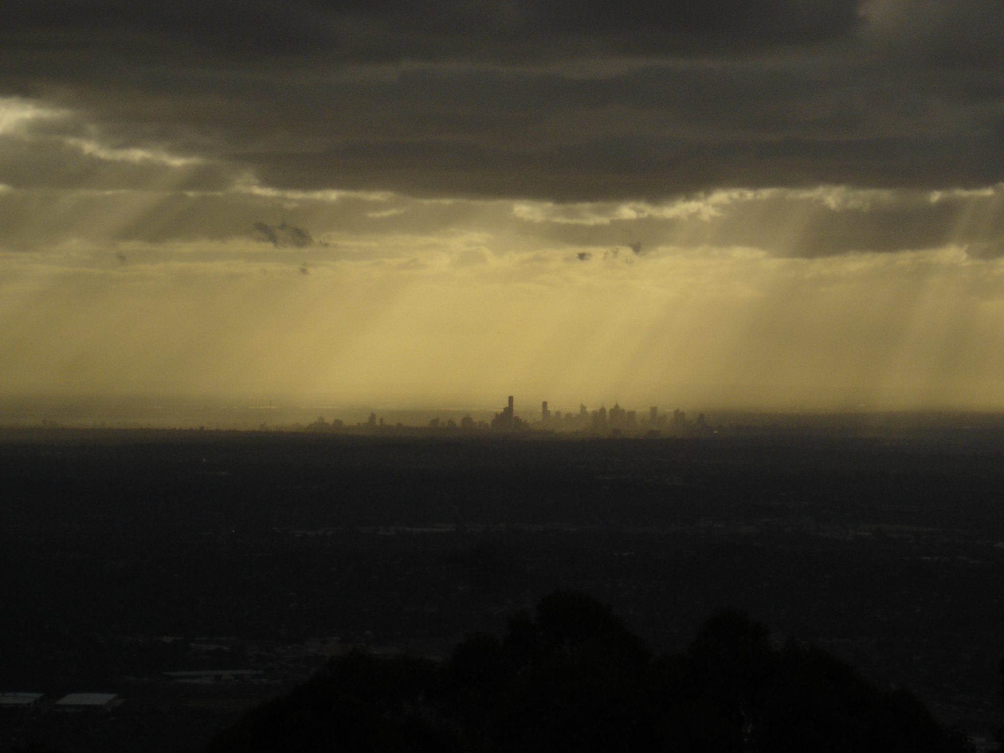
View of Melbourne from the summit of Mount Dandenong
-
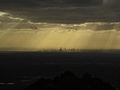
View of Melbourne from the summit of Mount Dandenong
-
Mount Dandenong as seen from Kilsyth
-

Transmission towers on the summit of Mount Corhanwarrabul
-

Transmission towers. Note that the upper parts of the tower in the background are guyed.
-

Channel 10 transmission tower
-

Channel 9 transmission tower
-

Channel 7 transmission tower
-

The Silvan Reservoir looking east from Kalorama
See also
External links
References
Categories:- Mountain ranges of Victoria (Australia)


Wikimedia Foundation. 2010.