- Port Fairy, Victoria
Infobox Australian Place | type = town
name = Port Fairy
state = vic

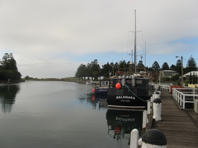
caption = Moyne river, Port Fairy
lga =Shire of Moyne
postcode = 3284
pop = 2,523
est =1843
elevation= 6
maxtemp = 18.6
mintemp = 9.5
rainfall = 770.1
stategov = South-West Coast
fedgov = Wannon
dist1 = 293
location1=Melbourne
dist2 = 75
location2= Portland
dist3 = 29
location3= WarrnamboolPort Fairy is a coastal town in western Victoria,
Australia . It is located on thePrinces Highway in theShire of Moyne convert|28|km|mi|0|lk=on west of Warrnambool and 290 km west ofMelbourne , where theMoyne River enters theSouthern Ocean .History
The area was initially inhabited by the
Knarn Kolak Aboriginal people.In the early 19th century the area was used by whalers and seal hunters. By 1835 a whaling station had been established on what is now
Griffiths Island .Bluestone cottages built by whalers and sealers of the time are still standing around the town. A general store was opened in 1839. In1843 ,James Atkinson , aSydney solicitor, purchased land in the town. He drained the swamps, subdivided and leased the land, and built a harbour on the Moyne River. He renamed the town 'Belfast ' after his hometown inNorthern Ireland . The Post Office opened onJuly 1 ,1843 Citation
last = Premier Postal History | title = Post Office List | url = https://www.premierpostal.com/cgi-bin/wsProd.sh/Viewpocd.w?access-date = 2008-04-11 ] as Port Fairy but was renamed Belfast on
January 1 ,1854 before reverting to the original nameJuly 20 ,1887 .Agriculture developed in the region, and Belfast became an important transport hub. By 1857 the town had a population of 2,190. In the mid-to-late 19th century, Belfast was one of Australia's largest ports, catering to the
whaling industry. In 1887 the town went back to the original name Port Fairy, as a result of an Act of Parliament.A railway was extended to the town in
1890 , but closed in1977 .cite journal
year = 1990
month = March
title = Tracks Across the State
author = Sid Brown
journal = Newsrail
publisher = Australian Railway Historical Society (Victorian Division)
pages = pages 71–76 ]The town
At the 2001 census, Port Fairy had a population of 2,523.Census 2001 AUS
id=UCL242600
name=Port Fairy (Urban Centre/Locality)
accessdate=2007-08-06
quick=on] Its primary industries aretourism andfishing , and it is the home port for one of Victoria's largest fishing fleets. A small pharmaceutical factory owned byGlaxoSmithKline is located on the outskirts of the town. Port Fairy contains 50 buildings protected by theNational Trust of Australia .Griffiths Island nearby holds a breeding colony of theShort-tailed Shearwater or AustralianMuttonbird .The
Port Fairy Folk Festival is held in March each year. Port Fairy also has a highly ratedgolf course .The town has an
Australian Rules football team playing in theHampden Football League .Citationlast = Full Point Footy | title = Port Fairy | url = http://www.fullpointsfooty.net/Port_Fairy.htm | accessdate = 2008-07-25 ]
ee also
References
External links
* [http://www.portfairyfolkfestival.com/ Port Fairy Folk Festival]
* [http://www.portfairy.com.au/ My PortFairy - Accommodation, Dining, Events and Activities]
* [http://www.port-fairy.com/ Port Fairy Community Pages]
* [http://www.australianplaces.com.au/drivetown/town-portfairy.html History and overview of the town today]
Wikimedia Foundation. 2010.
