- Mount Bogong
-
Mount Bogong 
Mount Bogong from near Mount BeautyElevation 1,986 m (6,516 ft) AHD Location Location Victoria, Australia Range Great Dividing Range Coordinates 36°44′S 147°18′E / 36.733°S 147.3°ECoordinates: 36°44′S 147°18′E / 36.733°S 147.3°E Climbing First ascent 1854 by the botanist Baron Sir Ferdinand von Mueller Easiest route Staircase Spur 
 Mount BogongMount Bogong (Victoria (Australia)|Victoria)
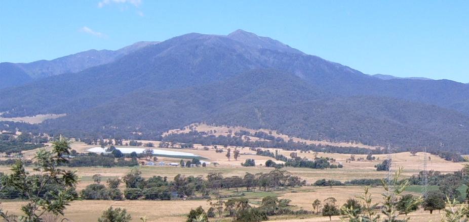
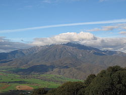 Mount Bogong from Tawonga Gap lookout
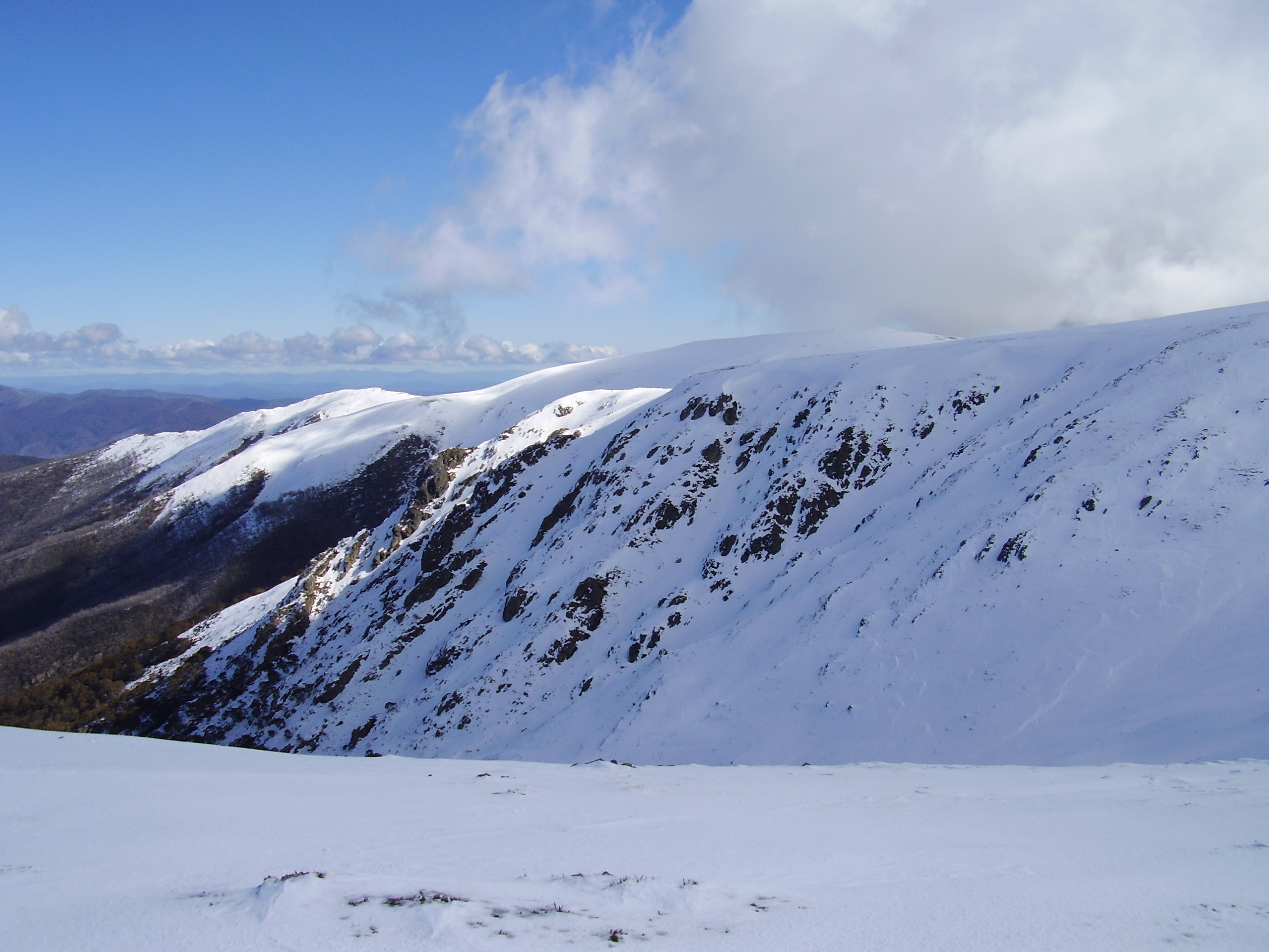
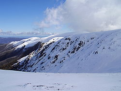 Mount Bogong the summit
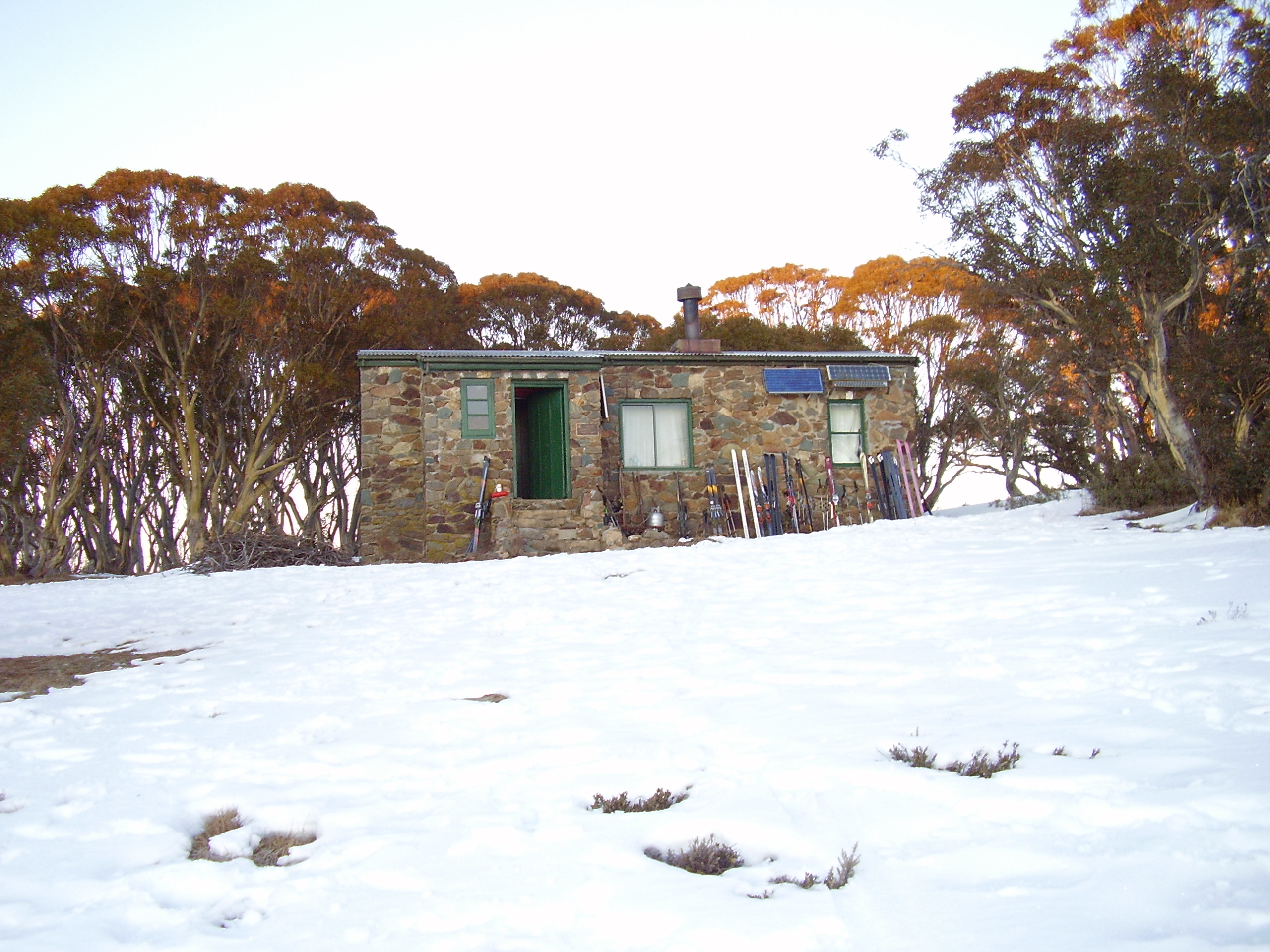
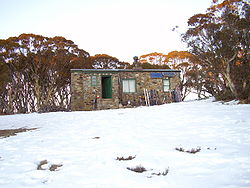 Cleve Cole Hut
Mount Bogong (pronounced /ˈboʊɡɒŋ/), located in the Alpine National Park, is the highest mountain in Victoria, Australia. The Big River separates the massif of the mountain from the Bogong High Plains to the south. "Bogong" in the local Aboriginal language means bigfella[citation needed]. From the nearby town of Mount Beauty to its summit, Mount Bogong rises more than 1,600 metres (5,200 ft),[citation needed] thus making it one of the highest peaks in Australia not only in terms of its elevation above sea level, but also in terms of actual base-to-summit prominence.[citation needed]
Mount Bogong is a popular backcountry skiing mountain through winter but only has snow for the mid winter-spring months. It is around 30 kilometres (19 mi) by road and walking track or 12 kilometres (7.5 mi) direct to Mount Beauty. Falls Creek & Mount Hotham ski resorts are also nearby. Camping is relatively safe below the treeline but the summit ridgeline is very exposed.
Emergency shelter is also available at Bivouac Hut on the Staircase Spur, and at Cleve Cole, above Camp Creek on the broad ridge to the south of the summit, and Michell's Hut on the Eskdale Spur.
Contents
Vegetation
The lower slopes of Mount Bogong are covered with tall forests of Alpine Ash (Eucalyptus delegatensis) to an altitude of about 1,300 metres (4,300 ft). From 1,300 metres (4,300 ft) to 1,800 metres (5,900 ft), woodland and open woodland of Snow Gum (Eucalyptus pauciflora) dominate, and above 1,800 metres (5,900 ft), the vegetation consists of alpine shrubland, grassland and herbfield.
Much of the mountain, especially the northern side, was badly burnt in the 2003 Eastern Victorian alpine bushfires.
History
This impressive mountain towers above the Valley of the Kiewa River and was of great significance to local traditional owner groups. As noted by Parks Victoria, "Many Aboriginal people have a remarkably rich history of Aboriginal use in the Victorian Alps and a vast knowledge of the cultural sites, oral history and ancestral stories that relate to the alpine region of Victoria. Throughout the many seasons each year, Aboriginal groups would come from as far away as the coast and south west slopes, to meet with the tribes of the mountains for intertribal ceremonies and feasting on Bogong Moths. During these festivities they would exchange cultural objects and materials for tools"[citation needed].
According to Indigenous historian Eddie Kneebone, "the Yiatmathong (people) controlled the Kiewa and Mitta Mitta Valleys, they also had control of the Alpine region on the Victorian side. Their southern most boundary extended to Hotham and ran along the highest ridge line of the Alps in an east-west direction. Because Mount Bogong fell within the Yiatmathong territory, permission had to be gained from them by the other tribes participating in the summer feast. Once this was done, the tribes would spend summer in the cooler climate of the mountains feasting on the protein rich Bogong moth".('[1]',)
According to Kneebone, prior to climbing Mount Bogong and the Bogong High Plains, the tribes would gather by the Murray River at Mungabarreena (near modern Albury). After ceremonies, initiations, marriages, trading, settling of disputes, and renewing of alliances and friendships, the groups would walk from Albury to the mountain region to feed on the protein-rich Bogong Moths.[2]
Following European settlement, Indigenous groups were decimated and survivors were placed onto settlements, often far from the traditional lands. Indigenous visitation to Mount Bogong is generally understood to have finished by the mid 19th century. While there was cattle grazing for some time, it was the walkers and then skiers who became the next group to visit the mountain in large numbers.
In August 1936 Mick Hull, Howard Michell and Cleve Cole attempted the first winter crossing of the Bogong High Plains. The group became lost in blizzard conditions and Cole died of hypothermia soon after he and Mick Hull were discovered by a rescue party raised by Michell. Cole was buried on 22 August at the Cheltenham Pioneer Cemetery. The hut commemorating Cole's life was completed in 1938, and has served as the hub of back-country skiing and bushwalking exploration of the Bogong area since. Accommodation at the hut is free on a first-in-first-served basis, although donations to The Bogong Club are welcomed.[3] Parks Victoria advises skiers and walkers to carry an alpine-capable tent, and not to rely on accommodation in the huts.
Cole's death illustrates the danger of Mount Bogong and of the Victorian Alps in general. The mountains are geologically old and worn. Their low altitude and flattish, rounded tops make for easy skiing and walking, but descent of their steep sides in whiteout conditions can be perilous.
Ascent routes
There are many routes up Mount Bogong for hikers, including (clockwise from north west) Staircase Spur, Eskdale Spur, Granite Flat Spur, Long Spur, Duane Spur, and Quartz Ridge. All involve a climb of more than 600 metres (2,000 ft) from the saddle or creek at the base of these spurs.
The two main walking trails lead to the summit. The Staircase and Eskdale Spur both begin at Mountain Creek Picnic Ground. A 4WD fire trail (closed during winter) connects these two trails at the base of the mountain. Both trails are of moderate difficulty. The Staircase is a 16 kilometres (9.9 mi) return trip, normally taking 6–9 hours return, while the Eskdale Spur is a 20 kilometres (12 mi) return trip, normally taking 8–11 hours return.
The Staircase Spur may be one of the most difficult tracks you ever walk due to its steep slopes. From the base of the staircase it is 6 kilometres (3.7 mi) to the summit. Halfway up the staircase is Bivouac Hut which sits about 3 kilometres (1.9 mi) from the summit on a little flat section, it offers emergency refuge, camp sites and a resting spot before heading to the summit.
The Eskdale spur may provide a slightly easier option up to the summit of Bogong if you have a 4wd, although if you walk up from Mountain Creek, it is just a longer way to do the same ascent. With a 4wd you can drive from the bottom of the Staircase Spur at Mountain Creek, through to Camp Creek Gap, from where it is about 2.5hrs walk to the summit of Bogong, and this is the easiest winter access, although occasionally the 4wd track is covered with snow.
Just over half way up the Eskdale Spur is Michell Hut which burnt down during the 2003 bush fires but was later rebuilt. Michell Hut provides emergency refuge, toilet, camp sites and a resting area before the final climb up to where the Eskdale meets Granite Flat Spur at the treeline, where there is also a good, but exposed campsite
Granite Flat Spur also provides access to the summit. It can be accessed by 4wd either from Eskdale, or by continuing on from Camp Creek Gap around the 4wd track, which is only possible outside of winter. An hour beyond Camp Creek Gap by 4wd will get you to the end of the 4wd track, from which it takes about 1.5hrs walk to the summit (ie it is no quicker than walking up the Eskdale, but you walk less, and drive further).
Above the treeline, both the Staircase and Eskdale Spurs are very exposed, particularly in winter, and they may "ice up" after about 4pm in the afternoon, making progress dangerous.
The name is also given to:
- the Bogong High Plains
- the Bogong Moth
- the Victorian Department of Education and Training's secondary-level Bogong Outdoor Education Centre at Bogong Village (at 700 m ASL, on Lake Guy) on the road between Mount Beauty and Falls Creek (and not to be confused with the nearby YMCA Howmans Gap Alpine Centre).
See also
- Skiing in Australia
- Skiing in Victoria, Australia
References
Parks Victoria information sheet: The High Country - around Bright, Mount Beauty, Omeo and Dargo, May 2008. http://www.parkweb.vic.gov.au/resources05/05_0517.pdf
External links
Categories:- Mountains of Victoria (Australia)
- Alpine National Park


Wikimedia Foundation. 2010.