- Maribyrnong River
-
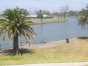
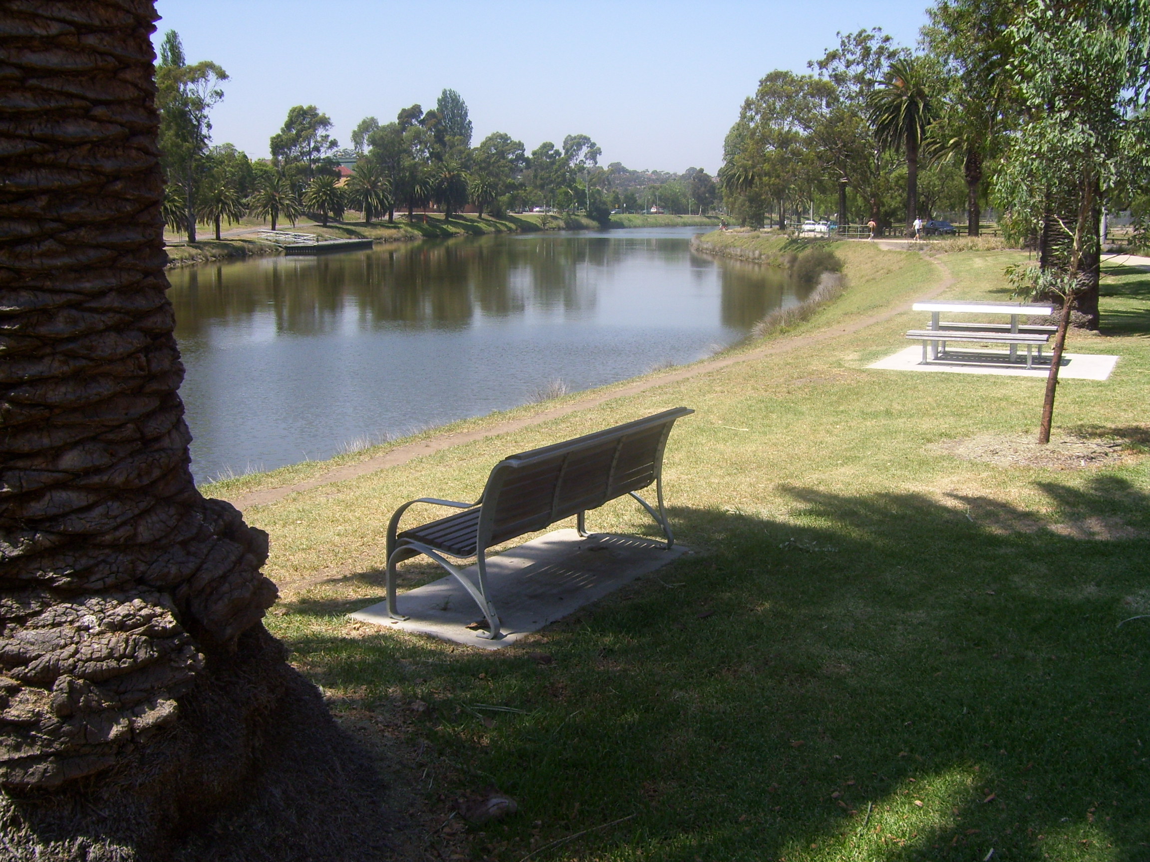
Maribyrnong River 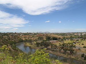 The Maribyrnong River as it flows past the Melbourne suburb of Essendon West
Name origin: Woiwurrung Country Australia State Victoria Region western Melbourne Tributaries - left Deep Creek - right Jackson Creek City Melbourne Source Macedon Ranges - location Great Dividing Range, Victoria - elevation 1,000 m (3,281 ft) Mouth Yarra River - location Melbourne, Australia Basin 1,450 km2 (559.8 sq mi) [1]  Contour map of the river basin
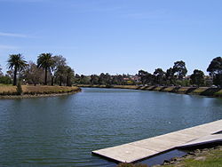
Wikimedia Commons: Maribyrnong River  Maribyrnong River in the suburb Maribyrnong
The Maribyrnong River rises about 50 km north of Melbourne, Victoria (Australia), near Mount Macedon. It flows generally southward and combines with the Yarra River to flow into Port Phillip.
The inner western and north-western suburbs of Melbourne are located in the vicinity of the Maribyrnong River and the river has given its name to the suburb of Maribyrnong and the local government area, the City of Maribyrnong.
Contents
Etymology
The river was initially named Saltwater River[2] by early settlers, due to the tidal nature of its lower reaches. The name Maribyrnong however, is derived from either mirring-gnay-bir-nong which in Woiwurrung, the language of the local Wurundjeri people, is said to mean "I can hear a ringtail possum"[2] or "saltwater river"[3] (Gunung or Gunnung is Woiwurrung for river,[4] as seen in the names of other watercourses in the area, such as; Koonung Creek and Birrarung).
Marriburnong is an alternate spelling listed on a map dated from 1840.[3]
History
The Maribyrnong River valley has been home for the Wurundjeri people of the Kulin nation for up to 40,000 years. Human remains dated at least 15,000 years old have been found along the river, with much older signs of human habitation also present.
The first Europeans to explore along the river were the party led by Charles Grimes, Deputy Surveyor-General of New South Wales, in February 1803. John Batman is likely to have explored up the river in early 1835. With the establishment of the colony of Melbourne later that year, sheep runs were soon established by Edmund Davis Fergusson and Michael Solomon in the Avondale and Sunshine areas. On Solomon's sheep station the ford now near the west end of Canning Street in Avondale Heights soon became known as Solomon's Ford. This was the lowest crossing on the Saltwater (Maribyrnong) River, and the furthest inland point of tidal influence. Batman is believed to have crossed the river at this point probably in the well worn steps of Aboriginals. It was for many years the only way from Melbourne to Geelong and land west.
During the second half of the nineteenth century much of Melbourne's industry was located along the river, and the water became very degraded. With the closure of many industries since the 1960s and 1970s, much river front land has opened up to parkland and highly sought after residential estates.
Geography
The geographic features and tributaries of the river are listed below, tributaries in bold:[5]
- Yarra River, of which the Maribyrnong River is a tributary
- Yarraville Wharves
- Maribyrnong Berth
- Newells Paddock Wetlands
- Burndap Lakes
- Jacks Canal
- Frogs Hollow Wetland
- Cliffs
- Steele or Rose Creek
- Grimes Flat
- Kulin Wetlands
- Taylors Creek
- Horseshoe Bend
- Gumms Corner
- Unnamed Creek
- Jackson Creek / Deep Creek
Course
Headwaters
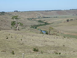 Jackson Creek, a tributary of the Maribyrnong river at Clarkefield
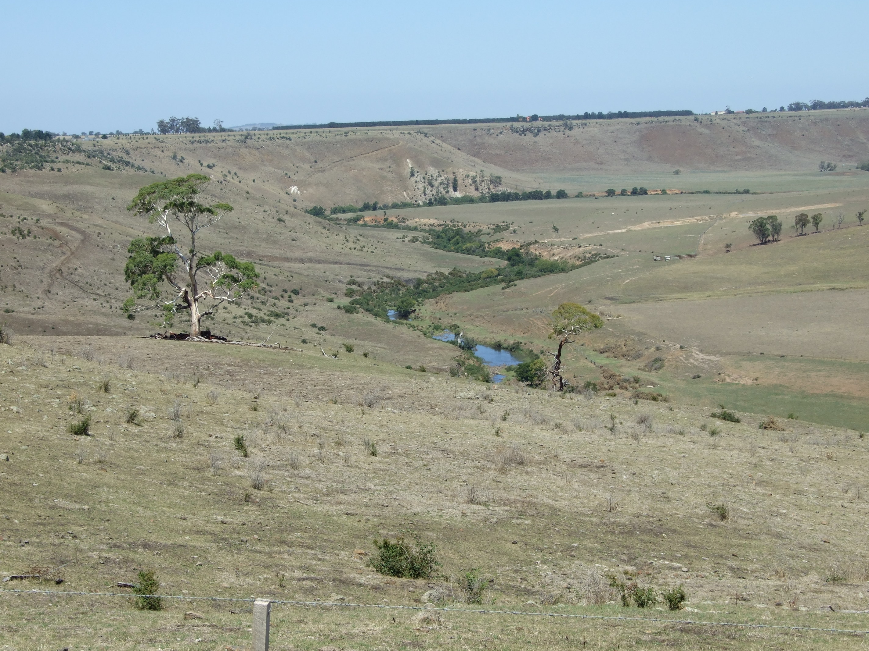
The head of the Maribyrnong catchment is situated in the Macedon Ranges region of central Victoria around 60 km NW of Melbourne. Various creeks beginning in the southern Mount Macedon area flow into Riddells Creek which in turn flows into Jackson Creek. Jackson Creek starts its journey NW of Gisborne, 50 km north of Melbourne. The other major tributary of the Maribyrnong is Deep Creek, which also has its headwaters in the northern and eastern parts of the Macedon Ranges. The creek has cut a deep valley through the surrounding basalt plains in its southward course, in particular as it flows through localities such as Konagaderra and Bulla.
To the west of Melbourne Airport the tributaries of Jackson Creek and Deep Creek conjoin to form the Maribyrnong River. The Organ Pipes National Park can be found on Jacksons Creek, near the Calder Freeway: a pleasant picnic site, and a unique display of basaltic columns a geological formation so named because they look like organ pipes.
Middle reaches
 Maribyrnong River at Brimbank Park
The river flows south and west. At Keilor the river winds back on itself in a giant horsehoe bend, before winding south again at Brimbank Park. Here the river flows fifty five metres below the western plains. Horseshoe Bend Farm is a small scale farm open to schools, kindergartens, playgroups and the general public.
Brimbank Park forms a huge amphitheatre in the bend in the river with picnic areas, cycle and walking trails, and a cafe, which reverberate with activity on weekends and public holidays. The area is rich in birdlife and native fauna.
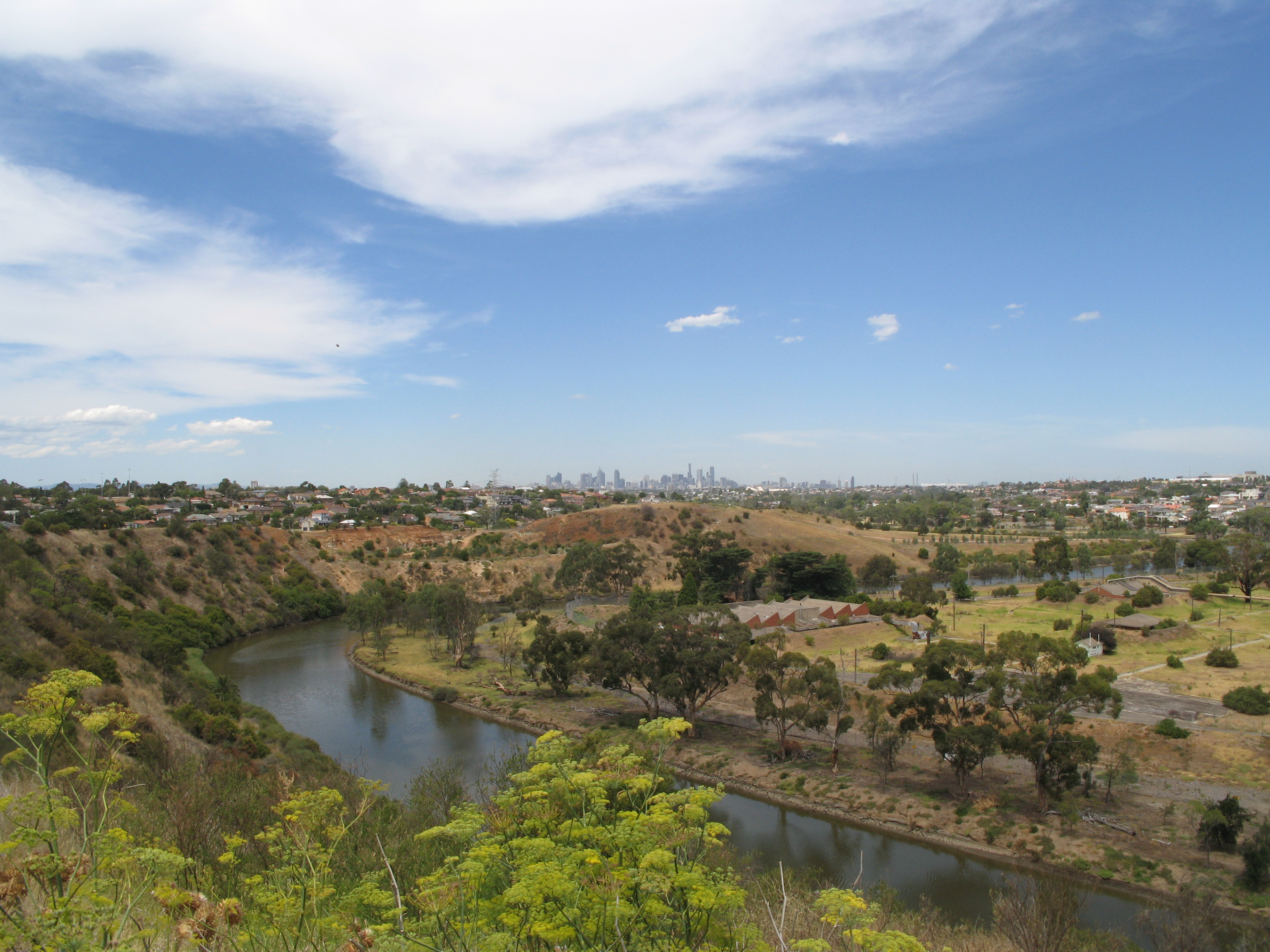
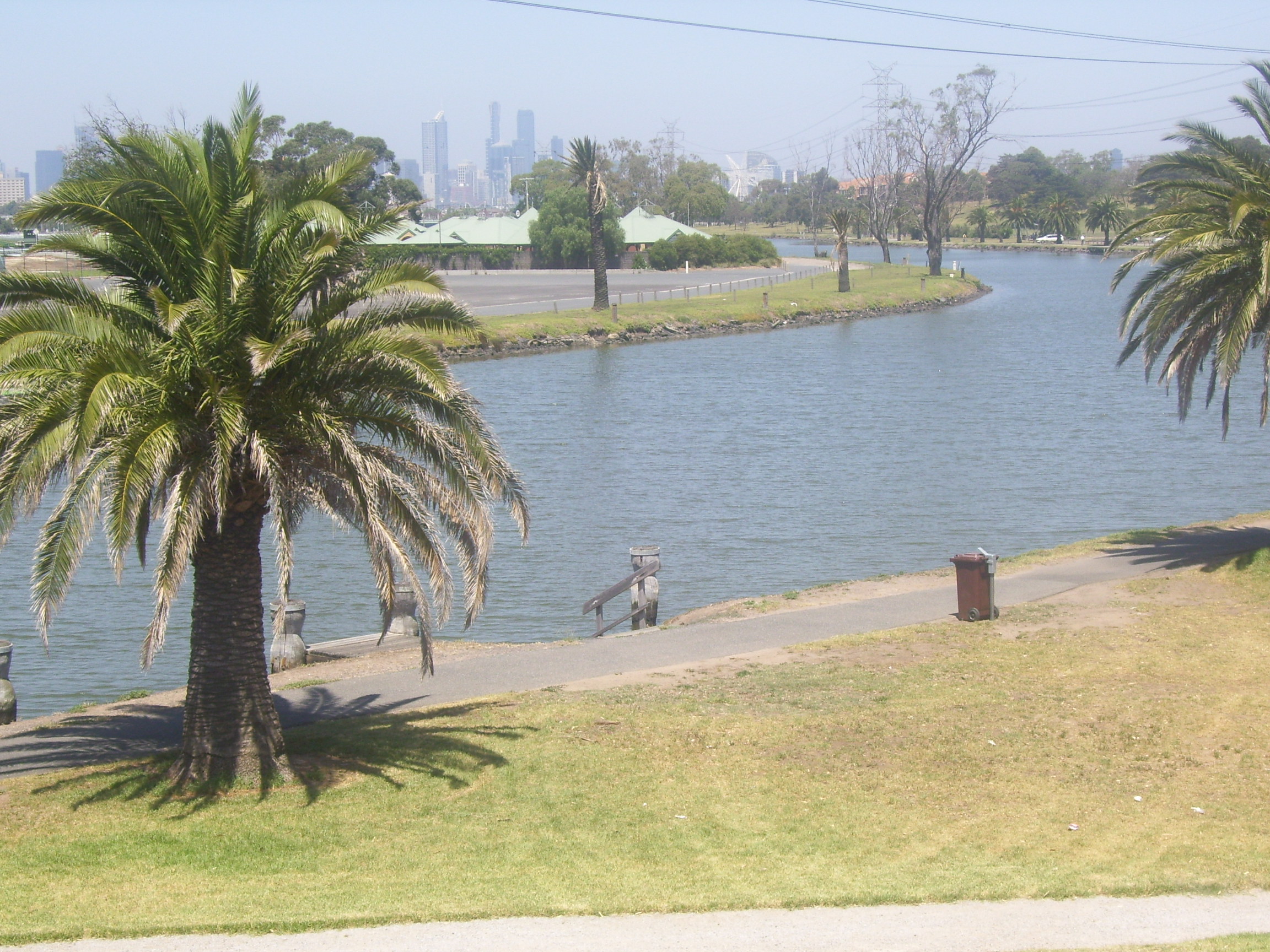
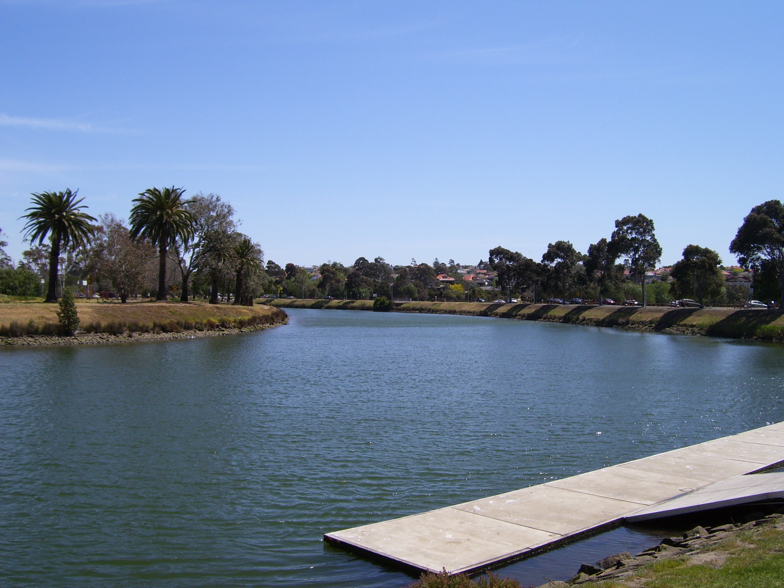
The Maribyrnong River Trail shared path starts at Brimbank Park, following mostly beside the river to near its conjunction with the Yarra River in Footscray. At Avondale Heights and Essendon West residents have a spectacular view over the river valley to the skyscrapers of the Melbourne CBD.
Lower reaches
The river flows past Pipemakers Park at Maribyrnong and the Living Museum of the West which presents information on the history of the river and the early industrial history of the site. Dolphins are sometimes sighted in the lower reaches of the river, along with many water birds, especially at Burndap Park.
Footscray Park opposite the Flemington Racecourse is only metres down river from Pipemakers Park and Burndap Park, the river then meanders across the floodplain to its juncture with the Yarra River at Yarraville.
Recreational use
Maribyrnong River at Footscray looking towards the CBD Maribyrnong River Bike Path Length 50km Difficulty Easy Connecting Transport As the second major river in metropolitan Melbourne, the Maribyrnong plays a very important part in Melbourne's recreation. Boating, cycling along its bike paths such as the Maribyrnong River Trail, fishing, and walking. Light bushwalking can also be done and nature watchers can observe Australian native fauna such as echidna, wallabies as well as the ubiquitous possums and flying foxes.
Crossings
Road and rail bridges and other crossing points along the Maribyrnong River include:[6]
- Shepherd Bridge - primary arterial road
- South Kensington-West Footscray railway
- Hopetoun Bridge - primary arterial road
- Suburban railway to Footscray
- Former stock bridge - relocated from Punt Road, South Yarra
- Lynchs Bridge - primary arterial road
- Farnsworth Avenue Bridge - secondary arterial road
- Pipemakers Park Footbridge
- Maribyrnong Road Bridge - primary arterial road
- Afton Street Footbridge - pedestrian
- Canning Street Bridge - primary arterial road
- Medway Golf Club Footbridge
- Solomons Ford - historic crossing point
- Maribyrnong River Viaduct, on the Albion-Jacana railway
- E.J. Whitten Bridge - Western Ring Road
- Ford
- Ford
- Old Calder Highway Bridge - primary arterial road
- Historic Calder Bridge (1868)
- Calder Freeway Bridge
- Flora Street Bridge - local road and private access
- Historic Arundel Road Bridge - (built 1906-7, closed to vehicles 1989, closed to pedestrians 2007)[7]
- Arundel Road Bridge (1989) - local road
Flora and fauna
 The river as it flows through Aberfeldie
Native species
Many native species exist along the Maribyrnong River with many species thriving in the area. Parks Victoria (January 2008). "Maribyrnong Valley Parklands". http://www.parkweb.vic.gov.au/1park_display.cfm?park=139.
Native mammals / marsupials
Swamp Wallaby, Grey-headed Flying Foxes or Fruit Bats, Common Brushtail Possum, Common Ringtail Possum, Water Rat or Rakali, Echidna, Platypus - up river only
Native reptiles
Eastern Brown Snake, Tiger Snake, Skinks, Common snakeneck turtle
Native birds
Eastern Whipbird, Cockatoo, Rainbow Lorikeet, Galah, Brown Falcon, Peregrine Falcon, Square-tailed Kite, Royal Spoonbill, Black Swan, Pacific Black Duck, Little Pied Cormorant, Moorhen, Long-billed Corella
Native amphibians
- Frogs
Native fish
- Short-finned Eel, Tupong, Short-headed Lamprey, Australian Grayling, Common Galaxias, Broad-finned galaxies and Spotted galaxias, Southern black bream etc.
Other native species
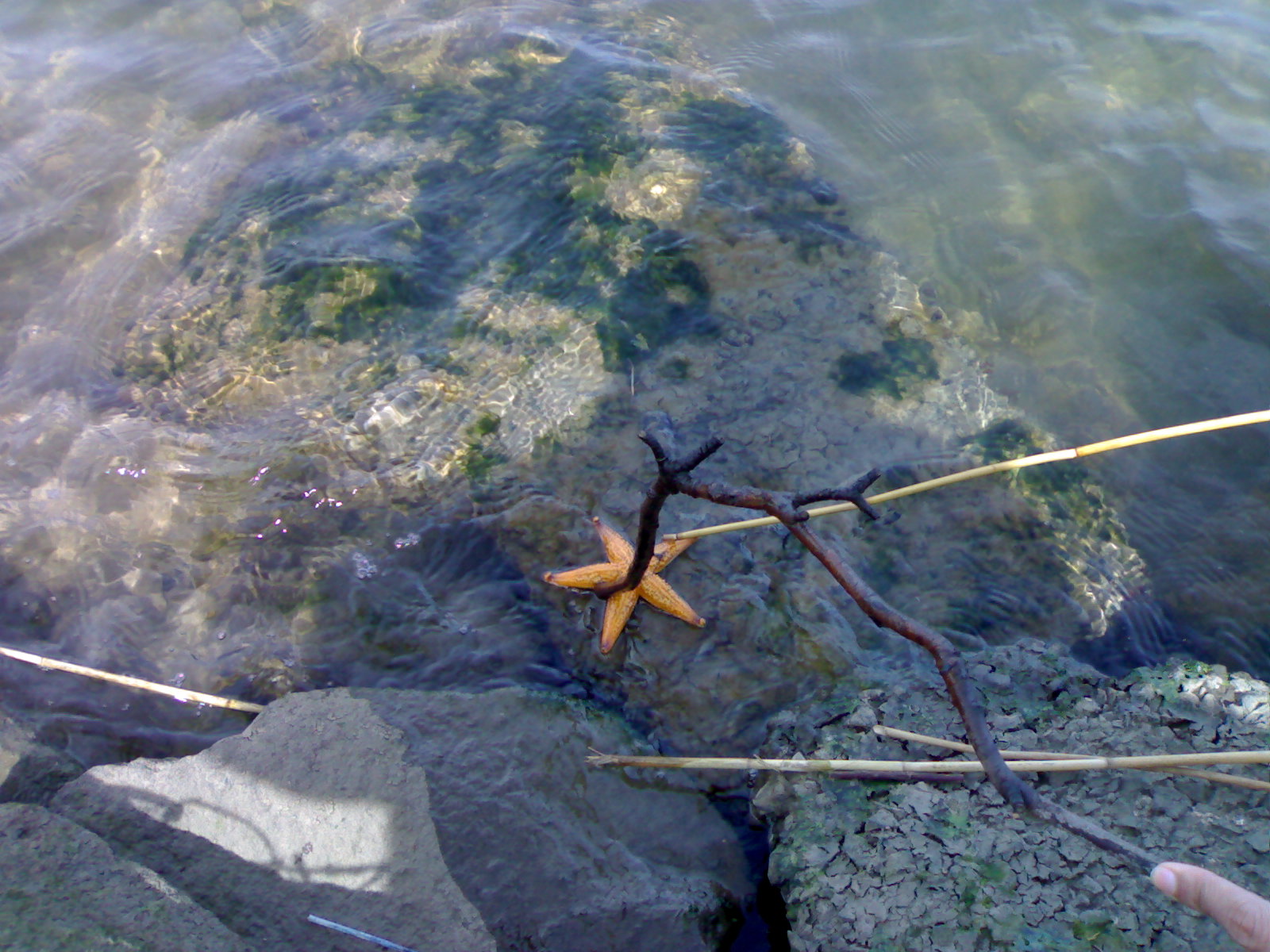
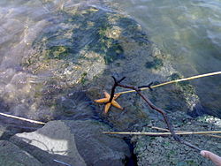 A starfish in the Maribyrnong river near the Melbourne Cup racecourse
Introduced mammals
Red Fox, European Rabbit, Feral cat
Introduced birds
Song Thrush, Common Blackbird, Common Myna, Common Starling, House Sparrow, Spotted Turtle Dove, Rock Pigeon, Mallard
Social Divider
For a long time, Melbourne's western suburbs have suffered the stigma of disadvantage. According to Campbell Rose from The Age, this perception of the west as a rust belt bedevilled by social and economic malaise hasn't been helped by the inevitable comparisons to the east — the affluent, leafy suburbs with iconic schools and institutions, with the Maribyrnong River acting as some sort of physical, mental, social and economic divide.[8]
See also
- Maribyrnong River Trail
- Afton Street Conservation Reserve
- Kororoit Creek another major watercourse in Melbourne's west.
- Deep Creek (Victoria)
- Jacksons Creek (Victoria)
References
- ^ Department of Primary Industries, Maribyrnong River Basin 30, http://www.dpi.vic.gov.au/angling/30-Maribyrnong/Basin%20TEMPLATE%20ED21Jan-worked.htm, retrieved 17 June 2010[dead link]
- ^ a b Parks Victoria, Maribyrnong River Visitors Guide, http://www.parkweb.vic.gov.au/resources05/05_0376.pdf, retrieved 20 June 2010
- ^ a b "Australian Places:Maribyrnong, Victoria". Monash University. 17 March 2006. http://www.arts.monash.edu.au/ncas/multimedia/gazetteer/list/maribyrnong.html.
- ^ "About The Wurundjeri People". Yarra Healing. 17 March 2006. http://www.yarrahealing.melb.catholic.edu.au/kulin/woiworung.html.
- ^ Melway, Edition 35, 2008
- ^ Melway Edition 36, 2009
- ^ Australian Heritage Database, Trestle Bridge, Arundel Rd, Keilor, VIC, Australia, http://www.environment.gov.au/cgi-bin/ahdb/search.pl?mode=place_detail;search=street_name%3Darundel%3Bkeyword_PD%3Don%3Bkeyword_SS%3Don%3Bkeyword_PH%3Don%3Blatitude_1dir%3DS%3Blongitude_1dir%3DE%3Blongitude_2dir%3DE%3Blatitude_2dir%3DS%3Bin_region%3Dpart;place_id=18458, retrieved 16 November 2010
- ^ Rose, Campbell (12 April 2009). "A prosperous future lies in looking west". The Age (Melbourne). http://www.theage.com.au/opinion/a-prosperous-future-lies-in-looking-west-20090412-a3zs.html.
- [1] Parks Victoria Brimbank Park page Sept 2007
- [2] Maribyrnong River Parks Victoria page Sept 2007
- [3] Maribyrnong Valley Parklands - See Parknotes
External links
Coordinates: 37°49′S 144°55′E / 37.817°S 144.917°E
Rivers of Victoria Rivers flowing towards the coast Agnes · Aire · Albert · Anglesea · Avon · Barham · Barwon · Bass · Bemm · Benedore · Betka · Brodribb · Bunyip · Calder · Cann · Cumberland · Darby · Dargo · Elliott · Eumeralla · Fitzroy · Ford · Franklin · Geary · Gellibrand · Glenelg · Grey · Hartland · Hopkins · Jamieson · Johanna · Jordan · Kennett · Lang Lang · La Trobe · Lerderderg · Little · Little Yarra · Macalister · Maribyrnong · Merri · Mitchell · Moorabool · Morwell · Moyne · Mueller · Nicholson · O'Shannassy · Parker · Patterson · Perry · Plenty · Powlett · Red · St George · Shaw · Snowy · Surry · Tambo · Tarra · Tarwin · Thomson · Thurra · Tidal · Timbarra · Wannon · Watts · Wentworth · Werribee · Wingan · Woady Yaloak · Wye · Yarra · Yarrowee · YeerungRivers of the Murray basin Rivers draining inland Categories:- Geography of Melbourne
- Rivers of Victoria (Australia)
- Tributaries of the Yarra River


Wikimedia Foundation. 2010.