- Deep Creek (Victoria)
-
For other geographic features called Deep Creek, see Deep Creek (disambiguation).
Deep Creek River Name origin: Descriptive Country Australia State Victoria Region western Melbourne Tributaries - left Boyd Creek, Dry Creek, Garden Hut Creek, Long Gully Creek - right Emu Creek, Konagaderra Creek, Monument Creek, Five Mile Creek Source Macedon and Cobaw Ranges - location Great Dividing Range, Victoria - elevation 760 - 964 m (-2,403 ft) Mouth Maribyrnong River - location Melbourne, Australia  Contour map of the Maribyrnong river basin; Deep Creek is the eastern tributary
Deep Creek is a watercourse in the Yarra-Maribyrnong catchment area, north of Melbourne in Victoria, which arises from the confluence of a number of smaller streams draining the north eastern slopes of the Mount Macedon range and the southern slopes of the Cobaw range, both ranges being constituent parts of the Great Dividing Range.
Deep Creek flows generally south to become the longest of the two main tributaries of the Maribyrnong River,[1] the other being Jacksons Creek. In its upper reaches the creek flows east in a broad shallow valley in the Lancefield area, before turning generally southwards to enter the deeper, narrower valley that characterises the remainder of the watercourse. The creek then flows east again for a number of kilometres before resuming its southward course at Darraweit Guim, eventually to join with Jacksons Creek near Bulla, where the two waterways form the Maribyrnong River. The deep and relatively narrow valley cut by the creek in its southward course through the surrounding basalt plains is particularly prominent at such localities as Darraweit Guim, Konagaderra and Bulla.
Being unregulated by major dams or diversions, water levels in the creek show great seasonal variation.[2] Recently, Deep Creek has flowed only seasonally along most of its length, although significant pools and stretches of water remain all year, some of which are locally noted swimming holes.
Contents
Etymology and Alternate Names
The creek was originally considered to be the extension of the Maribyrnong River, and as such has also been known as Saltwater River (an original name for the Maribyrnong)[3] or alternatively the Upper Maribyrnong River,[2] Maribyrnong Creek,[4] Maribyrnong River East Branch[5] or Maribyrnong River Left Branch. Another possible name for the river is Darraweit Guim,[6] also the name of a small town located on the river. The name Deep Creek may refer to the deep valley the watercourse has cut through the plains north of Melbourne or the deep pools which have formed in the riverbed.
Geography
The named tributaries of the river, ordered upstream, are:
- Jacksons Creek
- Emu Creek
- Konagaderra Creek
- Boyd Creek
- Five Mile Creek
- Long Gully Creek
- Dry Creek
- Monument Creek
- Garden Hut Creek
Crossings
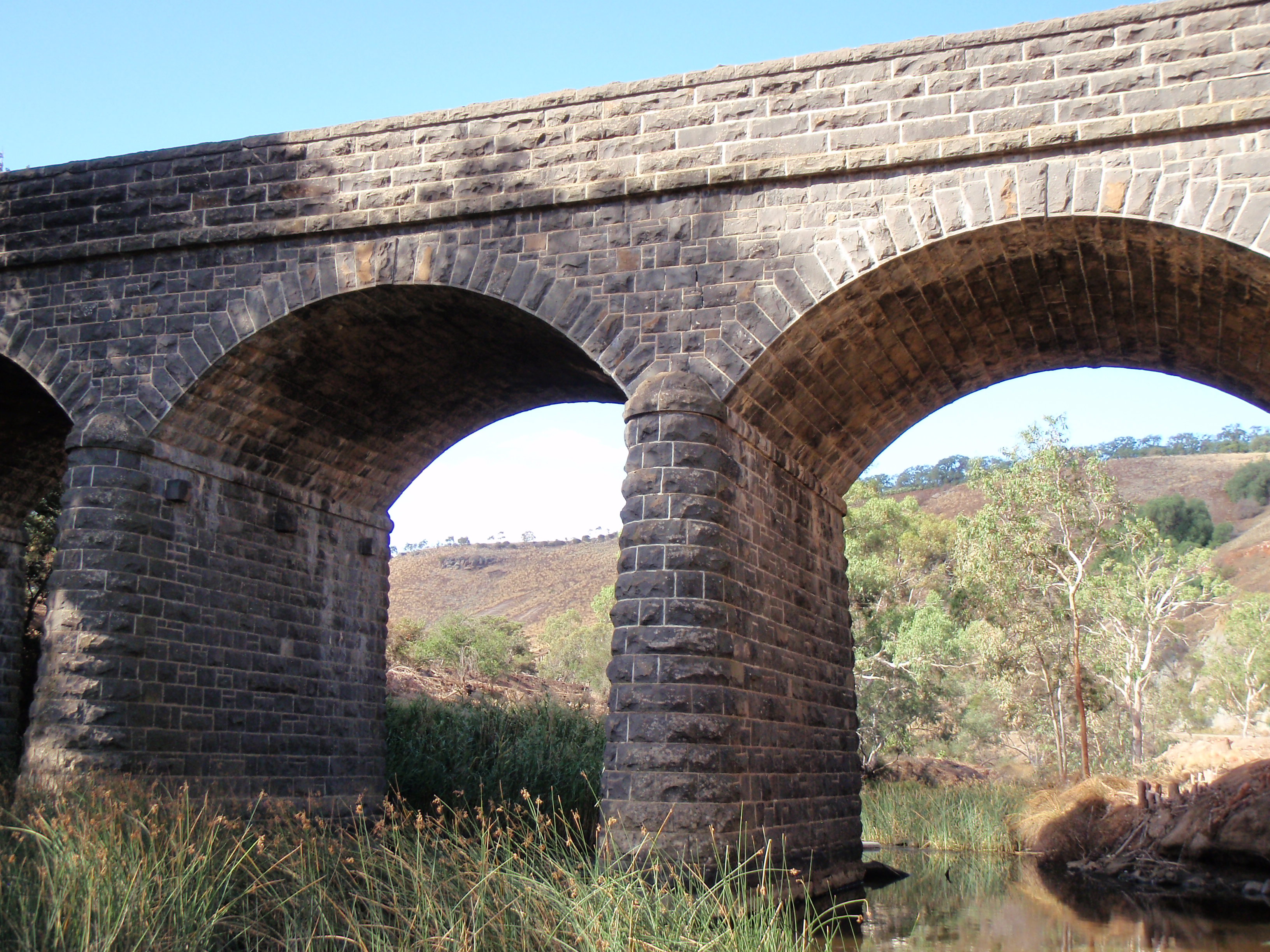
 Bulla bridge, built 1869
Named bridges and other significant crossing points along Deep Creek, ordered upstream, include but are not limited to:
- Bulla Bridge (current triple arch bluestone bridge built 1869, replacing an earlier timber bridge)
- Wildwood Rd
- Konagaderra Rd
- McCabes Bridge (Stockdale Rd)
- Darraweit Valley Rd
- Chintin Rd
- Gallaghers Ford (Joyces Rd)
- Dalys Bridge (Woodend – Wallan Rd)
- Sheehans Crossing bridge (Sheehans Rd)
- Forbes Bridge (Forbes Rd)
- Doggetts Bridge (Lancefield – Kilmore Rd)
- Musteys Bridge (Lancefield – Tooborac Rd)
- Linehans Bridge (Baynton Rd) (replaced by a low-level causeway during the 1990s, the old bridge is closed and derelict)
- Twin Bridges (Kyneton – Lancefield Rd)
- White Bridge (Whitebridge Rd)
See also
References
- ^ Fishing Victoria Project, Deep Creek, Lancefield, http://www.fishingvictoria.org.au/deep_creek_fishing.htm, retrieved 2010-06-17
- ^ a b Department of Primary Industries, Maribyrnong River Basin 30, http://www.dpi.vic.gov.au/angling/30-Maribyrnong/Basin%20TEMPLATE%20ED21Jan-worked.htm, retrieved 2010-06-17
- ^ Parks Victoria, Maribyrnong River Visitors Guide, http://www.parkweb.vic.gov.au/resources05/05_0376.pdf, retrieved 2010-06-20
- ^ Duncan, J.S., ed. (1982). Atlas of Victoria. Melbourne, Victoria: Victorian Government Printing Office. p. 207. ISBN 0-7241-8255-1.
- ^ Victorian Municipal Directory. Brunswick: Arnall & Jackson. 1956. p. 791.
- ^ Symonds, Ian William (1985). Bulla Bulla, an illustrated history of the Shire of Bulla. Melbourne: Spectrum. ISBN 867860812.
Categories:- Tributaries of the Maribyrnong River
- Rivers of Victoria (Australia)

Wikimedia Foundation. 2010.