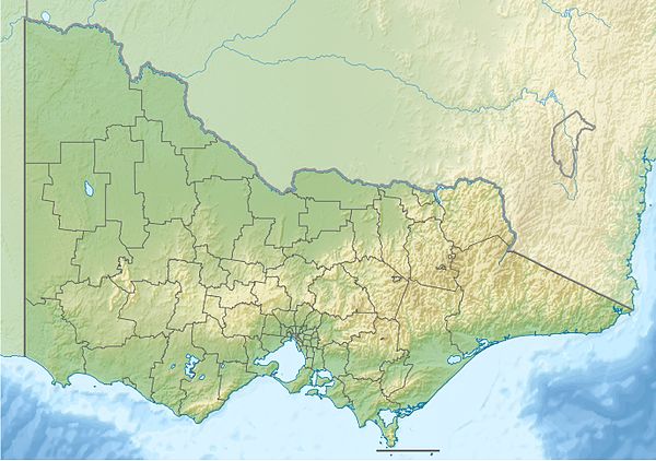
- Protected areas of Victoria
-
Victoria is the smallest mainland state in Australia. It contains 1966 separate Protected Areas with a total land area of 33,780 km² (14.84% of the state’s area). Of these, 36 are National parks, totalling 25,774 km² (11.32% of the state’s area).
The Parks are managed by Parks Victoria, a state government organisation. There are also many smaller state areas which are subject to commercial activity such as logging.
Coastal and marine parks

Historic and heritage areas and parks
- Beechworth Historic Park
- Castlemaine Diggings National Heritage Park
- Nyerimilang Heritage Park
- Oriental Claims Historic Area
- Point Gellibrand Coastal Heritage Park
- Steiglitz Historic Park
- Walhalla Historic Area
- Upper Goulburn Historic Area
- Whroo Historic Reserve
- Woodlands Historic Park
Indigenous Protected Areas
National Parks
As of 2011 there are 45 national parks in Victoria.[1]
Name Size (hectares) Established Notes Alfred 3050 1925 Alpine 646000 1989 Barmah 28521 2010 Baw Baw 13300 1979 Brisbane Ranges 7718 1973 Burrowa-Pine Mountain 18400 1978 Chiltern-Mount Pilot 21600 2002 Churchill 1668 1941 Cobboboonee 18510 2009 Coopracambra 35000 1991 Croajingolong 87500 1979 Dandenong Ranges 3215 1987 Includes the former Ferntree Gully NP Errinundra 26875 1988 French Island 11100 1997 Grampians 168000 1984 Great Otway 103000 1981 Greater Bendigo 17007 2009 Gunbower 2010 Hattah-Kulkyne 49975 1960 Heathcote-Graytown 12833 2002 Kinglake 22360 1928 Lake Eildon 27750 1957 Lind 1370 1925 Little Desert 132000 1968 Lower Glenelg 27300 1969 Lower Goulburn - 1992 Mitchell River 14338 1963 Includes former Glenaladale NP; expanded 1986, and 2003. Mornington Peninsula 2686 1988 Morwell 560 1967 Mount Buffalo 31000 1898 Mount Eccles 6120 1960 Mount Richmond 1733 1960 Murray-Sunset 633000 1991 Organ Pipes 152 1972 Point Nepean Port Campbell 1750 1962 Snowy River 98700 1979 St Arnaud Range 13900 2002 Tarra-Bulga 2015 1986 Terrick Terrick 5882 1999 The Lakes 2390 1927 Warby-Ovens 14655 2009 Wilsons Promontory 50400 1898 Wyperfeld 356800 1921 Yarra Ranges 76000 1995 State Parks
Current Arthurs Seat · Black Range · Broken-Boosey · Bunyip · Cape Nelson · Cathedral Range · Dergholm · Enfield · Holey Plains · Kooyoora · Langi Ghiran · Leaghur · Lerderderg · Moondarra · Mount Arapiles-Tooan · Mount Buangor · Mount Granya · Mount Lawson · Mount Napier · Mount Samaria · Mount Worth · Paddys Ranges · Reef Hills · Warby Range · Warrandyte · Werribee Gorge
Former Metropolitan parks

Reference Areas inside other Protected areas
- Ah Kows Gully
- Anser Island
- Baawang
- Barga
- Baw Baw
- Beehive Creek
- Benedore River
- Berrook
- Big River
- Blue Rag
- Blue Range
- Boiler Plain
- Broombush
- Buangor
- Buenba
- Bungil
- Burnside
- Calder River
- Carpendeit
- Chalka Creek
- Chiltern Box-Ironbark
- Cobboboonee
- Cooriemungle
- Crinoline Creek
- Danyo
- Dattuck
- Deep Creek
- Diamond Creek
- Disappointment
- East Caledonia
- Enfield
- Entrance Point
- Forest Hill
- French Island (East)
- French Island (North)
- Gelantipy Plateau
- Grasstree Creek
- Hollands Knob
- Jemba
- Jilpanger
- Joey Creek
- Jones Creek
- Kamarooka
- Keegans Bend
- Kentbruck Heath
- Kia
- Kooyoora
- Korong Vale
- Lagoon Plateau
- Lake Jerriwirrup
- Lake Walla Walla
- Little Desert (East)
- Little Desert (West)
- Macks Creek
- Merragunegin
- Millewa
- Millewa South
- Moora Valley
- Morkalla
- Mount Buffalo
- Mount Crozier
- Mount Gregory
- Mount Mcadam
- Mount Pleasant
- Mountain Creek
- Mullungdung
- Musket Creek
- Olangolah Creek
- O'Sullivans Lookout
- Patterson River
- Parker River
- Pine Mountain
- Porphyry Hill
- Pretty Creek
- Purnya
- Raak Plain
- Rocket Lake
- Rudds Rocks
- Ruths Gully
- Seal Creek
- Settlement Road
- Shepherds Creek
- Stony Creek (Otways)
- Stony Creek (Kinglake)
- Sunset
- Terrick Terrick
- The Sisters
- The Stones
- Tom Groggin
- Tomahawk Creek
- Tooan
- Top End
- Top Island
- Toupnein Creek
- Vereker Creek
- Walsh Creek
- Warby Range
- Watts Creek
- White Box Ridge
- Whiterock Creek
- Winnot Creek
- Wombat Creek
- Wonnangatta River
- Yambulla
- Zig Zag Creek
Reference Areas outside other Protected areas
- Beear
- Bennie Creek
- Burbibyong Creek
- Cambatong
- Concordia Gully
- Cudgewa Creek
- Drum Top
- Dry Forest Creek
- Durdidwarrah
- Eaglehawk Creek
- Glen Creek
- Hawthorn Creek
- Killawarra
- King
- Lightwood
- Lucyvale Creek
- Mitta Mitta
- Mount Separation
- Musk Creek
- Pilot Range
- Pyrete Range
- Roseneath
- Rushworth Forest
- Ryans Creek
- Sandhurst
- Spring Creek
- Stringybark Creek
- Stony Creek (Durdiwarrah)
- Tambo River
- Tarpaulin Bend
- Telopea Downs
- Thirteen Mile Spur
- Toorour
- Twenty Acre Creek
- Yan Yean North
- Yan Yean South
Wilderness Parks
- Avon
- Big Desert
- Wabba
Wilderness Zones inside other Protected areas
- Bowen
- Buchan Headwaters
- Cape Howe
- Chinaman Flat
- Cobberas
- Galpunga
- Genoa
- Indi
- Minook
- Mount Cowra
- Mount Darling - Snowy Bluff
- North Wyperfeld
- Razor-Viking
- Sandpatch
- Snowy River
- South Wyperfeld
- Sunset
- Tingaringy
Also in Victoria
- 1522 Natural Feature Reserves
- 328 Nature Conservation Reserves
See also
References
- ^ Parks Victoria: About, retrieved 8 May 2011
External links
Categories:- Metropolitan parks of Victoria (Australia)
- Protected areas of Victoria (Australia)
- Lists of national parks in Australia
- Victoria (Australia)-related lists
- National parks of Victoria (Australia)
Wikimedia Foundation. 2010.

