- Baw Baw National Park
Infobox_protected_area_of_Australia | name = Baw Baw National Park
iucn_category = II
caption =
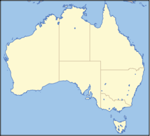
locator_x = 223
locator_y = 200
nearest_town_or_city = Rawson
coordinates = coord|37|45|50|S|146|13|23|E|type:landmark_region:AU
area = 135.3 km²
established = April 1979
visitation_num =
visitation_year =
managing_authorities = Parks Victoria
official_site = [http://www.parkweb.vic.gov.au/1park_display.cfm?park=44 Baw Baw National Park]Baw Baw is a national park in Victoria,
Australia , 111 km east of Melbourne. It contains the Baw-Baw Plateau andMount Baw Baw , a smallski resort , including nearby town, technically outside the national park.Geographically, Baw-Baw plateau is a
plateau of several peaks (Mount Baw Baw ,Mount Saint Gwinear , Mount Saint Phillack, Mount Erica and Mount Whitelaw) of largelysubalpine terrane outcrops of weatheredgranite boulders dot the plateau withalpine meadow s punctuated by stands of snow-gum.It is reported that Baw Baw is Aboriginal for 'echo' but the name could also come from 'Bo Bo', a name used on early maps meaning Big.
The area was first explored in
1860 by botanistFerdinand von Mueller . The area was settled in the 1880s and 1890s after the discovery of gold in the area. Baw Baw National Park was declared in April 1979.The typical vegetation in the park is low-lying
grass es, heathlands and snow gums, this is typically described as sub-alpine. Fauna abounds on the foothills to the major plateau (Baw Baw Plateau), includingLeadbeater's Possum , which is highly endangered and Victoria's state fauna emblem.Activities
Nowadays the major uses of the park are skiing in winter and bushwalking in summer. It is popular for cross country skiing, downhill skiing, summer bushwalking, hunting, rafting and canoeing, fishing, scenic drives and picnics. The
Australian Alps Walking Track traverses its entire length, starting at Walhalla and continuing north towards theAlpine National Park . The Baw Baw section takes a bit less than three days to walk.There is also plenty to see for those interested in botany or geology. The highest peak in the park is
Mount St Phillack , a granite plateau standing at 1566 metres.There is popular ski touring along the Baw Baw Plateau between Mount Baw Baw, past Mount St Phillack to Mount St Gwinear. There is even a volunteer ski patrol group, the St Gwinear Ski Patrol. They run on weekends and patrol around the St Gwinear portion of the national park. They access the park from the opposite side of the Plateau to the ski resort at Mt Baw Baw. [ [http://www.stgwinearsp.org/index.html St Gwinear Ski Patrol Inc] . Accessed on 6/2/06] Other popular skiing is
Nordic skiing atMount Baw Baw . This was introduced in 1972, including championship races and a ski school. [ [http://www.mountbawbaw.com.au/pdf/history.pdf History of the Mt Baw Baw region] June 2002]The deciduous Baw Baw Berry,
Wittsteinia vacciniacea is found on the plateau.ee also
*
Protected areas of Victoria (Australia) References
External links
* [http://www.parkweb.vic.gov.au/1park_display.cfm?park=44 Parks Victoria: Baw Baw National Park]
* [http://www.theage.com.au/news/Victoria/Mount-Baw-Baw/2005/02/17/1108500207010.html Mount Baw Baw - The Age]
* [http://www.parkweb.vic.gov.au/resources/05_0611.pdf Baw Baw National Park Visitor Guide] . Baw Baw National Park, Parks Victoria Web Page. Accessed on Feb 27 2005, 2001.

Wikimedia Foundation. 2010.