- Mitchell River National Park (Victoria)
-
For the national park in Western Australia, see Mitchell River National Park (Western Australia).
Mitchell River National Park
 IUCN Category II (National Park)
Nearest town/city Bairnsdale Coordinates 37°39′20″S 147°20′44″E / 37.65556°S 147.34556°E Area 143 km² Established 1986 Managing authorities Parks Victoria Official site Mitchell River National Park The Mitchell River National Park is a national park in Gippsland, Victoria, Australia. It is approximately 300 km east of Melbourne by the most direct road route, and about 40 km north of Bairnsdale.
Contents
Mitchell River
The park's central feature is the Mitchell River. The Mitchell River is the largest unregulated river in Victoria and provides a unique example of riparian ecology.
According to the Land Conservation Council Rivers & Streams Special Investigation 1990, "It is an important example of the large-scale biological systems that were once widespread in south-eastern Australia."[1] The Mitchell River was listed as a Heritage River in 1992.
The Park
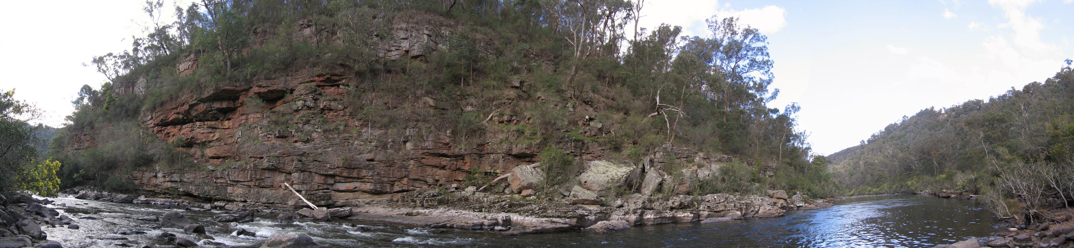
The National Park surrounds the spectacular Mitchell River where it has cut its way through rock strata creating high cliffs and several gorges.
The park originated as the Glenaladale National Park in 1963 following a donation of 1.63 km² of land from Australian Paper Manufacturers Ltd. An addition of 118 km² was made in 1986 at which time the name was changed to the Mitchell River National Park. The park was further extended in 2003 by 23.75 km² to bring the total area to 143.38 km².[2]
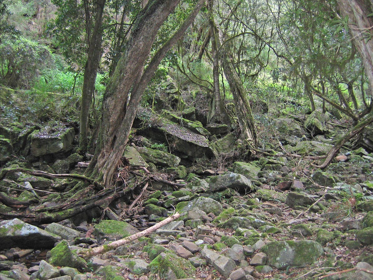
In some of the gorges are found remnants of warm-temperate rainforest, the southernmost occurrence of this type of forest in the world. It can survive here as the steep walls of the gorges protect it from the annual drying summer winds and the bushfires that occasionally rage through the area.
There are recorded sightings of more than 150 bird species and 25 mammal species in the park. Vegetation in the park includes papery-barked kanooka trees, lilly-pillys, muttonwoods, ferns, mosses, vines, and lianas. In the drier areas, typical Australian species such as wattle and eucalypt dominate.[3]
The Mitchell River was an important location to the Gunai/Kurnai nation, especially the Brabuwooloong and the Brayakuloong people of central Gippsland. One of the features of the park is the Den of Nargun mentioned in Aboriginal Legends.
Gold was discovered in the area in 1857. Alluvial fields along the Mitchell River and its tributaries were worked into the early twentieth century, while there was also some reef mining from the 1860s. Later use by Europeans mainly involved timber and farming.
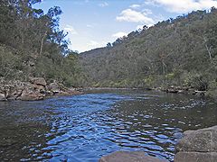 Mitchell River near the junction with Woolshed Creek
 Warm-temperate rainforest found along Woolshed Creek
 Deadcock Den, a site of cultural significance to the Gunai women
Den of Nargun
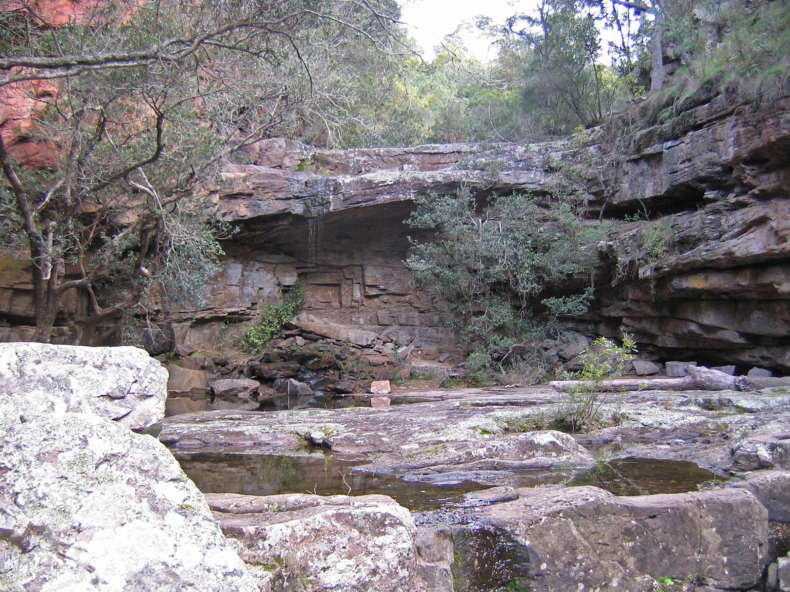
 The Den of Nargun
According to Gunai tribal legends, the Nargun is a fierce half-human half-stone creature that lived in the den, a cave under a rock overhang behind a small waterfall. The Den of Nargun, is found on Woolshed Creek, a small tributary of the Mitchell River, about one kilometre upstream from where the creek joins the river. In the legend the Nargun would abduct children who visited the rockpool. It was said the Nargun could not be harmed with boomerangs or spears, as they would be reflected back to the thrower.
The Den of Nargun was considered a special place for women of the Gunai tribe, being used for women's initiation and learning ceremonies. Thus the stories would have served the purpose of keeping children away from the sacred area, as well as keeping them near the campsite. The den was once rimmed with stalactites, but unfortunately these have been broken off as souvenirs by visitors over the years.
A similar, though less well known site, called Deadcock Den is situated on Woolshed Creek downstream from the Den of Nargun, only about 200 m from where it joins the Mitchell River. This site was also of great cultural significance to the Gunai people, in particular the women.
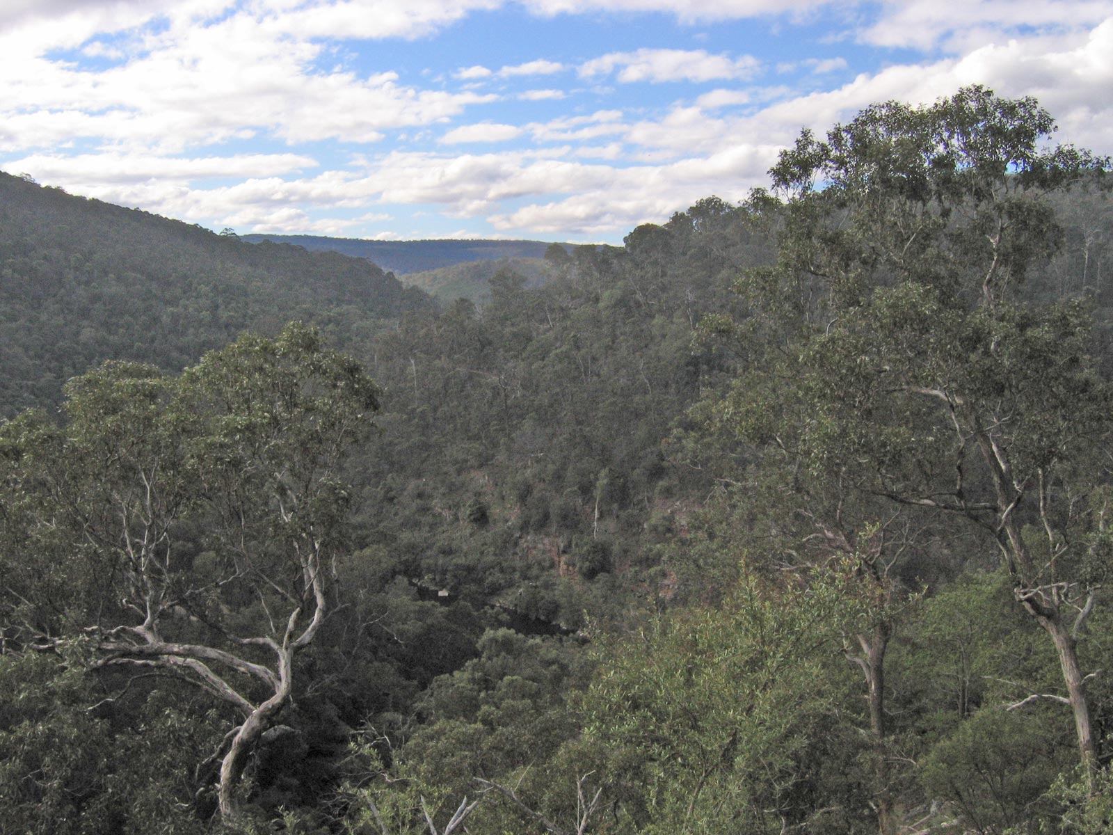
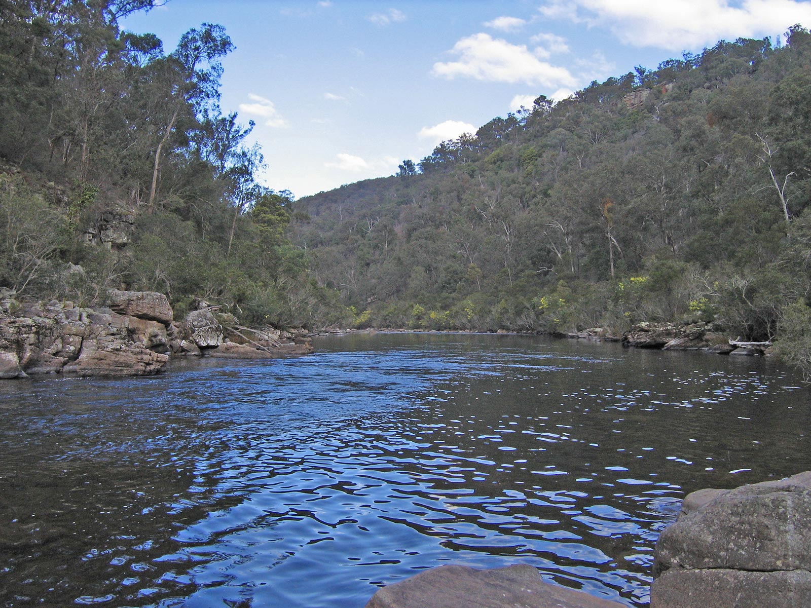
 Panorama of the Mitchell River as it carves a valley through the Mitchell River National Park
See also
- Protected areas of Victoria (Australia)
Notes
References
- "Mitchell River National Park". Parks Victoria. http://www.parkweb.vic.gov.au/1park_display.cfm?park=143. Retrieved 2006-08-27.
- (2004) Mitchell River National Park - Visitor Guide. Bairnsdale: Parks Victoria.
- Moon, R. and Moon, V. (Eds) (2000) Discover Australia: National Parks. Sydney: Global Book Publishing Pty Ltd.
External links
National Parks of Victoria Alfred · Alpine · Barmah · Baw Baw · Brisbane Ranges · Burrowa-Pine Mountain · Chiltern-Mount Pilot · Churchill · Cobboboonee · Coopracambra · Croajingolong · Dandenong Ranges · Errinundra · French Island · Grampians · Great Otway · Greater Bendigo · Gunbower · Hattah-Kulkyne · Heathcote-Graytown · Kinglake · Lake Eildon · Lind · Little Desert · Lower Glenelg · Lower Goulburn · Mitchell River · Mornington Peninsula · Morwell · Mount Buffalo · Mount Eccles · Mount Richmond · Murray-Sunset · Organ Pipes · Point Nepean · Port Campbell · St Arnaud Range · Snowy River · Tarra-Bulga · Terrick Terrick · The Lakes · Warby-Ovens · Wilsons Promontory · Wyperfeld · Yarra RangesCategories:- IUCN Category II
- National parks of Victoria (Australia)
- Protected areas established in 1986
- 1986 establishments in Australia
- East Gippsland


Wikimedia Foundation. 2010.