- Mitchell River (Victoria)
-
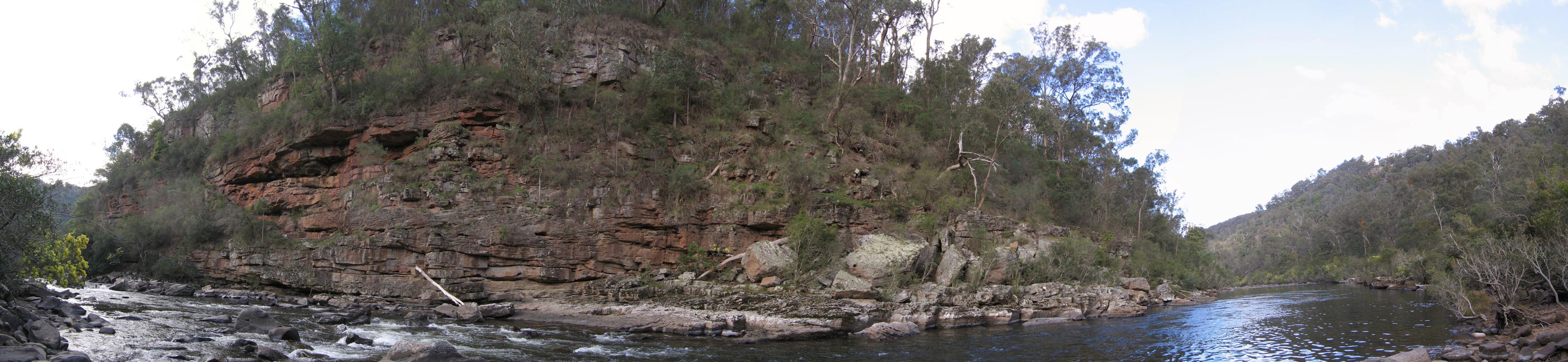
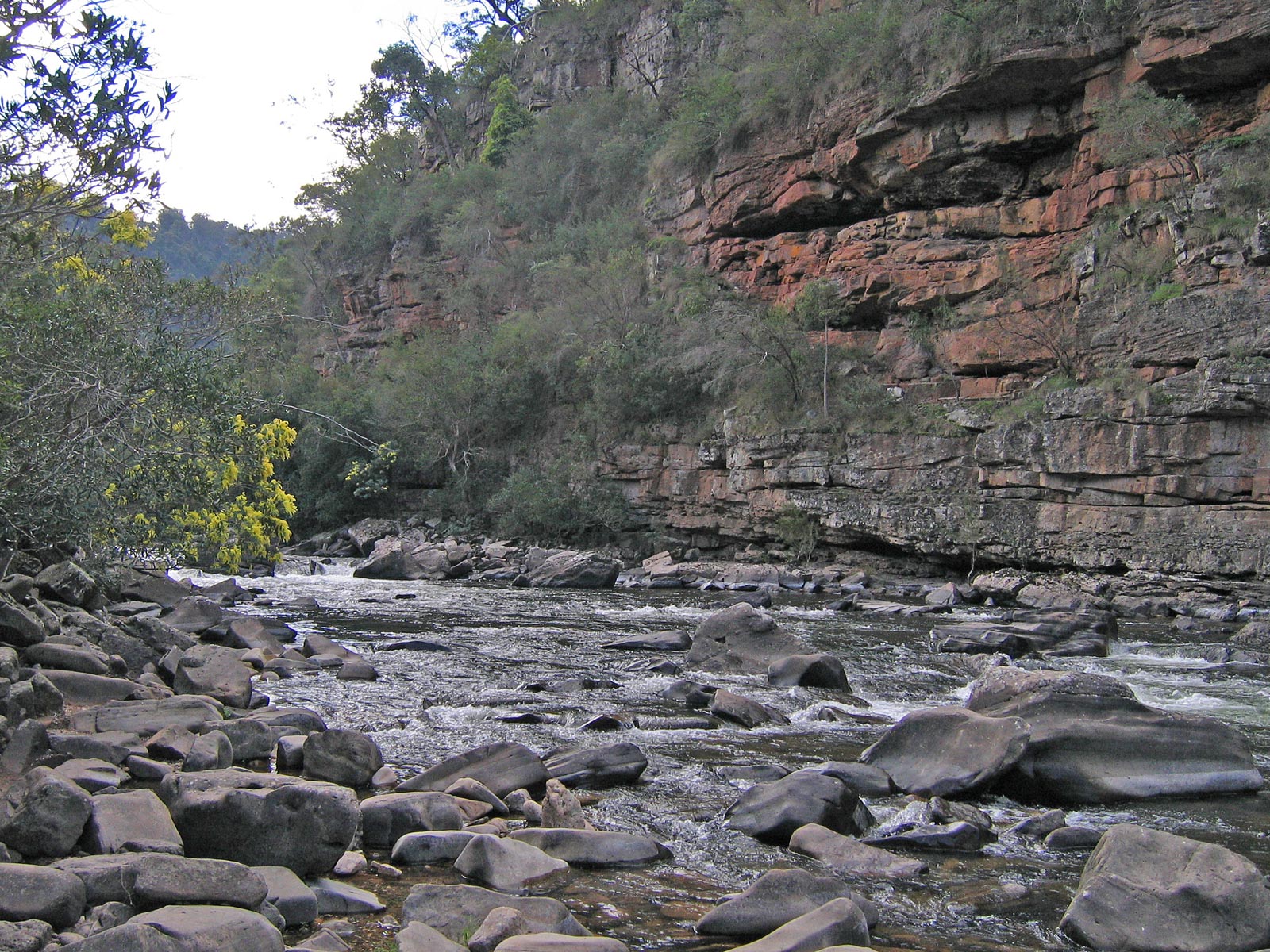
 Panorama of the Mitchell River as it carves a valley through the Mitchell River National Park
The Mitchell River is the largest unregulated river in Victoria, Australia and provides a unique example of riparian ecology. Tributaries include the Crooked, Dargo, Wentworth, Wonnangatta, and Wongungarra Rivers, which are surrounded by dense native forest on the steep mountains of the Victorian Alps. The river flows south and enters Lake King, one of the Gippsland Lakes.
The river was named by Angus McMillan in 1839 after Sir Thomas Mitchell, explorer and Surveyor General of New South Wales. [1] [2]
According to the Land Conservation Council Rivers & Streams Special Investigation 1990, "It is an important example of the large-scale biological systems that were once widespread in south-eastern Australia." The Mitchell River was listed as a Heritage River in 1992.
The Mitchell River National Park surrounds the spectacular Mitchell River where it passes between high cliffs and several gorges. The Den of Nargun mentioned in Aboriginal Legends is found about one kilometre from the river on a small tributary called Woolshed Creek. The Mitchell River was an important location to the Gunai/Kurnai nation, especially Brabuwooloong and the Brayakuloong people of central Gippsland.
The upper reaches of the Wonnangatta and Dargo rivers were mapped in 1850. From the 1860s, Bairnsdale developed as a port with the Mitchell River navigable for several kilometres upstream of Bairnsdale. The Gippsland Lakes provided access to steamers via Lakes Entrance for transport of livestock, timber, wool, skins and hides to market in Melbourne.
The Mitchell River is prone to flooding, sometimes cutting off towns such as Wy Yung and Lucknow from Bairnsdale and causing extensive damage to property, farmland and infrastructure. Most notable recent floods were those of April 1990 and June 2007. These floods are usually caused by severe weather systems in the Gippsland region that also flood other nearby rivers such as the Thomson and Avon rivers.
The tributary rivers have a very large population of Australian grayling, which is listed as a vulnerable species by the Department of Sustainability and Environment, and has a very high conservation value.
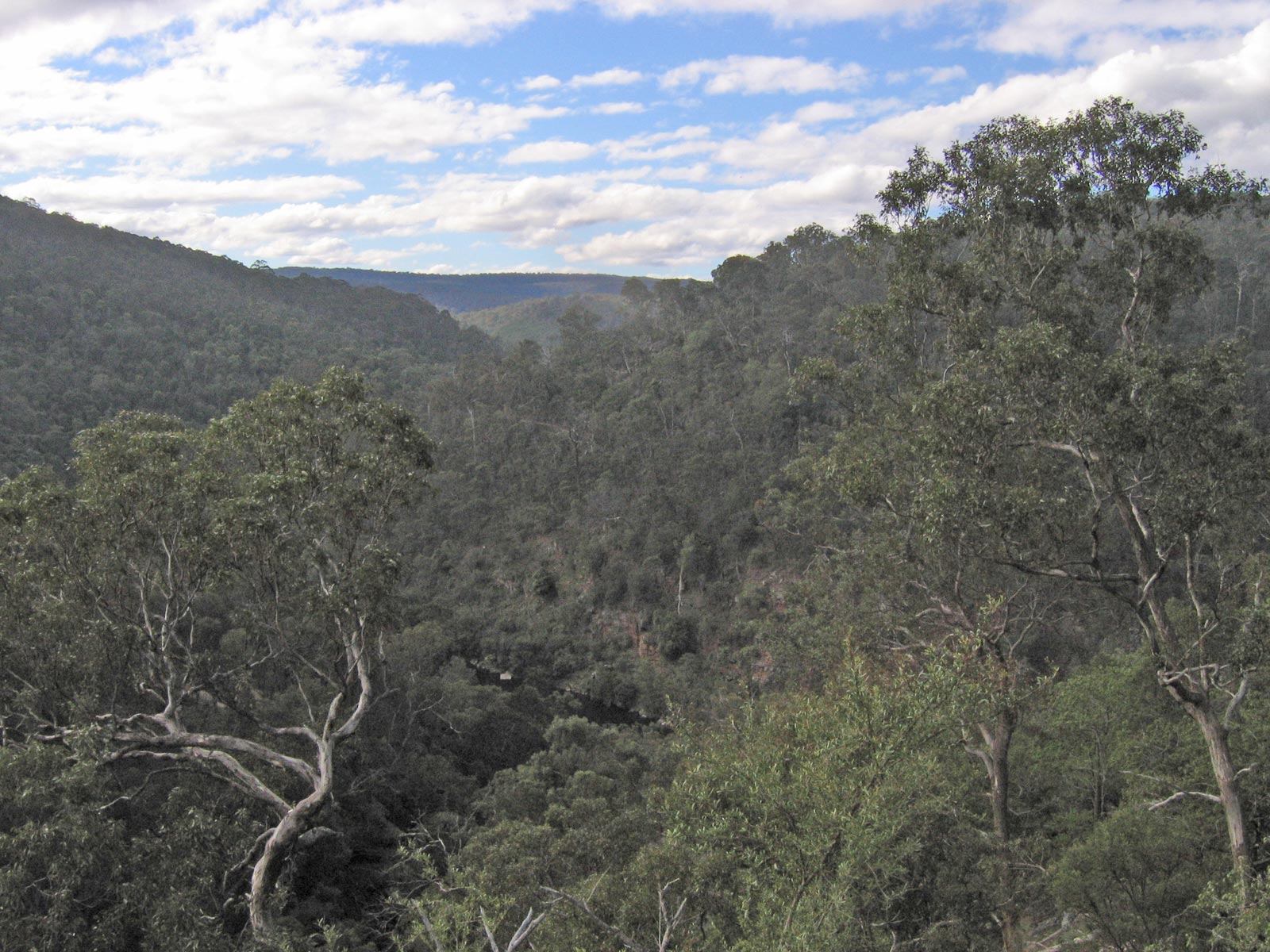
 The Mitchell River valley looking north from The Bluff Lookout high above the river in the Mitchell River NP
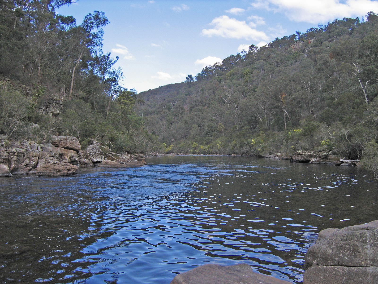
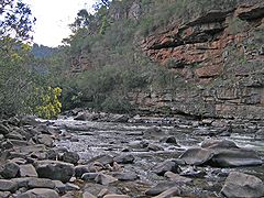 Upstream on the Mitchell River near the junction with Woolshed Creek in the Mitchell River NP
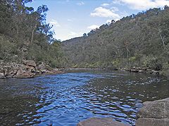 Downstream on the Mitchell River near the junction with Woolshed Creek in the Mitchell River NP
Geography
River Delta
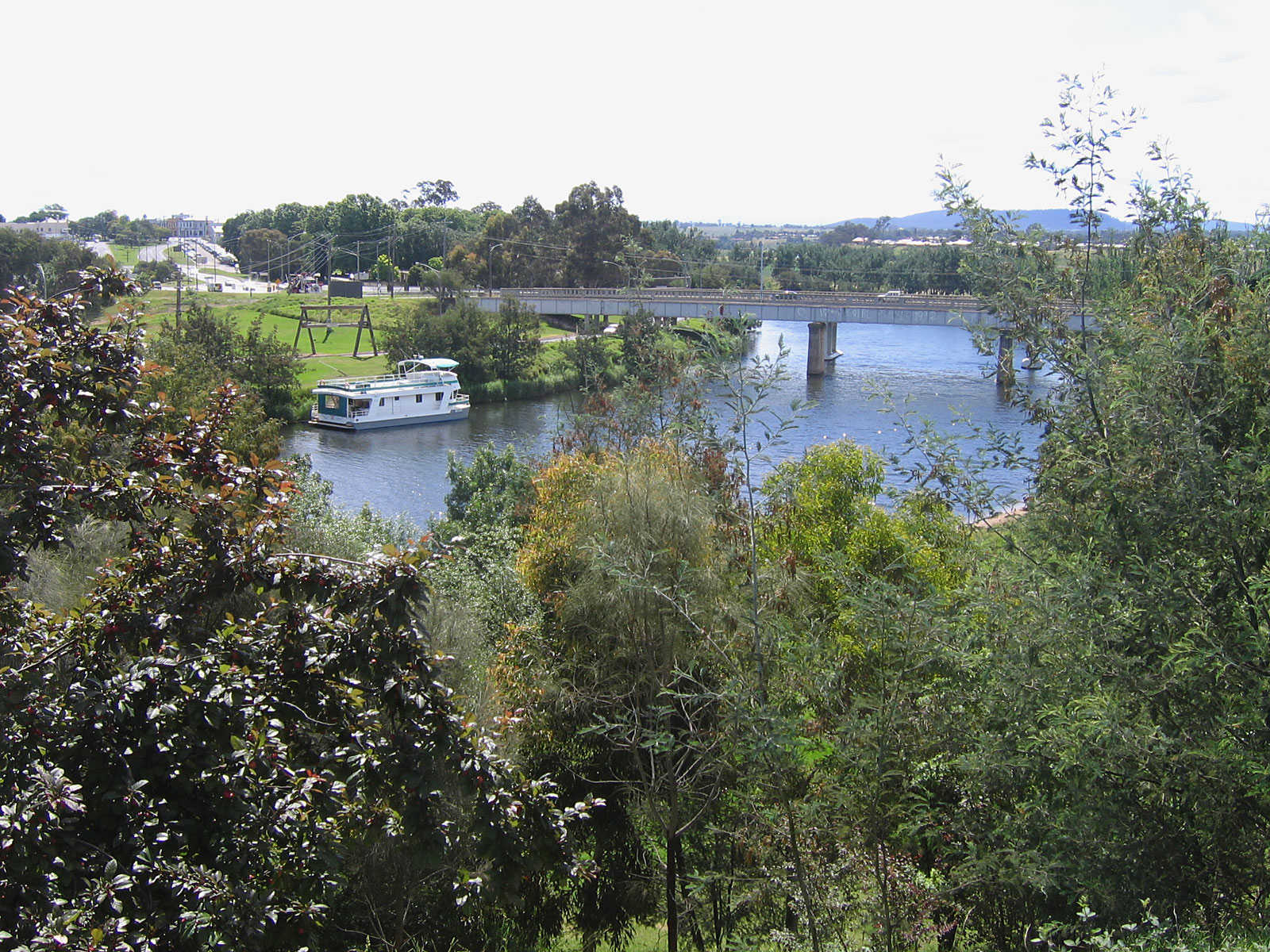
 The Mitchell River in Bairnsdale
The Mitchell River delta is a classic form of digitate delta and ranks as one of the world’s finest examples of this type of landform. The river sweeps near the western shore of Lake King before hitting Eagle Point Bluff and heading east into the lake.
Where the river meets the lake a river delta alluvial deposition of sediment has formed, known locally as silt jetties, which extend more than 8 kilometres east into the lake. Silt deposited by this process forms into long narrow banks which run many kilometres. The silt was deposited over millions of years to form silt banks or islets as the speed of the river slows. The silt jetties have been nominated by geologists as a site of international significance, second in size to those of the Mississippi River at the Gulf of Mexico.
The Mitchell River silt jetties are subject to erosion caused by a salinity increase in the lakes which is slowly killing off the vegetation. The creation and maintenance of the channel at Lakes Entrance in 1889 has increased salinity in the Lakes. Destruction of reeds, cattle grazing on the river banks, access by anglers, and scouring by boat wash also contribute to erosion.
Marshes near the river support an extensive range of waterbirds, including migratory waders and is used for education and interpretation purposes. The wetlands surrounding the Gippsland Lakes are listed for international significance under the Ramsar Convention on Wetlands.
References
- ^ Daley, Charles (1960), The Story of Gippsland, Melbourne: Whitcombe and Tombs, pp. 213, cited in Bird (2006)
- ^ Bird, Eric (12 October 2006). "Place Names on the Coast of Victoria". The Australian National Placename Survey (ANPS). Archived from the original on 2011-02-09. http://www.webcitation.org/5wNhWF4B7.
Coordinates: 37°50′10″S 147°38′24″E / 37.83611°S 147.64°E
Rivers of Victoria Rivers flowing towards the coast Agnes · Aire · Albert · Anglesea · Avon · Barham · Barwon · Bass · Bemm · Benedore · Betka · Brodribb · Bunyip · Calder · Cann · Cumberland · Darby · Dargo · Elliott · Eumeralla · Fitzroy · Ford · Franklin · Geary · Gellibrand · Glenelg · Grey · Hartland · Hopkins · Jamieson · Johanna · Jordan · Kennett · Lang Lang · La Trobe · Lerderderg · Little · Little Yarra · Macalister · Maribyrnong · Merri · Mitchell · Moorabool · Morwell · Moyne · Mueller · Nicholson · O'Shannassy · Parker · Patterson · Perry · Plenty · Powlett · Red · St George · Shaw · Snowy · Surry · Tambo · Tarra · Tarwin · Thomson · Thurra · Tidal · Timbarra · Wannon · Watts · Wentworth · Werribee · Wingan · Woady Yaloak · Wye · Yarra · Yarrowee · YeerungRivers of the Murray basin Rivers draining inland Categories:- Rivers of Victoria (Australia)
- East Gippsland
Wikimedia Foundation. 2010.