- Darraweit Guim, Victoria
-
Darraweit Guim
Victoria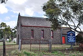
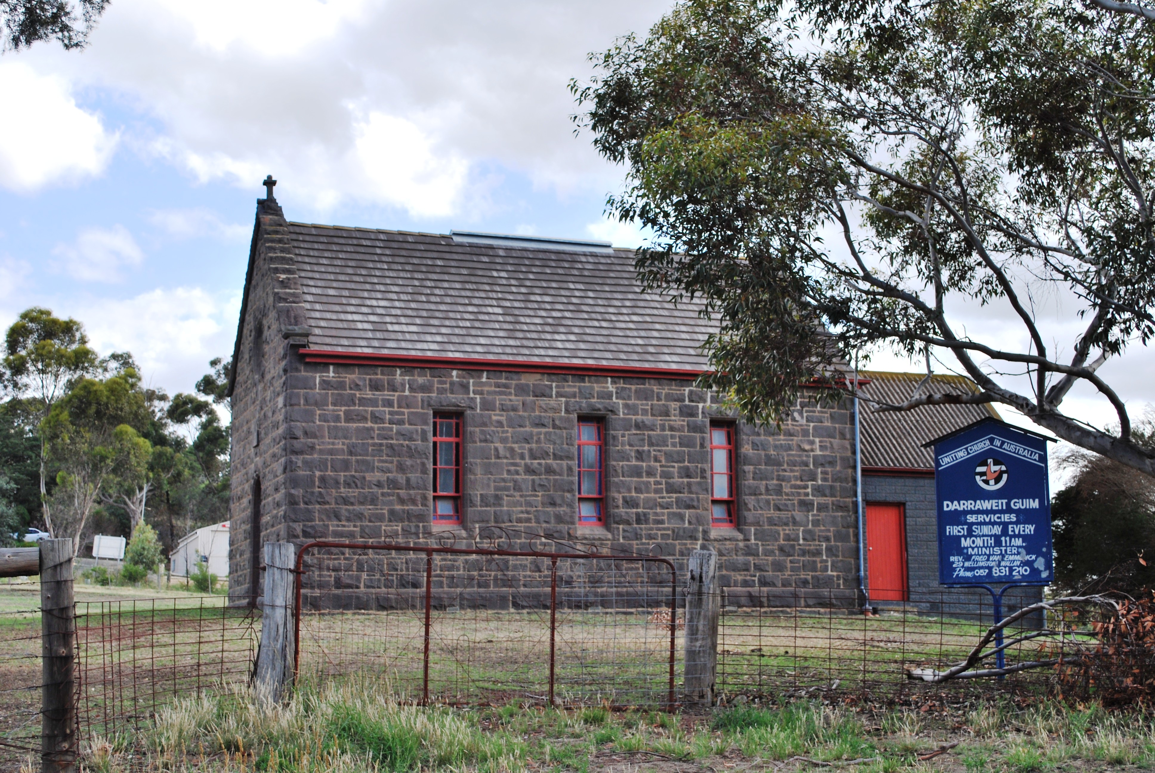
Bluestone Uniting church
 Darraweit Guim
Population: 672 (2006)[1] Postcode: 3756 Elevation: 306 m (1,004 ft) Location: LGA: Shire of Macedon Ranges State District: Macedon Federal Division: McEwen Localities around Darraweit Guim: Romsey Springfield Wallan Bolinda Darraweit Guim Beveridge Clarkefield Wildwood Mickleham Darraweit Guim (pronounced /ˈdærəwiːt ˈɡwɪm/) is a Victorian town situated on Deep Creek, which rises in the hills beyond Romsey on the edge of the Shire of Macedon Ranges near the shire's boundary with the Shire of Mitchell. In 1992 the town had an approximate population of 300 with approximately 120 homes and a local school overseeing 51 students. Next to the school are the two local tennis courts which are regularly used. Up the hill is the Town Hall, Churches and CFA which protects the area. Platypus can be spotted in the local creek, and Wombats also have burrows in the river banks.
Contents
Naming
It is thought by some that Darraweit Guim means "the meeting of the waters"[2] in a local Aboriginal language. Another legend has it that "Darraweit' means the meeting and "Guim" means the turn which the course of the water makes in the township. Which legend is correct no one is sure, but according to the Postal Department record of Post Offices in the Commonwealth of Australia, it is the only one known by that name. The first survey of the district was made in 1851 by Surveyor Foote, who gave it the name of Darraweit Guim,[2] which was approved by the authorities in Sydney.
History
The Toll Bar
It would appear that when early settlement was started it was at the Toll Bar Corner which is the junction of the now Old Broadmeadows road and the Darraweit Guim road. In the early 1860s Mr and Mrs Francis conducted a general store there and also collected the toll at the Toll gates. This toll was a charge made on those using the road and went to the maintenance of the road. There was also a hotel or wine shanty conducted by the Cummins family, descendants of whom are still in the district. One of the "Toll Gates" from Toll Bar corner later hung for many years below Mr Geo. Wilson's house where his property opens on to the road to Darraweit Guim (Stennings Lane). What other places of interest existed at the Toll Bar Hill is difficult to ascertain, but we have heard of a blacksmith, and possibly there would be others who lived there. It has been said that surplus butter from those living on the Deep Creek towards Darraweit Guim was carted to meet the transport wagons (either bullock or horse wagons) at the Toll Bar Corner for transport either to Melbourne or to the Goldfields in Bendigo. The early potatoes grown here were taken to the goldfields, north, rather than to Melbourne as today. In those days it was on the goldfields that the heavy concentration of population was to be found. The Stockdale family who settled at "Oakdale" in the 1850s and are still there, tell of produce going to the goldfields. Mrs Stockdale, snr was a Cummins of the Toll Bar, and the first of the family at "Oakdale" was born in 1858.
Township area
It would appear from the early parish plan that the township area was made available for selection in the year 1866, though some allotments were granted as early as 1864. Some of these earlier ones are the blocks opposite Chas. Coustley's and selected in the name of J. Crough, along with several lying to the north of them in the name of W. J. Lobb. J. Purves selected as early as 1864. As many of the blocks bear the date 18/511866 it would appear that that date rated high in the selection calendar. The block where the store stands was granted to Cornelius Francis on that day, as were those between the then Wesleyan Church and then Presbyterian Church. Above the Presbyterian Church there were four blocks in the name of T. Shelley and one in the name of E. Maher, all allotted between 3/5/1 and 6/711867.
Natural disasters
During the winter Deep Creek in Darraweit Guim is prone to the occasional flood and did so in 1906[3], 1916, 1934, 1964[3] and 1990, at its height reaching above the waist. Then in the summer the area was prone to bush fires and in 1904 & 1927 massive sections of the area were burned. Since those times technology and organisation skills have minimised the risks. Even so in 1969 fires destroyed 12 homes. Both the town's churches and the town hall were also destroyed, and later rebuilt.
Post Office
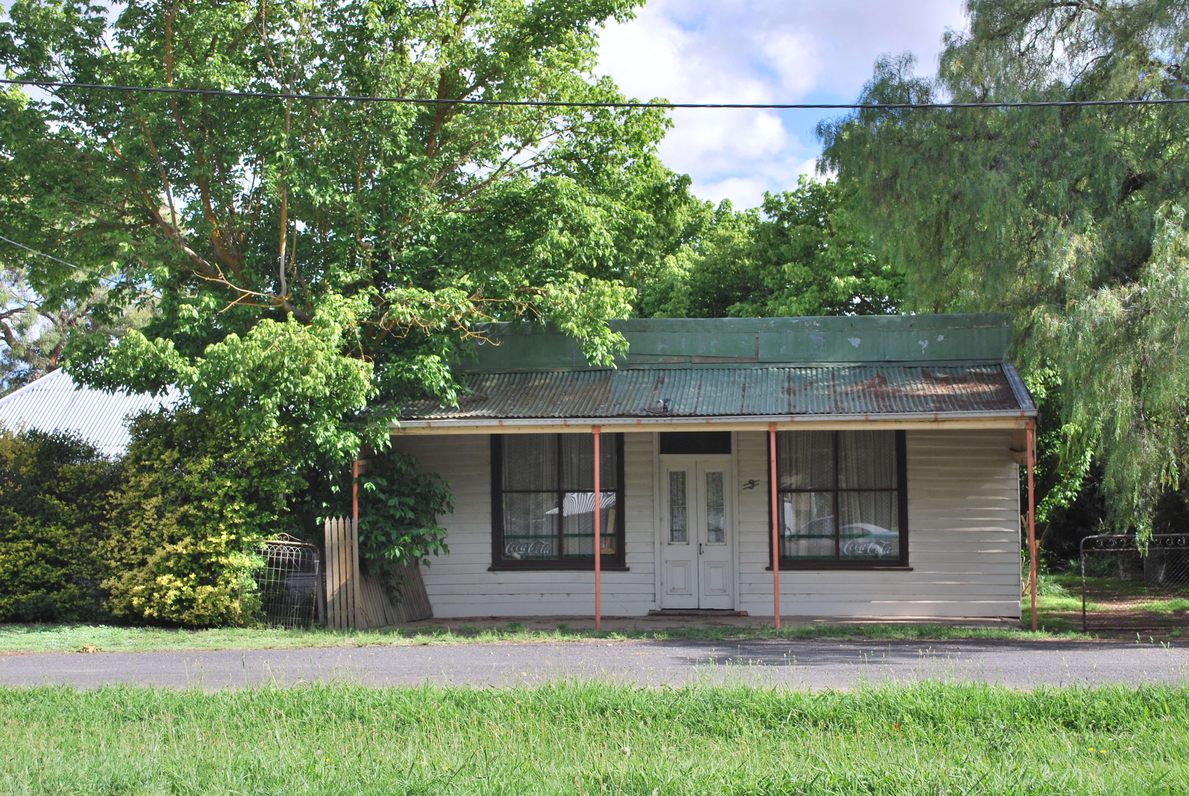
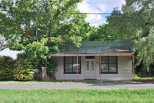 The general store, now closed
Wallan Wallan post office was opened in 1858 and serviced Darraweit Guim 6 times a week until the Darraweit Guim Office was opened in 1868 (closed 1976) [4]. It often shifted between households and continued until the mid 1950’s when Wallan reclaimed the run. Rail to the area was surveyed in the 1880s but was never followed through with. The town's general store closed in the 1980s, reopened for a while in the 1990s by the Guy family. The current owners hoped to reopen it, but it is getting a bit dilapidated
Pioneering Families
Anderton, Barry, Brown, Cummins, Delaney, Elder, Francis, Howden, Lade, Lobb, Maher, McCabe, McDonald, McDonell, Moore, Robson, Stenning, Stockdale, Tom, Waitt, Wilson and Hoban.
Resources
- Darraweit Guim P.S. 125th Anniversary Booklet: A Brief History of the School and District (1992, G. Taylor).
References
- ^ Australian Bureau of Statistics (25 October 2007). "Darraweit Guim (State Suburb)". 2006 Census QuickStats. http://www.censusdata.abs.gov.au/ABSNavigation/prenav/LocationSearch?collection=Census&period=2006&areacode=SSC25447&producttype=QuickStats&breadcrumb=PL&action=401. Retrieved 2007-10-01.
- ^ a b Reid, John, ed. (1992). When memory turns the key: the history of the Shire of Romsey. Bacchus Marsh, Victoria: Jovial. p. 123. ISBN 978-0-9588112-5-5.
- ^ a b Mitchell, Peter; Alan Jackson, Carol Moore, Gavin Smith (2004). Romsey: A Veritable Garden of Eden. Romsey: West Bourke Books Inc. pp. 46–49. ISBN 978-0-646-43570-1.
- ^ Premier Postal History. "Post Office List". https://www.premierpostal.com/cgi-bin/wsProd.sh/Viewpocdwrapper.p?SortBy=VIC&country=. Retrieved 2008-04-11
External links
Towns and localities in the Shire of Macedon Ranges
(major towns in bold)Ashbourne · Baynton · Bolinda · Bullengarook · Carlsruhe · Cherokee · Clarkefield · Cobaw · Darraweit Guim · Gisborne · Gisborne South · Hesket · Kerrie · Kyneton · Lancefield · Lauriston · Macedon · Malmsbury · Monegeetta · Monegeetta North · Mount Macedon · New Gisborne · Newham · Riddells Creek · Rochford · Romsey · Springfield · Tylden · Woodend · Woodend North
Categories:- Towns in Victoria (Australia)
- Macedon Ranges

Wikimedia Foundation. 2010.