- Shire of Mitchell
-
Shire of Mitchell
Victoria
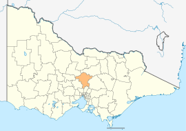
Location in VictoriaPopulation: 34,119(2009)[1] Area: 2862 km² (1,105.0 sq mi) Mayor: Cr William Melbourne Council Seat: Broadford 
LGAs around Shire of Mitchell: Mount Alexander Greater Bendigo Strathbogie Macedon Ranges Shire of Mitchell Murrindindi Hume Whittlesea Nillumbik Shire of Mitchell is a Local Government Area in Victoria, Australia. It is located in the central part of the state. It includes the towns of Broadford, Kilmore, Seymour, Tallarook, Pyalong and Wallan. It has an area of 2,847 square kilometres and in 2006 it had a population of 30,928. It was formed in 1994 and 1995 from the merger of the Shire of Pyalong, Shire of Kilmore, and parts of the Shire of Broadford, Shire of McIvor, and Rural City of Seymour. It is the second fastest growing regional municipality in Victoria.
Contents
Wards
- Central
- North
- South
Each ward is represented by three elected Councillors.[2]
See also
References
- ^ Australian Bureau of Statistics (30 March 2010). "Regional Population Growth, Australia, 2008–09". http://www.abs.gov.au/ausstats/abs@.nsf/Latestproducts/3218.0Main%20Features52008-09?opendocument&tabname=Summary&prodno=3218.0&issue=2008-09&num=&view=. Retrieved 3 June 2010.
- ^ Local Government Victoria. "Mitchell Shire Council". http://www.localgovernment.vic.gov.au/web20/dvclgv.nsf/AllDocs/4005CCC72DC2A4BFCA257168003040E6?OpenDocument. Retrieved 2008-10-30
External links
Towns in the Shire of Mitchell Local Government Areas of Victoria Greater Melbourne Inner MelbourneMetropolitanBanyule · Bayside · Boroondara · Darebin · Glen Eira · Hobsons Bay · Kingston · Maribyrnong · Maroondah · Monash · Moonee Valley · Moreland · WhitehorseOuter MetropolitanBrimbank · Cardinia · Casey · Frankston · Greater Dandenong · Hume · Knox · Manningham · Melton · Mornington Peninsula · Nillumbik · Whittlesea · Wyndham · Yarra RangesSouthwest Central Highlands and Goldfields Ballarat · Central Goldfields · Greater Bendigo · Hepburn · Loddon · Macedon Ranges · Mitchell · Moorabool · Mount AlexanderGoulburn Valley Northeast Gippsland Western District Wimmera The Mallee Coordinates: 37°06′00″S 145°04′00″E / 37.1°S 145.0666667°E
Categories:- Local Government Areas of Victoria (Australia)
- Australia government stubs
Wikimedia Foundation. 2010.
