- City of Kingston
-
This article refers to the municipal area of Kingston in Victoria, Australia. For other places called Kingston, see Kingston.
City of Kingston
Victoria
Population: 147,214(2009)[1] • Density: 1479.4/km² (3,831.6/sq mi) Established: 1994 Area: 91 km² (35.1 sq mi) Mayor: Steve Staikos Location: 15 km (9 mi) from Melbourne city centre Region: Melbourne State District: Mordialloc, Carrum Federal Division: Hotham, Isaacs 
LGAs around City of Kingston: Bayside Glen Eira Monash Port Phillip City of Kingston Greater Dandenong Port Phillip Frankston Frankston The City of Kingston is a Local Government Area in Victoria, Australia. It is located in the south-eastern suburbs of Melbourne, its northern boundary lying approximately 15 km from the Melbourne city centre[2] along the north-eastern shorelines of Port Phillip. It covers an area of 91 km² and has a estimated population of 134,626 people.[1][2]
Contents
Council structure
Elected representatives
The City of Kingston is divided into three wards, each with three Councilors:
North Ward: Highett, Moorabbin, Oakleigh South, Clayton South, Clarinda, Heatherton and Dingley Village
- Cr Steve Staikos (Mayor)
- Cr Arthur Athanasopoulos
- Cr Paul Peulich
Central Ward: Cheltenham, Mentone, Parkdale, Moorabbin Airport, Mordialloc and Braeside.
- Cr Ron Brownlees
- Cr Rosemary West OAM
- Cr Lewis Dundas
South Ward: Aspendale, Waterways, Chelsea, Chelsea Heights, Bonbeach, Carrum and Patterson Lakes.
- Cr Dan Moloney
- Cr John Ronke
- Cr Trevor Shewan
Corporate management
- Chief Executive Officer, John Nevins
- General Manager Environmental Sustainability, Tony Rijs
Environmental Management and Maintenance, Infrastructure Environment, Planning and Building, Strategic Planning, Economic Development - General Manager Organisational Development and Governance, Elaine Sowerby
Organisational Development & Governance, Community Engagement - General Manager Community Sustainability, Mauro Bolin
Community Services, Library and Education Services, Local Laws and Health Services, Leisure and Culture, Bayside Community Options - General Manager Corporate Services, Paul Franklin
Information Services, Financial Services, Property Services, Aquatic and Leisure Centres
Council services
The Council has an annual budget of approximately $122.2 million (2007/08)[3] with works involving areas such as road maintenance and construction, community, cultural and youth activities, town planning and development, waste management and recycling, maintenance of parks and public areas, public health and animal control, library services, and business and tourism support.
Suburbs
Suburb Postcode Population (2006) Area Dist. from CBD Establishment Notes Aspendale 3195 6,404 2.9 km² (1.1 sq mi) 26 km (16 mi) 1891 Aspendale Gardens 3195 6,383 3.3 km² (1.3 sq mi) 29 km (18 mi) 1891 Bonbeach 3196 4,992 2.8 km² (1.1 sq mi) 32 km (20 mi) 1927 Braeside 3195 6 N/A 26 km (16 mi) 1915 Carrum 3197 3,378 1.5 km² (0.6 sq mi) 33 km (21 mi) 1882 Chelsea 3196 6,694 2.6 km² (1.0 sq mi) 30 km (19 mi) 1907 Chelsea Heights 3196 5,125 3.2 km² (1.2 sq mi) 32 km (20 mi) 1907 Cheltenham 3192 19,526 10.1 km² (3.9 sq mi) 19 km (12 mi) 1854 shared with City of Bayside Clarinda 3169 7,652 3.7 km² (1.4 sq mi) 17 km (11 mi) 1846 Clayton South 3169 10,644 8.3 km² (3.2 sq mi) 20 km (12 mi) 1929 Dingley Village 3172 10,072 7.9 km² (3.1 sq mi) 22 km (14 mi) 1913 Edithvale 3196 4,991 2.1 km² (0.8 sq mi) 29 km (18 mi) 1919 Heatherton 3202 2,253 7 km² (2.7 sq mi) 21 km (13 mi) 1885 Highett 3190 9,402 3.9 km² (1.5 sq mi) 17 km (11 mi) 1881 shared with City of Bayside Mentone 3194 11,238 7.5 km² (2.9 sq mi) 21 km (13 mi) 1854 Moorabbin 3189 5,170 4.6 km² (1.8 sq mi) 16 km (10 mi) 1857 Moorabbin Airport 3194 N/A N/A N/A 1949 Airport treated as own suburb. Mordialloc 3195 7,524 4.4 km² (1.7 sq mi) 25 km (16 mi) 1863 Oakleigh South 3167 8,933 6.6 km² (2.5 sq mi) 17 km (11 mi) 1936 shared with City of Monash Parkdale 3195 10,618 3.6 km² (1.4 sq mi) 24 km (15 mi) 1920 Patterson Lakes 3197 7,235 4.2 km² (1.6 sq mi) 35 km (22 mi) 1876 Waterways 3195 806 N/A 29 km (18 mi) 2006 History
The City of Kingston area was originally governed by the Moorabbin Roads Board, which formed in 1862 and became a shire council in 1871, covering a large area of mixed agricultural and semi-urban land. After years of agitation, in 1917 the seaside town of Sandringham became a borough with its own council, and this fuelled the desire of those living in towns further south to combine their efforts and demand self-representation. This finally occurred in May 1920 and the "Borough of Mordialloc and Mentone" was formed. It became a town in 1923 and the City of Mordialloc in 1926.
In 1994, the Kennett Liberal government amalgamated local councils all over Victoria, as part of its local government reform. The new City of Kingston was one result, comprising all of the City of Chelsea, most of the City of Mordialloc, a substantial portion of the City of Moorabbin, and parts of the Cities of Oakleigh and Springvale.
A new electoral structure for Kingston was effected in November 2008. Under the new structure there are three wards - North Ward, Central Ward and South Ward, and three Councillors representing each ward. This makes a total of nine Councillors, instead of the previous structure of seven wards each represented by one Councillor.
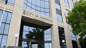
Kingston's headquarters are located at the 7-storey "1230 Nepean Hwy" building, which has become a landmark to Cheltenham as well as the council. The A-Grade office building was built in 1993.[4]
Schools
Primary Education
- Aspendale Primary School
- Aspendale Gardens Primary School
- Bonbeach Primary School
- Carrum Primary School
- Cheltenham East Primary School
- Chelsea Primary School
- Chelsea Heights Primary School
- Clarinda Primary School
- Clayton South Primary School
- Dingley Primary School
- Edithvale Primary School
- Our Lady of the Assumption Catholic Primary School
- Patterson Lakes Primary School
- Le Page Primary School
- Kingston Heath Primary School
- Kingswood Primary School
- St Andrew's Catholic Primary School
- St Catherines Catholic Primary School
- St Louis De Montforts Catholic Primary School
- St Mark's Primary School
- St Brigid's Catholic Primary School
- St John Vianney's Catholic Primary School
- St Joseph's Catholic Primary School
- St Patrick's Catholic Primary School
- Mordialloc Primary School
- Parktone Primary School
- Parkdale Primary School
- Mentone Primary School
Secondary Education
- Cheltenham Secondary College
- St Bede's Catholic College
- Kilbreda College
- Mentone Girls' Secondary College
- Mordialloc Secondary College
- Parkdale Secondary College
Primary & Secondary Eductation
Railway Stations
- Aspendale
- Aspendale railway station - April 1891
- Bonbeach
- Bonbeach railway station - February 1927
- Carrum
- Carrum railway station - August 1882
- Cheltenham
- Cheltenham railway station - December 1881
- Southland railway station - (Approved)
- Chelsea
- Chelsea railway station - February 1907
- Edithvale
- Edithvale railway station - September 1919
- Highett
- Highett railway station - December 1885
- Mentone
- Mentone railway station - December 1881
- Mordialloc
- Mordialloc railway station - December 1881
- Moorabbin
- Moorabbin railway station - December 1881
- Parkdale
- Parkdale railway station - September 1919
Library Services
City of Kingston operates nine free council run libraries.[5]
Opening Hours
Branch Monday Tuesday Wednesday Thursday Friday Saturday Sunday Chelsea* 10am-8pm 10am-8pm 1pm-8pm 10am-6pm 10am-6pm 10am-2pm 2pm-5pm Cheltenham* 10am-8pm 10am-8pm 1pm-8pm 10am-6pm 10am-6pm 10am-2pm 2pm-5pm Clarinda* 10am-8pm 10am-8pm 1pm-8pm 10am-6pm 10am-6pm 10am-2pm 2pm-5pm Dingley 2pm-6pm 2pm-6pm Closed 10am-2pm 2pm-6pm 10am-1pm Closed Highett 10am-6pm 10am-6pm Closed 10am-6pm 10am-6pm 10am-1pm Closed Moorabbin 1pm-5pm 10am-2pm Closed 10am-5pm 1pm-5pm 10am-1pm Closed Parkdale* 10am-8pm 10am-8pm 1pm-8pm 10am-6pm 10am-6pm 10am-2pm 2pm-5pm Patterson Lakes 10am-5.30pm 2pm-5.30pm 2pm-5.30pm 2pm-5.30pm 2pm-5.30pm 10am-1pm Closed Warrigal Road** Closed Closed Closed Closed Closed Closed Closed * - Major Libraries open every day of the week.
** - Currently closed as of February 23 2011.
See also
- List of Melbourne suburbs
- Local Government Area
References
- ^ a b Australian Bureau of Statistics (30 March 2010). "Regional Population Growth, Australia, 2008–09". http://www.abs.gov.au/ausstats/abs@.nsf/Latestproducts/3218.0Main%20Features52008-09?opendocument&tabname=Summary&prodno=3218.0&issue=2008-09&num=&view=. Retrieved 4 June 2010.
- ^ a b "Kingston City Council - Local Government Victoria - Department for Victorian Communities". Find your local council. Department for Victorian Communities. 2007-01-24. http://www.dvc.vic.gov.au/web20/dvclgv.nsf/AllDocs/CB60B4026FC4B5BBCA2571610024CC37?OpenDocument. Retrieved 2007-07-20.
- ^ Kingston City Council (2007-07-18). "Budget for Kingston Council 2007-08". http://www.kingston.vic.gov.au/Page/page.asp?Page_Id=1920&h=0. Retrieved 2007-07-20.
- ^ http://www.kingston.vic.gov.au/page/page.asp?page_Id=2694
- ^ http://www.kingston.vic.gov.au/page/page.asp?Page_Id=1646&=0
External links
- Kingston City Council
- Kingston Historical Website, in particular The Battle for Local Government: The Severance of Mordialloc from Moorabbin in 1920
- Department for Victorian Communities Kingston City Council Municipality Profile (includes ward map)
- Metlink local public transport for City of Kingston
- Link to Land Victoria interactive maps
Local Government Areas of Victoria Greater Melbourne Inner MelbourneMetropolitanBanyule · Bayside · Boroondara · Darebin · Glen Eira · Hobsons Bay · Kingston · Maribyrnong · Maroondah · Monash · Moonee Valley · Moreland · WhitehorseOuter MetropolitanBrimbank · Cardinia · Casey · Frankston · Greater Dandenong · Hume · Knox · Manningham · Melton · Mornington Peninsula · Nillumbik · Whittlesea · Wyndham · Yarra RangesSouthwest Central Highlands and Goldfields Goulburn Valley Northeast Gippsland Western District Wimmera The Mallee Categories:- Populated places established in 1994
- 1994 establishments in Australia
- Local Government Areas in Melbourne
- Local Government Areas of Victoria (Australia)


Wikimedia Foundation. 2010.