Shire of Hepburn

Shire of Hepburn

Infobox Australian Place | type = lga
name = Shire of Hepburn
state = vic


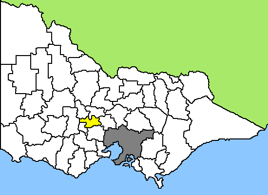
caption = Location in Victoria
pop = 13,732 (2006 Census)
area = 1470
est =
seat = Daylesford
mayor = Tim Hayes
region =

url = http://www.hepburn.vic.gov.au/
stategov =
fedgov =
near-nw = Central Goldfields
near-n = Mount Alexander
near-ne = Mount Alexander
near-w = Pyrenees
near-e = Macedon Ranges
near-sw = Ballarat
near-s = Moorabool
near-se = Macedon Ranges
The Shire of Hepburn is a Local Government Area in Victoria, Australia. It is located in the central part of the state. It includes the towns of Clunes, Creswick, Daylesford, Hepburn Springs and Trentham. It has an area of 1,463 square kilometres. In 2006 it had a population of 13,732. It was formed in 1995 from the merger of the Shire of Creswick, Shire of Daylesford and Glenlyon and parts of the Shire of Kyneton and Shire of Talbot and Clunes.

External links

* [http://www.hepburn.vic.gov.au/ Hepburn Shire Council official website]


Wikimedia Foundation. 2010.

Игры ⚽ Поможем сделать НИР

Look at other dictionaries:

  • Shire of Hepburn — Hepburn Shire Lage des Hepburn Shire in Victoria Basisdaten Bundesstaat: Victoria Hauptort: Daylesford Fläche: 1.470 …   Deutsch Wikipedia

  • Hepburn — may refer to:People with the surname Hepburn (the most famous in recent times being actresses Katharine Hepburn and Audrey Hepburn): * Hepburn (surname)Linguistics* Hepburn romanization, a system for the Romanization of JapanesePlaces;Australia * …   Wikipedia

  • Shire of Daylesford and Glenlyon — Infobox Australian Place | type = lga name = Shire of Daylesford and Glenlyon state = vic region = area = 609.3 est = 1860 seat = Daylesford pop = 5,980 (1992) [cite book|title=Victorian Year Book|author=Australian Bureau of Statistics, Victoria… …   Wikipedia

  • Hepburn Springs, Victoria — Infobox Australian Place | type = town name = Hepburn Springs state = vic caption = Main rd lga = Shire of Hepburn postcode = 3461 est = pop = 601 elevation= maxtemp = mintemp = rainfall = stategov = Ballarat East fedgov = Ballarat dist1 = 125… …   Wikipedia

  • Shire of Talbot and Clunes — Infobox Australian Place | type = lga name = Shire of Talbot and Clunes state = vic region = area = 541.31 est = 1860 seat = Talbot pop = 2,580 (1992) [cite book|title=Victorian Year Book|author=Australian Bureau of Statistics, Victoria… …   Wikipedia

  • Shire of Creswick — Infobox Australian Place | type = lga name = Shire of Creswick state = vic region = area = 551.66 est = 1859 seat = Creswick pop = 4,870 (1992) [cite book|title=Victorian Year Book|author=Australian Bureau of Statistics, Victoria… …   Wikipedia

  • Hepburn Shire — Lage des Hepburn Shire in Victoria Gliederung …   Deutsch Wikipedia

  • Shire of Mount Alexander — Victoria Location in Victoria …   Wikipedia

  • Shire of Moorabool — Victoria Location in Victoria Population …   Wikipedia

  • Shire of Cardinia — Lage von Cardinia Shire in Melbourne Basisdaten Bundesstaat: Victoria Hauptort: Pakenham Fläche: 1.280 …   Deutsch Wikipedia

Share the article and excerpts

Direct link
Do a right-click on the link above
and select “Copy Link”