- Shire of Creswick
Infobox Australian Place | type = lga
name = Shire of Creswick
state = vic
region =
area = 551.66
est = 1859
seat = Creswick
pop = 4,870 (1992) [cite book|title=Victorian Year Book|author=Australian Bureau of Statistics, Victoria Office|year=1994|page=49-52|id=ISSN 0067-1223]
logosize =
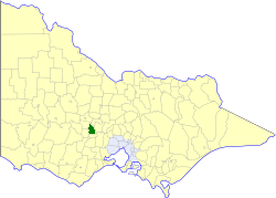
caption = Location in Victoria
county = Talbot
near-nw = Talbot and Clunes
near-n = Newstead
near-ne = Newstead
near-w = Talbot and Clunes
near-e = Daylesford and Glenlyon
near-sw = Ballarat
near-s = Bungaree
near-se = Ballan
_noautocat = yesThe Shire of Creswick was a Local Government Area located about convert|120|km|mi|0 west-northwest of
Melbourne , the state capital of Victoria,Australia . The shire covered an area of convert|551.66|km2|sqmi|1, and existed from 1859 until 1994.History
Creswick was first incorporated as a district on 11 January 1859, and became a shire on 31 December 1863. The Borough of Creswick, incorporated on 19 November 1858 with an area of convert|19.26|km2|acre|0, was united with the Shire on 29 May 1934.cite book|title=Victorian Municipal Directory|year=1992|publisher=Arnall & Jackson|location=Brunswick|pages=642-643 Accessed at
State Library of Victoria , La Trobe Reading Room.]On 20 January 1995, the Shire was abolished, and merged with Shires of Daylesford and Glenlyon and part of Kyneton and Talbot into the
Shire of Hepburn . [cite book|url=http://www.ausstats.abs.gov.au/ausstats/free.nsf/0/76E601D6DB55E88ACA25722500049195/$File/12570_1994-95.pdf|title=Victorian local government amalgamations 1994-1995: Changes to the Australian Standard Geographical Classification|author=Australian Bureau of Statistics |date=1 August 1995|publisher=Commonwealth of Australia|page=7|isbn=0-642-23117-6|accessdate=2008-01-05]Wards
Creswick was divided into four ridings, each of which elected three councillors:
* Creswick Riding
* North Creswick Riding
* Northeast Riding
* South RidingTowns and Localities
* Allendale
* Broomfield
* Blampied
* Cabbage Tree
* Campbelltown
* Creswick
* Creswick North
* Dean
* Glengower
* Kangaroo Hills
* Kingston
* Kooroocheang
* Lawrence
* Mollongghip
* Moorookyle
* Mount Prospect
* Newlyn
* Rockyn
* Smeaton
* Springmount
* Ullina
* Wattle FlatPopulation
* Estimate in 1958 Victorian Year Book.
References
Wikimedia Foundation. 2010.