- Shire of Ballarat
Infobox Australian Place | type = lga
name = Shire of Ballarat
state = vic
region =
area = 481.74
est = 1856
seat = Wendouree
pop = 19,530 (1992) [cite book|title=Victorian Year Book|author=Australian Bureau of Statistics, Victoria Office|year=1994|page=49-52|id=ISSN 0067-1223]
logosize =
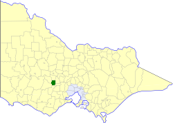
caption = Location in Victoria
county = Ripon, Talbot, Grenville
near-nw = Lexton
near-n = Talbot and Clunes
near-ne = Creswick
near-w = Lexton
near-e = Bungaree
near-sw = Ripon
near-s = Grenville
near-se = Ballaarat
_noautocat = yesThe Shire of Ballarat was a Local Government Area located immediately to the northwest and west of the regional city of Ballarat, Victoria,
Australia . The shire covered an area of convert|481.74|km2|sqmi|1, and existed from 1856 until 1994.History
Ballarat was first incorporated as a district on 7 October 1856, and became a shire on 24 November 1863.cite book|title=Victorian Municipal Directory|year=1992|publisher=Arnall & Jackson|location=Brunswick|pages=584 Accessed at
State Library of Victoria , La Trobe Reading Room.]On 6 May 1994, the Shire was abolished, and merged with
City of Ballaarat ,Borough of Sebastopol and parts of the Shires of Bungaree, Buninyong, Grenville and Ripon into theCity of Ballarat . [cite book|url=http://www.ausstats.abs.gov.au/ausstats/free.nsf/0/76E601D6DB55E88ACA25722500049195/$File/12570_1994-95.pdf|title=Victorian local government amalgamations 1994-1995: Changes to the Australian Standard Geographical Classification|author=Australian Bureau of Statistics |date=1 August 1995|publisher=Commonwealth of Australia|page=|isbn=0-642-23117-6|accessdate=2008-01-05]Wards
Ballarat was divided into four ridings on 11 November 1952, each of which elected three councillors:
* Alfredton Riding
* Central Riding
* Rural Riding
* Showgrounds RidingTowns and Localities
* Addington
* Ascot
* Alfredton (split withCity of Ballaarat )
* Bald Hills
* Ballarat North
* Blowhard
* Burrumbeet
* Cardigan
* Cardigan Village
* Coghills Creek
* Dowling
* Glendaruel
* Invermay Park
* Learmonth
* Miners Rest
* Mitchell Park
* Mount Rowan
* Sulky
* Tourello
* Weatherboard
* Wendouree
* WindermerePopulation
* Estimate in 1958 Victorian Year Book.
References
Wikimedia Foundation. 2010.