Shire of Grenville

Shire of Grenville

Infobox Australian Place | type = lga
name = Shire of Grenville
state = vic
region =
area = 845
est = 1861
seat = Linton
pop = 8,580 (1992) [cite book|title=Victorian Year Book|author=Australian Bureau of Statistics, Victoria Office|year=1994|page=49-52|id=ISSN 0067-1223]

logosize =


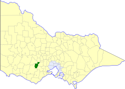
caption = Location in Victoria
county = Grenville
near-nw = Ripon
near-n = Ballarat
near-ne = Ballaarat
near-w = Hampden
near-e = Buninyong
near-sw = Hampden
near-s = Hampden
near-se = Leigh
_noautocat = yes

The Shire of Grenville was a Local Government Area located southwest of the regional city of Ballarat, Victoria, Australia. The shire covered an area of convert|845|km2|sqmi|1, and existed from 1861 until 1994.

History

Grenville was first incorporated as a district on 27 August 1861, and became a shire on 16 February 1864. On 1 October 1915, under the "Local Government Amendment Act 1914", it absorbed the areas of two boroughs—Browns and Scarsdale, which had incorporated on 25 July 1862 with an area of convert|23.31|km2|acre|0, and Smythesdale, incorporated on 12 April 1861 with an area of convert|5.83|km2|acre|0.cite book|title=Victorian Municipal Directory|year=1992|publisher=Arnall & Jackson|location=Brunswick|pages=689 Accessed at State Library of Victoria, La Trobe Reading Room.]

On 6 May 1994, the Shire was abolished, and merged with Shire of Bannockburn, Shire of Leigh and part of Buninyong into the Golden Plains Shire.

Wards

Grenville was divided into four ridings on 16 May 1977, each of which elected three councillors:
* Delacombe Riding
* East Riding
* North Riding
* West Riding

Towns and Localities

* Bonshaw
* Delacombe
* Haddon
* Happy Valley
* Linton
* Nintingbool
* Piggoreet
* Scarsdale
* Smythesdale
* Smythes Creek

Population

* Estimate in 1958 Victorian Year Book.

References


Wikimedia Foundation. 2010.

Игры ⚽ Поможем написать курсовую

Look at other dictionaries:

  • Shire of Leigh — Infobox Australian Place | type = lga name = Shire of Leigh state = vic region = area = 982 est = 1861 seat = Rokewood pop = 2,340 (1992) [cite book|title=Victorian Year Book|author=Australian Bureau of Statistics, Victoria… …   Wikipedia

  • Shire of Bannockburn — Infobox Australian Place | type = lga name = Shire of Bannockburn state = vic region = area = 702.28 est = 1862 seat = Bannockburn pop = 4,560 (1992) [cite book|title=Victorian Year Book|author=Australian Bureau of Statistics, Victoria… …   Wikipedia

  • Shire of Moorabool — Victoria Location in Victoria Population …   Wikipedia

  • Shire of Buninyong — Infobox Australian Place | type = lga name = Shire of Buninyong state = vic region = area = 785.1 est = 1858 seat = Buninyong pop = 12,760 (1992) [cite book|title=Victorian Year Book|author=Australian Bureau of Statistics, Victoria… …   Wikipedia

  • Shire of Ballarat — Infobox Australian Place | type = lga name = Shire of Ballarat state = vic region = area = 481.74 est = 1856 seat = Wendouree pop = 19,530 (1992) [cite book|title=Victorian Year Book|author=Australian Bureau of Statistics, Victoria… …   Wikipedia

  • Shire of Hampden — Infobox Australian Place | type = lga name = Shire of Hampden state = vic region = area = 2620.91 est = 1857 seat = Camperdown pop = 6960 (1992) [cite book|title=Victorian Year Book|author=Australian Bureau of Statistics, Victoria… …   Wikipedia

  • Shire of Ripon — Infobox Australian Place | type = lga name = Shire of Ripon state = vic region = area = 1533 est = 1861 seat = Beaufort pop = 3530 (1992) [cite book|title=Victorian Year Book|author=Australian Bureau of Statistics, Victoria… …   Wikipedia

  • Shire of Winchelsea — Infobox Australian Place | type = lga name = Shire of Winchelsea state = vic region = area = 1294 est = 1860 seat = Winchelsea pop = 5,020 (1992) [cite book|title=Victorian Year Book|author=Australian Bureau of Statistics, Victoria… …   Wikipedia

  • Shire of Colac — Infobox Australian Place | type = lga name = Shire of Colac state = vic region = area = 1458.2 est = 1859 seat = Colac pop = 7230 (1992) [cite book|title=Victorian Year Book|author=Australian Bureau of Statistics, Victoria… …   Wikipedia

  • Shire of Bungaree — Infobox Australian Place | type = lga name = Shire of Bungaree state = vic region = area = 228 est = 1863 seat = Leigh Creek pop = 4,900 (1992) [cite book|title=Victorian Year Book|author=Australian Bureau of Statistics, Victoria… …   Wikipedia

Share the article and excerpts

Direct link
Do a right-click on the link above
and select “Copy Link”