- Shire of Colac
Infobox Australian Place | type = lga
name = Shire of Colac
state = vic
region =
area = 1458.2
est = 1859
seat = Colac
pop = 7230 (1992) [cite book|title=Victorian Year Book|author=Australian Bureau of Statistics, Victoria Office|year=1994|page=49-52|id=ISSN 0067-1223]
logosize =
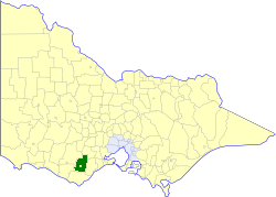
caption = Location in Victoria
county = Polwarth, Grenville
near-nw = Hampden
near-n = Leigh
near-ne = Leigh
near-w = Hampden
near-e = Winchelsea
near-sw = Heytesbury
near-s = Otway
near-se = Winchelsea
_noautocat = yesThe Shire of Colac was a Local Government Area located about convert|150|km|mi|0 west-southwest of
Melbourne , the state capital of Victoria,Australia . The shire covered an area of convert|1458.2|km2|sqmi|1, and existed from 1859 until 1994.History
Colac was first incorporated as a district on 11 May 1859, and became a shire on 10 May 1864. On 31 May 1901 it was divided into four ridings, although these were later abolished. A significant portion of the Shire seceded to join parts of Heytesbury and Winchelsea in forming the new
Shire of Otway on 6 May 1919. On 19 January 1938 the town of Colac itself split away to form the Borough, laterCity of Colac .cite book|title=Victorian Municipal Directory|year=1992|publisher=Arnall & Jackson|location=Brunswick|pages=633-634 Accessed atState Library of Victoria , La Trobe Reading Room.]On 23 September 1994, the Shire was abolished, and merged with
City of Colac , most of theShire of Otway and parts of the Shires of Heytesbury and Winchelsea into theColac-Otway Shire . [cite book|url=http://www.ausstats.abs.gov.au/ausstats/free.nsf/0/76E601D6DB55E88ACA25722500049195/$File/12570_1994-95.pdf|title=Victorian local government amalgamations 1994-1995: Changes to the Australian Standard Geographical Classification|author=Australian Bureau of Statistics |date=1 August 1995|publisher=Commonwealth of Australia|page=5,11|isbn=0-642-23117-6|accessdate=2008-01-05]Towns and Localities
Population
* Estimate in the 1958 Victorian Year Book.
References
Wikimedia Foundation. 2010.