- Shire of Otway
Infobox Australian Place | type = lga
name = Shire of Otway
state = vic
region =
area = 1906.94
est = 1919
seat = Beech Forest
pop = 3960 (1992) [cite book|title=Victorian Year Book|author=Australian Bureau of Statistics, Victoria Office|year=1994|page=49-52|id=ISSN 0067-1223]
logosize =
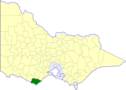
caption = Location in Victoria
county = Heytesbury, Polwarth
near-nw = Heytesbury
near-n = Colac
near-ne = Winchelsea
near-w = Heytesbury
near-e = "Bass Strait "
near-sw = "Southern Ocean "
near-s = "Bass Strait "
near-se = "Bass Strait "
_noautocat = yesThe Shire of Otway was a Local Government Area located about convert|190|km|mi|0 southwest of
Melbourne , the state capital of Victoria,Australia . The shire covered an area of convert|1906.94|km2|sqmi|1, and existed from 1919 until 1994.History
Otway was first incorporated as a shire on 6 May 1919, carved out of parts of the Shires of Colac, Heytesbury and Winchelsea. In 1964, it annexed further parts of Heytesbury (in Coradjil Parish) and Winchelsea (in Kanglang Parish). In 1969, it lost the town of Simpson to Heytesbury.cite book|title=Victorian Municipal Directory|year=1992|publisher=Arnall & Jackson|location=Brunswick|pages=799 Accessed at
State Library of Victoria , La Trobe Reading Room.]On 23 September 1994, the Shire was abolished, and merged with City and most of the
Shire of Colac and parts of the Shires of Heytesbury and Winchelsea into theColac-Otway Shire . The town of Princetown merged west into theCorangamite Shire . [cite book|url=http://www.ausstats.abs.gov.au/ausstats/free.nsf/0/76E601D6DB55E88ACA25722500049195/$File/12570_1994-95.pdf|title=Victorian local government amalgamations 1994-1995: Changes to the Australian Standard Geographical Classification|author=Australian Bureau of Statistics |date=1 August 1995|publisher=Commonwealth of Australia|page=5|isbn=0-642-23117-6|accessdate=2008-01-05]Wards
Otway was divided into four ridings in 1987, each of which elected three councillors:
* Apollo Bay Riding
* Coastal Riding
* Central Riding
* West RidingTowns and Localities
* Apollo Bay
* Barham Paradise
* Beech Forest
*Cape Otway
* Carlisle River
* Forrest
* Gellibrand
* Glen Aire
* Hordern Vale
* Johanna
* Kennett River
* Lavers Hill
* Marengo
* Princetown
* Skenes Creek
* Wye River
* Wyelangta
* YuulongPopulation
* Estimate in the 1958 Victorian Year Book.
References
Wikimedia Foundation. 2010.