Lavers Hill, Victoria

Lavers Hill, Victoria

Infobox Australian Place | type = town
name = Lavers Hill
state = vic
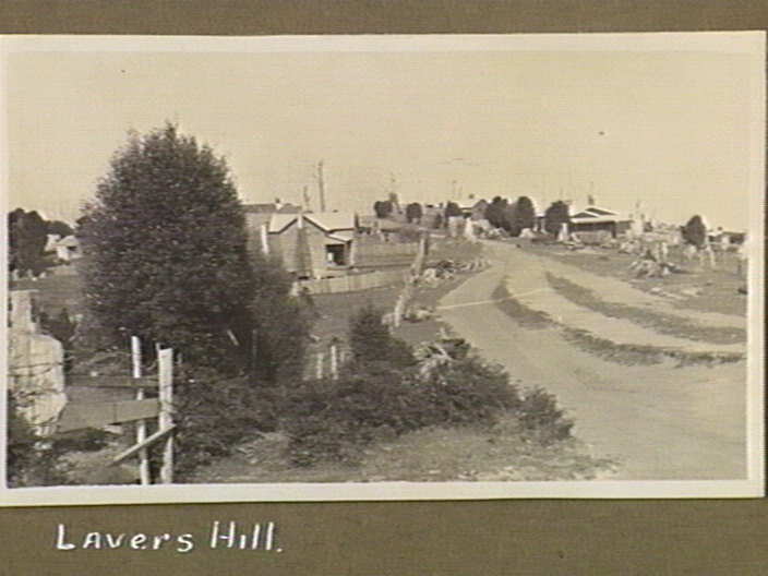


caption = Lavers Hill, 1926
lga = Colac Otway Shire
postcode = 3238
pop = 208
est =
stategov = Polwarth
fedgov = Corangamite
dist1 = 205
dir1 = SW
location1= Melbourne
dist2 = 134
dir2 = SW
location2= Geelong
dist3 = 56
dir3 = S
location3= Colac
dist4 = 48
dir4 = W
location4= Apollo Bay
dist5 = 48
dir5 = E
location5= Port Campbell

Lavers Hill is a town in Victoria, Australia, located convert|48|km|mi|0|lk=on inland from Port Campbell and convert|48|km|mi|0|lk=on from Apollo Bay. The township is located approximately convert|205|km|mi|0|lk=on south-west of the state capital, Melbourne. At the 2006 census, Lavers Hill had a population of 208.Census 2006 AUS
id=SSC25983
name=Lavers Hill (State Suburb)
accessdate=2007-08-04
quick=on
]

References


Wikimedia Foundation. 2010.

Игры ⚽ Поможем сделать НИР

Look at other dictionaries:

  • List of localities in Victoria (Australia) — Map of Local Government Areas in Victoria This is a list of locality names and populated place names in the state of Victoria, Australia, outside the Melbourne metropolitan area. It is organised by region from the south west of the state to the… …   Wikipedia

  • Colac, Victoria — Colac Victoria The Princes Highway running through Colac …   Wikipedia

  • List of high schools in Victoria — This is a list of high schools, also known as secondary colleges, in the state of Victoria, Australia. The list includes Government, Private, Independent and Catholic schools. It does not include primary schools.A* Academy of Mary Immaculate *… …   Wikipedia

  • Torquay, Victoria — Torquay (Australia) redirects here. For the town in Queensland, see Torquay, Queensland. For the town in Tasmania, see Torquay, Tasmania. Torquay Victoria …   Wikipedia

  • Cressy, Victoria — Cressy Victoria The historic Frenchman s Inn …   Wikipedia

  • Crowes railway line, Victoria — The Crowes railway line was a narrow gauge (RailGauge|30) railway located in the Otway Ranges in south eastern Victoria, Australia, running from the main line to Port Fairy at Colac to Beech Forest and later Crowes.It was the third of four Narrow …   Wikipedia

  • Great Ocean Road — Surfcoast Highway …   Wikipedia

  • Великая океанская дорога — Начало Дороги Великая океанская дорога (англ. Great Ocean Road) туристическая дост …   Википедия

  • Great Ocean Road — …   Deutsch Wikipedia

  • Narrow gauge lines of the Victorian Railways — NA class locomotive, preserved on the Puffing Billy Railway in the original green livery used by the Victorian Railways until 1903. Photographed at Gembrook in 2006. The former Victorian Railways, the state railway authority in Victoria,… …   Wikipedia

Share the article and excerpts

Direct link
Do a right-click on the link above
and select “Copy Link”