- Cressy, Victoria
-
Cressy
Victoria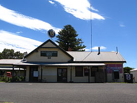
The historic Frenchman's Inn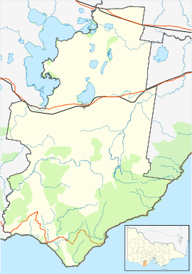
 Cressy
Population: 122[1] Postcode: 3322 Location: LGA: Colac Otway Shire State District: Polwarth Federal Division: Corangamite, Wannon Cressy is a country town in Victoria, Australia, about 38 km north of Colac on the Ballarat road. At the 2006 census, Cressy and the surrounding area had a population of 122.[1]
History
George Russell put Cressy on the map around 1836. A Frenchman named Jean Duverney crossed the Woady Yaloak River in 1837, claimed land on both banks and called the area Frenchman's Run. Duverney called the small, developing village Cressy, after Crecy in France, where he was born.
Cressy Post Office opened on 1 January 1858. [2]
The old airfield towards Colac was used by the RAAF during WWII. It operated during the war years 1939-1946 as a combat training aerodrome. The history group at the church have some photos and information on the airmen and the planes. The local cemetery is surrounded by old trees, very peaceful and still in use today.Cressy in recent times
Cressy was once a bustling town with several shops, garages, churches and a thriving railway station. Cressy still boasts many interesting old buildings, although many were destroyed in the fires of 1977. There are two beautiful old churches, and the Cressy Historical Society is now housed in the Presbyterian Church, opposite the old Post Office and general store. The church was built in 1862 and is open for research on the first Sunday of every month. The old post office was built in 1924 at a cost of £5,000 and is currently a family home. The public restrooms back onto a picnic spot with a new children's playground.
References
- ^ a b Australian Bureau of Statistics (25 October 2007). "Cressy (State Suburb)". 2006 Census QuickStats. http://www.censusdata.abs.gov.au/ABSNavigation/prenav/LocationSearch?collection=Census&period=2006&areacode=SSC25419&producttype=QuickStats&breadcrumb=PL&action=401. Retrieved 2007-07-26.
- ^ Premier Postal History, Post Office List, https://www.premierpostal.com/cgi-bin/wsProd.sh/Viewpocdwrapper.p?SortBy=VIC&country=, retrieved 2008-04-11
Towns in the Colac Otway Shire Local Government Area Alvie · Apollo Bay · Barongarook · Barwon Downs · Beeac · Beech Forest · Birregurra · Colac · Cororooke · Cressy · Elliminyt · Forrest · Gellibrand · Irrewarra · Irrewillepe · Johanna · Kawarren · Kennett River · Larpent · Lavers Hill · Pirron Yallock · Swan Marsh · Warrion · Wye River
Coordinates: 38°01′S 143°38′E / 38.017°S 143.633°E has a primary school
Categories:- Towns in Victoria (Australia)


Wikimedia Foundation. 2010.