- Derrinallum, Victoria
-
Derrinallum
Victoria
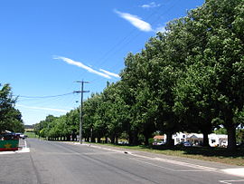
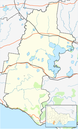
Avenue on main streetPopulation: 557 (2006)[1] Postcode: 3325 Location: LGA: Corangamite Shire State District: Polwarth Federal Division: Wannon Derrinallum is a town in Victoria, Australia, located on the Hamilton Highway, in the Corangamite Shire. The town is the centre for the surrounding farming community and lies at the foot of Mount Elephant.
Mount Elephant is a 240 m high conical breached scoria cone formed by an extinct volcano.
At the 2001 census, Derrinallum had a population of 266. At the 2006 census, Derrinallum had a population of 557.
The Post Office opened on 7 December 1868 but was named Tooliorook until 1873. [2]
The town in conjunction with neighbouring township Lismore has an Australian Rules football team Lismore-Derrinallum competing in the Mininera & District Football League.
Derrinallum P12 College is a co-educational state school in the town.
References
- ^ Australian Bureau of Statistics (25 October 2007). "Derrinallum (State Suburb)". 2006 Census QuickStats. http://www.censusdata.abs.gov.au/ABSNavigation/prenav/LocationSearch?collection=Census&period=2006&areacode=SSC25469&producttype=QuickStats&breadcrumb=PL&action=401. Retrieved 2007-10-01.
- ^ Premier Postal History, Post Office List, https://www.premierpostal.com/cgi-bin/wsProd.sh/Viewpocdwrapper.p?SortBy=VIC&country=, retrieved 2008-04-11
Towns in the Corangamite Shire Camperdown · Cobden · Derrinallum · Foxhow · Lismore · Noorat · Port Campbell · Princetown · Simpson · Skipton · Terang · Timboon
Categories:- Towns in Victoria (Australia)
- Australian Aboriginal placenames
- Victoria (Australia) geography stubs
Wikimedia Foundation. 2010.


