- Noorat, Victoria
-
Noorat
Victoria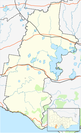
 Noorat
Population: 252 (2006)[1] Postcode: 3265 Location: LGA: Corangamite Shire State District: Polwarth Federal Division: Wannon Noorat is a small town in southwestern Victoria, Australia. Noorat is located approximately 240km west of Melbourne. The township is located at the base of Mount Noorat, a dormant volcano, which is considered to have Australia's largest dry crater. At the 2006 census, Noorat had a population of 252.
Noorat derives its name from Mount Noorat, a dormant volcano named by Major Mitchell after a local Indigenous elder, Ngoora. Europeans first settled the Noorat area in early 1839 when MacKillop and Smith established a run called Strathdownie – which was renamed Glenormiston by Niel Black, who purchased the property in 1840.
Prior to European settlement, the area near Mount Noorat was a traditional meeting site where Indigenous tribes – the Kirrae Wuurong people - held ceremonies, bartered goods and settled disputes. There are conflicting reports about the number of Indigenous people living in the district at the time of white settlement, but in 1841, the population of the Mount Noorat clan numbered only four people. An outbreak of small pox during the 1830’s was one cause of the population decline and the alleged massacre of Indigenous people by white settlers was another.
One of the worst massacres in the western district of Victoria allegedly occurred along Mount Emu Creek near Noorat in August 1839. This was seemingly verified by Niel Black, who found a mass grave on the Glenormiston property.
The settlement history of Noorat is closely linked with the Black family and the establishment of Glenormiston. Noorat ostensibly grew as a service centre for the Black family estate and many of the early residents either emigrated with Niel Black or worked at Glenormiston.
The Post Office opened on 1 August 1874 as Mount Noorat, and was renamed Noorat in 1875. [2]
Noted author, Alan Marshall, was born in Noorat's general store, in 1902.
It has two schools, Noorat Primary School, and the Noorat campus of Mercy Regional College, which has recently been renovated and now houses the year 7 and 8 students of the school. There is also the senior campus at Camperdown. The Glenormiston campus of South West Institute of TAFE is located a few kilometres north-east of the township, on the other side of the mountain.
The town has a local football team, the Kolora-Noorat Power, who merged in 2002 from the Noorat Bombers and Kolora Magpies. They compete in the Warrnambool & District Football League. Their colours are teal, black and white.
References
- ^ Australian Bureau of Statistics (25 October 2007). "Noorat (State Suburb)". 2006 Census QuickStats. http://www.censusdata.abs.gov.au/ABSNavigation/prenav/LocationSearch?collection=Census&period=2006&areacode=SSC26357&producttype=QuickStats&breadcrumb=PL&action=401. Retrieved 2007-10-01.
- ^ Premier Postal History, Post Office List, https://www.premierpostal.com/cgi-bin/wsProd.sh/Viewpocdwrapper.p?SortBy=VIC&country=, retrieved 2008-04-11
External links
Towns in the Corangamite Shire Camperdown · Cobden · Derrinallum · Foxhow · Lismore · Noorat · Port Campbell · Princetown · Simpson · Skipton · Terang · Timboon
Coordinates: 38°11.4733′S 142°55.6591′E / 38.1912217°S 142.9276517°E
Categories:- Towns in Victoria (Australia)
- Victoria (Australia) geography stubs
- Australian Aboriginal placenames

Wikimedia Foundation. 2010.