- Cobden, Victoria
-
Cobden
Victoria
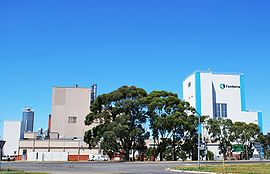
Fonterra dairy plant at CobdenPopulation: 1813(2006)[1] Established: 1840s Postcode: 3266 Coordinates: 38°20′S 143°04′E / 38.333°S 143.067°ECoordinates: 38°20′S 143°04′E / 38.333°S 143.067°E Location: - 210 km (130 mi) SW of Melbourne
- 50 km (31 mi) N of Port Campbell
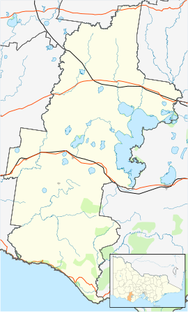
LGA: Corangamite Shire State District: Polwarth Federal Division: Wannon Cobden is a town located 210 kilometres southwest of Melbourne, Victoria, Australia named in honour of Richard Cobden. At the 2006 census, Cobden had a population of 1813. At the 2001 census, Cobden had a population of 1419.[1]
Contents
History
The Cobden area was first settled in the 1840s by Dr. Daniel Curdie. He settled in the Heytesbury forest area on a small creek not far from where the present day Cobden lies. Dr. Curdie, so overcome by its beauty, christened the area Lovely Banks. The Cobden township was established in the late 1860s, the Post Office opening on January 6, 1867.[2] The Heytesbury Forest attracted logging companies and with them more settlers. Homes were built and stock set to graze on the newly established pasture. In April 1892 a railway was established from Camperdown thru Cobden to Timboon , a plan to extend the line to Port Campbell was never built , the train carried out timber and came back loaded with produce and provisions. The prosperity was not to last however and as the Heytesbury forest was reduced in size, most of it surviving in the Jancourt State Forest, The need for freight trains waned. The last train was in 1987. The line has since been removed, its place taken by a walking trail. In 1888 Cobden opened the first cheese and butter factory in Victoria. Today the factory still operates, owned by Fonterra Co-operative Group Ltd, and houses the largest milk drying plant in Australia. Today Cobden and its surrounding area claim to be the "Dairy Capital" of the world, a claim based on the over 140,000 head of cattle in and around the area.
Geography
Part of the reason for the rich soil that surrounds Cobden is its convenient location on the southern border of the Lakes and Craters Country ,the fourth largest volcanic plain in the world.[3] Though the volcanoes are dormant, the ash they once spewed has enriched the soil greatly.
Community
The town has an Australian Rules football team playing in the Hampden Football League. The Cobden Bombers was a foundation club of the League and have won 6 premierships....[4]
Golfers play at the Cobden Golf Club on Neylon Street.[5]
References
- ^ a b Australian Bureau of Statistics (25 October 2007). "Cobden (State Suburb)". 2006 Census QuickStats. http://www.censusdata.abs.gov.au/ABSNavigation/prenav/LocationSearch?collection=Census&period=2006&areacode=SSC25359&producttype=QuickStats&breadcrumb=PL&action=401. Retrieved 2007-10-01.
- ^ Premier Postal History, Post Office List, https://www.premierpostal.com/cgi-bin/wsProd.sh/Viewpocdwrapper.p?SortBy=VIC&country=, retrieved 2008-04-11
- ^ Department of Primary Industry, Corangamite, http://www.dpi.vic.gov.au/DPI/Vro/coranregn.nsf/pages/corangamite_eruption_points_leura, retrieved 2008-07-21
- ^ Full Points Footy, Cobden, http://www.fullpointsfooty.net/Cobden.htm, retrieved 2008-07-25[dead link]
- ^ Golf Select, Cobden, http://www.golfselect.com.au/armchair/courseView.aspx?course_id=952, retrieved 2009-05-11
Towns in the Corangamite Shire Camperdown · Cobden · Derrinallum · Foxhow · Lismore · Noorat · Port Campbell · Princetown · Simpson · Skipton · Terang · Timboon
Categories:- Towns in Victoria (Australia)
Wikimedia Foundation. 2010.


