Shire of Bungaree

Shire of Bungaree

Infobox Australian Place | type = lga
name = Shire of Bungaree
state = vic
region =
area = 228
est = 1863
seat = Leigh Creek
pop = 4,900 (1992) [cite book|title=Victorian Year Book|author=Australian Bureau of Statistics, Victoria Office|year=1994|page=49-52|id=ISSN 0067-1223]

logosize =


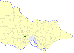
caption = Location in Victoria
county = Grant, Talbot, Grenville, Ripon
near-nw = Ballarat
near-n = Creswick
near-ne = Daylesford and Glenlyon
near-w = Ballarat
near-e = Ballan
near-sw = Ballaarat
near-s = Buninyong
near-se = Ballan
_noautocat = yes

The Shire of Bungaree was a Local Government Area located northeast of the regional city of Ballarat, Victoria, Australia. The shire covered an area of convert|228|km2|sqmi|1, and existed from 1863 until 1994.

History

Bungaree was first incorporated as a district on 16 January 1863, and became a shire on 27 January 1871. The shire was originally divided into three ridings in August 1879, but after it lost a small section to the City of Ballaarat on 31 March 1930, it was redivided into two ridings. All divisions were abolished on 6 August 1988 and the council from then until its dissolution had nine councillors. cite book|title=Victorian Municipal Directory|year=1992|publisher=Arnall & Jackson|location=Brunswick|pages=620-621 Accessed at State Library of Victoria, La Trobe Reading Room.]

On 6 May 1994, the Shire was abolished, and merged with Shires of Bacchus Marsh, Ballan and parts of Buninyong into the Shire of Moorabool.

Towns and Localities

* Bungaree
* Brown Hill
* Bullarook
* Chapel Flat
* Claretown
* Clarkes Hill
* Glen Park
* Gong Gong
* Invermay
* Leigh Creek
* Nerrina
* Pootilla
* Wallace

Population

* Estimate in 1958 Victorian Year Book.

References


Wikimedia Foundation. 2010.

Игры ⚽ Поможем написать реферат

Look at other dictionaries:

  • Shire of Moorabool — Victoria Location in Victoria Population …   Wikipedia

  • Shire of Ballan — Infobox Australian Place | type = lga name = Shire of Ballan state = vic region = area = 919.45 est = 1862 seat = Ballan pop = 4,900 (1992) [cite book|title=Victorian Year Book|author=Australian Bureau of Statistics, Victoria… …   Wikipedia

  • Shire of Buninyong — Infobox Australian Place | type = lga name = Shire of Buninyong state = vic region = area = 785.1 est = 1858 seat = Buninyong pop = 12,760 (1992) [cite book|title=Victorian Year Book|author=Australian Bureau of Statistics, Victoria… …   Wikipedia

  • Shire of Ballarat — Infobox Australian Place | type = lga name = Shire of Ballarat state = vic region = area = 481.74 est = 1856 seat = Wendouree pop = 19,530 (1992) [cite book|title=Victorian Year Book|author=Australian Bureau of Statistics, Victoria… …   Wikipedia

  • Shire of Daylesford and Glenlyon — Infobox Australian Place | type = lga name = Shire of Daylesford and Glenlyon state = vic region = area = 609.3 est = 1860 seat = Daylesford pop = 5,980 (1992) [cite book|title=Victorian Year Book|author=Australian Bureau of Statistics, Victoria… …   Wikipedia

  • Shire of Bacchus Marsh — Infobox Australian Place | type = lga name = Shire of Bacchus Marsh state = vic region = area = 565 est = 1862 seat = Bacchus Marsh pop = 12,590 (1992) [cite book|title=Victorian Year Book|author=Australian Bureau of Statistics, Victoria… …   Wikipedia

  • Shire of Creswick — Infobox Australian Place | type = lga name = Shire of Creswick state = vic region = area = 551.66 est = 1859 seat = Creswick pop = 4,870 (1992) [cite book|title=Victorian Year Book|author=Australian Bureau of Statistics, Victoria… …   Wikipedia

  • Moorabool Shire — Lage des Moorabool Shire in Victoria Gliederung …   Deutsch Wikipedia

  • City of Ballaarat — Victoria Location in Victoria Population: 35500 (1992)[1 …   Wikipedia

  • City of Ballarat — Victoria Map of the City of Ballarat s municipal borders, urban areas and location in Victoria …   Wikipedia

Share the article and excerpts

Direct link
Do a right-click on the link above
and select “Copy Link”