- Rural City of Bellarine
Infobox Australian Place | type = lga
name = Rural City of Bellarine
state = vic
region =
area = 331.78
est = 1853
seat = Drysdale
pop = 44,180 (1992) [cite book|title=Victorian Year Book|author=Australian Bureau of Statistics, Victoria Office|year=1994|page=49-52|id=ISSN 0067-1223]
logosize =
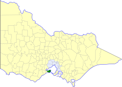
caption = Location in Victoria
county = Grant
near-nw = Geelong
near-n = "Corio Bay "
near-ne = "Port Phillip "
near-w = South Barwon
near-e = Queenscliffe
near-sw = South Barwon
near-s = "Bass Strait "
near-se = "Bass Strait "
_noautocat = yesThe Rural City of Bellarine was a Local Government Area located to the southeast of the regional city of Geelong, Victoria,
Australia , and covered most of theBellarine Peninsula . The shire covered an area of convert|331.78|km2|sqmi|1, and existed from 1853 until 1993.History
Bellarine was first incorporated as a district on 12 December 1853, and became a shire on 26 September 1865. On 12 December 1989 it was proclaimed a Rural Citycite book|title=Victorian Municipal Directory|year=1992|publisher=Arnall & Jackson|location=Brunswick|pages=299-300 Accessed at
State Library of Victoria , La Trobe Reading Room.]On 18 May 1993, the Shire was abolished, and merged with Cities of Geelong, Geelong West and Newtown,
Shire of Corio , part of theCity of South Barwon and parts of the Shires of Barrabool and Bannockburn into theCity of Greater Geelong .Wards
Bellarine was divided into three ridings , each of which elected three councillors:
* Bellarine Riding
* Paywit Riding
* Moolap RidingTowns and Localities
* Bellarine
* Clifton Springs
* Curlewis
* Drysdale
* Fenwick
* Indented Head
* Leopold
* Mannerim
* Marcus
* Moolap
* Murradoc
* Newcomb
* Ocean Grove
* Point Henry
* Point Lonsdale (split withBorough of Queenscliffe )
* Portarlington
* St Leonards
* Swan Bay
* Wallington
* WhittingtonPopulation
* Estimate in 1958 Victorian Year Book.
References
Wikimedia Foundation. 2010.