- Moolap, Victoria
-
Moolap
Geelong, Victoria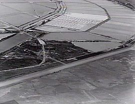
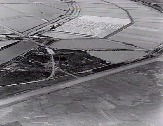
Salt pans at the Cheetham Saltworks.Population: 696 (2006)[1] Postcode: 3221 LGA: City of Greater Geelong Suburbs around Moolap: Port Phillip Newcomb Moolap Leopold Marshall Connewarre Moolap is a residential and industrial suburb of Geelong, Victoria, Australia. The name Moolap is derived from an Aboriginal word for nearby Point Henry, moo-laa, thought to mean 'men gathering to go fishing'. Moolap in Aboriginal tongue means "Shady Place"[citation needed].
Contents
History
The first Moolap Post Office opened on 1 May 1864 and closed in 1890. A Point Henry Post Office opened on 1 January 1867 which was replaced by Moolap Railway Station in 1887 and by Moolap in 1893. This latter office closed in 1962. A Geelong East office open since 1871 was renamed Moolap West in 1921 and closed in 1951. [2]
In 1888, Richard Cheetham established his saltworks at Moolap - an industry which survived more than 100 years.
Timeline
Some events in the history of Moolap:
Pre-European Settlement the area inhabited by Bengalat balug (Clan) of the Wathaurong Tribe
First European explorers were Lieutenant John Murray (January 1802) and Captain Matthew Flinders (April 1802)
1803 to 1835 - William Buckley the first European living in the area
1854 - Whitehorse Hotel operating on the corner of Queenscliff Road and Whitehorse Road
1855 - Moolap Inn operating on the corner of Moolap Station Road and Bellarine Highway
1855 - Parsonage built on a site near the present State School
1858 - United Methodists Free Church chapel built
1871 - Moolap State School No. 1143 opened
1882 - 16 occupiers using Moolap address
1888 - Cheetham Saltworks established
Point Henry
Point Henry is an industrial peninsula of Geelong, located approximately 5 km east of the Geelong central business district. Only one sealed road leads to Point Henry, being Point Henry Road which leaves the Portarlington Road at Moolap and travels to the Alcoa's Point Henry aluminium smelter and smaller surrounding industries. A small weather station is also located on the peninsula.
Census population
- 1921 - 319
- 1947 - 651
- 1991 - 565
- 1996 - 568
- 2001 - 554
See also
References
- ^ Australian Bureau of Statistics (25 October 2007). "Moolap (State Suburb)". 2006 Census QuickStats. http://www.censusdata.abs.gov.au/ABSNavigation/prenav/LocationSearch?collection=Census&period=2006&areacode=SSC22086&producttype=QuickStats&breadcrumb=PL&action=401. Retrieved 2007-10-01.
- ^ Premier Postal History, Post Office List, https://www.premierpostal.com/cgi-bin/wsProd.sh/Viewpocdwrapper.p?SortBy=VIC&country=, retrieved 2008-04-11
 Suburbs and localities of GeelongArmstrong Creek Growth Area • Bell Park • Bell Post Hill • Belmont • Breakwater • Corio • Drumcondra • East Geelong • Fyansford • Geelong City • Geelong West • Grovedale • Hamlyn Heights • Herne Hill • Highton • Lara • Leopold • Lovely Banks • Manifold Heights • Marshall • Moolap • Mount Duneed • Newcomb • Newtown • Norlane • North Geelong • North Shore • Rippleside • Rosewall • St Albans Park • South Geelong • Thomson • Wandana Heights • Waurn Ponds • WhittingtonAnakie • Avalon • Balliang • Barwon Heads • Batesford • Breamlea • Ceres • Clifton Springs • Connewarre • Curlewis • Drysdale • Indented Head • Little River • Mannerim • Marcus Hill • Moorabool • Ocean Grove • Point Wilson • Portarlington • Staughton Vale • St Leonards • Swan Bay • Wallington
Coordinates: 38°11′S 144°26′E / 38.183°S 144.433°E
Categories:- Suburbs of Geelong
- Victoria (Australia) geography stubs
Wikimedia Foundation. 2010.