- Waurn Ponds, Victoria
Infobox Australian Place | type = suburb
name = Waurn Ponds
city = Geelong
state = vic
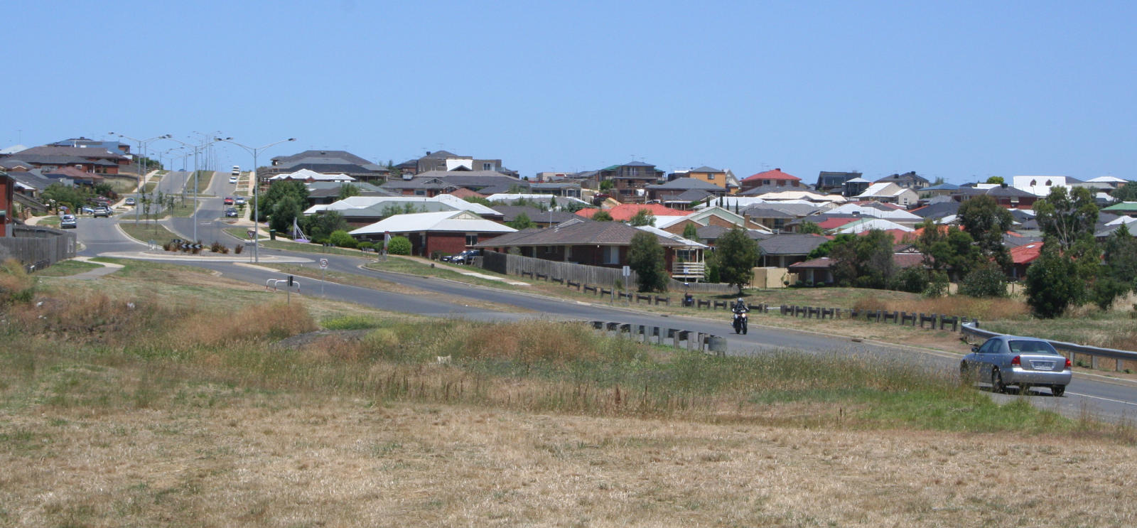
caption = View of the suburb south from Rossack Drive
lga =City of Greater Geelong
postcode = 3216
pop = 2326 (2006)Census 2006 AUS | id = SSC22141 | name = Waurn Ponds (State Suburb) | accessdate = 2007-10-01 | quick = on]
area =
propval = [http://www.domain.com.au/Public/SuburbReport.aspx?searchTerm=3216] (2007)
stategov =
fedgov =
near-nw = Ceres
near-n = Fyansford
near-ne = Wandana Heights
near-w = Mount Moriac
near-e = Highton
near-sw = Freshwater Creek
near-s = Mount Duneed
near-se = Grovedale
dist1 =
location1=Waurn Ponds is a mainly residential southern suburb of Geelong, Victoria,
Australia .The suburb is bounded by Rossack Drive,
Princes Highway , the Geelong to Warnambool railway, Reservoir Road, Draytons Road, Pigdons Road,Deakin University and Honeys Road.History
The town was named after the Waurn chain of ponds, a watercourse that flows from Mt Moriac over 30 km into the Barwon River. [http://www.geelongaustralia.com.au/Services_In_Geelong/Environment/Environews/Waurn_Ponds_Revegetation_Project/ Waurn Ponds Revegetation Project] ] Two early hotels - the Victoria Inn (1845-60) and the Waurn Ponds Inn (1856) were located on the Princes Highway serving travellers on the road. The Albert and Victoria vineyards, owned by David Pettavel, began growing grapes in 1848 and the area was better known as Pettavel in the 1860s. [http://www.geelongcity.vic.gov.au/Visiting_Geelong/Towns/Waurn_Ponds/ City of Greater Geelong: Waurn Ponds] ] The Pettavel Post Office opened on 12 January 1865 and remained open until 1952. The Waurn Ponds Post Office opened on 1 December 1871 and closed in 1968. Citation
last = Premier Postal History | title = Post Office List | url = https://www.premierpostal.com/cgi-bin/wsProd.sh/Viewpocdwrapper.p?SortBy=VIC&country= | accessdate = 2008-04-11 ]A
quarry for limestone was opened in the 1840s, with quarrying continuing from 1964 to today at the nearby Blue Circle Southern cement works. [ [http://www.railgeelong.com/locations.php?name=Waurn%20Ponds Rail Geelong: Waurn Ponds cement works] ] Kilns for making mortar lime operated until the 1970s.Waurn Ponds started to become part of the outer suburbs of Geelong from the 1970s, with the opening of the Deakin University campus and the Waurn Ponds Hotel on the highway. Major development did not begin until the early 1990s, based around Ghazeepore Road. The intervening years have seen housing developments spread across the hillside towards Grovedale.
Geography
Waurn Ponds is home to the quite small Waurn Ponds Creek. It starts around the Mount Moriac region and eventually flows into the Barwon River near Belmont Common.
As of 2007, it is low on water and is no more than 1 meter deep in most sections. It has a large weed problem which makes the creek look uninhabitable. The creek is home to species of fish (many introduced) including
Carp , Redfin, Roach,Tench ,Australian Grayling andshort finned eel s. The creek also is a large habitat of native birds including the pacific black duck. Increase in annual rain will bring the creek back to its original status.Waurn Ponds has a large linear parkland following the creek. The neighbouring suburb of Grovedale has a
skate park andbaseball complex.Transport
Waurn Ponds is located on the
Princes Highway that links the suburb the centre of Geelong. It is also the southern endpoint of the under constructionGeelong Ring Road . Anglesea Road heads south through the suburb linking the area to Torquay and Anglesea. Pioneer Road links the region west to Grovedale, the road not being completed eastward across the Waurn Ponds Creek until the mid 1990s. [Gregory's 1982-83 Melbourne Street Directory]Public transport to the area is provided by
bus es operated byBenders Buslines andMcHarrys Buslines , on routes to the Geelong city centre travelling via the university, Belmont, Highton and Grovedale.The 2003–04 Victorian State Budget saw funding made available for an extension of rail services on the line between Melbourne and Geelong southwards to Grovedale. A number of options were examined, among them a new
railway station at Waurn Ponds. [ [http://www.doi.vic.gov.au/DOI/Internet/transport.nsf/AllDocs/5B8CEA11A3D8F676CA2571F800022DAD?OpenDocument Department of Infrastructure: Marshall Railway Station] ] Marshall station was opened in 2005 in nearby Grovedale on the site of a closed station. [ [http://www.railgeelong.com/locations.php?name=Marshall Rail Geelong: Marshall Station] ]University
The
Deakin University campus at Waurn Ponds had the beginnings in theGordon Institute of TAFE , who purchased land there in 1969. A building for the Applied Sciences was first built, followed by a library and student lodgings in 1975. [ [http://www.gordontafe.edu.au/index.cfm?action=2&secAction=7&terAction=2&pageAction=2 Gordon Institute of TAFE: History 1941 - Today] ] In 1976 the Gordon Institute was divided into two parts, with academic courses becoming part of the newly formed Deakin University based at the Waurn Ponds campus.Deakin enrolled its first students at its Waurn Ponds campus in
1977 . Today the university is located on a 365 hectare site, has over 1,000 staff and over 4000 on-campus students. [ [http://www.deakin.edu.au/campuses/waurnponds.php Deakin University: Waurn Ponds campus] ]Retail
Waurn Ponds Shopping Centre
The Waurn Ponds Shopping Centre was opened in adjacent Grovedale in the around 1985 on the corner of the
Princes Highway and Pioneer Road. Opened as the 'Town and Country' shopping centre, the initial tenants included Safeway supermarket which remain today, aFranklins supermarket and aMitre 10 hardware store on the current Coles supermarket site, a now demolished plant nursery, and a number of smaller independent stores. The stores were arranged around a central open air carpark. The first major changes was the closure of the hardware store, followed by the expansion of Franklins into the empty space.The late 1990s saw the first refurbishment, and saw the expansion of the centre to the east with the opening of a Target department store. A number of smaller stores were also built linking it to the rest of the complex. They were later followed by the 8 screen Readings cinema complex. The early 2000s also saw the closure of the Franklins supermarket and the opening of a Coles supermarket in its place. [ [http://www.geelongcity.vic.gov.au/library/pdf/5266/15.pdf Geelong Investment News Vol 1, May 2007] ]
A third expansion has just been completed, costing $35 million. The Target department store has been expanded, 36 new speciality shops opened, and vehicle and pedestrian access improved. Floorspace at the centre increased by one-third to 21,000sqm. Another Expansion has been announced, this to Include an brand new Coles Supermarket, K-Mart, Officeworks an unnamed Liquor Store and retail space extended to 35,000sqm.
Geelong Homemaker Centre
The Geelong Homemaker Centre opened in mid 2005 and is located on the Princes Highway. It is the home of
Bunnings Warehouse andHarvey Norman stores, as well as a number of smaller stores includingSupercheap Auto , Retravision, Beacon Lighting, Snooze and Ray's Outdoors.ee also
*
Geelong Ring Road References
Wikimedia Foundation. 2010.