- Fyansford, Victoria
Infobox Australian Place | type = suburb
name = Fyansford
city = Geelong
state = vic
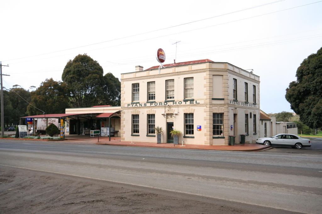
caption = Fyansford Hotel
lga =City of Greater Geelong
postcode = 3221
pop = 171 (2006)Census 2006 AUS | id = SSC25625 | name = Fyansford (State Suburb) | accessdate = 2007-10-01 | quick = on]
area =
propval = [http://www.domain.com.au/Public/SuburbReport.aspx?searchTerm=3221 $319,000] (2006)
stategov =
fedgov =
near-nw = Sutherlands Creek
near-n = Batesford
near-ne = Manifold Heights
near-w = Stonehaven
near-e = Newtown
near-sw = Ceres
near-s = Waurn Ponds
near-se = Highton
dist1 =
location1=Fyansford is a township on the western edge of Geelong, Victoria,
Australia , named after CaptainFoster Fyans who came to Geelong as aPolice magistrate in October, 1837. It is located at the junction of the Barwon and Moorabool rivers.Fyansford is one of the earliest places of settlement in the Geelong region. Fyans established his police camp nearby where the Moorabool could be forded - giving the name 'Fyan's Ford'. [http://www.geelongcity.vic.gov.au/Visiting_Geelong/Towns/Fyansford/ City of Greater Geelong: Fyansford] ]
Industry
The area was once a centre for Geelong industry. In 1845 the first
flour mill was erected by William Henry Collins on the banks of the Barwon. [ [http://www.geelongcity.vic.gov.au/Services_In_Geelong/Archives/Timeline_of_Geelong/ Geelong Timeline 1802 - 1910 ] ] . By 1859 the population was sufficient to justify a Post Office which opened on 1 February 1859 (closing in 1978).Citation
last = Premier Postal History | title = Post Office List | url = https://www.premierpostal.com/cgi-bin/wsProd.sh/Viewpocdwrapper.p?SortBy=VIC&country= | accessdate = 2008-04-11 ] The Barwon Paper Mill opened at nearby Buckley's Falls in 1876. In 1895 mill became part of theAustralian Paper Mills company, the predecessor of Amcor Limited.Cement production began at Fyansford in 1890 led byPeter McCann , but it was not until 1911 that a modern rotary kiln was installed. The original Australian Portland Cement company plant was located at the foot of the Fyansford hill between Deviation Road and Hyland Street. In 1918 a railway line was extended from the North Geelong railway station to the top of the hill above Fyansford,cite web | title = Fyansford Line | work = Rail Geelong | publisher = Marcus Wong | url = http://railgeelong.com/lineguide.php?line=fyansford | format = HTML | accessdate = 2008-02-08 ] and in 1926 the narrow gaugeFyansford Cement Works Railway was opened to serve a new quarry ["The Fyansford Quarry Railway" Buckland, John Australian Railway Historical Society Bulletin, June, 1951, pp81-82] , and the works themselves expanded across Hyland Street, which became the main production site in later years. The cement works were later acquired byAdelaide Brighton Cement , and were closed in 2001. [ [http://www.adbri.com.au/pdfs/Dec2000-18monthreport.pdf Adelaide Brighton Ltd Summary Report: December 2000] ]Transport
The
Hamilton Highway runs though the town. The first river crossing at Fyansford was a ford, with the first wooden bridge built downriver by the Corio and Bannockburn Shire councils in 1854, and was tolled until 1877. It was in poor condition by 1898, with load restrictions being put into place. A new bridge was built nearby in 1900 byJohn Monash andJ.T.N. Anderson , the three-arch bridge being the largest Monier reinforced concrete bridge in the world at the time.John, McNeil (1990) "A Journey to Destiny 1890-1990 100 Years of Cement Manufacturing at Fyansford by Australian Cement Limited"] In 1970 a new bridge was built on the site of the old wooden bridge to cater for heavier traffic on the Hamilton Highway, the 1900 bridge retained for pedestrians.High Street (now Hyland Street) was one of the first sealed roads in the area in 1933, the road being relaid in concrete in 1937. Deviation Road was built between 1931-32 with unemployment labour during the
Great Depression and opened in 1933. Cut into the hillside, the surface was originally of concrete construction. The road opened 54 years after the first petition by Fyansford residents for such a road.Census populations
* 1861 - 227
* 1901 - 134
* 1933 - 189
* 1961 - 238Gallery
References
External links
* [http://railgeelong.com/lineguide.php?line=fyansford Rail Geelong: Fyansford Cement Works and railway line]
Wikimedia Foundation. 2010.