- Batesford, Victoria
Infobox Australian Place | type = town
name = Batesford
state = vic
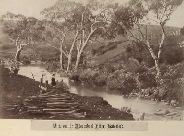
caption = TheMoorabool River , at Batesford, Victoria, 1882
lga =City of Greater Geelong
postcode = 3221
pop = 880 (2006)Census 2006 AUS | id = SSC25099 | name = Batesford (State Suburb) | accessdate = 2007-10-01 | quick = on]
est =
stategov = Lara
fedgov = Corangamite
near-nw = Sutherlands Creek
near-n = Anakie
near-ne = Lara
near-w = Sutherlands Creek
near-e = Lovely Banks
near-sw = Stonehaven
near-s = Fyansford
near-se = Bell Post Hill and Hamlyn HeightsBatesford, Victoria is a small township located approximately 10 kilometres west of Geelong and 167 kilometres south-west of the state capital,
Melbourne .It is located on the banks of the
Moorabool River and on theMidland Highway .History
The Post Office opened on 18 August 1886 and closed in 1949. Citation
last = Premier Postal History | title = Post Office List | url = https://www.premierpostal.com/cgi-bin/wsProd.sh/Viewpocdwrapper.p?SortBy=VIC&country= | accessdate = 2008-04-11 ]References
External links
* [http://web.archive.org/web/20040511085826/www.arts.monash.edu.au/ncas/multimedia/gazetteer/list/batesford.html Australian Places - Batesford]
Wikimedia Foundation. 2010.