- Norlane, Victoria
-
Norlane
Geelong, Victoria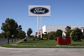
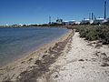
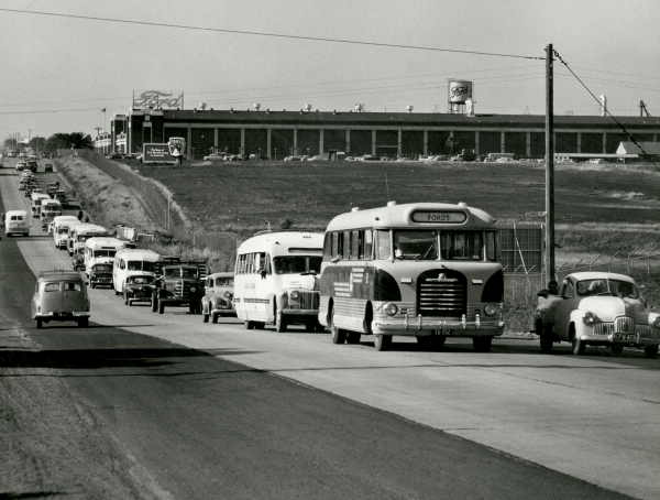
Princes Highway outside the Ford stamping plant in 2009Population: 7934 (2006)[1] Postcode: 3214 Area: 5.1 km² (2.0 sq mi) LGA: City of Greater Geelong State District: Lara Federal Division: Corio Suburbs around Norlane: Corio Lovely Banks Norlane North Shore Bell Park North Geelong Norlane is a northern suburb of Geelong, Victoria, Australia. Norlane is located approximately 7 km from the Geelong central business district and approximately 70 km from the state capital, Melbourne. Situated 1 km from the Port Phillip Bay, Corio Bay, North Shore Beach.
Contents
History
The suburb of Norlane was named after Norman Lane, a local serviceman from the district who died working on the Burma Thai Railway in 1943, after being captured in Singapore.[2]
The Post Office opened on 17 December 1945 as development of the suburb began. Later, the Post Office of Norlane West opened on 13 October 1958.[3]
With the enormous pressure on housing in the early 1950s, residents resorted to small dwellings, tents and partially completed buildings. The Housing Commission of Victoria provided accommodation for families unable to rent or to afford the purchase of their own home.[2]
In 1947 the government Housing Commission began its house-building program in Norlane, and by 1976 when its program was completed there were 2,464 commission houses available for low income renters. Much of the housing was for employees at the nearby Ford Motor Company, International Harvester, Shell, Pilkington Glass, Hendersons and Pivot Phosphate factories.
As workers hungry for employment (among them wartime migrants building new lives) flocked to Geelong to take up jobs the Victorian Government responded through its Housing Commission by buying up broad acres north of the Ford plant and building homes by the hundreds. Norlane was quickly transformed from paddocks to busy working class suburbia in a decade. By 1960, the urban landscape of streets, roads, crescents, courts and boulevards which we know today had extended as far as Corio Village. For Geelong, it was an amazing and exciting time.
Many of the houses built in Norlane were prefabricated units imported from the Netherlands and France.[2] Today many of the original prefabricated houses are being demolished to make way for newer government funded brick units and private development, due to the rapid growth and rapid development of Norlane the dominate issue of the area is state funded and controlled re-development of Norlane into a more modern suburb utilizing contemporary planning methodologies and a higher levels of private housing ownership as Melbourne real estate swelters and people look for more affordable and alternative lifestyle options.
Demographics
 View of Norlane, looking towards the City of Geelong, as it looked in 1925.
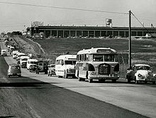 Melbourne Road, Norlane, near Cowies Creek in 1957. The Ford Motor Company factory is visible in the background.
In the 2001 Australian Bureau of Statistics Census of Population and Housing, the population of the Norlane census area was 8,628 people, in an area of 5.1 square kilometres. Females outnumbered males, with 4,436 females and 4,192 males as of 2001. Some 24% of the population of Norlane were born outside of Australia.[4] The predominant age group in Norlane is 40 – 49 years.
The three most common forms of dwelling were (in decreasing order): a separate house, a flat or apartment and a semi-detached house.[4] Residents enjoy generous land parcels, ample backyards with single story weatherboard housing built during the 1960s on 600 to 800 square metres blocks, progressively brick based sud-division buildings and double story dwellings on approximately 300 square metre lots are beginning to become more common, with higher rise especially where views of the peninsula from a higher rise viewpoint are applicable. In August 2010 the median sale price of houses in the area is $184,500 up 15% from the previous year but generally raising by a modest 10% per year on average. 2002 saw a 38.9% growth in real estate value. Demand for renting a home in Norlane is good with an expected rental return of $180 to $220 per week for a 3 bedroom house in comparing the price of property it is a reason why some choose to invest in Norlane.
A majority of residents of are employed (in decreasing order) in Engineering (6.83%), Management and Commerce (2.2%) and Food, Hospitality and Personal Services industries (1.5%).
The five strongest religious affiliations in the area in 2001 were (in descending order): Catholic, Anglican, Orthodox, Presbyterian and Uniting.[4]
Facilities
Affordable housing close to shopping, transport and Geelong's largest employers make Norlane a popular suburb. Norlane boasts an olympic sized indoor heated swimming pool, gymnasium, two water slides, diving pool and children's pools, Water World is located at Cox Road on the northern border of the suburb.[2] Labuan Square shopping centre opened in 1954.[2] but has since been largely superseded by the Corio Shopping Centre. Labuan Square, and other smaller shopping precincts around Norlane provide residents convenience within walking distance. Norlane Hotel on the Princes Hwy is also the largest local gambling venue and it's bistro offers reasonably priced food. Additionally, there is the Norlane RSL Sub-Branch situated at 29 Rose Ave. More recently large areas of land along the Princess Hwy have to been allocated for commercial development and have seen the large multi-national franchises operate in the area such as all the major fast food chains and the large thrifty stores. Norlane's has many churches the majority of which are of British origin. There are also several boat ramps, Corio Bay Boat Club, Grammar School Lagoon Boat Ramp and St Helens Boat Ramp. There are 7 parks covering nearly 9% of the total area with varying facilities such as ovals, skating and ball games facilities.
Schools
Primary schools in Norlane were opened in 1955 and 1962, and a high school in 1959. The Norlane Primary School closed during the 1990s and is now a private college, Isik College. North Shore Primary School and also the Norlane High School remain open as of 2007. Other schools include Norlane West Primary School, St Thomas Aquinas Primary School and Geelong Kindergarten Association.
Transport
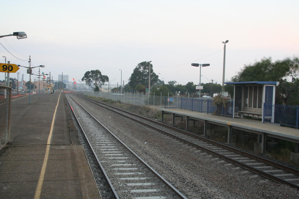
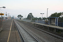 [North Shore railway station
, located in Station Street, provides two-hourly rail transport to both Melbourne and Geelong from Norlane.]]
Cars are the preferred method of transport in Norlane, followed by walking and bicycles.[4]
North Shore railway station is located in Station Street, Norlane on the south eastern border of the suburb, with V/Line providing two-hourly rail transport on the Geelong line to both Melbourne and Geelong central business districts. The train between Geelong and Melbourne stops at the station in the south-east corner of the suburb.
Several highways provide convenient and speedy transport with the Princess highway being the main arterial from Melbourne to Norlane or from Norlane to Geelong city centre. The new Geelong Ring Road providing a Geelong city centre and greater Geelong bypass for faster access to coastal areas including the popular surfing and holiday destination, Torquay and other coastal towns along the south west of Victoria such as Lorne and Apollo Bay. The Midland Highway provides direct route to Ballarat and to northern Victoria and Bacchus Marsh Geelong Road as the name suggests. There is also a ferry from Queenscliff to Portsea twice daily.
Census populations
- 1947 - 347
- 1971 - 12,098
- 2001 - 8,616
- 2001 - 8,945 Norlane and North Shore combined
- 2006 - 7,935
- 2006 - 8,254 Norlane and North Shore combined
Norlane photo gallery
-
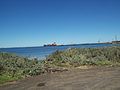
A ship coming out of the bay
-

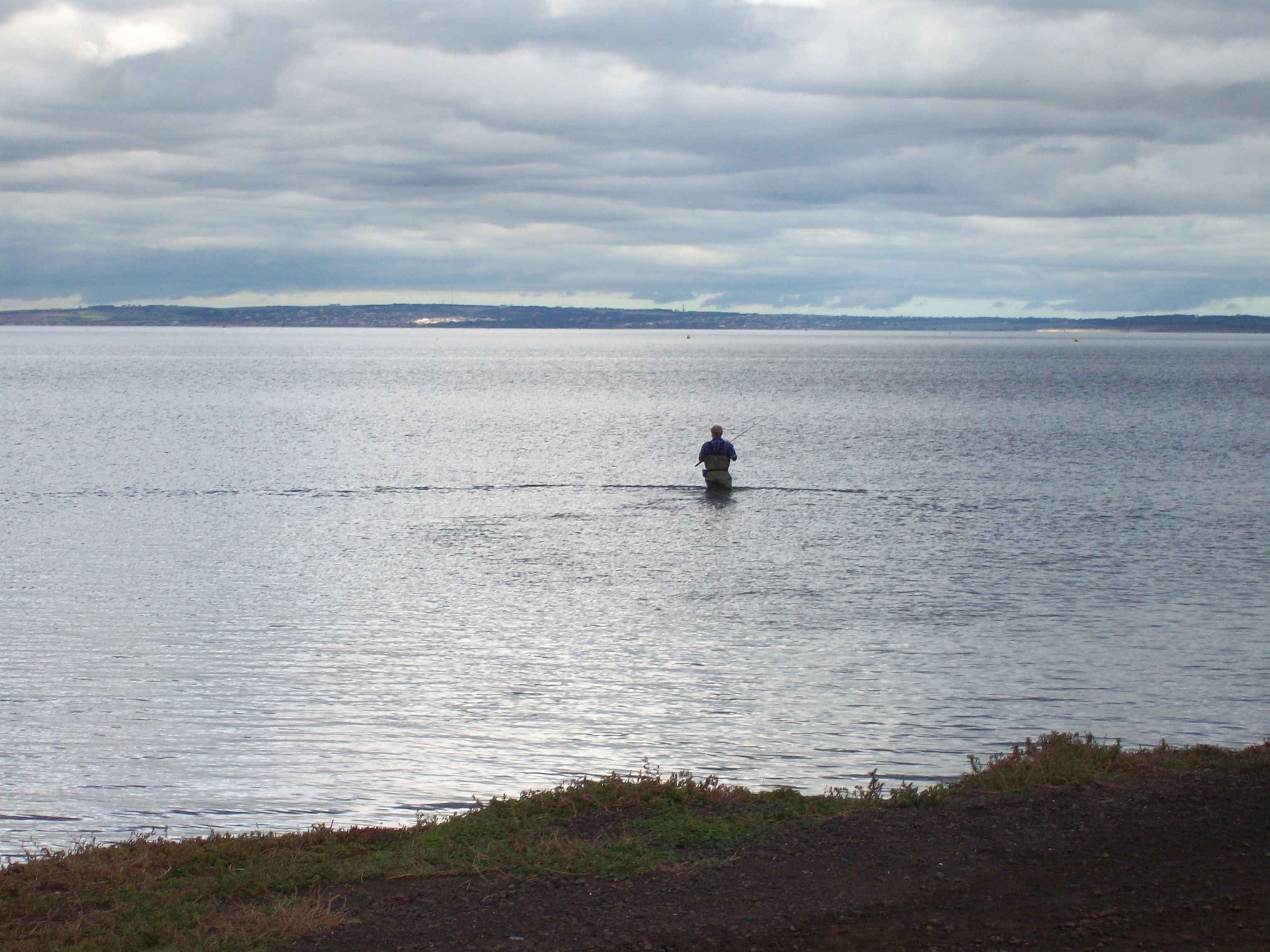
A fly fisherman in the bay
-
Industrial park by the bay
-

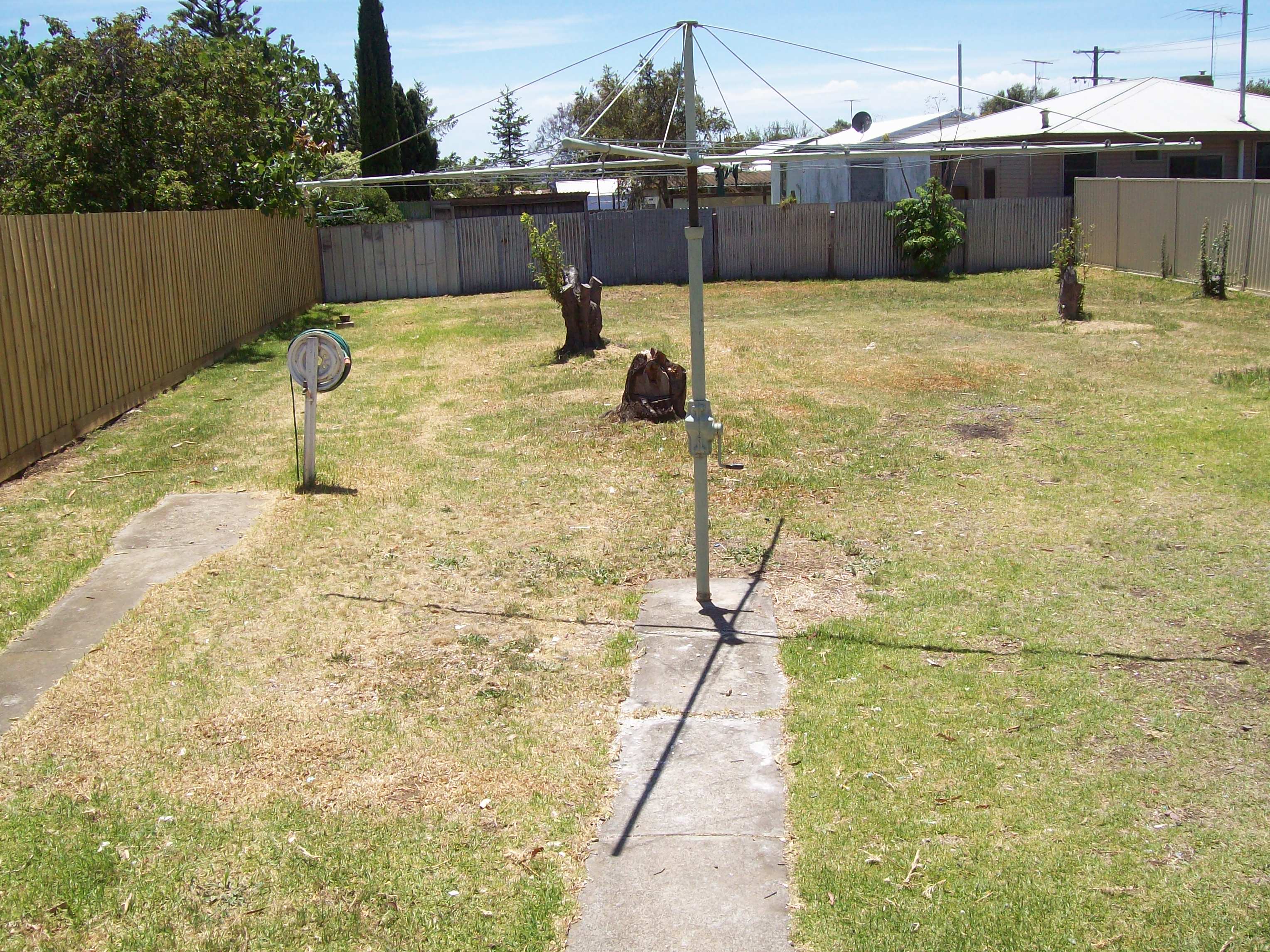
A typical 750m2 lot backyard
-

A typical front yard and street
-

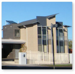
A typical 3 bedroom house in Norlane
-
New style commission housing
References
- ^ Australian Bureau of Statistics (25 October 2007). "Norlane (State Suburb)". 2006 Census QuickStats. http://www.censusdata.abs.gov.au/ABSNavigation/prenav/LocationSearch?collection=Census&period=2006&areacode=SSC22101&producttype=QuickStats&breadcrumb=PL&action=401. Retrieved 1 October 2007.
- ^ a b c d e City of Greater Geelong, Norlane, accessed 31 January 2007 Archived August 27, 2006 at the Wayback Machine
- ^ Premier Postal History, Post Office List, https://www.premierpostal.com/cgi-bin/wsProd.sh/Viewpocdwrapper.p?SortBy=VIC&country=, retrieved 11 April 2008
- ^ a b c d Australian Bureau of Statistics Census of Population and Housing, accessed 31 January 2007
External links
- Norlane, Victoria is at coordinates 38°05′31″S 144°21′22″E / 38.092°S 144.356°ECoordinates: 38°05′31″S 144°21′22″E / 38.092°S 144.356°E
- Show Houses For Sale In Norlane
- Property Data for Norlane
- Norlane Redevelopment Precincts
- Corio Norlane Development Advisory Board
- Norlane Regeneration Project
- Redfern makeover plan for Corio and Norlane
- Guide To Boat Ramps In The City Of Greater Geelong
- Commercial Property For Sale In Norlane
- Commercial Property For Lease In Norlane
- Business For Sale In Norlane
- The Sphinx Hotel
- Norlane Hotel
 Suburbs and localities of GeelongArmstrong Creek Growth Area • Bell Park • Bell Post Hill • Belmont • Breakwater • Corio • Drumcondra • East Geelong • Fyansford • Geelong City • Geelong West • Grovedale • Hamlyn Heights • Herne Hill • Highton • Lara • Leopold • Lovely Banks • Manifold Heights • Marshall • Moolap • Mount Duneed • Newcomb • Newtown • Norlane • North Geelong • North Shore • Rippleside • Rosewall • St Albans Park • South Geelong • Thomson • Wandana Heights • Waurn Ponds • WhittingtonAnakie • Avalon • Balliang • Barwon Heads • Batesford • Breamlea • Ceres • Clifton Springs • Connewarre • Curlewis • Drysdale • Indented Head • Little River • Mannerim • Marcus Hill • Moorabool • Ocean Grove • Point Wilson • Portarlington • Staughton Vale • St Leonards • Swan Bay • WallingtonCategories:
- Suburbs of Geelong


Wikimedia Foundation. 2010.