- Drysdale, Victoria
-
Drysdale
Geelong, Victoria
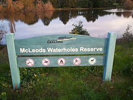
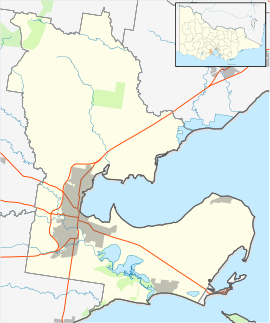
McLeods Waterholes Reserve in DrysdalePopulation: 3740 Postcode: 3222 Location: LGA: City of Greater Geelong State District: Bellarine Federal Division: Corangamite Localities around Drysdale: Clifton Springs Leopold Drysdale Portarlington Barwon Heads Ocean Grove Indented Head Drysdale is a rural township near Geelong, Victoria, Australia, located on the Bellarine Peninsula. The town has an approximate population of over 3700.
The town is named after Anne Drysdale whose estate "Coriyule""it's haunted" still sits above the township. The area was formerly known as McLeod's Waterholes and Bellarine. A township began to develop in the late 1840s[1] and a Post Office (known as Bellarine until 1862) opened on 1 January 1855. From 1902 until 1951 Murrudoc Post Office to the west operated in the area also known as Murradoc.[2] The railway reached the local railway station from South Geelong on the way to Queenscliff in 1879, and remained in Victorian Railways service until 1976. It is now the western terminus of the tourist orientated Bellarine Peninsula Railway.[3] The station lies next to Lake Lorne, an important regional site for waterbirds.
Until abolished in 1993, the Rural City of Bellarine council seat was in Drysdale.
Aldi Supermarket is expected to build a store in Murradoc Road in 2011.
A popular youth music and performing arts venue, affectionately labelled 'The Potato Shed' is located in the back of Drysdale. The industrial size venue is the site of 'Battle of The Bands', a yearly music festival which has seen a number of local bands make a name for themselves in a popular setting.
Drysdale is home to a number of primary and high schools, including Saint Ignatius College, the senior campus of Bellarine Secondary College, and a campus of Christian College. The local football club is the Drysdale Hawks, who play Australian Rules Football and compete in the Bellarine Football League. [4] The Bellarine Rail Trail also runs through the town.
References
- ^ Bellarine Historical Society Inc., The History of Drysdale, http://www.zades.com.au/bellhs/drysdale.html, retrieved 2008-06-19
- ^ Premier Postal History, Post Office List, https://www.premierpostal.com/cgi-bin/wsProd.sh/Viewpocdwrapper.p?SortBy=VIC&country=, retrieved 2008-04-11
- ^ "Rail Geelong - Drysdale Station". www.railgeelong.com. http://www.railgeelong.com/location/drysdale. Retrieved 2008-12-28.
- ^ Full Points Footy, Drysdale, http://www.fullpointsfooty.net/Drysdale.htm, retrieved 2008-07-25[dead link]
 Suburbs and localities of GeelongArmstrong Creek Growth Area • Bell Park • Bell Post Hill • Belmont • Breakwater • Corio • Drumcondra • East Geelong • Fyansford • Geelong City • Geelong West • Grovedale • Hamlyn Heights • Herne Hill • Highton • Lara • Leopold • Lovely Banks • Manifold Heights • Marshall • Moolap • Mount Duneed • Newcomb • Newtown • Norlane • North Geelong • North Shore • Rippleside • Rosewall • St Albans Park • South Geelong • Thomson • Wandana Heights • Waurn Ponds • WhittingtonAnakie • Avalon • Balliang • Barwon Heads • Batesford • Breamlea • Ceres • Clifton Springs • Connewarre • Curlewis • Drysdale • Indented Head • Little River • Mannerim • Marcus Hill • Moorabool • Ocean Grove • Point Wilson • Portarlington • Staughton Vale • St Leonards • Swan Bay • Wallington
Towns on the Bellarine Peninsula Barwon Heads · Clifton Springs · Collendina · Drysdale · Indented Head · Leopold · Mannerim · Ocean Grove · Portarlington · Point Lonsdale · Queenscliff · St Leonards · WallingtonCategories:- Towns in Victoria (Australia)
- Victoria (Australia) geography stubs
- Bellarine Peninsula
Wikimedia Foundation. 2010.

