- Curlewis, Victoria
-
Curlewis
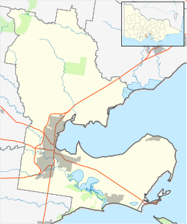
VictoriaPopulation: 399 (2006)[1] Postcode: 3222 LGA: City of Greater Geelong Curlewis is a bounded rural locality of the City of Greater Geelong Local Government Area on the Bellarine Peninsula, Victoria, Australia. At the 2006 census, Curlewis had a population of 399.
History
Curlewis Post Office opened on 1 November 1866 and closed in 1973. [2]
Today
Golfers play at the Curlewis Golf Club on Portarlington Road. [3]
References
- ^ Australian Bureau of Statistics (25 October 2007). "Curlewis (State Suburb)". 2006 Census QuickStats. http://www.censusdata.abs.gov.au/ABSNavigation/prenav/LocationSearch?collection=Census&period=2006&areacode=SSC25429&producttype=QuickStats&breadcrumb=PL&action=401. Retrieved 2007-10-01.
- ^ Premier Postal History, Post Office List, https://www.premierpostal.com/cgi-bin/wsProd.sh/Viewpocdwrapper.p?SortBy=VIC&country=, retrieved 2008-04-11
- ^ Golf Select, Curlewis, http://www.golfselect.com.au/armchair/courseView.aspx?course_id=960, retrieved 2009-05-11
Coordinates: 38°11′02″S 144°30′43″E / 38.184°S 144.512°E
 Suburbs and localities of GeelongArmstrong Creek Growth Area • Bell Park • Bell Post Hill • Belmont • Breakwater • Corio • Drumcondra • East Geelong • Fyansford • Geelong City • Geelong West • Grovedale • Hamlyn Heights • Herne Hill • Highton • Lara • Leopold • Lovely Banks • Manifold Heights • Marshall • Moolap • Mount Duneed • Newcomb • Newtown • Norlane • North Geelong • North Shore • Rippleside • Rosewall • St Albans Park • South Geelong • Thomson • Wandana Heights • Waurn Ponds • WhittingtonAnakie • Avalon • Balliang • Barwon Heads • Batesford • Breamlea • Ceres • Clifton Springs • Connewarre • Curlewis • Drysdale • Indented Head • Little River • Mannerim • Marcus Hill • Moorabool • Ocean Grove • Point Wilson • Portarlington • Staughton Vale • St Leonards • Swan Bay • WallingtonCategories:
- Towns in Victoria (Australia)
- Bellarine Peninsula
- Victoria (Australia) geography stubs
Wikimedia Foundation. 2010.

